Bhutan’s Snowman Trek Preview: Part 1 – Paro To Shana To Laya

Last revised on February 3, 2023.

Table of Contents:

Next Post: Bhutan’s Snowman Trek Preview: Part 2 – Laya To Chozo To Sephu

Bhutan’s Snowman Trek Preview: Part 2 – Laya To Chozo To Upper Sephu

See my Hiking/Trekking Page for other walks I’ve done over the past decade.

—————————

Snowman Trek – Possible Complications

I spent most of October 2019 in the northwest corner of Bhutan, a small country just south of Tibet in the eastern Himalayas. What drew me there was the long-distance Snowman/Lunana Trek, said by some to be one of the world’s most demanding.

Covering over three hundred kilometres in twenty-three days at high altitude means there is lots of time for something to go wrong –

  • external factors like rain at lower altitudes, snow-covered passes as you get higher,  and delayed horse and yak arrangements;
  • personal factors like aching joints, especially knees; accidental slips and falls; respiratory problems due to increased breathing rate; food or hygiene-related stomach issues; and inadequate acclimatization leading to acute altitude sickness.

Now back at Base Camp Toronto,  I am happy to report no real problems except for

  • My Garmin inReach was almost confiscated by an Indian customs official on leaving Indira Gandhi Airport in New Delhi for Paro. I did not know that the satellite communication device was illegal in India. He let it pass, either accepting my explanation that it was just a GPS device or knowing that it was more, but giving me a break. See this article on Outside’s online page for more information on another traveller’s less fortunate outcome.
  • mostly awful weather for the first ten days (it rained some mornings, most afternoons, and some overnights) and
  • The puzzlement of the unprepared local cook team at what to do with a vegan who had made his dietary requirements clear months in advance to the non-Bhutan agency organizing the trek and had been assured that my plant-based-only food request would not be an issue.

A sample of the 500 images I framed during the first 12 days we spent going from Paro to Laya follows. The end of this post has a complete list of the day-by-day reports, which include maps, more background info, and a few more pix.

—————————

Pre-Trek Visit To Taktsang Monastery

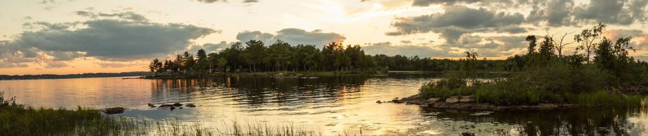
Bhutan is a country with a population of 800,000. While Thimphu is the capital and largest city, the country’s only international airport is just south of Paro, a town of 11,000 or so pictured below. I flew in from New Delhi, where I had overnighted.

The town of Paro with the Paro Chhu flowing down

We spent Day 2 visiting Bhutan’s single most famous tourist attraction – the Taktsang Monastery (aka the Tiger’s Nest), perched high on the side of a steep vertical rock face. It is a 10-km drive from Paro, followed by a two-hour walk from the parking area at the entrance to the site. The current building dates to the early 2000s;  the original monastery from the 1690s burned down in 1998.

Taktsang Monastery to the north of Paro

—————————

The Ride From Paro To Shana

The next morning, we set off for the trailhead at Shana in the twenty-seater bus you see in the image below. An extra pick-up carried our duffels and backpacks.

On the way to the beginning of the trail at Shana, we stopped for a half-hour to check out the Drukgyel Dzong, currently undergoing reconstruction. Cloud cover meant I would not get my hoped-for shot of the dzong with Jomolhari in the background!

Drukyel Dzong on our way to Shana and the trailhead

—————————

Our Version of the Snowman Trek Route

The map below shows the variation of the Snowman Trek route we did.

Bhutan - Snowman Trek Route

This first section of the Snowman is often marketed as the Laya Trek since Laya is the endpoint of the ten-day walk along the east side of the mountains that make up the Bhutan-Tibet border.

The KE Adventure promo image below is typical of how the trek is sold. However, the reality does not match the promoted fantasy of a remote Himalayan Buddhist beyul since Laya is now no more than a four-hour walk from a road to Punakha, and the village has had electricity since 2017.

The first part of the Snowman Trek – the trail up to Laya – included four of the eleven high passes we would cross;  campsites were mainly at the 4000-meter level once we arrived at Jangothang and the camping area at Jomolhari B.C.

Snowman Trek effective amount of oxygen

As the graph above shows, most of the trek is spent in the 4000 to 5000-meter range, with the day’s campsite lower than the same day’s high point.  The first three days see an altitude gain of almost 2000 meters from Paro.

—————————

Day One: Shana To Thongo Sampa

It was raining when we set off from Shana around 2 p.m.

Check out the cloud cover for September 28 and the days following at the NASA Worldview website. I’ve entered the GPS coordinates of Paro, Jomolhari, Lingshi, and Laya to indicate the route in rough.  We walked into Laya on October 8 and, after a rest day, set off for Lunana.

A view of our first camp on Day 2 morning

Full Report … Day One: Paro To Shana To Thongo Sampa

Bhutan’s Snowman Trek: Day 1 – Paro To Shana to Thongo Samba

  • There were 16 in our trekking party, most with a tent of their own.
  • Our support crew – guides, the cook team, the tent team, and horse handlers – numbered 12.
  • The 43 horses made up the single largest group!

We were a village on the move!

—————————

Day 2: Thongo Sampa To Thangthangkha

horse being prepped for the day’s carry

The first three days were spent walking up the Paro Chhu (chhu is “river” in Dzongkha, a Tibetan language and that of the country’s dominant political group). Never far away were the hydro poles and wires installed in 2015 to bring electricity to this isolated area of the country.

The Paro Chhu – we followed the wires to Laya!

Our Snowman Trek village is on the move!

Full Report … Day Two: Thongo Sampa To Thangthangkha

Bhutan’s Snowman Trek: Day 2 – Thongo Campsite to Thangthangka

—————————

Day 3: Thangthangka To Jomolhari B.C.

break time by a chorten (i.e. stupa) as we walk up the Paro Valley to Jangothang

We got to Jangothang (“thang” means flat area!) and spent two nights there to help with acclimatization. It is at 4100 meters. The big attraction is a view of the 7315-meter Jomolhari.  This is the view you hope to get –

Chomolhari and Jigku Drake from Jangothang

Full Report … Day Three: Thangthangka To Jomolhari B.C./Jangothang

Bhutan’s Snowman Trek: Day 3 – Soi Thangthangka To Jomolhari B.C./Jangothang

However, the low-hanging cloud meant we were to get only very early morning glimpses of it. Here is the afternoon view from Jangothang!

First view of Jomolhari from the Jangothang stupas

And here is a morning view! It is one of my first pics with a blue sky in it! It is one of four or five that I got during the first ten days of our Snowman Trek.

Morning view of Jomolhari

—————————

Day Four: Acclimatization Day at Jomolhari B.C.

On our off day, we walked up the hillside behind the tents in the image below. There, we accessed the plateau and its two small lakes.

The Jangothang campsite at Jomolhari B.C.

Our morning hike took us up another three hundred meters and was a good acclimatization exercise. The image below shows us on the plateau with the lakes just around the corner to the right.

On our way back to camp, we saw the lower flanks of Jitchu Drake (6850m), one of Jomolhari’s neighbouring peaks.

Full Report … Day Four: Jomolhari Acclimatization Day

Bhutan’s Snowman Trek: Day 4 – Jomolhari B.C. Acclimatization Day

an afternoon view of Jitchu Drake, one of Jomolhari’s neighbouring peaks

—————————

Day Five: Jomolhari to Lingshi Via Nyile La

We’d get a better but incomplete view the following day as we set off for Lingshi via our first pass, Nyile La (5090m), the first of our eleven high passes of the trek.

Jitchu Drake the next morning as we set off for Lingshi

a bit of a tease – a false pass before  we actually got to Nyile La

Full Report … Day Five: Jomolhari B.C. To Lingshi Via Nyile La

Bhutan’s Snowman Trek: Day 5 – Jomolhari B.C. To Lingshi Via Nyile La

a stream flowing from a glacial lake on the north side of Nyile La

—————————

Day Six: Lingshi To Chebisa

The next morning, we would visit the Lingshi Dzong (4300m) on the hill above our campsite.

  • The fort was built in the 1660s,
  • partially destroyed by an earthquake in 1897,
  • rebuilt in the 1950s, and
  • badly damaged again by the 2011 earthquake.

Some bad karma here? Local workers were busy with reconstruction when we visited.

The Lingshi Dzong – under reconstruction in October 2019

On this day, we walked to Chebisa (3990m), one of the three biggest villages we would visit during our 23-day trek. In the image below, our orange tents are already up as we approach.

Full Report … Day 6 – Lingshi To Chebisa

Bhutan’s Snowman Trek: Day 6 – Lingshi To Chebisa

Chebisa panorama

After putting my duffel and backpack in my tent, I walked to the far end of the village to see the waterfall. It was harvest time, and some locals were working in the fields.

Chebisa village and waterfall at west end

A recurring post-supper topic dealt with the exploits and the significance of the Buddhist monk Drukpa Kunley, aka “the Divine Madman.” His “thunderbolt” is sometimes depicted on the sides of buildings as a good luck charm. With his “crazy wisdom” as the precedent, exporters of Himalayan (i.e.Tibetan) Buddhism to the West – supposedly enlightened beings like Chogyam Trungpa of the Shambhala Movement and Sogyal Rinpoche of Rigpa – were able to pass off their sexual abuse of naive Western students of the dharma as Buddha-like behaviour.

Drukpa Kunley's thunderbolt on a chebisa house

Drukpa Kunley’s thunderbolt on a Chebisa house

This brief YouTube video summarizes the “divine thunderbolt” role in traditional Bhutanese culture.

—————————

Day Seven: Chebisa To Shakyapasang Via Gombu La

From Chebisa, it was on to a camp near Shakyapasang. On the way, we would cross Gombu La, at 4400m, one of the lower passes of our trek.

break time at the top of the day's pass -.Gombu La at 4400m

break time at the top of the day’s pass – Gombu La at 4400m

Full Report … Day 7: Chebisa To Shomuthang Via Gombu La

Bhutan’s Snowman Trek: Day 7 – Chebisa To Shomuthang Via Gombu La

approaching our Day 6 campsite - the blue dining tent and the sleeping tents are already up

approaching our Day 7 campsite – the blue dining tent and the sleeping tents are already up

—————————

Day Eight: Shomuthang To Robluthang Via Jare La

flowers on the Himalayan hillside

flowers on the Himalayan hillside

trekkers approaching a makeshift bridge

Full Report … Day 8: Shomuthang To Robluthang Via Jare La

Bhutan’s Snowman Trek: Day 8 – Shomuthang To Robluthang Via Jare La

a few of our horses and the end of another day

a few of our horses and the end of another day – Robluthang campsite

—————————

Day 9: Robluthang To Limithang Via Sintia La

The next day involved our highest pass so far – Sinche La at 5,000 m. The tent crew and their horse team are approaching the pass in the image below. About ten minutes later, it started snowing!

the tent crew approaching Sinche La

the tent crew approaching Sinche La

Before continuing, we set up a lunch shelter on this side of the pass. By now, everyone had on rain gear – top and bottom.

Sinche La with our lunch tent just below.

Full Report … Day 9: Robluthang To Limithang Via Sintia La

Bhutan’s Snowman Trek: Day 9 – Robluthang To Limithang Via Sinche La

We would lose almost 900 meters in altitude by the time we got to our Limithang campsite. The tent crew was still putting up the sleeping tents. Already up was the blue cook tent on the left, the double green/blue dining tent for 16 trekkers in the middle, and the small army green toilet tent on the right-hand side. The members of the tent crew really knew what they were doing – our tents were often down by the time breakfast was over and often all up by the time we got to the day’s camp.

Limithang campsite

—————————

Day Ten: Limithang To Laya

The first leg of our trek ended at Laya, the layout of which reminded me of what Namche Bazaar in the Nepalese Khumbu may have looked like fifty years ago.

Full Report … Day 10 – Limithang To Laya

Bhutan’s Snowman Trek: Day 10 – Limithang To Laya Village

the village of Laya on an overcast October morning

We would spend two nights in Laya, using the day off to rest for the second leg of our trek. Meanwhile,  the guide finalized arrangements for a new horse team to take us from Laya to Chozo in the Lunana district.

Once we got to Chozo, the horses and their handlers returned to Laya while a new set of yaks or horses were hired to take us down the final section. The Thimphu agency – Yangphel – that organized the actual trek, had all of this figured out. Everything –

  • the logistics
  • camp set up
  • and take down –

unfolded without a problem.

—————————

Day 11: Rest Day in Laya

the dining room of the Laya lodge we used d

The dining room of the Laya lodge we used during our stay

Full Report … Day 11: Rest Day in Laya

Bhutan’s Snowman Trek: Day 11 – Rest Day In Laya

horses coming up main street laya on a sunny afternoon

Horses coming up the main street of Laya, on a sunny afternoon

—————————

Snowman Trek Preview – Part 2 – Laya ToChozo To Upper Sephu

Bhutan’s Snowman Trek Preview: Part 2 – Laya To Chozo To Upper Sephu

Day-By-Day Snowman Trek Trip Report

—————————

Arranging A Visit To Bhutan:

Before 2020 and the COVID-19 Epidemic:

Click here to see how one adventure travel agency, World Expeditions, markets the trek! It is the Australia-based agency I went with. Other non-Bhutanese agencies that cater to the  pre-2022 US$250.+ a day that Brits, Canadians, Americans, Australians, and Europeans had to pay before the massive tourism policy revamp in 2022 – include:

The various adventure travel agencies offer different versions of the trek with other start and endpoints, so keep that in mind when you compare prices! Some include a stay in Kathmandu and the Druk Air flight to Paro; some only cover the Bhutan portion of the trip. In late 2022, some agencies updated the trek prices, while others still had the old ones with the $65 rather than the $ 200-a-day government tax.

[See here for a breakdown of where the $250 US a day + $15 to $20 in “optional” (but expected) tips went. Choosing one of the agencies listed above also added another $30 to $50 a day for their value-added service.]

In all cases, the travel agency will be a Bhutanese one. There are over 3000 registered travel agencies and 4500 licensed tour guides in Bhutan, primarily based in Thimphu, Paro, and Punakha.

Our local agency was Yangphel Adventure TravelI would definitely recommend this agency; its guides and support team were superb. You may save 20% if you book directly with a Bhutanese agency instead of doing what I did and having a non-local company handle all the paperwork for you.

Then again, it is always nice to know that all the details are being taken care of for you, from the glossy website to attract your initial attention to creating the small group of trekking companions you need to make the trek. Pre-2022, if you went on your own, you had to pay an extra $40 a day; if there were two of you, it was a $30-a-day surcharge per person.

——————–

The New Bhutanese Tourism Policy Since July 2022

As expensive as the Snowman Trek was in 2019, it is much more so since a total revamp of Bhutan’s tourism policy. Now, instead of a $ 65-a-day tax, most visitors must pay $200 a day. (The fee for Indians went from $0 to $15.)  A 27-day stay in Bhutan to do the Snowman would mean that the visitor will pay $200 x 27 = $5400 in tax (called the Sustainable Development Fee).  This is before the actual cost of the trek is added!

The above UK or US-based trekking agencies have all raised their prices. An email sent to MK, for example, got this response –

We are still yet to formally confirm the price for this trek. However, it is likely to be around £17,500 per person on a land only basis.

A further query about the price before 2020 received this additional information –

Bhutan has recently implemented a new pricing structure. Previously there had been a daily rate of $250 per person. This would cover all costs whilst in Bhutan and would include a $65 fee for sustainable development. The daily rate has now been done away with. However, the sustainable development fee remains and has now been increased to $200 a day, then the costs of accommodation, guiding, meals etc are added on top of this. This has therefore led to an increase in cost for all of our trips to Bhutan.

Further to this our trips are paid for in dollars and due to a less than ideal exchange rate prices have seen further increases.

The price in 2019 was £6,885 however our most recent price before the change in pricing structure was £7195.

As a point of comparison, in 2019, the Government of Nepal charged Everest climbers a fee of $11,000 for a 90-day permit, which included a charge of $1,500 for garbage removal from the mountain. In 2023, the tax was still the same. From arrival in Kathmandu to summit and return takes from 6 to 9 weeks, within the 90 days allowed by the permit.  At the new $200 a day, Bhutan has a “cash cow” almost double a Nepalese Everest permit!

——————–

In 2019,  315,599 tourists visited Bhutan. Of that

  • 72, 199 were of the “high value, low impact” class, up less than 1% from the previous year.
  • 243,400 were in the “unregulated” regional category, up 20% from 2018. Most (92%) were from India. The dramatic change from 2010 to 2019 to a “low value, high impact” tourism policy created obvious tensions.

The new $200 a night SDF that non-Indian visitors will now have to pay will undoubtedly reduce the number of “high-value, low-impact” tourists. More to the point is what will happen to the number of Indian tourists.  Not only do they now have to pay a nominal SDP of NU1200 ($15) a night, but they are also subject to all sorts of new rules –

  • a NU4500 a day fee to travel in Bhutan in their own vehicle
  • mandatory travel insurance
  • The services of a guide are now required/no more independent travel
  • The need to pay entry fees to visit temples and monasteries – NU2000 ($25) for Bhutan’s #1 tourist attraction, The Tiger’s Nest.

With the new fees and other requirements, the Bhutanese government aims to welcome a more manageable number of tourists, especially from India. The pre-COVID situation was not sustainable.  In 2023, perhaps 40,000 Indian visitors and 20,000 from everywhere else, for a total of 60,000, will be added to the graph below. That will be quite a reduction from the  315,599 in 2019, the last tourism year before COVID-19.

It will, however, leave those Bhutanese tourist industry workers, travel agencies, hotel owners, and restaurants used to the old numbers having to scramble to find some other way of making a living.

Bhutan tourist arrivals graph – “high value” and total – note the explosive growth in the number of Indian tourists from 2010 to 2019

Time will tell how it all unfolds. Meanwhile, Bhutan’s new branding encourages its citizens and tourists to  “Believe.”

A Reuters article from late August 2023 discusses the Bhutanese government’s decision to back off from the $200. a night tourist fee for non-Indian tourists. It also provides some statistics on arrivals to convey the devastating impact of a truly unsound decision to triple that tax from $65.

Lowering the tax from $200 to $100 a night will attract more of the “high value, low impact” visitors the government so clearly wants. Meanwhile, Indian visitors can hope that the sustainable development fee they pay will also be halved to $7.50!

Click on the headline to access the article.

——————-

Day-By-Day Snowman Trek Trip Report

Posted in Bhutan, hiking/trekking | Tagged , , , , , , , , , , | 4 Comments

November 7, 2019: Viggo Checks Out The First Dusting of Snow In Toronto’s Riverdale Neighbourhood

Well, that was early!  We woke up to a light dusting of snow in Riverdale; it is only Nov. 7. I decided to take my camera along on our morning ramble as Viggo and I checked out the first little bit of snow of the 2019-2020 winter season!

Viggo doing his business in our backyard – 8:00 a.m.

off on our morning adventure – garbage day in Riverdale

a light dusting of snow covers Riverdale Nov 7, 2019

looking down Riverdale Avenue

Riverdale streetscape with a light dusting of snow

Our morning walk will take us up the Don River valley; it is hidden in the tree cover that goes from left to right across the middle of the panorama in the image below. It is a favourite ramble Viggo and I have done hundreds of times over the past decade.

looking west from Broadview Avenue

For the past two months, dump trucks and tractors have been working on the slope you see below.  They have been regrading it to eliminate bumps and cavities which were thought to be too dangerous for the many tobogganers who make this hill one of Toronto’s most popular winter sledding destinations.

The Broadview toboggan hillside – under renovation!

We bump into Uba (“little bean” in Estonian) and her owner and Viggo does what he needs to to get a treat!

Viggo and Uba – treat time!

Viggo being incredulous – “You’re kidding? You mean only one treat?” Charming, eh!

We headed down to the bike trail which runs up the Don River valley; it makes for a nice one-hour walk. The occasional Zen moments when I forget that I am in a city of millions of people is my reward. The snow also means that there will be a bit less bike traffic for Viggo to hyperventilate over!  We also make use of the riverside trail and takes us away from the bike path and Viggo gets to walk off-leash for a while.

down on the bike path

The Don River south of the Prince Edward (Bloor Street) Viaduct was straightened in the late 1800s and has all the charm of a canal.  North of the viaduct, the river is still the way it was  – bends and all.  This is our favourite part of the walk! As we head up the riverside trail I do some basic maintenance, putting my little portage hand saw to work to clear branches and fallen trees.

From the footsteps in the snow, I can see that a couple of other dog walkers have already been by this morning.  The two tents south of the viaduct, however, are abandoned, as is the tarp-covered camp spot to the north.  Left behind were also piles of garbage. Over the next month, it will all get moved to the bike path where the City garbage crew will hopefully deal with it.

Viggo approaching the river – will there be ducks?

no ducks – but maybe a dead fish carcass to roll in

Viggo giving me that “It’s treat time”  stare on the banks of the Don

a section of the” trail” along the riverside

a view of the Don River from the trail

the Don River – one of the stretches left untouched

our trail just north of the Prince Edward Viaduct

back to Broadview and another view of downtown T.O.

Just across the street from the view in the image above is the Rooster Coffeehouse, the perennial winner in Now magazine’s “most popular coffeehouse” category.

The Rooster Coffee House on Broadview – Toronto’s most popular coffee spot!

lingering snow on flowers as we walk down Riverdale

We walked by two of the original houses on Riverdale Avenue.  They go back to the 1890s when the street was still called Preston Street. One of them still has a two-storey stable in the backyard.   Our semi-detached house was constructed in 1907, with no stable included!

typical semi-detached houses on Riverdale Avenue – including ours in the middle of the image

The pic below of our backyard 1 1/2 hours since we set off on our walk – and the snow is already disappearing.  By tomorrow it will all be gone and it may be a week or a month before we get another installment of the white stuff!

Viggo and I are looking forward to a more substantial snowfall that will turn the Don River Valley into a bike-free zone for a few months!

In retrospect, that little dusting of snow chronicled in the above post did not deserve all that fuss.  You want fuss – look at this from five days later – the biggest one-day snowfall in Toronto in 70 years –  now that’s snow!

Nov 12 – Viggo scanning the Don River beach for ducks


Posted in Ramblin' With Viggo, Toronto | Tagged , , , , , , | 2 Comments

Canoeing The French River From Top To Bottom: Days 8 & 9 – Across the Delta From East To West

Last revised: June 15, 2022.

Day 8 – From Fox Bay CS726 To CS804 W of Whitefish Bay

Day 9 –  To The West End of French River Prov. Park

Previous Post: Days 6 & 7 – From Pickerel Bay to Georgian Bay Via Fox Creek

Canoeing The French River From Top To Bottom: Days 6 & 7 – To Pickerel Bay and Down Fox Creek to Georgian Bay

—————

The Day’s Basic Data and Maps

  • Distance: 15.4 km
  • Time: 8:45 a.m. to 1:00 p.m.
  • Portages/rapids: 0/0:
  • Weather:  a drizzly morning with some sun in the afternoon; a strong wind (25+ km) from the WSW
  • Campsite: CS804 (old #723) – good shelter for 1 x 4-person; possible for 2 or 3         2-person tents; on the cross-channel side of the delta; there is room for more, depending on how fussy you are for a ‘flat’ or sheltered spot.
  • NRC topo sheet: Key Harbour 041 H 15
  • Our GPS tracks – 2019 French River (3.2Mb Dropbox file)

day-8-from Fox Bay to-west of Whitefish Bay

—————

It’s A “No Go” To The Bustards

The big rainstorm we had been expecting the afternoon and evening before never did happen. Instead, we got more of the low-grade drizzle of Day 7 with one added element – a strong wind blowing from the southwest.  We had planned to spend a couple of days in the Bustard Islands, but the whitecaps on the waves we saw rolling our way made us change our plan.

Cantin Point to the Bustard Islands

The crossing at its shortest (i.e. from Cantin Point to Tarpot Island)  is 1.7 kilometres. There are some smaller rocks and shoals that shorten this distance to about a kilometre. Given the 25 km.+/hr.  wind and the waves, even a half-hour in an open canoe to do the crossing was taking a needless risk.  There certainly wouldn’t be any passers-by to help!

one last shot of CS726 (old # 920) as we head out on a windy morning

—————

Passing By The Georgian Bay Fishing Camp

So –  a new goal! Instead of a couple of days out on the Bustards, we’d aim for the westernmost campsite in the Park and use the many islands en route to provide us with some shelter from the wind.  As we headed west from CS920 in Fox Bay, we paddled past the abandoned Georgian Bay Fishing Camp.

The Fishing Camp – quite the complex consisting of a marina, lodge, restaurant, cabins, a store, and boat rentals – closed in 2016, two years after the owner Dave Bulger’s death.  Bulger had owned and run the camp since the 1980s.  His son Matt tried to keep it open, but things did not work out.  It had been in operation since 1928.  [The Bulgers had purchased the property after the death of its previous owner, Tom Beaudry.  When he passed away unexpectedly in July 1984, his wife Joy sold it to Bulger.]

With its demise, the closest similar camp is probably Camp McIntosh on the French River’s Main Outlet below Dalles Rapids and across from the location of the once-French River Village. (See here for a topo map view.)

In September 2017, we paddled by Dock Island just a half-kilometer NE of the Fishing Camp.  Sitting on the south shore of Dock Island was a dock, and I made a wrong connection between the dock and the island’s name.  A reader of that post (see here) did email me that the dock actually belonged to the Fishing Camp and had drifted across.

Georgian Bay Fishing Camp – main dock area and gas pump

Our brief paddle visit along the Fishing Camp shoreline brought home the transient nature of all things. If time itself is not the ultimate destroyer, then a changing culture and different notions of leisure time make casualties of things like fishing camps and, I hate to say it, wilderness canoe tripping and camping!  Other than maybe ten fishing boats, we saw no one on our ten-day trip down the French and across the delta!

—————

Heading West While Avoiding The Wind

We would spend the next hour and a half dealing with a strong WSW wind by ducking behind a string of islands and making our way along the Georgian Bay coast to the bottom of the French River’s Main Outlet at Bluff Point. The reward: 5.5 km. of forward movement!

French River Delta – Georgian Bay

Crossing the Main Outlet to the west side, we took advantage of the protected passage provided by the long narrow islands which run parallel to King’s Island.  Once past Sand Bay, a couple of times, we got blown into bays that looked like channels.


—————

Setting Up At CS804

By 1 p.m., we were just west of Whitefish Bay and at CS804 (old #723).

our tent spot at CS804 on Georgian Bay

We have used this site before and like the tucked-in and sheltered nature of the tent site combined with the easy walk to the exposed shore of Georgian Bay.  Thanks to this year’s high water, that walk was much shorter than it was two years ago!  The wind continued to blow hard all afternoon.

—————

Looking At The Bustards and the Wind Turbines

The Bustard Rocks Lighhouses – so close!

In my hands, I have a Sony HX80 with a 24-720mm reach!  I bought it at Henry’s for $160 CDN for a trip to Tanzania.  It came in handy there on the short safari I did after my walks up Meru and Kilimanjaro.

On this French River trip, I left behind all the heavy gear – the Sony A77, even the Sony A6000 — and just took the HX and my Sony RX100.  I kept the RX100 in a Pelican 1010 case and the HX 80 inside two medium-sized Ziploc bags. Max also had his Canon SX280 with its 25-500 reach in a Pelican case.  Maybe like the Fishing Camp, my huge DSLR has seen its day!

Unfortunately, the Bustards were not a part of this year’s ramble. However, if you find yourself anywhere near the islands and the wind and waves are agreeable, the time you spend there will be among the highlights of your trip. See the following post for some background on the Bustard Rock lighthouses on the west side of this group of islands.

Canoeing Georgian Bay’s French River Delta:: Day 3 -The Bustards To Eagle Nest Point

It is 3.5 kilometres south of CS804 to the Bustard Lighthouses. Then we walked to the east end of the island we were on and were amazed to see something else.  Well, we could barely make anything out of it, but here is what popped up on our camera viewfinders when we zoomed in!

We counted about fifty wind turbines (of a total of 87 planned) on the Henvey Inlet First Nation land some twenty kilometres away!  It was the turbine construction crew working on this project in July 2018 that caused the massive fire labelled Parry Sound 33, thanks to their continued blasting in tinder-dry conditions in mid-July.

While in the long run, the energy generated by the wind turbines will be a “plus,” for some reason, the notion of corporate responsibility for the costs of the fire has never become an issue.  See this CBC report by David Seglins for more background –

Why it’s difficult to make industry pay when it’s accused of starting costly wildfires

2019 Update: The wind farm – the largest single-phase wind power facility in Canada when it was completed in 2019, is a 50/50 joint venture owned by Henvey Inlet First Nation and Pattern Energy Group LP. whose press release noted that it will generate CAD 10 million in annual income for Henvey Inlet First Nation.  [See here for the source of info.]

—————

Day 9 –  To The West End of French River Prov. Park

The Day’s Basic Data And Maps

  • distance: 17.7 km
  • time: 8:20 a.m. to 3:35 p.m.
  • Portages/rapids/linings: 3/1/1: 
    • 22m – empty the canoe, lift over, and repack
    • 60m – over the hump around Devil Door Rapids
    • 40m – short 20-meter  La Petite Faucille portage; repack canoe and line for a few meters
    • 40m – high water level meant very fast water, lined a short section to bypass the worst of it.
    • 130m – fast water section above the real ride!
    • 230m – all in less than 2 minutes!! looks rough but rides nice; vigilance is still required
  • weather: it was sunny all day
  • Campsite: CS838 (od #822) – last ‘official” campsite at the west end of FRPP; lots of room for multiple 4-person tents; a couple of nicely sheltered spots; the rest are more open.
  • Natural Resources Canada Topo Sheet – Key Harbour 041 H 15; Collins Inlet 041 H 14.
  • our GPS tracks – 2019 French River (3.2Mb Dropbox file)
  • Maps By Jeff: West French River covers the river from a few kilometres east of Highway 69 to Georgian Bay. It has all the official park campsites indicated.  Click on the title for access to a free digital download – or buy the $20. waterproof copy.  Note: we don’t rely just on the Maps By Jeff map – we make a paper copy of the relevant bits of the topos above for the detail which is occasionally necessary.

Note: CS #s on the map are the pre-2021 ones. See here for the list with all the CS # changes!

—————

The French R. Delta East Cross-Channel:

Just a couple of kilometres from the Georgian Bay shore is an interior passage that allows you to make progress on days when the full force of the wind and waves is hammering the coast.  It presents few difficulties and some incredible scenery to paddle through.

  • The 4.4 km. East Cross-Channel goes from Whitefish Bay to the bay below Devil’s Door;
  • The 3.2  km. West Cross-Channel stretches from Devil’s Door Rapids to Black Bay.

We had done the entire Cross-channel before from west to east; now we would be doing at least a part of it – the East Cross-Channel in reverse. At Devil’s Door Rapids, we would be at the bottom of the French River Delta’s three Western Outlets:

  1. the Bad River Channel
  2. the Old Voyageur Channel
  3. the Voyageur Channel

The plan was to go up the Bad River Channel via Lily Chutes all the way to the beginning of the Old Voyageur Channel.  Then we would come down the Old Voyageur Channel to the end of the West Cross-Channel and paddle down the Voyageur Channel to Batt Bay and our campsite at 838 (old #822).

And that Plan B  – Plan A had been a visit to the Bustards – is what we ended up doing!

a slice of the East Cross Channel in the French River Delta

The map below shows the East Cross-Channel route from 804 (old #723) to Devil’s Door Rapids and Portage followed by the right turn into one of the Bad River Channel’s sub-channels.

East Cross-Channel – French River Delta

Fifteen minutes into the day’s paddle we just had to stop. We were paddling through a very scenic section of the cross-channel when we spotted what looked to be an excellent campsite somewhat elevated from the surrounding terrain.  A minute later, we had assigned a grade of A to the site and agreed that if a quieter interior site was what you wanted instead of our CS804 of the night before with its access to Georgian Bay, then this would be an excellent choice.  [Note: I have since learned that camping at FRPP sites other than designated ones is illegal and subject to a potential fine. Proceed with caution!]

the view from a potential East Channel campsite – French River delta

We also paddled over to the other side of the channel from the above ‘campsite’ location and found another pretty decent one.

a view of the above campsite from the other side of the channel

Shortly afterward, we faced our first mini-portage of the day – a 10-meter lift-over which the image below somewhat captures!

a 10-meter lift-over on the East Cross-Channel French River Delta

Here is a satellite view of what it is we were lifting over. As the GPS track above indicates, we had initially turned south and into that small bay before we realized our mistake. We had done the lift-over a couple of years before coming from the west.

the 10-meter lift-over on the French River Delta east cross channel

—————

Devil’s Door Rapids

As we approached the bay below Devil’s Door Rapids, we saw our first bit of graffiti since Gibraltar Point on Lake Nipissing.  We did not go up to look closer, but some of the letters already seem to be fading.  Hopefully, next year it will be all but gone.

some graffiti on the sloping rock near the west end of the East Cross-Channel French River

And then it was a paddle into the bay before Devil’s Door Rapids. As we came to the end of the east cross-channel, I noticed a No Camping sign on the NE point, a first anywhere in the park. Perhaps it is aimed at sailboaters or larger watercraft that might park in the bay for shelter? A sailboat was anchored in the bay as we paddled by, but no one seemed to be around.

Devil’s Door Rapids (Falls)

We approached the bottom of Devil’s Door Rapids. There was the 1.5-meter drop we remembered from our last time there.  Then we headed to the north side of the bay for the take-out spot for the 40-meter carry around the rapids.  The higher water level meant the landing we used last time was underwater!

Devil’s Door Rapids – a shot from the east

The portage trail was somewhat overgrown, and we spent a few minutes trimming the junipers to make it more obvious for the next crew coming through.  Typical for the park’s portages, neither end of the trail is indicated by a portage marker.

the turtle on the Devil’s Door portage trail

There is a stupendous viewpoint on the rock overlooking the rapids, and we spent some time up there taking in the neighbourhood.  Here is a view looking east to the rapids, the bay, and that anchored sailboat.

Devil’s Door Rapids – a shot from above

—————

Up the Bad River Channel

We turned around and looked west up the cross-channel; it goes all the way to Black Bay and the south end of the Voyageur Channel.  However, this day’s plan was to head north up one of the Bad River Channels – the one with Lily Chutes at the bottom. The map below shows our route.

looking west from the great viewpoint above Devil’s Door Rapids

The voyageurs probably named the Bad River Channel as such, thanks to the larger number of rapids and chutes they would have had to deal with, which explains why they avoided its various options.

—————

Down The Old Voyageur Channel

We did a lift-over, lined the canoe up Lily Chutes, and then paddled up to the top of the Old Voyageur Channel.  Along the way, we encountered some stretches of fast water coming our way that required a few intense bursts of paddling to make progress.  We rounded the corner (see the map below) and began our descent of the Old Voyageur Channel.


The Old Voyageur Channel runs 3.2 kilometres from top to bottom with only one portage.  Along with the French River’s Main Outlet to the east, it would have been the one most used by the voyageurs of old.

Toni Harting’s The French River: Canoeing The River of the Stick Wavers (1996, Boston Mills Press) is by far the best book out there on the French River. It takes you from Lake Nipissing to Georgian Bay and covers everything from geology to history and canoe-specific topics. Included are helpful maps and some excellent photos, both in colour and black and white.

Of the Channel, Harting writes:

…the Old Voyageur Channel was probably only used by the voyageurs at quite high water levels and by the big brigades of fur trade canoes. Smaller fur-trade canoes and specialized big canoes carrying only passengers, mail, and other important cargo would also have used this channel. These express or light canoes had less weight to carry and therefore enjoyed more freeboard to run rapids and shallow parts. [110]

————-

La Petite Faucille & La Dalle

At the top of the channel are some swifts. A bit more than halfway down, you come to a set of rapids named La Petite Faucille.  These rapids were until recently mistakenly identified with the set of rapids depicted in a Paul Kane painting titled “French River Rapids.”  Harting writes:

The existence of the Petite Faucille is mentioned a few times in the notes of the old travellers. The artifacts found in the late 1960’s on the river bottom below the drop are another indication that this route was used by the fur traders. In his 1845 painting, French River Rapids, Paul Kane gives a curious artist’s impression of what presumably is the Petite Faucille. [109]

Harding’s use of the word curious is fitting because the location does not really look like the one that Kane painted! A map of Kane’s route to and back from the west shows that he was not on the French River.

Paul Kane’s route to the West

[In 2006, Ken Lister located the actual site some 830 kilometres to the west of Petite Faucille in northwestern Ontario between Lake Superior and Rainy River. See here for his account.]

The painting is a part of the Royal Ontario Museum’s collection.

Here are a couple of shots of La Petite Faucille – the first is the section below the rapids, and the second continues the view up to the top.

La Petite Faucille Rapids on the Old Voyageur Channel

Other than the short 20-meter or so portage around La Petite Faucille, there is little to deal with.  Above these rapids are some swifts; below the rapids is a 100-meter stretch of fast water known as La Dalle before you reach the West Cross-Channel.  We enjoyed the ride as we zipped down, hitting a top speed of 11 km/hr. for a few seconds, according to our GPS track data!

looking east on the French River Delta's West Cross-Channel

looking east on the French River Delta’s West Cross-Channel

We stopped for lunch on the southeast corner of the island at the bottom of the Old Voyageur Channel and then continued our way westward along the southwest end of the channel referred to as the Voyageur Channel.

—————

“The Fort” – A Supposed Ambush Location

Not far from our lunch spot, we passed by a landmark identified by Harting as The Fort, a supposed ambush site used by Indigenous pirates to rob the voyageurs of their trade goods.  The site is a jumble of rocks that may or may not look like a fort depending on how much you want it to be one!  Again, to quote the best book written about the French River:

On the south shore of the West Cross Channel, close to Black Bay, there is a peculiar collection of tumbled-down rocks where several circular openings seem to have been constructed. This was possibly used as a shelter by Natives lying in ambush for the treasure-filled fur-trade canoes that would pass down the channel, which is quite narrow at this point. This could well be the “Fort” talked about in some old reports and after which the Fort Channel is named. [Harting 32]

The story itself left us skeptical.  How often could it have been used as an ambush site before the fur brigades realized there would be trouble up ahead? It is no more amazing an ambush site than many others they could have picked.

Furthermore, just which Indigenous tribe would be doing the hold-up? If it was an Algonquian (i.e. Anishinaabe) people, they would only be ticking off their many fellow tribesmen who worked with the French.  If it was an Iroquois tribe from the upper New York State area, it would seem a long way to come to steal goods that could be taken much closer to home. It would also date its use to the 1600s when the Iroquois were still a military power. By 1700 various Anishinaabek (i.e. Algonkian) peoples controlled southern Ontario.

Two Fur Trader Accounts of the Fort 

  1. John Macdonell 1793

The  Journal of the fur trader John Macdonell – found in a collection titled Five Fur Traders of the Northwest has this entry from June 26, 1793:

john macdonell - the Fort story

See here for a 9.7 Mb pdf file of Macdonell’s Journal.

Macdonnell’s account puts a different spin on the story than Harting’s. For one, it sounds like a one-off ambush and not an oft-used spot; it also makes clear who the attackers were – and also how unsuccessful they were! It would date the attempted ambush around 1740, long after the military power of the Iroquois had been defeated by an alliance of  Algonkian-speaking tribes. By 1740 all of southern Ontario was controlled by various Anishinaabek peoples, and it is quite unlikely that the upper New York State Iroquois would have dared venture all the way to the French River Delta.

2. Daniel Harmon 1800

The fur trader Daniel Harmon has yet another account of the indigenous pirates who ambushed westward-bound voyageurs with their trade goods. His May 24, 1800 diary entry reads:

Daniel Harmon. May 1800. The Fort story.

Download a 19.7 Mb pdf file of Harmon’s A Journal of The Voyages And Travels In The Interior of North America.

Harmon cover title

His account has the bandits as Anishinaabe – Ojibwe or Cree –  and implies that the spot was used for an extended period before “the Good Indians” decided enough was enough. While Macdonnell places the incident(s) in the French period, Harmon’s mention of the NW Co. puts it post-Conquest sometime after 1770. The Montreal-based NW Co. was established in the late 1770s.

As for a photo of the jumble of rocks – as we passed by, I figured we would get one the next morning on our way back.  The next morning we amazingly missed it!  Lesson: take the shot while you can!

Update: In September 2024 we passed by the location of the imagined fort again.  This time we stopped and got some photos!

The Fort – a closer-up view

The Fort – a view from the top

The nearby presence of other boulder and gravel deposits, and even a bay named Gravel, provides a clue to the origin of the jumble of rocks which the voyageurs paddled by and turned into a fort.

Much more fantastical to them would have been the story we tell about a two-kilometer ice sheet covering the area for thousands of years while sub-glacial streams moved and broke and ground the rocks into grains of sand!

—————

See this post from September 2024 for a discussion of other bits of history in the neighbourhood:

Up and Down The French River Delta’s Many Channels And Outlets

—————

Our CS -Another Likely Voyageur Rest Stop

Given the still-blowing southwest wind, we made as much use as possible of the numerous islands in Batt Bay as we headed to CS838 (old #822).  Along the way, we passed by another voyageur landmark identified by Harting. It was known as La Prairie. As with the Fort, we did not stop to take any pix. Unlike the Fort, we did spend fifteen minutes at the site the next morning! [See the next post for what we found!]

FRPP CS838 – the furthest west campsite in the park

CS 838 is the westernmost campsite in French River Provincial Park.  It is easy to imagine it as a stopping place for the fur brigades at the beginning or end of the French River part of their journey.  There is ample room for many tents.  Behind the flat rock outcrop are many sheltered spots. We could peg our tent down, a novelty at a Georgian Bay campsite.

Next Post: Days 10 & 11 – From Georgian Bay To Hartley Bay Marina Via The Mills Channel

Posted in Georgian Bay, wilderness canoe tripping | Tagged , , , , , , , , , , , , , , , , , | 8 Comments

Canoeing The French River From Top To Bottom: Days 6 & 7 – To Pickerel Bay and Down Fox Creek to Georgian Bay

Last revised: February 27, 2024.

Table of Contents:

Day 6 – The Lower French From CS 601 To Pickerel Bay (CS 634)

Day 7 – The Fox Creek/Lake/Bay Route to Georgian Bay

Previous Post: Day 5 – From E of Cross I.  to Below Recollet Falls (CS522)

Canoeing The French River From Top To Bottom: Day 5 – CS503 (old 419) To Below Recollet Falls

————–

Day 6 – The Lower French From CS 601 To Pickerel Bay (CS 634)

  • Distance: 12 km
  • Time: 9:00 a.m. to 11:40 p.m.
  • Portages/rapids: 0/1:  Second Rapids – 2 minutes spent lining
  • Weather: sunny all day, light wind from N.W.?
  • Campsite: CS634 – another haul up the hill (~100 m) worth it! The stern paddler’s favourite site of the trip; multiple sites 1 fair, semi-sheltered one at the top suitable for a 4-person tent, one at the bottom in a pinch; more possibilities in the open and on rock – your choice; 2 boats the whole evening, 2 sea-doos earlier and after that, it was just us.
  • Natural Resources Canada topos: Delamere 041 I 02; Key Harbour 041 H 15
  • GPS tracks – 2019 French River (3.2Mb Dropbox file)
  • Maps By Jeff: West French River covers the river from a few kilometers east of Highway 69 to Georgian Bay. It has all the official park campsites indicated. Click on the title for access to a free digital download – or get a hard copy you will often be using! Note: do not set off with this map as your only map. It is not detailed enough.

Lower French River – CS601 (old #522) to Pickerel Bay (CS 634 – old #633)

The sixth day in a row of sunny warm weather! We slipped our canoe into the water and could feel the noticeable current as we headed down the rest of the Gorge section. There were some stretches where the GPS device recorded 14 and 15 km/hr speeds.

————–

Little Flat Rapids (aka Second or Derraud’s Rapids)

Then it was through a stretch of fast water our Garmin topo map named “Little Flat Rapids.” Another name may be Second Rapids, the First being just after Recollet Falls. The Friends of French River map indicates a portage of 25 meters here. We spent a couple of minutes lining through one section at the top on river left.

Little Flat Rapids – French River

The June 1793 entry from John Macdonell’s Journal (the quote is immediately below) refers to Derraud’s Rapids two leagues (six miles) below Recollet Falls. Six miles or ten kilometers is approximately the distance from Recollet Falls to these rapids. He refers to someone breaking a canoe here. This would certainly qualify as a freak accident!

A pictograph or not? iron oxide stain on the French River rock

on the north side of the French River – Gorge Section near Ox Island

From here, it is 2.5 kilometers to the railway trestle crossing the French River at the east end of Ox Island. We paddled slowly past various vertical rock faces lining the river as we approached.

————–

The Long-Gone Lichenographs

After his comment about the rapids, Macdonell goes on to discuss the presence of Anishinaabe pictographs (images “painted” with a mixture of iron oxide powder and fish oil) and lichenographs (images carved out of the lichen and moss which cover the rock face):

entry from John Macdonell’s Journal – below Recollet Falls

See here for the entry – pp.84-85. The entire journal makes for interesting reading, as do the others included in Five Fur Traders of the Northwest, edited by Charles M. Gates.

Given Macdonell’s observation, Ox Bay would have gotten its name from the animal figure scratched out of the lichen on a prominent rock face nearby. It was likely a lichenograph of a moose or woodland caribou rather than an ox!

Macdonell confuses his account by combining lichenographs and pictographs. He writes:  “all of them painted with some kind of Red Paint” and then of the same images  “made by scratching the Rock weed.” He probably had two different sites in mind. These days neither are to be seen!

————–

A Favourite FRPP Campsite – CS634

We rounded the point at the east end of Ox Bay, headed into Pickerel Bay, and towards one of our favourite campsites, the one numbered 633 on the map above but renumbered 634 in 2021. We had camped there in September 2017 at the end of our one-week ramble up and down and across the French River Delta.

Canoeing Georgian Bay’s French River Delta: Days 6 – To Pickerel Bay (The Elephants)

It was not even noon, and we were done for the day – an unusual occurrence for us! Adding the 12 km. we had done this morning to the 30 from the day before helped us rationalize it! Being at #634 (old 633) clinched it.

We figured that the site might already be taken,  but since it was a Thursday in mid-June, the odds were in our favour. In fact, the entire area was pretty much devoid of anyone. Over the next day, we would count a couple of motorboats passing by below us as they made their way to or from Pickerel River.

looking east towards the Pickerel River

Those chairs in the image below are where we spent quite a bit of time until past sunset! Every once in a while, we would face them in a different direction as we took in the views on a beautiful clear day on Pickerel Bay. Our kitchen/dining area was just behind the chairs, complete with our overturned canoe as a tabletop. And a bit further behind the trees was our tent, sitting on a patch of earth that we were able to use tent pegs on.

French River Pickerel Bay CS634 – the hilltop view looking east

looking south to the start of the Fox Creek route to Georgian Bay

The following video gives a 360º panorama of the view from the top of CS634. It starts looking south to the series of bays in the image above and then pans east up the narrow bay that you see two images above. Then it is west into the sun – and you’ll notice the image quality degrade quickly.

We took quite a few shots of what we were looking at as we sat there sipping on Gatorade, coffee, and later, our single shot each of whisky – here are a few that you can scroll through quickly. The magic was in being there!

Max and his camera facing west as the sun sets

looking west towards Ox Bay

portrait view of the sunset from Pickerel Bay CS634

looking west to Ox Bay French River

sunset view of Pickerel Bay French River

————–

Day 7: Down Fox Creek/Lake/Bay to G’Bay

Route Choices To Georgian Bay

optional routes to G’Bay

There are a few routes to get to Georgian Bay from Ox and Pickerel Bay.  The voyageurs and their massive canoes would have used the Main Outlet (#4) and the Western Channel’s Old Voyageur Channel. Since we had already gone down those waterways, we decided to go down the Fox Creek route.  However, it is not the easiest way to get to Georgian Bay.

The alternatives are less work and all of them are quite scenic. Over time you will probably do them all!

  • The Main Outlet via the Dalles Rapids portage
  • The Old Voyageur Channel with a 20-meter portage at La Petite Faucille and some swifts before and after.
  • The Bass Creek Route is arguably the easiest of all, with just a lift-over and an easy 100-meter portage
  • The Pickerel River with just one 250-meter carry.

If this is your first time down the French River, you could go down the historical Old Voyageur Channel. Doing so will replace the three portages of the Fox route with one easy 20-meter carry around La Petite Faucille. You will also zip down some easy swifts – some above the portage and then the famous La Dalle below La Petite Faucille. A return route up the Main Outlet would allow you to experience the most used voyageur route to and from the Bay.

The Maps by Jeff map provides a clear visual image of the options. The map image below will give you an idea of what you’re getting for your $20. – i.e. a map you will be using on more than one occasion as you return to the French for more.

click on the map to access the Maps By Jeff website

See the post below for more info and maps on the Main Outlet, the site of  the now-gone French River Village, and the portage around Dalles Rapids:

Canoeing Georgian Bay’s French River Delta: Day 2 – Down The Main Outlet From The Elbow to The Bustards


—————–

The Day’s Basic Data and Maps

  • distance: 12.2 km
  • time: 8:20 a.m. to 1:10 p.m.
  • portages/rapids: 3/0:
    • 150 m – along the lower ridgeline from the take-out spot to a long narrow ‘pond.’
    • 230 m – more rugged with  multiple and possibly confusing trails
    • 195 m – likely longer in low water
  • Weather: overcast most of the day with some intermittent rain, which added to the gloomy atmosphere paddling through the edge of 2018’s burn area.
  • campsite: CS726 (old #920) with “thunderbox”! – very sheltered, 1 x 4-person; possible for 2-3 x 2- person tents; with high water (and likely any heavy rainfall) butts up to a swampy area, but the bugs were not bad!
  • Natural Resources Canada 1:50,000 topo sheets: Delamere 041 I 02; Key Harbour 041 H 15
  • GPS tracks – 2019 French River (3.2Mb Dropbox file)

Why We Chose The Fox Creek Route

One of the highlights of our French River trip was the half-day we spent going down to Georgian Bay via the Fox Creek route, which starts right across from our favourite Pickerel Bay campsite. While we have paddled up or down the other possible routes, we had never used the Fox Bay/Lake/Creek route.

There was an additional pull this year – we wanted to see the impact of Parry Sound 33, the 2018 Henvey Inlet Fire, which had blown out of control and spread westward to the Pickerel River and Fox Creek.

Henvey Inlet Fire 2018 – and east end of French River Provincial Park

The Fox route is a bit more work than all of the above but is worth it, getting an A+ for scenic views and enchanting paddling. The more paddlers use them, the more apparent the portages will become.

Note: We did this trip in 2019. Mike Burr did the Fox route with his son in 2022 and wrote this in the comments section below – the portages down Fox Cr. are all well marked and maintained now. Absolutely no issues there.

————-

The First Two Portages From Pickerel Bay to Fox Bay

the two portages into the Fox Creek/Lake system

My copy of the 2012 Friends of French River Park Map (pink cover) does not have any information on the Fox Creek portages, nor does the more recent 2017 third edition (blue cover). It really should since it is mostly canoe trippers who buy the map!

The overall lack of portage information and discrete on-the-ground signage for paddlers is puzzling, given that FRPP has existed for thirty years. The Park needs – but obviously will not be getting – more attention than the commendable volunteer service that the Friends of French River provides in campsite monitoring and maintenance and map production.

———

The First Portage

the takeout for the first of the Fox portages on the south side of Pickerel Bay

We paddled across Pickerel Bay to the beginning of the portage that would take us into Fox Creek. The Unlostify map above has the portage indicated as a 140-meter carry. It is an easy one; it could use some trimming and signing. According to our GPS track, we spent less than twenty minutes dealing with this portage and were soon at the top end of the long narrow lake you see in the image above.

One moment of concern –  Max had slipped on a section of sloped rock in his not-very-grippy L.L. Bean boots and went for a tumble, bags and all. While the bags provided a bit of a cushion, his hip was a bit sore for the next couple of days as we paddled to the west end of the park.

I’m looking south at the take-out spot for the second of the Fox portages

Fox Creek - the small lake between the two portages at teh top of Fox Creek

the lake between the two portages at the top end of Fox Creek in the French River delta

After paddling south down the lake, we scrambled to a hilltop on the southwest end, hoping for another “wow” view or two but could not get to that one vantage point that would deliver. Here is what I came up with!

a view from S.W. of the lake between the two Fox Creek portages

———

The Second Portage

And then it was on to the second portage; the poorly maintained 230-meter trail would require more effort thanks to an initial uphill and then the scamper across a rocky ridge to the final downhill to the north end of Fox Creek. All in all, we put in about forty-five minutes to haul everything up and over. We also added some orange duct tape and did some bush trimming to help make the trail a bit more obvious.

Two Portages – Pickerel Bay To Fox Creek

When we got to the put-in, we found a collection of four abandoned boats, seat cushions, and fishing gear belonging to Camp Wanikewin Lodge located on the Pickerel River just east of Highway 69.

the put-in at the end of the second Fox portage from Pickerel Bay

———

Paddling Through The Edge of 2018’s Burn

With the two portages done by 10:15 or so, we now had six kilometers (one hour) of easy paddling until the third and last portage at the south end of Fox Lake.

Fire damage on upper Fox Creek – French River delta

It would not be long after setting off from the put-in at the top of Fox Creek that we would see evidence of 2018’s fire (named Parry Sound 33 to the consternation of people living in the town itself!). It had started on the Henvey Inlet First Nation land below Key River, thanks to the wind turbine construction crew who continued blasting despite bone dry earth and windy conditions.

[A few days later, we would count fifty wind turbine pillars from our campsite just east of Whitefish Bay, some twenty kilometers away. See here for one of the images.]

some burn on the west side of Fox Creek as we paddle down

fire damage on Fox Creek -a view from June 2019

Fox Creek -French River delta – June 2019

signs of new growth after the fire on Fox Creek in June 2019

Fox Creek green and charcoal

heading for the third (and final) Fox portage

———

The Third Portage

The third and last portage on the Fox Creek route to Georgian Bay took about thirty minutes. Given the water levels in June 2019, we were able to paddle a middle section of the portage, which may not be possible at other times of the year or in lower water years

Fox Portage – From Fox Lake to Fox Bay

In the image below, I am stuffing the silnylon tarp back into its bag at the top of the portage trail. As the above images make clear, the weather had changed from sunny to intermittent drizzle this morning, and the tarp had covered the bags and duffels. At the start of the portage is a  boat, perhaps left by a fishing lodge for clients.

the south end of Fox Lake and the start of the portage into Fox Bay

At the end of the initial carry, Max is looking at the trickle of Fox Creek and the patch of water we will paddle down to access the final bit of the portage. The Unlosity map has the entire thing as a 220-meter carry. You may be walking down that short stretch of water with lower water levels!

the water we paddled across to get to the last bit of the portage into Fox Bay

And that is it for portages on the Fox Creek Route. Next up  is Fox Bay and the hunt for a decent campsite.

———

Looking For a Campsite in Fox Bay

heading to Fox Bay after the portage

more dramatic scenery as we head down the narrow channel right after the last of the Fox portages

There are (on paper) quite a few campsite choices. In reality, some of them are mediocre and will definitely be paddled by. The Unlostify map (see below) provides some info on the condition of some of them.

Note: the C.S. #s are the old ones. In 2021 the Park people decided to renumber them, thus making all existing park maps and reports out of date!

C.S. #s are the old ones; see this list for the renumbered sites.

Fox Bay area in French River Delta on Georgian Bay

Unlostify – campsite locations in Fox Bay/French River Delta/Georgian Bay

We would find our campsite at CS726 (old #920), a well-sheltered spot inside a stand of pines and behind a rock outcrop that rises up to a nice hilltop sitting area. The shoreline to the south is accessible, and we went for a walk after setting up camp.

Note: I heard that the old CS920 was moved to the small island above it. I cannot imagine why and would still use 920 if ever in the vicinity again and in need of a site. Send me an email if you find our CS726 (old #920) decommissioned!

our campsite (CS726)

For the second day in a row, we had stopped somewhat early. Both our Garmin weather app information and an email from back home told us that a heavy downpour and a thunderstorm were expected in our area, and we were ready!

the  CS726 (old #920) – well sheltered

Next Post: Day 8 – From Fox Bay To W of Whitefish Bay CS723

Canoeing The French River From Top To Bottom: Days 8 & 9 – Across the Delta From East To West


Posted in Anishinaabek World, Georgian Bay, Pictographs of the Canadian Shield, wilderness canoe tripping | Tagged , , , , , , | 10 Comments

Canoeing The French River From Top To Bottom: Day 5 – CS503 (old 419) To Below Recollet Falls

Last revised: March 29, 2024.

Table of Contents:

Previous Post: Day 4 – The Upper French Five Mile Rapids Section to CS 419

Canoeing The French River From Top To Bottom: Day 4 – Down The Five Mile Rapids Section of the Upper French River

————–

The Day’s Basic Data and Maps

  • distance: 30.5 km
  • time: 8:15 a.m. to 4:15 p.m.
  • portages/rapids: 1/0: around Recollet Falls (~100 m), then eddy and rock face fun
  • weather: sunny all day, light wind from NW?
  • campsite: CS 601 – a carry up the hill!, 1 okay spot for 4-person; possible multiple 2-person (fair weather) sites; another long veranda to the water, cottages across from site – lawn work was finished by about 7 p.m., the site had a nice bed of chives though!
  • Natural Resources Canada topo: Noelville 041 I 01;  Delamere 041 I 02
  • GPS tracks – 2019 French River (3.2Mb Dropbox file)
  • Unlostify: West French River covers the river from a few kilometers east of Highway 69 to Georgian Bay. It has all the official park campsites indicated.  Click on the title for access to a free digital download – or get a hard copy you will be using often!

Day 5 – French River – CS 503 (old #419)  to CS 601 (old #522)

————–

A Visit To Cross Island – And A Bit of History

We set off planning to stop at a campsite somewhere on the east side of Highway 69; we ended up putting in our biggest travel day, covering 30 kilometers and setting up our tent a few kilometers west of Recollet Falls.

Just across the river from our campsite 503 is 505. We took a look as we passed by and found a sheltered site with room for multiple tents. It would make a better foul-weather site than the one we stayed at but it did not have the excellent hilltop view that 503 did.

Not far downriver from our CS503 is Cross Island. We saw the white cross as we came to the west tip of the island and pulled in to have a look.

the white cross at the west end of Cross Island: – French River

Attached to the center of the cross was a dedication plaque erected by a local branch of the Roman Catholic service organization The Knights of Columbus. It read –

  • In memory of one of our Canadien missionaries
  • Cross dedicated by the Reverend Father Rondeau
  • The 15 of June, 1982
  • erected by The Knights of Columbus
  • Noelville, Ontario   Council 4435

Unclear is who the missionary was, what happened to him and when, and why he was being honoured on this particular island.  The lack of concrete detail makes for an ideal situation for conflicting stories about the significance of Cross Island – and there are a few out there!

Without a doubt, these Roman Catholic missionaries laboured hard in the fields of the Lord to bring new souls to their God and some gave up their lives trying to make it happen.   It was the Recollets who first journeyed down the French River in 1615 on their way to Huronia; their work was later carried on by the Jesuits, whose meticulous recording of their mission work and observations of Huron and Algonkian life and culture can be found in the multi-volumed Jesuit Relations, a piece of work considered among the first examples of New World ethnography. It covers the period from 1632 to 1773.

Further downriver, we would come to Recollet Falls, named (according to one story)  in memory of some missionaries who drowned there. A less dramatic explanation has the falls named after the Rapides du Sault de Recollet on the Rivière de Prairie between Isle de Jésus and Isle de Montréal. Apparently, the French River rapids reminded the Canadien voyageurs of the ones back home.

plaque on the white wooden cross on Cross Island on the upper French River

————–

Checking Out Some Potential Pictograph Sites

Across from Cross Island and all the way down through the Gorge section of the river are impressive stretches of vertical rock face, some of which look like spots that would host pictographs or lichenographs.  While the iron oxide-based “paint” of the pictographs can last for hundreds of years, the images carved out of the lichen on the rock face are more transient.

Despite claims of a multitude of such sites on the French River system, we are only aware of five claimed sites and have seen one (See our Day 3 post).  Thor Conway, who worked in the area as an archaeologist for the Ontario Government in the 1980s, has the number at eight.

rock face just south of Cross Island – no pictographs to be seen

————–

Campsite 512 – a dud of a site

After we scanned this particular rock face and then another 30 minutes of paddling, we hopped ashore to check out CS512 (old #501), a campsite on river left just south of Parisien Island.  The mediocre site had us wondering who picked this spot and why! Maybe we are just overly particular?  A bit further on 514 (old 503) looked like a better choice but we did not get out to take a closer look.

Checking out CS512 on the French River (just south of Parisien Island)

French River CS512 – fire ring and exposed rock

————–

A Scramble To The Top of Haystack Island

Then it was on down the Main Channel.  Just 1.5 km. from CS512 we passed by the Haystack Islands and decided to see what the neighbourhood looked like from its hilltop viewpoint.

approaching the Haystack Islands from the east – Upper French River Main channel

As we rambled around and up to the top of the rock we did look around for a potential campsite but found nothing note-worthy. [Note: it is apparently illegal to camp at any but  official campsites in French River Provincial Park.]

We did get this west-looking view of the French River as we stood on top. According to our GPS device, we were 17 meters higher than the water level.

a view from the top of the large Haystack Island

On the smaller of the Haystack Islands sits a camp that looks like it has not been visited much lately. At least it blends in nicely with the surroundings, something which cannot be said for other newer and louder cottages we saw on our trip down to Georgian Bay.

camp on the smaller of the Haystack Islands on the Upper French River

————–

A Wee Break And Another Pictograph Site Check

Yet a bit further down it was time for a short break to stretch our legs and pass around the water bottle.  We also had a bit of our snack allotment. [Over the past decade, we’ve settled on one Clif Bar and a 3-oz. (90 gm.) Ziploc bag of gorp per person per day.]

looking back at our canoe from our shady rest spot on the upper French River

One more stop to check out a potential pictograph site – it had some of the ingredients of actual sites we have visited:

  • one of the more dramatic rock faces in the vicinity
  • a noticeable overhang
  • pronounced cracks in the rock face
  • streaks of calcium or quartz

rock face on the upper French River just east of the Power Line

a close-up of the rock overhang – but no pictographs

I got excited as we approached and I saw the red iron oxide streaks. However, while you could certainly will a pictograph image into existence, I have learned to resist “picto fever” over the past few years. In a pinch, Max is always ready to curb my enthusiasm.  The saying associated with St. Augustine – I believe so that I may see – doesn’t really cut it as you stare at natural iron oxide stains in the rock!

————–

Lunch At Campsite #537 (old #517)

We paddled under the power lines around 11:30;  a bit further and it was time for lunch. We made use of CS537 (old #517) as our lunch spot, hauling our chairs to a shady spot that gave us an hour’s relief from another full-out sunny day. The site has room for multiple tents.  Another positive is that there were no cottages in view.

French River Prov. Park campsite marker – site renumbered in 2021 to 537!  Why?

————–

The Story Behind Lost Child Bend

We looked out at the river; to the west was another channel with the name “Canoe Pass”. We’d be going down it on our way to the Gorge section just west of the Highway 69 bridge. To the south are Lost Child Bend and Lost Child Rock, the locale of some voyageur and Nipissing folklore.  An entry in the diary of John Macdonell from 1793 is the oldest telling of the story I have found.  His June 26 entry read –

[ See here for an online source of Macdonell’s Diary. There is also a cleaned-up version found in a recent series of posts based on John Macdonell’s diary by Nikki Rajala.  See John Macdonell’s Journal: part 4.   Seven years after Macdonell wrote down his account of the story,  the fur trader and diarist Daniel Harmon recorded another one in 1800. (See here.). More recently,  Thor Conway in  Discovering Rock Art (2016) recorded other variations of the folktale still being told in the 1980s in the French River area.

The French River – From Lost Child Bend To Below Recollet Falls via Canoe Pass

————–

Underneath The Hwy 69 Bridges

With lunch over at 1,  we decided it was way too early to be stopping for the day.  We figured a couple of hours and we’d be through Canoe Pass and down Dry Pine Bay to the river’s Main Channel where we could finally paddle down the Gorge section of the river.

upper French River – CS 537 (old 517)

Once under the rail trestle crossing the river, we approached the Highway 69 bridge and saw a section of the new one already in place.  In a year or so this stretch of 69 will have been upgraded to a divided highway.

approaching Hwy 69 with a section of the new bridge already installed

[Update: A CBC news item discusses the construction progress up to May of 2021. See here for text and video –New bridge over the French River, but its twin won’t be ready for another year]

This aerial view from the south shows the current Hwy 69 bridge and the new ones being constructed for the soon-to-be-divided highway through this section. The image is a still I took from an excellent YouTube video posted by Larry’s Drone Zone that takes you on a drone trip from the highway past Recollect Falls and First Rapids.

aerial view of Hwy 69 – the old bridge and the two new ones under construction  – source here

The thought of dropping in at the French River Supply Post and Marina just before Highway 69 to pick up a few cans of beer did cross our minds – but as we passed by the marina on river right we decided to go with the flow and let the 15 km/hr. current carry us under the bridge – and past another pictograph site!

The two rusty red markers on the map below indicate their approximate locations.  We should maybe come up in winter and check out the rock face on snowshoes instead of by canoe!

————–

Going Down The French River’s Dramatic Gorge

We were now on a stretch of the river we have often looked down on our rides up and down Highway 69 to other northern Ontario canoe trips. Here is a shot from a couple of years ago from the snowmobilers’ bridge just west of the now-decommissioned Highway 69 bridge:

a look down the French River from the snowmobilers’  bridge by Highway 69

A more enticing rendition of this majestic stretch of the French is captured by the painter Pierre Sabourin in this work, The Land of the Voyageur, which could easily hang in a collection of Group of Seven paintings –

Pierre Sabourin.Land of the Voyageur

————–

Recollet Falls – And The Potential Danger Below It

Thanks to this year’s unusually high water level and the current, we zipped down the dramatic Gorge section!  The day’s one complication – Recollet Falls – was approaching faster than we wanted.  A couple of years previously we had walked down to the falls on the 1.5 km. trail from the Visitors’ Center and even in September it looked impressive –

a view of Recollet Falls on the French River

As already noted above,  Recollet Falls was named (according to one story)  in memory of some missionaries who drowned there. A less dramatic explanation has the falls named after the Rapides du Sault de Recollet on the Rivière de Prairie between Isle de Jésus and Isle de Montréal. Apparently, the French River rapids reminded the Canadien voyageurs of the ones back home.

From the same page of John Macdonell’s diary quoted above comes this passage –

~ A league below is the Grand Recolet Portage. Here one of the North West Company’s canoes manned by the Majeau brothers was upset and lost half the cargo about 15 days ago. They had made portage and loaded the canoe below the portage but neglected to put a man on shore with a line to stem the strong eddy which carries back to the falls. In consequence it was drawn down by the eddy under the falls and was instantly filled and sunk. The few survivors and the goods that floated were picked up below the rapid by other canoes of the brigade. Seven crosses are erected here, as well as seven others of former casualties.

Macdonell had come down the French in 1793 on the way to his assigned fur trading post in Saskatchewan.  Thirty years later, the landscape painter Charles Ramus Forrest would also pass by Recollet Falls. See below for the two paintings he made.

Just above the Falls on river right is a solitary pictograph.  Looking for it given the water conditions was not even a possibility!  We were focused on the Falls coming up.

The late-season portage take-out is fairly close to the falls on river left; we would pull in some distance above that spot for the high-water portage landing, which I think was indicated with a portage sign.  For the next forty minutes, we hauled the gear over to the put-in and then dealt with the challenging water currents at the bottom of the rapids. The one thing we did not do was take any photos!  In retrospect, this was a shame because that satellite image above is not the Recollet Falls we had to deal with!

The carry itself was easy. It was the twenty minutes we spent trying to get downriver after we pushed off at the bottom of the rapids that proved to be the challenging part. This aerial view from Larry’s Drone Zone gives you a better idea of potential drama as you put in on the edge of the falls on river left.

We were initially spat back to the put-in thanks to a challenging combination of currents. It was only on our third attempt when we headed further out into the middle of the main current and then knifed our way between it and the one curling back to the put-in that we made forward progress!

Along river left below the Falls is a one-hundred-meter stretch of vertical rock. We rode the three-foot waves, skimmed by the rock face, and quickly headed downriver.  Goodbye, Recollet!  Be careful if you come down this way! As the Majeau brothers found out, the currents can be deadly.

————–

Charles Ramus Forrest and Recollet Falls

A reader of this post sent me a JPG image of one of the two French River paintings done by Charles Ramus Forrest in the early 1820s. The drawings, now at the National Gallery of Canada after having been purchased in 1970 from a private collection, provide dramatic and exaggerated renditions of the Falls and its environs.  They are both dated 1822 and have the same title, Sault au Recollet, French River, Lake Huron.

The first has the same perspective as the image above with Max standing on the rock.

SAULT AU RÉCOLLET, FRENCH RIVER, LAKE HURON – source

The other image is more difficult to place. It could be his depiction of the river just below the Falls – or maybe the west side just above. In either case, the reality is hardly that dramatic.

————–

Campsite Choices Below Recollet Falls

a view from our campsite CS 601 (old #522) to the Lower French River

An hour’s paddle down from the Falls are the first campsites – 600 and 601.  We checked out CS600 (old #521) tucked inside a bay; it was a sunless spot. You would have to be desperate to stop here for the night.

F.R. park boundaries with private properties indicated – our CS522 is now CS601

Around the corner was a better choice  – 601,  an open hilltop site with decent views of the neighbourhood. Had it not been for cottages on the other side of the river – with the two of them right across from us in use – it would have been even better.  We got to listen to one cottager cut his lawn for forty-five minutes! It spoiled the illusion of being in the wilderness – or, for that matter,  even in a provincial park!  Luckily there was not much motorboat traffic.

our tent going up on CS601 on the French – and our canoe set to do table duty for the evening

a chive patch at CS601 on the French River – Max’s flower pic of the day

Thanks to the fast water the 30.5 km. we had paddled this day would stand as our longest single-day total of the trip.  We revisited one more time the jumble of currents and standing waves at Recollet Falls and sipped on our Crown Royal as we watched the sun set downriver. The next day we would reward ourselves with a stay at one of our favourite campsites in French River Provincial Park.

Next  Post: Days 6 & 7 – To Pickerel Bay (CS 634) And Fox Creek To Georgian Bay

Canoeing The French River From Top To Bottom: Days 6 & 7 – To Pickerel Bay and Down Fox Creek to Georgian Bay

Posted in Georgian Bay, wilderness canoe tripping | Tagged , , , , , , , , , | 1 Comment

Canoeing The French River From Top To Bottom: Day 4 – Down The Five Mile Rapids Section of the Upper French River

Last revised: August 10, 2022.

Day 4 – Down The Five Mile Rapids Section of the Upper French River (CS304 to CS503)

Table of Contents:

The Five Mile Rapids Section on the Upper French

Previous Post:  Day 3 – From Canoe Pass to Below Portage Dam

Canoeing The French River From Top To Bottom: Day 3 – From Canoe Pass To Below The Portage Channel Dam

————–

Day 4’s Basic Data and Maps

  • distance: 21 km
  • time: 8:30 a.m. to 3:45 p.m.
  • portages/rapids: 2/7 
  • weather: sunny all day, light wind from N.W.
  • campsite: CS 503;  1 decent fair-weather spot for a 4-person tent; possible multiple 2- 2-person tents; longish sloped outcrop to water, cottage across from the site, views are good, especially at sunset
  • NRC topo sheet: Noelville 041 I 01
  • GPS tracks – 2019 French River (3.2Mb Dropbox file)

Day 4 – Upper French River From CS304 to CS419

————–

CS306 – A Better Tent Spot Downriver

After we had retired to the tent the night before, we were treated to what sounded like a rain shower – it was just the sound of bugs hitting the outside of our tent wall and ceiling. We expected more blackfly and mosquito action when we crawled out the next morning – but all was good. In fact, bugs were not a problem for most of our 11 days on the river.

Nobugzone – CT13

We usually bring along two 10′ x 14′ MEC silnylon tarps – one to put over the tent fly for the ultimate peace of mind and the other over our dining and sitting area. We left one tarp behind on this trip and brought our Eureka No Bug Zone shelter. We bought it two years ago just for June canoe tripping in Missinaibi country near Chapleau.   However, on this trip, it only got put up twice and never for its intended purpose. At the start of  Day 2, we used it for breakfast during a brief rain shower. [See Eureka’s Canadian or U.S. websites.]

As we paddled downriver, we stopped at CS306, just 1.5 kilometers from where we had stopped the night before. We found a better campsite with more shelter for the tent and better water drainage. The photo below is a shot of the site from the water. As with other sites on the Upper French, it looks like it has been co-opted as a lunchtime spot by fishermen from the nearby fishing lodges of Wolseley Bay. We looked around for a “thunderbox” but did not see one.

CS306 – a view as we paddled by

————–

The Five Mile Rapids on the Upper French:

Hooligan nylon pack

Hooligan nylon pack

We were coming up to the Five Mile Rapids section of the river by ten o’clock. It is an eight-kilometer stretch of the river running along the south side of Eighteen Mile Island that has a few rapids, some of which require scouting, a bit of caution, and perhaps a portage around.

Note: The total drop from above Little Pine Rapids (the first set) to the bottom of Crooked Rapids (the last set) is only three meters – from 186 m to 183 m a.s.l. In the grand scheme of things, this is not a wild river run! It is still fun to do!

Given that we travel alone and since we still have all our gear in two old-fashioned Duluth-style packs (115-liter volume) and two duffel bags, as opposed to those nifty 60-liter plastic blue barrels, we lean towards the caution side in our approach!

We would spend two hours on this section before stopping for lunch on the island just above the last set of rapids,  Crooked Rapids, which we dealt with after our almost two-hour break. Mid-June 2019, water levels were about 1.5 meters higher than usual. Our GPS device recorded speeds of up to 17 km/hr at a few points along the way!

  1. Little Pine Rapids –  paddled down
  2. Big Pine Rapids – 20-minute portage
  3. Double Rapids – floated through
  4. The Ladder –  lined – 5-minute line and run
  5. Big Parisien Rapids – a 20-minute lift-over/line
  6. Little Parisien Rapids – paddled down –
  7. Crooked Rapids –  we spent 30 minutes here

————–

Little Pine Rapids: easy swifts with high water

The Friends of French River map indicates a 40-m portage on river right. High water made it into swifts. We paddled down.

Little Pine Rapids – gone in high water

————–

Big Pine Rapids: P 100m on River Right

After zipping down Little Pine Rapids, the first of the rapids in the Five Mile Rapids section, we came to Big Pine Rapids. Later in the season, we may have run it, but given the unusually high early-season water levels,  we figured a carry was a better option.

Big Pine Rapids – French River

The easy 100-meter trail on river right uses the rock outcrop running alongside the rapids. Twenty minutes later, we pushed off at the bottom of the rapids, having stopped to take a few photos of this very scenic spot on the French. And who knows – maybe that lone tall pine in the image below is the one which prompted the name of the rapids?

looking up the French River from the top of Big Pine Rapids

sitting by the side of the French River at Big Pine Rapids

Here are a few seconds of video which capture a bit of sitting there and taking in the energy of the spot –

Max’s flower shot of the day

————–

Double Rapids: just swifts with high water 

The Friends of French River map indicates a 30-meter portage here. Higher water levels covered up whatever rapids were there. We enjoyed the 5-second zip down.

Double Rapids – French River

————–

The Ladder – lined the top and ran the rest.

When we came to the Ladder, we lined the top section on river right thanks to the decent footing provided by the rock outcrop and then rode the rest down to the bottom.

The Ladder – the Rapids just after Double Rapids

————–

Big Parisien Rapids: 

If “Big’ implies more turbulence and a more significant drop than “Little,” then having the rapid’s correct name does matter!   Unfortunately, there is some confusion here. Our Garmin topo map, for example, labels the rapids we now came to as Little Parisien Rapids!

The French River’s Parisien Rapids – N.B. Big is upriver from Little!

So too does the archived Federal Government’s Natural Resources Canada topo sheet from 1994 [Noelville 041 I 01] –

On the other hand, the Friends of French River map has it labelled correctly – it calls it Big Parisien. So too does the more recent one at the Natural Resources Canada Toporama site.  It has Big Parisien upriver from Little Parisien.

French River – Big and Little Parisien Rapids

the French River just above Big Parisien Rapids

Max checking out the top of the Big Parisien Rapids on the French River

the top of Big Parisien Rapids on the French River – June 2019

We spent about twenty minutes on the portage around Big Parisien Rapids. The red line on the satellite image shows what we came up with as a solution – a mini-carry and line combination.   There may be an actual portage trail that we did not see – probably on river right!

Big Parisian Rapids – lift-over and line on river left

————–

Little Parisien Rapids: 

As we approached these rapids, Max, going by the Big Parisien he was seeing on his Garmin eTrex later mentioned that he was expecting a step up in intensity. As it was,  we stuck with the right shore and zipped down the ripples of Little Parisien in 10 seconds!

Without a doubt, Big Parisien comes before Little Parisien!

Little Parisian Rapids – French River

We stopped soon after at a shady spot on an island just above Crooked Rapids. It was time for lunch. This one was an uncharacteristically long one, from 12:15 to 2:00! Mostly we wanted to sit out the heat of the day instead of being out on the water in full sun. It was that hot!

————–

Crooked Rapids:  

Then it was on to the last of the rapids in the Five Mile Rapids section of the French River’s Main Channel. The GPS track from Max’s eTrex 20 shows our roundabout route:

First, we paddled over to check out the vertical rock face on the off chance that four hundred years of paddlers had somehow missed the rock paintings there! Then we turned back to deal with Crooked Rapids, avoiding the main channel and opting for the narrow side channel on the left side of the small island. A partial carry and a line job here, and we were done with The Five Mile Rapid stretch of the French! In retrospect, floating down the main channel would have made more sense!

Crooked Rapids – The French River

————–

Day 4 CS 503 (old #419) –  An Elevated View!

From all the images which follow it is fair to say we enjoyed the half-day we spent there. Admittedly, the initial impression was not positive. Below is what we paddled towards. We wondered where we’d find a flat spot for our four-person tent as we approached.

the view of CS419 from upriver – not too promising!

We paddled around the left side of the island to find something much more to our liking – a gently sloping rock face that went up to a flat spot sheltered from the north wind by more vertical rock and capped with a great hilltop patio. While we prefer our sites more sheltered and with more tree cover, this fair-weather site would do thanks to our weather.

our Day 4 C.S. on the French River – CS503

CS503 on the French – an excellent fair-weather site

Dusk on our hilltop patio – and you can see our Helinox Chairs and our whisky glasses – repurposed 35mm film canisters that conveniently hold over an ounce. We’re not big drinkers, but every once in a while – and sometimes as a reward after an especially rough day – we’ll have an ounce or two as we watch the sun go down and point our cameras in different directions.

looking over French River CS503 from the hilltop patio

a view of the French River CS503 neighbourhood from the hilltop

a spider web that caught Max’s eye

sunset on the upper French River – CS503

sunset on the French River – CS503 – take 2

————–

Next Post: Day 5 – From CS419 To Below Recollet Falls West of Highway 69

Canoeing The French River From Top To Bottom: Day 5 – CS503 (old 419) To Below Recollet Falls

Posted in Anishinaabek World, Georgian Bay, wilderness canoe tripping | Tagged , , , , , , , | Leave a comment

Canoeing The French River From Top To Bottom: Day 3 – From Canoe Pass To Below The Portage Channel Dam

Day 3 – From Canoe Pass to Below Portage Channel Dam

Last revised: October 12, 2022.

Table of Contents

Canoeing The French River From Top To Bottom: Day 2 – From Lafleche Point to Canoe Pass

————-

The Day’s Basic Data and maps

  • distance: 27 km
  • time: 8:00 a.m. to 4:00 p.m.
  • portages/rapids: 2/0: ~570 m (FoFRPP says 600m), around the channel cut, easy trail for the most part, especially near to and after the road; messy portage around Cradle Rapids (see map and comments below)
  • weather: sunny all day, light wind from NW
  • campsite: CS304 w/TB up the hill; room for multiple tents, However, not a lot of spots for a 4-person tent.
  • GPS tracks – 2019 French River (3.2Mb Dropbox file)
  • Federal Gov’t (Natural Resources Canada) Topos:  Noelville 041 I 01 and Nipissing 31 L 04
  • Parks Ontario Map – Restoule and the Upper French River

Day 3 – Upper French River – Canoe Pass To Portage Channel Dam Portage

Day 3 – Upper French River – From the 580-meter Portage  to CS304

————-

Looking For Gibraltar Point’s Pictographs

red dots indicate the approximate locations of picto sites

We were on the water early and heading to Gibraltar Point and another narrow channel with a warning to boaters to slow down.  Gibraltar’s vertical rock face had us looking for evidence of pictographs. We knew that Selwyn Dewdney had seen something here on a visit in 1960. In Indian Rock Paintings of the Great Lakes, he wrote:

The paintings on “Gibraltar”, as it is called locally, are badly weathered, and little can be deciphered but a few canoes. [p.93]

Other than the four canoes, he also noted

  • a stick figure,
  • a round smudge,
  • and some horizontal and vertical lines.

More recently (in the early to mid-1980s), there was apparently graffiti on some of the rock (mentioned by Nick Adams in his study – see below) and then some whitewash on top of the graffiti.  We really should have spent more time looking for evidence of the ochre canoe images and the covered-over graffiti.

As it was, all we saw in our quick scan was a painted name that someone felt compelled to leave behind. If you visit, you may want to give the rock face a more intensive examination than we did! Since the site faces west, a mid-afternoon visit would mean the sun would be at your back and lighting up the rock face. That may bring out details that we did not see. Good luck!

————-

The Kennedy Island Pictograph Site

We approached the rock face pictured in the image below just around the corner from Gibraltar Point. Along with the Gibraltar site, Selwyn Dewdney examined this site in 1960.

Site #80…is in clear, strong pigment. Only the thunderbird, turned on its side, is somewhat obscured by lichen. The stick figures remind us of those at Diamond Lake and Scotia Lake. Among the others are a canoe, a pig-like bear, and a likely fish. [93-94]

And that is it for his cursory treatment of this site, which hosts the single largest collection of rock paintings on the French River system.

The Kennedy Island Pictograph Site – and location of a plaque honouring Bill Kennedy

As we paddled towards the site, our attention was first drawn to a metal plaque a few feet to the north.  The Island’s name is Kennedy; the massive plaque explains why. Given the ample space on that rock face, we wondered why they thought it was a good idea to place it so close to the Anishinaabe pictographs.

Kennedy Plaque next to the Anishinaabe Pictographs

To the south and below the plaque is the panel of rock paintings.  It covers a small  .6 sq. meter area.  Also evident below the plaque on the right-hand bottom corner of the white-painted square is what may well be another image, badly faded and indecipherable.

Kennedy Island – plaque and pictographs

As for the main panel, pictured below, it has, over the years, been seen by many boaters staying at nearby fishing lodges and cottages, as well as by the probable descendants of those who painted the images some two or three hundred years ago.

the Kennedy Island pictograph site – the entire collection of images

————-

The Nick Adams Analysis of the Kennedy Island Site

A study by Nick Adams, a field archaeologist in  Ontario’s Ministry of  Culture and Recreation,  published in 1985, provides some analysis.  [See here for a pdf copy.]

Adams contrasts the general condition of this site with the Gibraltar Point site –

…the proximity of the Kurtz  cottage clearly discourages would be vandals from paying any attention to the site. Another nearby pictograph site in a more isolated location [i.e. the Gibraltar Point site] has not been so fortunate and many of the paintings there have been painted over with recent graffiti.

discovering-rock-art-cover_300x454Another more recent source is Thor Conway’s Discovering Rock Art: A Personal Journey With Tribal Elders (2016).

An entire chapter is dedicated to the French River, and the Kennedy Island site is given some coverage.  An explanation is also given as to the meaning of the panel and the relationship of the various images to each other.

The most vivid images are captured in the photo below.  These may

  • be newer than the other images
  • have been painted with a better formulation of the iron oxide powder/fish oil “paint”
  • have weathered better than the images closer to the water.
  • have been painted first before the person applying the “paint” started running out and had to draw the stick figures with what was left. This assumes the entire panel was done in one session.

close up of the right side of the Kennedy Island pictograph site

Using Adams’ paper to identify the images, here is what we see –

————-

Other Possible Meanings of the Pictographs

My view is that various “painters” over an extended period visited the site and left their particular image(s) for shamanistic or vision-quest reasons. While the animal figures on the top right are vivid and deeply coloured, the dog or wolf image on the bottom left is badly faded. So, too, is what looks like another Y-shaped figure below the bear and to the right of the beaver (skin).  Even more, remnants of other faded images have been painted over.  Some flaking has occurred – see the thunderbird’s triangular body for a section that has flaked off.

It does seem odd that they would choose a site so close to major summer band sites at Frank’s Bay and  Campbell Bay, no more than seven kilometres away.   Other sites we have visited – for example, the Cliff Lake and Artery Lake sites  – are isolated and require some effort to get to. However, the channel between Eliot Island and Kennedy Island is somewhat tucked away from the main passage to the Lake Nipissing outlet at Chaudiere Falls and would have seen little traffic.

Kennedy Island Pictograph site – entire panel and surrounding rock face

While I resisted the temptation to create a narrative for the collection of images drawn over many years by various people from their common mythological image bank,  there is a more satisfying alternative that most people are drawn to!

Indeed, the human impulse is to find (and even impose) meaning on random events, objects, or marks placed close to each other.  Think of what we have done with stars or Tarot cards or severe weather events!  Finding meaning in coincidence …

We also love explanations in the form of stories, and coming up with one for this collection of images is certainly possible. I am reminded of a Wim Wenders quote: “Stories are impossible, but it’s impossible to live without them.’  While neither Dewdney nor Adams recounts a story that they heard from the distant descendants of those who painted the images, Thor Conway includes several in his chapter on the French River. The go-to story often involves invading Iroquois.

The most fantastical story I have come across is one Bill Steer recounts in his North words: highlights of the near North’s History (1990).

Steer. North Words. 1990.p.13.The story is undoubtedly some non-Indigenous person’s late-1800s attempt to outdo Longfellow’s Song of Hiawatha.  To connect it to the collection of images on the Kennedy Island rock face shows the lengths the mind can go to bend boring fact into stirring fiction. Admittedly, Steer does begin with a note of possible skepticism with his “The symbols may tell us…” as does his Wayne Bliss quote with its “It is still said…”

Another story connects the pictographs to the supposed massacre of a 300-to-400-strong Iroquois raiding party during the great Algonkian-Iroquois War of the mid-1600s. [See the Day 2 post for more discussion.]  The stick figures represent the headless Iroquois warriors, while the Thunderbird leads the Nipissing warriors, represented by their clan totem animals.

Even the possible canine image is incorporated into the story; it is connected to a white dog sacrifice ritual practiced by the Nipissings. The story is undoubtedly a piece of revisionist “history” more flattering than what actually happened. The following quote recounts how the Nipissing dealt with the Iroquois raiders in the mid-1600s:

A tribe of the Algonkin. When they first became known to the French, in 1613, they were residing in the vicinity of Lake Nipissing, Ontario, which has been their home during most of the time to the present. Having been attacked, about 1650, by the Iroquois, and many of them slain, they fled for safety to Lake Nipigon, where Allouez visited them in 1667, but they were again on Lake Nipissing in 1671. (source)

A similar interpretation of a collection of images has been made of Panel III at Agawa Rock on Lake Superior. This panel, attributed to an Ojibwe warrior named Myeengun (“Wolf”),  apparently depicts a historical event from the mid-1600s, the confrontation of the Anishinaabe of the area with an invading Iroquois war party.

Agawa Rock Panel 3 – “The Wolf’s War Party” Paintings

————-

Okikendawt Island & Dokis First Nation

After our brief stop at Kennedy Island, we switched into “git ‘er dun” paddle mode and covered the 14 kilometres to the north end of Okikendawt Island and the top of the portage around the Portage Channel Dam!  There was a bit of wind blowing, and we used the string of islands to avoid the boat traffic on the main channel.  Our cameras did not come out for a couple of hours as nothing really caught our eye.

The name Okikendawt is an Ojibwe word that comes from the many circular depressions – i.e. potholes –  created by fast-moving water swirls over the centuries on the rock outcrop on the sides of the falls. Bill Steer (aka Backroads Bill) got this explanation from  Clayton Dokis while on a hike in the area.

“The main settlement or community is located on the northern island called “Okikendawt Island” (meaning island of the buckets/pails). The name is derived from several bucket formations in the rock due to centuries of water flows to these areas. The buckets were often utilized for tobacco offerings for safe passage through the territory.” See here for source

Perhaps another time, we’ll slow down and visit the Dokis First Nation museum on Okikendawt Island and see some of those potholes for ourselves!

————-

The Lake Nipissing Outlet Dams

The Three Lake Nipissing Outlet Dams

Another thing we could do is visit the Big Chaudière Dam, the largest of the three dams which control the water level of Lake Nipissing:

  1. Big Chaudière Dam – the original opened in 1916; replaced by the current dam in 2016. It is made up of north and south channel gates.
  2. Little Chaudière Dam – the original opened in 1916; the current dam opened in 1996.
  3. Portage Channel Dam – first opened in 1951; replaced by the second one in 1992; replaced by the current one, which also serves as a 10 MW hydroelectric facility,  in 2015. The Dokis band invested in its construction.

The Portage Channel was created to provide a third major outlet for Lake Nipissing water. The deep channel was blasted through the rock outcrop. Work started in 1946 and the dam opened in 1951.  Of the three dams, only this one has been upgraded to make use of the water flow to generate hydroelectricity.  We would have to portage around it. The satellite view below shows our approach from the top right – i.e. the northeast.

————-

The Portage Around The Portage Channel Dam

The map below – taken from the essential book on the French River by Toni Harting – shows both the original pre-Channel Dam portage trail and the one which the dam and the man-made channel made necessary.

We paddled to the end of the bay and the beginning of the 570-meter portage trail, indicated by a portage sign and a visible landing, even given the high water.  Looking back from the landing, the safety boom is visible, as are other dam-related buildings.

Portage Channel Dam

The Portage Channel Dam portage trail

the Portage Channel Dam take-out spot across from the dam

The trail was in good shape, and we were at the put-in about forty minutes after setting off from the take-out point pictured above.  It would have been faster had I not somehow gotten disoriented on my way back to the canoe after dropping off my share of the bag carry at the halfway point!  The photo below shows the put-in below the dam.   When I arrived, the Helinox chairs were set up, water was filtered, and lunch was organized. A 30-minute post-lunch snooze helped to beat the heat of the mid-day.

lunch break at the bottom end of the Portage Channel Dam portage

the French River below the Channel Dam Portage

Max finds another flower on The Channel Portage

————-

Cradle Rapids Pictograph Site

After our break, we pushed on to Cradle Rapids. Higher than usual water levels made it a bit more work, but a combination of carry, line, run, and carry got us through this section in about 45 minutes.  We thought it was because we were among the first of the season to go down since there was little evidence of a portage trail, and we felt like we were improvising one as we pushed ahead.  We later discovered that this is not where the portage around Cradle Rapids is located!

See below for where to access the 55-meter Leonard Portage.

Click on the header above or the title below to access the article.

the red dot marks the pictograph site location – 17T  574058 5107295

Paul Kirtley’s Frontier Bushcraft website has an entry from 2013- Finding The Lost Bundle – by Norman Dokis of the Dokis First Nation. In it, Dokis includes a few images of the Cradle Rapids/Keso Point pictograph site, including this one by Kirtley. Given that the pictograph site is usually referred to as Keso Point, I assumed it was on river left. It is not! The site is misnamed; the use of a more fitting Anishinaabe name should be encouraged.

If we ever come down this section of the French again, the UTM coordinates above and the Kirtley image details below will make it a much easier find!

Keso Point picto site - labelled "Miidewiin Rock with-Offering Shelf"

Keso Point picto site – labelled “Miidewiin Rock with-Offering Shelf” – photo by Paul Kirtley

In her Reading Rock Art: Interpreting the Indian Rock Paintings of the Canadian Shield, Grace Rajnovich includes a sketch (p.33) of the above pictographs.  Click on the book title above to access the Amazon web page for a Kindle download of a very informative book on the topic of Anishinaabe rock paintings. The Internet Archive has an online copy available to borrow. Sign-up is free, and you can access the digital copy for an hour at a time.

Given the scale indicator, the illustration below (done by Wayne Yerxa) looks like it covers a 60 cm x 60 cm (2′ x 2′) area. The colour looks much stronger than in the photo above.

Rajnovich is either acknowledging the existing view that the site is associated with the Midewiwin or Norm Dokis is using her early 1990s interpretation of the site as the basis of a new “oral tradition” that connects it to the Midewiwin, the exclusive Ojibwe shamans’ society.

Dokis goes on to speculate that the red smear is a sign left by the shamans to indicate that a medicine bundle is nearby, a supposedly hidden bundle whose existence he was told about by a Dokis elder,  sometime in the early 2000s, some three hundred years after it was “lost.”  For more details and images, see Norm Dokis’ article here.

the red dot marks the pictograph site location – 17T  574058 5107295

The usual view of rock painting sites involves the rock-dwelling maymaygweshiwuk (one of many spellings!) to whom the shaman or vision quester came searching for medicine or favour.  On the ledge below the pictographs, they would leave an offering of tobacco or some other gift.

Other Dokis First Nation members have proposed other meanings or purposes for the painted rock images. A Jan/Feb 2010 issue of the Ontario Archaeology Society’s Arch Notes included an article by W.A. Allen – Anishinaabemowin: Traditional Languages in the Naming of Archaeological Sites.  (Click on the title to access).  In discussing the pictograph site with various members of Dokis First Nation, Allen noted this –

See here for more info on the Cradle Rapids/Keso Point site.

Another point of interest to look for is a rock from which some can derive the shape of a cradle.  It helps to be told it is a cradle to see it as such!  Bill Steer (aka Backroads Bill) paid a visit to the Dokis First Nation and was given an eco-tour by Clayton Dokis. Here is the story that Dokis relayed:

Clayton recalls the oral tradition of the legend. “During the Indian wars with the Iroquois, in a panic, a baby was left in a cradle as our people fled.   The baby turned to stone to avoid being taken by the captors and was immortalized forever; you can see the cradle leaning against another rock on the south-east side of the river at the narrowest, upstream point of the rapids.”   See here for Steer’s article

————-

Our Portage Around Cradle Rapids

We were so focused on just getting the portage dealt with that we did not make a major point of looking for the various Ojibwe cultural landmarks at Cradle Rapids. As mentioned, our assumption that they were on river left, given the Keso Point name, was wrong.  BTW –  thanks to the reader of this post who emailed the UTM coordinates!

We didn’t even take any pix as we made our way around and down this stretch.  However, here is the GPS track of our route through the Cradle Rapids area.

Cradle Rapids – French Rive – portage, line, and run

We did not know it at the time but after the trip on looking more closely at the maps in the Toni Harting book on the French River, we finally noticed an alternative!  Harting labels it Leonard Portage.

Leonard Portage around Cradle Rapids – click on the map image for the exact location

Update: thanks to a reader (see John’s comment below) I can confirm that the Leonard Portage still exists!   Here is a segment of the current official Parks Ontario map which shows the immediate area of the dams and Cradle Rapids.

Note: If you have done the Leonard Portage, let me know if it is 50 m or 120 m long!

The Leonard Portage – 55 meters – See here for the entire Parks Ontario map – Restoule and the Upper French River –  in pdf format

————-

Looking For a Campsite:

Done with Cradle Rapids, it was on to the number of official campsites further down, beginning with the one on Boom Island.

CS 301 Boom Island

Passing by CS 301 at the south end of Boom Island, we quickly looked and figured we could do better. Off to the next one – CS304.

CS 304

The scale of the Friends of French River map is such that sometimes the exact location of the campsite is not clear.  We paddled south along the island you see in the image above and then realized that CS304 might be on the other side!  When we got there, we found a site a half-grade better than the CS301 that we had just left.  It was 4:15 – and we had done 27 kilometers.  We decided to make do with “good enough” instead of pushing on and hoping that the next one would be better.

The next morning we paddled by and checked out CS306 about 1.5 km. downriver.  It would have been an upgrade!  None of the campsites looked like they had been used yet this year and, given the proximity to the fishing lodges down at Wolseley Bay, are probably more used by fishing parties for shore lunches than by canoe trippers.

Day 3 – French River CS 304

checking out CS304 – we decided to call it a day

Some of the upper French campsites are outfitted with tables and, at 304, with a left-behind cooler! Also typical of these sites are three or four fire pits where one would do.  CS304 was one instance where we spent some time eliminating a couple of fire pits from the site and tidying things up.

CS304 on French River – “It’ll do”

————-

Next Post: Day 4 – Down The French River’s Five Mile Rapids Section 

Canoeing The French River From Top To Bottom: Day 4 – Down The Five Mile Rapids Section of the Upper French River

Previous Post: Day 2 – Lafleche Point to South of Canoe Pass

Canoeing The French River From Top To Bottom: Day 2 – From Lafleche Point to Canoe Pass

Posted in Anishinaabek World, Georgian Bay, Pictographs of the Canadian Shield, wilderness canoe tripping | Tagged , , , , , , , , , , | 2 Comments

Canoeing The French River From Top To Bottom: Day 2 – From Lafleche Point to Canoe Pass

Day 2 – From Lafleche Point to Canoe Pass

Canoeing The French River From Top To Bottom: Day 1 – Lake Nipissing’s West Bay

Lake Nipissing From Lafleche Point (West Bay) to Canoe Pass below Sandy Island

Day 2 – and our first full day on the water.  Our goal for the day was to paddle east on Lake Nipissing to Canoe Pass and then head south to the first decent campsite we found.  Conditions were ideal – almost no wind and mostly sunny all day as we paddled along the south shore of West Bay and then continued east past a string of small islands until we came to the single largest island in the lake, Sandy Island.

Lake Nipissing – Lafleche Point to Canoe Pass – Day 2

As noted in the Day 1 post, less than a kilometre from our Day 1 CS, we found a much better one at Lafleche Point itself. About an hour later, we would check out another site as we were paddling through Hay Narrows, the entrance of West Bay.

West Bay Lake Nipissing – the shoreline of an abandoned camp property

Initially curious about an iron post embedded in the sloping rock face, we walked up to see the concrete foundation of what was once a camp.  Other than the post and that foundation, the site was remarkably clean, with little of the usual debris you often see at abandoned sites.  It would make a good campsite for multiple tents.

The concrete foundation of a camp on West Bay Lake Nipissing

Max gets in his flower shot of the day!

site reconnaissance over – Max on his way back to the canoe

Ten minutes after passing by Jennings Island (top left on the map below), we pulled up on a point and set up our Helinox chairs in the shade of some pines. Out came the butane stovetop and butane canister – it was time for our usual Thai soup and peanut butter on Wasa bread lunch!

An hour later, we were back on the water and, once we passed by Wigwam Point, paddling along the south side of Sandy Island.  While we were struck by the number of camps/cottages, few of them seemed to be in use. One motorboat did come ripping by and was the object of a curse or two as the driver seemed oblivious to the impact of the wake he was leaving for us to deal with. We also saw our first paddler – a kayaker from one of the camps out for an afternoon paddle.

[We would not see any other canoes or kayaks until Day 10, when we approached the Washer Woman at the top of Black Bay in the Voyageur Channel!  As for motorboats, we saw perhaps ten over the following ten days. It was pretty quiet on the French, just the way we like it.]

Sandy Island Lake Nipissing

The Nipissing Slaughter of Iroquois Invaders:

In his study of Ontario pictograph sites, Discovering Rock Art, Thor Conway recounts a story he heard in the early 1980s from an elder named John Fisher from what used to be called the Garden Village Indian Reserve. Now named  Nipissing First Nation, the community is located on the north shore of Lake Nipissing.

Fisher’s account involved an ambush by his Nipissing ancestors of a group of invading Iroquois during the Iroquois-Algonkian War of the mid-1600s. Supposedly, three to four hundred Iroquois were killed in the surprise attack while they slept. It is not clear on which exact island the ambush and ensuing massacre took place; however,  from the text, I got the impression that it was in the vicinity of the Sandy Island we were paddling by.  Fisher says he visited the site with his father when he was quite young (around 1910-1915) and said he saw bones and skulls lying on the ground.

While Frank’s Bay on the east side of the entrance to the French River system is known to have been the site of a pre-1600s Nipissing summer tribal gathering site and has seen archaeological excavation, none of the literature makes reference to this incident or attempts to come up with evidence.

I guess it comes down to how reliable the storyteller, John Fisher, was about an incident that happened 320 years before he recounted it and which he is telling when he is in his 80s.  As Conway quotes him –

And they [the Nipissing warriors] got their clubs. And they’re [the Iroquois raiders] all sleeping, the others.

And they clubbed them. Oh, yeah.

They killed them all. And then….I didn’t know anything about that very much because they used to talk about it. But I never paid attention, you know. When you’re young, you don’t bother to listen or anything like that. [Conway 117]

As detail-free as his account is, it is a borrowed story about Anishinaabe-speaking warriors defeating a large Iroquois war party has been changed to fit with local place names, in the same way that various traditional Anishinaabe communities adapted the Nanabush and the Flood myth to fit their local lakes and rivers. While the actual Nipissing band had fled to the Lake Nipigon region in the 1660s, Fisher presents a more palatable narrative.

The Lake Superior Slaughter of Iroquois Invaders:

Here is an account from the 1790s by John Macdonell, at the end of which is a brief mention of a large Iroquois war party.  The island is located in Lake Superior and not Lake Nipissing –

The incident probably dates to the 1650s or 1660s when the Iroquois (the Five Nations or Haudenosaunee) were at the height of their power.  It was control of the fur supply that drew them from their home territory on the south shore of Lake Ontario.

See here for a recounting by Alexander Henry from his Travels and Adventures 1760-1776 of a similar Lake Superior slaughter of Iroquois invaders.  However, it occurs, not on an island, but on what is now named Iroquois Point on the Michigan side near Sault Sainte Marie.

The Georgian Bay Slaughter of Iroquois Invaders:

Peter Jones, an Ojibwe born and raised near what is now Burlington, Ontario in the early 1800s, recounts yet another version of this story.  In his The History of the Ojebway Indians (published 1861) he tells of the start of the ultimately successful Ojibwe counter-offensive against the Iroquois in the second half of the 17th C.

The first attack they made was on an island on the south shore of Lake Huron. There they fell on a large body of the Nahdoways, who had been dancing and feasting for several nights, and were so exhausted as to have sunk into a profound sleep the night on which they were killed. The island is called Pequahkoondebaymenis, that is, skull island, from the number of skulls left on it. In one of my tours to the north I visited this island, and lodged on it for a night.  (p. 112. Access a copy of his book here.)

“Nahdoways” was the Ojibwe term for the Iroquois, and its uncomplimentary meaning of  “big snake” makes clear the nature of the relationship between the two. Not clear is which island Jones is referring to since the name he mentions is no longer in use.

Three separate incidents of invading Iroquois being slaughtered on an island, or the same incident with places changed to those more familiar to the teller and listeners of the story?  It highlights the issue of the reliability of “oral tradition”.

For more on the conflict between the Anishinaabeg (i.e. the Ojibwe and other Algonkian-speaking peoples) and the Iroquois in the mid to late 1600s, this paper is an excellent introduction –

The next day we would visit the single largest pictograph site on the French River, and it too would be connected to a story about Iroquois raiders.

the west end of Sandy Island

Heading South Through Canoe Pass

Canoe Pass is a narrow 600-meter channel along the west side of Burnt Island.  To us, it represented the end of Lake Nipissing paddle and the start of our trip down the French River system to Georgian Bay.  [You could argue that the French River actually begins at the bottom of the Chaudière Falls but see here for a map from the Ontario Government’s topo website. At both ends of Canoe Pass are signs telling motorboats to reduce their speed. Given that it was a Thursday afternoon in mid-June, we were not expecting much traffic!

the south end of Canoe Pass at the top of the French River system

At the south end of the channel, we stopped to examine more closely the vertical rock face on the west end of Burnt Island.  While the hope is always that we will find a pictograph or two, the fact is that they are actually fairly scarce on the French and, in any case, the entire surface of this particular rock face was covered with moss and lichen.  So – nothing to see; move along!

The rock face at the south end of Canoe Pass – French River

It was only 2:30 when we came through Canoe Pass. Since we wanted to keep our visit to the Kennedy Island pictograph site until the next morning, we switched into campsite hunting mode. The Friends of French River map has all of the French River Provincial Park campsites indicated; we were close to a couple of them – 104 and 105.

First, we checked out campsite 105; it looked fine. But just to make sure we didn’t pass up on an even better one, we did paddle over to CS104 to see what it was like.  A quick look and it was back 500 meters to the first one!

CS 104 just south of Canoe Pass –  Lake Nipissing /French River

CS 104 and CS 105 French River Park

By 3:30, we had both our tent and the bug tent up, and we were chillin’ on the rock outcrop on the water’s edge with our freshly brewed cups of coffee.

our Day 2 Campsite – French River Park CS105

Day 2 had been an easy day with no drama.  We were looking forward to the next morning’s visit to the Kennedy Island pictograph site and then the 15-km. paddle down to the Portage Channel hydroelectric dam. It would be there that we would face the trip’s single longest portage, the 600-meter carry around the dam.

Next Post: Day 3 – From Canoe Pass To Below The Portage Channel Dam

Canoeing The French River From Top To Bottom: Day 3 – From Canoe Pass To Below The Portage Channel Dam

Posted in Georgian Bay, Pictographs of the Canadian Shield, wilderness canoe tripping | Tagged , , , , , , , , | Leave a comment

Canoeing The French River From Top To Bottom: Day 1 – Lake Nipissing’s West Bay

Last revised on March 29, 2024.

Table of Contents:

Getting To The Put-In From Downtown Toronto

Day One: West Bay Lake Nipissing – Shuswap Camp To W of Lafleche Point

Previous Post: Canoeing The French River From Top To Bottom: Intro, Maps, and Logistics

Canoeing The French River From Top To Bottom: Intro., Logistics, Planning and Maps

————–

To The Put-In From Downtown Toronto

We left downtown Toronto at 6:40 a.m., and by 11, we were at the reception desk at Hartley Bay Marina.  Another hour and we’d be unloading our canoe and gear at the dock at the Shuswap Camp at Sucker Creek Landing, ready to slide our canoe into the water of Lake Nipissing’s West Bay.

Compare that to the previous year’s Cliff Lake/Lake Nipigon trip, which had started with a 1600-kilometer drive over two days and was capped off with a thirty-minute bush plane ride to get to the put-in point!

Canoeing From The Pikitigushi’s Cliff Lake To Echo Rock on Lake Nipigon

Canoeing From The Pikitigushi’s Cliff Lake to Echo Rock on Lake Nipigon

This year we’d also be spared the two-day return journey to southern Ontario!  Instead of last year’s four solid travel days, this year, there would only be two easy half-days.  Nice!

Hartley Bay to Shuswap Camp

———

To Hartley Bay Marina

It is a one-hour drive from Hartley Bay to the Shuswap Camp at Sucker Creek landing. Our shuttle driver Mike – an old guy, maybe 70  or so (i.e. even older than our 65 and 68!) – hopped in our car and off we went. [An aside: “It’s weird being the same age as old people!”]

It became clear that our passenger was quite knowledgeable about the French River area and he certainly had some stories to tell.  I asked him if he did odd jobs for the Marina, thinking that it was a good way for him to make some extra cash in his retirement years. He admitted that he did and then matter-of-factly added this kicker – “Actually, I’m the owner.”   Mike Palmer!

Hartley Bay Marina header

The Palmer family has been running the Marina since 1952. According to their website, its original version was actually a restaurant and welcome center for rail passengers arriving from down south.  The Palmers had started their business more than a decade after Mike’s father first came to the Hartley Bay area in 1939.  The rail track that passes by brought in camp owners and other visitors from southern Ontario at a time when the road did not yet exist. These days Mike’s son James carries on the family business – but the restaurant is no longer a part of it. Now they have five cottages for rent and provide a full marina service for boaters. Canoe rental and route advice are also available for those planning a trip.

———

To Shuswap Camp On Lake Nipissing

The Shuswap Lodge dock – ready to go!

Mike dropped us off at the water’s edge by Shuswap Camp and then drove our vehicle back down to Hartley Bay.  After we loaded the canoe, we headed to the restaurant for lunch.  Bad timing meant there would be a bit of a wait as the cook tried to catch up to an order from a group of 12 seniors whose ATVs we had noticed parked outside. There were also – to no surprise – no vegan options on the menu so while Max munched on some toast, I had a cup of coffee with the last of the soy creamer I had brought up from T.O. We ended up postponing lunch until after a half-hour of paddling when we came to a shady spot to set up our Helinox chairs.

An Overview of the Shuswap Camp

——————-

Day 1: West Bay Lake Nipissing – Shuswap Camp To W of Lafleche Point

The (Half) Day’s Basic Data and Map

  • distance: 11 km
  • time: 12:40 p.m. to 4:00 p.m.
  • Portages/rapids: 1/0: ~20 m – a nice easy start to the trip, from car to water!
  • weather: sunny, cool overnight, overcast with some rain the next morning,
  • campsite: room for a 4-person and/or multiple 2-persons, sheltered from wind in most directions, ok veranda
  • GPS tracks – 2019 French River (3.2Mb Dropbox file)
  • Natural Resources Canada 1:50,000 topoNoelville 041 I 01

Lake Nipissing (West Bay) – Day 1 Sucker Creek to Lafleche Point

—————

Paddling East On A Placid Lake Nipissing

A Look Back at Shuswap Camp

the mandatory trip photo of Max, the stern paddler!

Just east of Shuswap is another lodge – Saenchiur Flechey.  While the first one uses the “up North” word “Camp” to describe itself, the latter bills itself as a “Resort.”

Saenchiur Flechey Resort – east of Shuswap West Bay Lake Nipissing

It was a sunny and windless afternoon, and as the overview map above shows,  we paddled by one little island after another on our way to the day’s target, Lafleche Point. I used the Google Earth satellite view to get a preview of the area, and it looked promising. I focussed on the area at the west end with the exposed rock outcrop and figured we’d find something there.

—————

Our “It’s Good Enough” Campsite Choice

After checking it out, we ended up paddling back around the point to the Lake side and setting up our tent in a nice sheltered spot surrounded by some tall pines – and one that had been blown over in the past year or so.  It makes for a “good enough” campsite at the end of an easy first-day start.  The next morning we would find out that we had stopped 400 meters too early and that Lafleche Point had far nicer views and tent sites.  That’s how it goes sometimes!

Day 01 CS Lafleche Point Campsites

our Day 1 Campsite just before Lafleche Point

Max phoning home from Day 1 CS Lake Nipissing

nearing dusk on Lake Nipissing – our campsite

end of the day on Lake Nipissing – CS 01

Day 1 was in the books – from 7:00 a.m. driving up the DVP near Eglinton to 4:00 p.m. putting up our tent on Lake Nipissing.  Quite the transition!  No paddlers were sighted but a couple of motorboats zipped by on West Bay.

—————

Update: Kevin Callan Paddles West Bay – And Loves It!

Posted on August 8, 2022, on the Explore Magazine website was an article by Kevin Callan aka The Happy Camper titled Paddling Lake Nipissing’s West Bay.  It’s worth checking out for his recommendations on put-in spots, campsites, and points of interest.

—————

Next Post:  Day 2 – Lake Nipissing From Lafleche Point To Canoe Pass

Canoeing The French River From Top To Bottom: Day 2 – From Lafleche Point to Canoe Pass

Posted in Georgian Bay, wilderness canoe tripping | Tagged , , , , | 2 Comments

Canoeing The French River From Top To Bottom: Intro., Logistics, Planning and Maps

Last revised on May 7, 2024.

Canoeing The French River From Top To Bottom:

Table of Contents:

——–

Day-By-Day Reports – Maps, Campsites, Points of Interest, etc.

——————-

A Bit of History:

In 1989 the Ontario government created French River Provincial Park to protect and promote a river that was once an integral part of a water highway that stretched from Montreal to the Canadian Rockies. Flowing downstream 110 kilometers from the south side of Lake Nipissing to Georgian Bay, it was a short but crucial section of a transcontinental trade route used by Indigenous Peoples and then, after 1615, by French and Canadien explorers, coureurs de bois, and Roman Catholic missionaries.

Frances Hopkins - shooting the rapids

a painting by Frances Anne Hopkins from 1879, long after the demise of the transcontinental fur trade route

With the British take-over of Canada in 1763 and the establishment of the North West Company in Montreal,  the interior route to the fur riches of the West continued to flourish. The twelve-meter-long canots du Maître with their 4 tonnes of cargo and crew came down the French River each spring.

The voyageurs were on their way to the NWC warehouses and trading post at Grand Portage (and later at Fort William) at the west end of Lake Superior. There they dropped off the trade goods and collected the furs for the return journey.

the online source of the map: here (link dead May 2023)

The river system’s integral connection with Canada’s early history meant that when the newly formed federal government program The Canadian Heritage Rivers System named its first river in 1986, the French River – La Rivière des Français – was chosen.

Canadian Heritage Rivers plaque – French River Visitors’ Center off Highway 69

This June, my brother and I returned to the French River. A few years ago, we spent a memorable week paddling the French River Delta from our put-in at Hartley Bay Marina in mid-September.

Canoeing Georgian Bay’s French River Delta: Logistics, Maps, & Day 1

_____________________________

Mid-1980s Visits to the French River:

In the mid-1980s, I paddled the upper French River a couple of times. On both trips, we started in Restoule Provincial Park and paddled down the Restoule River to where it meets the French.

[See 2020 Ontario Parks Restoule map for detailed  canoe route info.]

Restoule Lake and River to the French below the Portage Channel Dam

Both times we also left the French River just before Highway 69 via  Horseshoe Falls to access Cantin Lake and the  Pickerel River system, which we paddled up to Dollars Lake and an eventual take-out at Port Loring.

from French River to Port Loring via the Pickerel River system

_____________________________

The difference this time?

This time we planned to include the Upper French above the mouth of the Restoule River and see for ourselves the following landmarks –

  • Canoe Pass,
  • Gibraltar Point,
  • the Kennedy Island Pictograph site,
  • the Chaudière and Portage Channel dams,
  • the Keso Point pictograph site.

We also wanted to experience

  • the Gorge stretch from Highway 69 down to Ox Bay.

the French River from the snowmobilers’ bridge behind the Interpretive Center

Every time we’ve crossed the Hwy. 69 bridge on the way up North to another canoe trip, and again on the way back, we’d look down that dramatic corridor and say – “Someday we’re going down that!”

Pierre Sabourin (click on his name to access his website) captures the feel of that stretch just south of the bridge in a “Group of Seven” kind of way:

Pierre Sabourin- Land of the Voyageur

Another Ontario artist – Blake Richardson – takes the same view of the French River looking south from Hwy. 69 and draws you in with an image that is more than initially meets the eye, with elements not so much hidden as embedded in the surface view we all see. The artist explains his process here.

Find the animals! Blake Richardson’s painting on top of the photographed image –

We would see the Richardson photograph/painting when we stopped at the French River Interpretive Center on our way back south after the trip. But first, we walked onto the Snowmobilers’ Bridge and got the shot you see above of the iconic view.

_____________________________

Where To Start?

The original plan was to start at Champlain Park in North Bay. The Park is located on the shore of Lake Nipissing at the mouth of the La Vase River. It is at the end of the portage route which Etienne Brulé in 1610, Champlain in 1615, and everyone who followed made use of to get to the shore of Lake Nipissing from the Mattawa River and Trout Lake. If we were going to retrace the route taken by those voyageurs, this was the place to start!

La Vase Portage Plaque

Logistics:

The plan was this: we would get  Hartley Bay Marina to provide a shuttle driver,  whom we would pick up and then drive over to North Bay. He would drive the vehicle back to Hartley Bay while we set off on our little adventure. Our ten-day trip would end when we unloaded our gear on the marina dock.

However, a closer look at the map had me reconsidering the point of driving to the east end of the lake just to paddle southwest across a very exposed section to get to the Upper French.

Lake Nipissing from Sucker Creek Landing to North Bay

The conversation in my head went something like this –

  • It’s the route those voyageurs took on their epic journeys. That’s the route we’re going to take!”
  • “Aren’t we getting a bit obsessive about all of this? They did it because they had to. We don’t have to!”
  • “It would only take us a day and a half to cover the 40 kilometres from Champlain Park to the top of the French.”
  • “But look how exposed we’d be to winds from the northwest or southwest. That is some pretty open water there. Surely we could find an alternative that would be less stressful!”

_____________________________

Sucker Creek Landing (Shuswap Camp):

At the west end of Lake Nipissing is Sucker Creek Landing. It is a one-hour ride from Hartley Bay Marina to Shuswap Camp just off Highway 64 at the west end of West Bay,  a long narrow bay with a string of islands along its south shore. Compared to the open water from North Bay to the top of the French, it is much more sheltered, and we’d be paddling east,  a more favourable direction given the prevailing winds.

Hartley Bay Marina header

A phone call to James Palmer at Hartley Bay Marina established a $140. shuttle cost, a reasonable expense that eliminated most canoe trips’ #1 logistical problem. Our vehicle would be waiting for us in the Hartley Bay Marina parking lot (a $ 10-a-day fee). Note that we did the trip in 2019: the Marina apparently no longer does shuttles or sells Park Backcountry camping permits.

Hartley Bay to Shuswap Camp

I also phoned Shuswap Camp to see if we could put in at their dock. Their response: no problem! I figured we’d have lunch at their restaurant to pay them back.

So – Sucker Creek Landing it was.

_____________________________

Alternative Put-Ins:

There are other possibilities for those canoe trippers not quite so obsessed about entering the French River system from Lake Nipissing or those looking for a somewhat shorter trip length!

  • The Restoule River entry I used on two previous occasions is one of them.

The map below shows three more:

All options require some sort of shuttle arrangement and vehicle parking.

See this Fed Govt map sheet – Noelville  041 I 01 – for a more detailed view.

Shuttle Providers:

A shuttle makes the trip logistics that much easier. Hartley Bay Marina had been our preferred option because a return from G’Bay does not require a paddle back to Hwy 69, especially up the Gorge section of the French itself.

————–

2021 Update: A Hartley Bay Marine is no longer doing shuttles. A possible solution? Ask the Shuswap Camp folks if they can arrange a shuttle of your vehicle down to Harley Bay from their property on the final day of your canoe trip.

————–

We only had one vehicle. With two, you would eliminate the need for a shuttle. Leave one at the endpoint – e.g. Hartley Bay Marina – and the other at the put-in –

You pay to park two vehicles instead of one and spend an hour driving back to the put-in at the end of the canoe trip.

Other possibilities for a shuttle driver and a place to park your car for a week include

  • The French River Supply Post and Marina
  • Smith Marine on the Pickerel River by Hwy 69.  Seb and Chantel Smith can arrange a driver and provide vehicle parking at the marina. Phone 1 705 857 2722 or email smith_marine@hotmail.com .  Sept 2025 update: We are having the marina shuttle us up Hwy 69 to Secord Falls on the Wanapitei River in their vehicle and then paddling back to the marina over an eight-day  period.
  • Pickerel River Marina.

Paddling up the Pickerel from Ox Bay is better if your take-out point is back at Hwy 69. it would mean that you would not have to deal with Recollet Falls and the sometimes strong current in the Gorge section of the French.

If you’ve used any of these, a comment at the end of this post on your experience would be appreciated. It may help the next paddler decide which one to choose!

_____________________________

Maps:

Friends of French River P.P. Map for campsite info 

The official park map to get in 2023 is the 2021 4th. Edition of the 1:50,000 scale  Friends of French River map. It has the new campsite numbers. The waterproof map is not only a good investment,  it also provides the Friends with a bit of money to keep on doing their work.

The map needs more canoe paddler information on the relatively few portages in the Park. The one thing it is helpful for is indicating campsite locations.

Out-of-date older maps:

In 2021 the FRPP managers decided to retire a few campsites and renumber many others. The result is that pre-2021  Unlostify and the Friends of FRPP maps and trip reports with specific numbered campsites are now outdated. Some campers will be confused as they try to match the number on their pre-2021 map to the one nailed to a tree.

Here is a list of the campsites with their old and new numbers. I’ve reviewed my report and changed many of the campsite #s I mentioned. The new # appears first; the old # follows.

Campsite Re-Numbering Reference

Getting a copy of the new park map at the Park Visitors’ Center along with your backcountry permit would be the easiest thing to do.

—————

Federal Government NRC Topo Maps:

Natural Resources Canada

If you want to download and make your own paper copies of the relevant bits from the Natural Resources Canada 1:50,000 topos,  just click on the following map titles. The links will take you to a tif file at the Government of Canada’s geogratis site –

Note: The Federal Government provides the maps for “free” but is no longer in the map printing business. Some entrepreneurs have stepped in and set up businesses to print the maps. Most use a plastic material (Dupont’s Tyvek?) instead of paper; individual sheets cost $20. CDN or so.

The NRC maps are the most accurate. They lack two essential bits of info:

  • 1. portage and
  • 2. campsite locations.

—————

Crawshay’s Topo Canada iOS App – free.

Thanks to its GPS capability, your smartphone is a helpful thing to bring along.

I also brought along my iPhone 6 with David Crawshay’s Topo Canada app with the topographic sheets above installed. The app is free, as are the NRC topo maps you must download before the trip. On a few occasions, especially as we paddled through a maze of channels and islands, I fired it up to see where we were. The one thing I did not do was leave my iPhone on all day with GPS enabled.

ATLOGIS Canada Topo Maps for Android OS: free/$14.

There is an Android OS app from a German app developer similar to Crawshay’s Topo Canada iOS app. However, it costs $14. U.S.  Given its usefulness, the one-time cost is a worthwhile investment that will save you time and aggravation. Click here to access the Google App Store page –

Note: The free version of the app may be enough for your purpose.

—————

Maps By Jeff:

Screenshot

Another useful map is the Maps By Jeff French River map,  available for $20. in a waterproof plastic material. It covers the French River from just east of Highway 69 to Georgian Bay. It has the new campsite numbers.

Here is an image of the map to give you an idea of the look –

If the map’s overall style looks familiar, the reason is the involvement of Jeff McMurtie, who used to be Jeff’s Maps and then Unlostify! The map provides some historical and geological background on notable spots, as well as up-to-date campsite locations and numbers.

One caution – the 1:50000 NRC topos give much more accurate mapping of narrow channels and passages between islands. I wouldn’t rely just on the Maps By Jeff map, as useful and informative as it is.

_____________________________

Ontario Parks Online Backcountry Permit:


Note: In the fall of 2024 the Park changed its reservation protocol for FRPP. You now pre-book individual campsites.

Backcountry camping permits can be purchased online at the Ontario Parks website. Click on the Reservations option in the header and then the “Backcountry Registration” prompt on the right-hand side of the page.

The 2022 French River fee structure looks like this:

Another option is to stop at the French River Park Visitor Center and get your camping permits there. Maps and up-to-date info on matters relating to the park – fires, bear sightings, water levels, campsite closures, etc. –  would also be available.

_________________________

Planning Our Route:

The French River system - from Lake Nipissing to Georgian Bay

For the most part, a trip down the French River system is pretty straightforward: just stick to the main channel and cover the 110 km. to Georgian Bay in four or five days. It took us a day and a half to paddle along the south shore of Lake Nipissing from Sucker Creek Landing to the top of the French River at Canoe Pass.

Day 1 – Lake Nipissing’s West Bay

Day 2 – From Lafleche Point To Canoe Pass

Then there are four sections where you have some choice of route:

1. At The Top of Okikendawt Island:

You can go down the main channel on the south side of Okikendawt Island after doing the 580-meter Portage Channel portage and the Cradle Rapids portage, or you could go down the Little French River channel on the north side of the island and then rejoin the Main Channel after portaging Five Finger Rapids.

Our Choice:  We went down the main channel on the south side of Okikendawt Island.  This is the route the voyageurs used. I planned to visit the pictograph at Cradle Rapids.

Day 3 – From Canoe Pass To Below The Portage Channel Dam

—————–

2. Eighteen Mile Island:

You could choose to paddle the North Channel on the north side of Eighteen Mile Island instead of going down the main channel on the south side.

Our Choice: We went down the Main Channel on the south side of Eighteen Mile Island so we could experience the half-dozen sets of rapids in the Five Mile Rapids section.  The Main Channel is the one the fur traders would have used. Also, the North Channel has quite a few more cottages along its shore and when canoe tripping, fewer cottages is always better!

Day 4 – Down the Five Mile Rapids Section of the Upper French River

Day 5 – From CS419 To Below Recollet Falls

—————–

3. From Ox Bay At the Top of the Delta To Georgian Bay

  1. Once you paddle down the Gorge section to get to Ox Bay at the top of the Delta section of the river, you have five main channels or outlets to take you down to Georgian Bay. If you choose the Western Channel, you have three possible options –  a. the Bad River Channel;  b. the Old Voyageur Channel;  and c. the Voyageur Channel. Within these sub-channels, there are yet more possible routes!

The voyageurs used the Main Outlet (#4) and what we now call the Old Voyageur Channel (one of #5’s the Western Channel’s many outlets).

If this is your first time to Georgian Bay, you could take the historic Old Voyageur Channel with its one 10-meter portage at La Petite Faucille and the nice ride through the swifts at La Dalle.

french-river-delta

Our Choice: We chose the Fox Creek route to Georgian Bay since it was one we hadn’t done yet. The 2018 Henvey Inlet Fire had apparently reached as far as Fox Creek and we wanted to see how things looked a year later. It was definitely not used by the voyageurs! See below for a map of the Henvey Inlet Fire 2018 and east end of French River Provincial Park.

Days 6 and 7 – To Pickerel Bay and Down Fox Creek to Georgian Bay

Henvey Inlet Fire 2018 – and east end of French River Provincial Park

—————–

4. The Return From Georgian Bay:

Return options to Hartley Bay include the Main Outlet, the other channel used by the voyageurs. Both are easier to deal with than the misnamed Voyageur Channel to the west of the Old Voyageur Channel.

The easiest return route from Georgian Bay to Ox Bay is the Eastern Outlet via Bass Creek and Bass Lake.

Once we got to Georgian Bay and spent a couple of days out on the Bustard Islands, we planned to head back to Hartley Bay and our vehicle via Bass Creek and the Eastern Outlet. We had already checked out the Bass Creek portages in 2017 and figured this would make for an easy return route with one easy portage and one lift-over.

What we did: Bad weather – rain and 30 km/hr winds – had us forego a visit to the Bustards. Instead we made use of the cross channel, an inside passage  across the delta,  to paddle to the westernmost campsite in the park and also paid a visit to a favourite camping spot of the voyageur brigades. We returned to Hartley Bay via the channel just to the east of the Old Voyageur Channel.

Days 8 and 9 – Across The French River Delta From East to West

Days 10 and 11 –  From Georgian Bay to Hartley Bay Marina

a safe inside passage route on a stormy day on Georgian Bay

_____________________________

GPX/KMZ Files of our Route:

A GPX file of our route can be downloaded here: French River June 2019

Click here to access a kmz file of the 220-km route. You can open the file in the Earth app found within the Google Chrome browser.

______________________________

Historical Context For the Journey

Eric Morse. Fur trade Routes of Canada/Then and Now.

In his classic Fur Trade Routes of Canada/Then and Now (first edition in 1968), Eric Morse devotes a couple of pages to what he noted was a pleasant one-day run down the French River from Lake Nipissing by the Lake Superior-bound voyageurs. (Click on the title to access a  pdf file I created of the pages dealing just with the French River section.)

A free pdf download of the entire book is available from the Government of Canada Publications website.

A hard copy of the book is available at the Amazon site and would be at home on any keen wilderness canoe tripper’s bookshelf! (See Amazon.ca for more info.)

_____________________________

Toni Harting. French River: Canoeing The River of the Stick Wavers

Tired of waiting in line for the one copy in the Toronto Library system of Toni Harting’s French River: Canoeing The River of the Stick Wavers (1996), I turned instead to Amazon and found a used copy. $20. (shipping included). A week later, I had my own copy of the single best source of information on the French River.

It has everything from geology to history to topography and canoe-specific information. While a few things have changed in the past quarter-century since it was written, it has aged well. Any time spent on the French can only be enriched by reading this well-researched book; Harting points out things that you’d never know otherwise as you paddle by. (Example: the Voyageur Channel is misnamed.  It was not used by the voyageurs as a way to get to Georgian Bay!)

BTW -The reference to “stick wavers” in the title refers to the Jesuits with their wooden crosses!

_____________________________

Canoeing Ontario’s Rivers has been on my bookshelf for over thirty years and is one I have returned to often. The authors, Ron Reid and Janet Grand, highlight a couple of dozen Ontario river systems, providing insight into natural and human history that adds layers of context and enrichment to a simple canoe trip. The book includes a chapter on the French River  – The French: In The Wake of the Voyageurs.

Unfortunately, a hard copy of the book is difficult to find these days. The Toronto Public Libary system has one copy – and it is for reference only and cannot be signed out.

Luckily, the book is available on the Internet Archive website. A digital copy can be accessed for one hour at a time after a free sign-up. It is easy enough to take screenshots of the pages and then have a copy of the chapter to read at your leisure.

_____________________________

An extract from Alexander Henry:

Alexander Henry’s Travels and Adventures 1760-1776 contains a brief account of his trip down the French River in 1761 when he was 21. First published in 1809, the book was meant by the veteran fur trader and merchant to set the record straight.

As the Dictionary of Canadian Biography explains:

Henry sensed, however, that new men were taking over the fur trade and in 1809 he wrote to Askin, “There is only us four old friends [James McGill*, Isaac Todd*, Joseph Frobisher, and himself] alive, all the new North westards are a parcel of Boys and upstarts, who were not born in our time, and suposes they know much more of the Indian trade than any before them.” To recapture his exciting past, he wrote a memoir of his life which he published in New York in 1809. Travels and adventures in Canada and the Indian territories, between the years 1760 and 1776 has become an adventure classic and is still considered one of the best descriptions of Indian life at the time of Henry’s travels. [See here for the entire Henry biography.]

Access a pdf file of the few pages that record Henry’s French River impressions.

Click here for a pdf file of the entire book, or go to archive.org here for yet more formats. You’ll find one great story after another, filled with perceptive details from what appears to be a very reliable narrator.

_____________________________

John Macdonell’s Diary Entries From June 1793:

Macdonell’s Diary is included in Five Fur Traders of the Northwest, a 1933 collection of 18th C diaries edited by Charles M. Gates. In his entries, he recounts his journey from Montreal to Mackinac and then on to his first NorthWest Company job as a clerk at the Qu’Appelle post in Saskatchewan.

Click on the cover image or here to access a pdf extract from Macdonell’s entries dealing with the section from Lake Nipissing to Georgian Bay.

[See here for a 9 Mb pdf file of the text of the entire Macdonell diary.]

The above pdf files will make for some good canoe trip reading if you bring your iPad along!

_____________________________

Daniel Harmon’s Journal  From April 1800 to 1819

Daniel Harmon was a  native of Vermont who, after a year spent in Montreal, joined the Northwest Co. as a clerk at 22 and was assigned to a post in western Canada.  

See Harmon – La Chine to Grand Portage for a pdf file of the first 18 pages of his journal. Covering the period from April 29 to July 14, 1800, he provides perceptive details on voyageur life and the route from Montreal to the west end of Lake Superior. His crew spent a day on The French River section of their journey! See also Chapter V of the Eric Morse book –

for a 1970s account of the voyageurs’ trip to the west end of Lake Superior.

Harmon’s entire journal can be accessed here.  It is a very readable account of the fur trader’s life, his observations of the people and cultures he encountered, and the nature of the trade he was engaged in.

_____________________________

Memorable Campsites:

the view from CS 634 (old 633) on Pickerel Bay

Once in the Park, we camped at eight different official campsites. Some are genuinely memorable; a few, especially in the Upper French section north of Highway 69, are mediocre. Their use by fishing lodge clientele may also explain the beer cans, related mess, and multiple fire pits at some sites. We just kept paddling after a quick look at some sites and wondered who decided to put the campsites there.

For the record, our favourites were the following:

634 (old 633) – on the north side of Pickerel Bay across from the beginning of the Fox Creek route. There are incredible elevated views in all directions and an excellent spot to put our four-person tent.

503 (old 419) – a campsite after the Five Mile Rapids section of the Upper French

726 (old 920) – a sheltered island campsite in Fox Bay where we hunkered down for a storm that never came!

838 (old 822) – the westernmost campsite in the Park, though 832 (old 816) on Eagle Nest Point across the Bay has better views of Georgian Bay and Green Island Bay

There were some nice campsites in the Five Miles Rapids section of the river. Big Pine Rapids was one spot that comes to mind. The campsites are available on a “first come” basis with no need to pre-book as you do with other parks like Killarney. That is always a plus. If you avoid July and August, there should be no worries about finding a spot.

a view of the French River CS 503 (old 419) neighbourhood from the hilltop

sheltered 726 (old 920) campsite in Fox Bay on an overcast afternoon

_____________________________

 Trip Conditions: 

the Kennedy island pictograph site – the entire collection of images

Water Levels:  This June, water levels on Lake Nipissing and the French River were quite high – a meter to 1.5 meters higher than usual. Portage take-out spots like the one at Recollet Falls were underwater; a stronger than usual current made paddling up some channels in the Delta area HIIT work-outs. Without a doubt, a September trip would eliminate some of our issues.

All in all, however, the French is a pretty mild river. There is only a 21-meter drop in water level from Lake Nipissing to Georgian Bay; half of that happens at the first portage, around the Portage Channel hydro-electric dam.

  • 196 m asl – Lake Nipissing
  • 185 m – below the Chaudiere Dam and the Portage Channel Hydro Dam
  • 180 m – below Five Mile Rapids
  • 180 m – Dry Pine Bay
  • 177 m – Ox Bay
  • 175 m – Georgian Bay

Wind:  Our planned paddle out to and back from the Bustard Islands did not happen, thanks to the fairly strong 30 km.+ wind and drizzle coming from the southwest. Instead, we spent a couple of days paddling inland from the Bay across the sheltered Cross Channel and going up and down some of the channels at the west end of the Park below Robinson Bay.  

Bugs: Given that it was June, we were expecting much worse! Our Eureka NoBugZone tent did get put up twice in ten days, mostly so we could refresh our memories on the best way to put it up!

We sat inside the tent just once, and that was to escape a shower which coincided with our first breakfast at Lafleche Point on Lake Nipissing!

_____________________________

Cell Phone Coverage:

Along for the ride was our inReach Explorer+ with its two-way email communication and a once-every-ten-minute track uploaded to the Garmin website so the folks at home could follow along. We’ve come a long way since the unforgettable summer of 1981 when we said we’d be back in six or seven weeks and paddled from Pickle Lake to Attawapiskat without any contact. Now that was off the grid!

However, you don’t really need an inReach for a French River trip. Your cellphone will allow you to connect with the folks back home from most locations.

Bell cell coverage – 2025


We should have kept a record of the campsites where we could make phone calls! We were able to make a connection about 2/3rds. of the time. The Bell map below shows a large area – the Point Grondine Ojibwe territory to the west of the French River delta – without coverage. It shows coverage along the French River’s Main Channel right down to Ox Bay/Pickerel Bay.

Calls that we were able to make include:

  • campsite on Lafleche Point on the south shore of Lake Nipissing’s West Bay
  • CS 503 (old# 419): on the Main Channel of the Upper French below the Five Miles Rapids section

Access Bell’s coverage map here

  • CS634 (old #633): on Pickerel Bay not far from Ox Bay
  • CS726 (old #920) on Finger Island at the bottom of Fox Bay
  • CS804 (old #723) to the east of Whitefish Bay on the Georgian Bay Coast.
  • CS838 (old #822) at the west end of the Park.

An October 2022 comment (see the Comments section below) provided the following info about cell service – and “thunderboxes”:

  • old 706/new 688 – had 1 bar signal and did have a thunderbox
  • old 801/new 830 – no signal and no thunderbox (also saw a bear behind camp as we were paddling away)
  • old 724/new 805 – sketchy one bar of signal and no thunderbox (fresh bear poop by the canoes in the morning)
  • old 617/new 662 – 2 bars signal and did have a tricky to find in the dark thunderbox

If you’ve paddled the river, if you could email me (true_north@mac.com)  where you were able to make calls from – either campsite # or map location – that would be appreciated. Future paddlers will benefit. It is an added safety element in case of emergency, especially for those without off-the-grid devices like our Garmin inReach Explorer+ or the Spot Connect we used before.

_________________________

The following post will get you started on all the details of a short yet multi-faceted canoe trip we are glad we made!

Next Post: Day 1 – Lake Nipissing (West Bay) From Sucker Creek Landing To Lafleche Point

Lake Nipissing (West Bay) – Day 1 Sucker Creek to Lafleche Point – Day 1

_____________________________

TV Ontario – Tripping The French River 

Released in April 2024, this TV Ontario documentary provides stunning 4K Ultra HD video of the French River with an effective mix of drone imagery as well as canoe-level views of the historical waterway.  Watching this will convince most canoe trippers that a trip down the French needs to be on that to-do list!

Click on the image to access the video.

The three-hour-long film is divided into the following smaller chronologically arranged segments that take you from the top to the bottom.

Note: The links no longer work but you may find the list of chapters and their locations useful.

  • 00:00 Sunrise and Tripping Start
  • 01:19 Lake Nipissing [Mouth of The French River]
  • 02:34 Title
  • 03:20 Canoe Pass
  • 04:55 Canoe POV: Quiet and Peaceful
  • 06:33 Bird’s Eye POV: Landing and Portage
  • 09:24 Trip Map [Lake Nipissing — Georgian Bay]
  • 12:45 Bird’s Eye POV: Launching the Canoe
  • 15:10 Canoe POV: Trees and Rock Tripe
  • 18:50 Animation: Beavers
  • 19:30 Canoe POV: Lilly pads and Beaver Facts
  • 26:22 Bird’s Eye POV: Tranquil Waters
  • 28:40 Canoe POV: Junipers and Greenery
  • 30:18 Kennedy Island
  • 32:50 Canoe POV: A Pictograph
  • 34:10 Trip Map [Chaudière Lodge — Five Finger Rapids]
  • 35:00 Canoe POV: Sport Fishing
  • 37:15 Chaudière Lodge
  • 38:26 Animation: Indigenous Canoers
  • 40:12 Bird’s Eye POV: Paddling Forward
  • 42:50 Five Mile Rapids
  • 43:34 Canoe POV: Through the Five Mile Rapids
  • 47:19 Canoe POV: Through More Rapids
  • 48:22 Bird’s Eye POV: On Calmer Waters 
  • 53:00 Canoe POV: Speckled Alders
  • 54:19 Canoe POV: Rapids
  • 57:00 Bird’s Eye POV: Paddling Onward
  • 1:01:50 Canoe POV: A Blue Heron Appears 
  • 1:05:31 Bird’s Eye POV: Approaching Five Finger Rapids
  • 1:09:42 Canoe POV: Just Around the Bend
  • 1:15:38 Five Finger Rapids
  • 1:21:56 Canoe POV: Rock Splinters
  • 1:25:39 Canoe POV: The French River in Autumn
  • 1:30:35 Bird’s Eye POV: Back to Summer
  • 1:33:08 The Lodge at Pine Cove
  • 1:37:39 Canoe POV: Cottages
  • 1:39:20 Animation: Champlain in Canoe
  • 1:40:01 French River Gorge
  • 1:40:15 Trip Map [CPR French River Bridge — Old French River Village]
  • 1:42:23 The French River in Winter
  • 1:42:55 The Green MacGilivray Bridge
  • 1:46:00 The French River in Summer
  • 1:46:46 Recollet Falls
  • 1:48:59 Camp Site 675 [East of Dalles Rapids]
  • 1:51:46 Animation: Alligator
  • 1:52:40 Bird’s Eye POV: Approaching the Rapids
  • 1:57:19 Dalles Rapids
  • 1:57:34 Canoe POV: Intense Ride through Dalles Rapids
  • 2:02:22 Animation: French River Village
  • 2:03:14 Eagle’s Nest
  • 2:08:18 Old Voyageur Channel
  • 2:13:00 Trip Map [Old Voyageur Channel — Lovers Lane]
  • 2:13:34 Canoe POV: Old Voyageur Channel and Water Striders
  • 2:20:10 Bird’s Eye POV: Islands
  • 2:23:26 Bird’s Eye POV: Portage 
  • 2:27:12 Canoe POV: Back in the Water
  • 2:33:25 Canoe POV: Water Lines in the Rocks
  • 2:43:46 Canoe POV: Approaching Fast Currents
  • 2:46:28 Canoe POV: Calmer Waters
  • 2:49:25 Devil’s Door Rapids
  • 2:52:34 Bird’s Eye POV: World’s Largest Freshwater Archipelago
  • 2:53:00 Canoe POV: Freshwater Islands
  • 2:55:46 Trip’s End
  • 2:58:14 Credits


Posted in Georgian Bay, wilderness canoe tripping | Tagged , , , , , , | 26 Comments