Table of Contents:
Related Post: Early Autumn Canoe Tripping In the Heart Of Temagami
Early Autumn Canoeing In The Heart Of Temagami
____________________________
Introduction And Map

Max framing the north arm of Diamond Lake from the previous night’s island tent spot
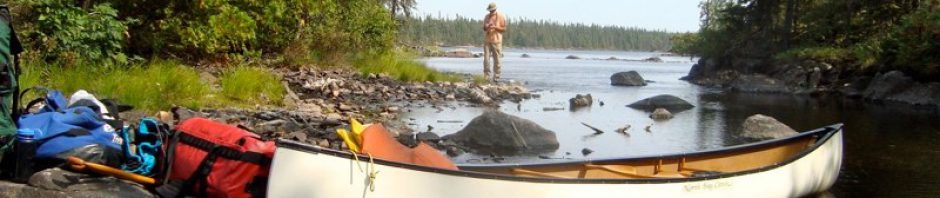
After the portage from Bob Lake to Diamond Lake, we originally planned to paddle up the lake’s north arm that afternoon to check out the pictographs. Having done a less-than-satisfactory job of documenting the rock painting site on our last visit in 2009, we planned on doing better this time! However, the wind and the waves had their own agenda, so we ended up camping on a small island at the south end of the arm. We hoped there would be less wind and no rain by the next morning.

looking up the north arm of Diamond Lake

- Click here to open a Google Map view of Diamond Lake and the surrounding area.
- Download the 041 P 01 Obabika Lake 1:50000 topographical map here.
Morning came, and the weather for the next three hours would be the best of the entire five days of our early October trip. We paddled the 2.6 kilometres to the pictograph site on the west side of the arm on completely calm water. In my thoughts was the withering conclusion about the meaning of the Diamond Lake pictographs delivered by Canada’s then-pre-eminent archaeologist, David Boyle, over a hundred years ago.
____________________________
W. Phillips and David Boyle: 1906
The Annual Archaeological Report for 1906 (Being Part of the Appendix to the Report of the Minister of Education Ontario) included an article titled “Rock Paintings At Temagami District”. Near the end of the article, attributed to W. Phillips but with Boyle as the editor, Boyle writes this –

Overview of Diamond Lake Pictograph Site
This article (published in 1907) represents the first scholarly record of the Diamond Lake pictographs. Doing the recording was W. Phillips, a “temporary Assistant” in the Archaeology Department at the Ontario Provincial Museum. As the Museum’s Superintendent, Boyle had sent Phillips up to Temagami to check reports of rock paintings. Here is Phillips’ own account of his visit –


The Diamond Lake Pictograph Site – view from the north
As Phillips noted in his report, the ochre markings are spread out over a ten-meter length of the white quartzite surface. Overhead ledges protect the painted markings from the worst of the run-off water. They face east/south-east and are thus spared the worst of the winds from the NW. The above photo shows the site from the north end, with the dot in the circle as the last of the pictographs.
Phillips does not note any insights about the pictographs’ purpose or meaning he may have received from “Steve Ryder, the Indian guide” or from other Anishinaabeg living near the H.B. Co. post on Bear Island.
_____________________
F.G.Speck/Aleck Paul: 1913

Frank Speck with Timagami band members on Bear Island in 1913
In 1913, F.G. Speck visited Bear Island in Lake Temagami while working for the Geological Survey of the Canadian Federal Government’s Department of Mines. He was an American anthropologist whose main focus was Eastern Woodlands cultures (Algonkian and Iroquoian); at the time, he was a professor at the University of Pennsylvania. He recorded this statement (which sounds like it has been edited and polished somewhat) by Aleck Paul, who was one of the estimated 95 members of the Temagami band on Bear Island at that time. He was also serving as the second chief that year. His family had moved to the Temagami area from Fort Mattagami after the 1850s.

from F.K. Speck. Myths and Folk-Lore of the Temiskaming Algonquin and the Timagami Ojibwa. 1915. p.76.
If one were to take the above account as reliable and accurate, it would mean that (almost all of) the pictographs in the area are not Anishinaabe but rather Iroquois (i,e. Haudenosaunee) in origin. It would also date them back to no older than the 1780s when the Iroquois, led by Thayendanegea (known to us as Joseph Brant) left the Five Nations territory of Upper New York State for what was then Upper Canada (i.e. Ontario), having picked the losing British side in the rebellion of the Thirteen Colonies. Since the Iroquois do not have a pictograph tradition, the story is not supported by any facts, and the reason offered for why they were painted does not really make sense.
There is anecdotal evidence of Iroquois raids in the lands north of Lake Nipissing in the 1830s. However, these accounts do not have the raiders from south of the French River searching for a new permanent homeland in northern Ontario.
 In the end, some supporting evidence from nearby Hudson Bay Co. post journals that these supposed fur raiders were indeed upsetting the local fur trade would make for a stronger case.
If nothing else, Paul’s account of the pictograph origins shows that the Ojibwe living with the pictographs in 1913 had no idea of who put them there and why. Speck concluded from his conversations with the Bear Island Ojibwe that their not-so-distant ancestors had migrated from the Lake Huron area in the early 1800s, not long before the 1830s Iroquois fur raids.
As regards the history of the Timagami band itself, evidences seem to support the assumption that these people are part of a steady northward drift of Ojibwa-speaking tribes from the Great Lakes. The Timagami themselves say that their ancestors came from near Sault Ste. Marie (Pawatiri “at the rapids”). See here for the source – p.11
The Temagami-area pictographs were already there when the dozen or so Ojibwe families migrated to the area. The Anishinaabe people who painted the images were not Ojibwe but Algonquins. Their spring/summer settlements would have been at locations like
- the mouth of the Montreal on Lake Temiskaming
- the mouth of the Lady Evelyn River on the Montreal River.
Sometime before the Ojibwe migration into Temagami, the handful of Algonquian families who thought of Temagami as their long-held fall/winter hunting grounds stopped coming.
Perhaps Boyle got something right when he wrote in that 1907 Report discussed above, “Even the Indians of today are unable to give the least hint with respect to the meaning of anything in such pictographs.”
 Click on the title to download a 5 Mb pdf copy of the booklet Speck wrote for the Department of Mines – Myths and Folk-Lore of the Temiskaming Algonquin and the Timagami Ojibwa. It was published in 1915. Speck does not mention having visited any of the pictograph sites in the Temagami area, of which the Diamond Lake site is by far the most impressive. One of his main sources of information was Aleck Paul, the second chief, who was born in Temagami but whose ancestors had moved into the area from the Lake Mattagami area further north after the 1850s.
_____________________
Harold C. Lowrey in Macleans: 1919.
 In The Unspoiled Wonder, an article about the wonders of Temagami in the August 1919 issue of Macleans (see here for the text), Harold Lowrey also explains the pictographs as an Iroquois piece of work. Lowrey had spent some time in the Lake Temagami area and would have spoken to many people, Ojibwe and others, during his time there. While the Iroquois explanation seems to have been accepted at the time, Lowrey’s account differs in the purpose of the pictographs and when they were put there. Raiding Five Nations Iroquois war parties were a feature of the mid-1600s, not the 1830s.
Lowrey also provides a fanciful explanation of the pictographs as tribute by Iroquois warriors to one of their princesses (travelling with a war party?) who apparently drowned near the rock. It is as unhistorical as its inspiration, Longfellow’s Song of Hiawatha!

And, like Boyle before him, he understood the collection of pictographs to have been put there at one time by one person to tell a coherent “hieroglyphic story”! What we actually see are individual, unrelated painted images put there over generations by many “painters,” all drawing from their shared Anishinaabe cultural image bank.
_____________________
Selwyn Dewdney: 1959
 It would be fifty-three years before the next visit from the museum (now named The Royal Ontario Museum) would check out the pictographs. It was Selwyn Dewdney, then at the start of his decade-long quest to document the pictograph sites of the Canadian Shield. The Diamond Lake Site would be #40 of the more than 260 he would eventually visit. In the 1962 first edition of the book Indian Rock Paintings of The Great Lakes (click on the title to access), he writes the following –


Diamond Lake/Lady Evelyn South Arm – clink on the image to enlarge
The flooding that Dewdney noted was the work of the A.J. Murphy Lumber Company. In 1942, it had built a dam just north of the pictograph site at Lady Evelyn Falls, the point where Diamond Lake’s outflow tumbles down into Lady Evelyn Lake. These falls had seen their height decrease by some 3 meters when an earlier (1926) dam had raised the water level of Lady Evelyn Lake itself. An insightful Ottertooth article provides a detailed history.
Of the dam at the outlet of Diamond Lake, the writer (Brian Back) notes this:
 This explains why a part of the Diamond Lake pictograph site was underwater when Dewdney visited in 1959. The Dewdney sketch below shows which pictographs were underwater. Strangely enough, they are the ones that seem most vibrant these days! [I added the blue waterline and the text.]

In 1973 the dam at the outlet of Diamond Lake was removed. In 1976 Dewdney would visit with Thor Conway and Gilles Tassé and a CBC film crew working on a potential episode for the This Land series. According to Dewdney’s measurements, the water level had lowered by 1.37 meters!
I wonder what happened to the film footage shot by that CBC crew in 1976 for that episode of This Land. It would make for a fascinating look a half-century later.

Related Post: Selwyn Dewdney, Norval Morrisseau and the Ojibwe Pictograph Tradition
Selwyn Dewdney, Norval Morrisseau and the Ojibwe Pictograph Tradition
_____________________
Thor Conway: 1974
 Since Dewdney, with a few exceptions, there has been very little discussion and research on the Diamond Lake pictographs – or of the pictographs of the Temagami area in general. One exception is the work of Thor Conway. It was Conway who, as a young archaeologist, visited the Diamond Lake site with Dewdney in the mid-1970s and who continues to publish material on pictograph sites all across the Canadian Shield area. For example, his book on the Agawa Rock pictograph site stands as the definitive study of that Ojibwe rock painting location.

Conway first visited the Diamond Lake site in 1974. As luck would have it, the year before, the dam had been destroyed by a work crew from the Ontario Ministry of Natural Resources, and the water had come down to its natural level. Two years later, he was there again with a CBC film crew. Along for a visit were Dewdney and Gilles Tache, a Quebec archaeologist who also focused on the pictograph quest. During their visit, they were able to determine that water levels were lower by about 4.5 feet (1.37 meters) from where they had been on Dewdney’s 1959 visit. The dynamiting of the dam in 1973 made that much of a difference.
Conway’s book Discovering Rock Art In Ontario’s Provincial Parks (2009) has a chapter on the Diamond Lake pictographs. Though the 2009 book is impossible to find, the fall of 2016 saw the publication of a revised edition of the book with 35 pages of introductory material followed by 240 pages of discussion of twelve rock art sites across Ontario. (See here for the chapter titles.)
Titled Discovering Rock Art: A Personal Journey With Tribal Elders, it claims to preserve the ” traditional knowledge” of Ojibwe elders from across northern Ontario, which the Conways had gathered in their years spent in various First Nations communities. Any reader will come away with a bit more of an understanding of the Anishinaabe culture behind the images painted with hematite on rock faces across Ontario – and of the Canadian Shield in general. Clearly, the locals Conway spoke to in the 1970s had abandoned the notion of the Iroquois origins of the Temagami-area pictographs. No mention is made by Conway of the Iroquois origin stories.
The book is available on Amazon and from Thor Conway himself. The very first site Conway examines in detail is the one on Diamond Lake.
_____________________
Justice J. Steele of the OSC: 1984
In December of 1984, after months of testimony and evidence from Gary Potts, the chief of the Bear Island band, a few other Temagami band members, and numerous non-Indigenous academics, Justice Steele of the Ontario Supreme Court dismissed the land claim brought forward by Chief Potts and the Bear Island Foundation. While the entire decision makes for interesting reading, here is what Steel concluded after hearing various statements made about the pictographs:
Dr. Noble’s evidence is that pictographs have not yet been identified in any time frame. In addition, Mr. Conway’s evidence itself was conflicting as to the uniqueness of pictographs to the Temagami area. He stated that the upright canoe pictograph was distinctive to the area, but he gave more examples of upright canoes from outside the area than from inside it. His evidence about other unique pictographs was not supported archaeologically.
The oral Indian evidence is conflicting as to who made the pictographs. Some Indian witnesses believe they were made by the Iroquois. Others say they were made by their ancestors. Two Indians who were called made no reference to rock art having any relation to folklore. Michael Paul stated that he had been told by his father that his people had painted some of the pictographs and that, even now, some old people know the meaning of them but will not tell. The only “old person” called was William Twain and he gave no evidence relating to rock art.
Mr. Conway, in an article written in 1974, stated that he had been told that rock art was made by the Iroquois during the Iroquois wars. Now he says that they were made by Algonquins. However, he also stated that the oral traditions of the defendants had not changed from 1913 to today because even now Chief Potts believed them to be painted by the Iroquois, while others believed them to be malevolent to the Iroquois. Chief Potts’ evidence was that all except one had been painted by his own people. Alex Misabi said they were made by the Iroquois. Michael Paul, Sr. said some were made by each group.
I find that the pictographs have not been proven to show any continuity between the defendants and whoever made them, or that any conclusions can be drawn from them.
The full report: ATTORNEY GENERAL FOR ONTARIO V. BEAR ISLAND FOUNDATION ET AL. Ontario Supreme Court, Steele J., December 11, 1984
_____________________
Checking Out The Pictographs:
The site begins with some indecipherable ochre marks and concludes some ten meters or so further north with the most well-known of the Diamond Lake rock paintings.
The South End of the Site
We approached the pictograph from the south. The following sequence of images follows the ten meters of rock face in the order that Phillips numbered his drawings of the various ochre markings. Conway counted 77 individual ochre marks or paintings on the entire site. We were not as successful!
They were “painted” with a mixture of ground haematite (i.e. iron oxide) and perhaps fish oil or bear grease and then applied to the rock surface, not with a brush, but with a finger or two. The figures are usually no more than an inch (2.5 cm) wide and up to five or six inches long.
People are sometimes disappointed when they see them since, in the grand scheme of things, these are admittedly very rudimentary expressions of the values and beliefs of a Paleolithic culture. However, even if they are not the Lascaux Cave paintings, they speak to anyone who has experienced the rugged beauty of the Canadian Shield and how Indigenous Peoples survived in such unforgiving terrain.

Ochre on rock at Diamond Lake
The photo above is of the first of them, three ochre marks of which what may be a star pattern or a figure with outstretched arms is the most visible. Phillips did not make drawings of these indecipherable smudges.

T mark- #1 on Phillips Plate IV – and other ochre marks at Diamond Lake
The next evidence of ochre comes just a meter further north. Still visible is what looks like a T. It is with this pictograph that Phillips began his drawings of the Diamond Lake pictographs; it is #1 in his inventory. There is an ochre smudge above and to the right of the T, but it is badly eroded.

Phillips – Plate IV top
Phillips also passed by the slash mark below. The faint upward-pointing arrow just below it and to the right may be his drawing #2. There is more badly faded ochre, but it is impossible to say what they might have been.

Diamond Lake – ochre slash
We have now moved up about four meters of the site. In the image below, we have two pictographs corresponding to drawings #3 and #4 on the top of Phillips’ Plate IV above. #3 is on the bottom left, and #4 is quite visible on the right side of my photo. Is #4 a very rudimentary Thunderbird image?

Diamond Lake – Thunderbird pictographs or Crane footprints?

Bloodvein River shaman – and medicine bag?
As for #3, Conway comments that it may represent an otter skin. If so, it certainly would be an abstract rendition of the otter’s skin laid out flat. A shaman’s “medicine” bag would typically be made of otter skin.
If, as the quote above by the Bear Island elder from 1913 seems to indicate, the painting of the pictographs predated the Ojibwe arrival in Temagami, then seeing Ojibwe otter skin bags and totem emblems in the images may be the wrong interpretation. More information on the Algonquins’ shamanic medicine bags might clarify the question.
————
The Middle Section of the Site:

Diamond Lake Pictograph Site – The Core
And then we come to the core of the site – the stretch beginning to the right of the deep cut into the rock face. The first pictograph we see is of the moose (#6).

To the right (i.e. north) of the moose painting are three other clearly visible pictographs. On the Phillips Plate, they are numbered
- #7 (the six vertical lines, often referred to as tally marks, but who can say for sure?),
- #9 (a puzzling construction we called “the half banana”), and
- #10 (usually interpreted as a canoe with 6 paddlers, an image meant to convey the strength and power of a hunting party).
Looking more closely at the panel, other faint lines can be seen, with the highest one looking like Phillips #8 with the five fading vertical lines. All that is missing these days is the moss!

Diamond Lake – overview of the moose panel and #9 and #10 to the north of it

Phillips #9 – and canoe pictograph (#10) – note the impact mark between the two
————
The Case of the Stolen Pictograph
The moose is #6 on Phillips’ Plate IV. Underneath the moose image is evidence of an impact or two – most likely from a bullet. However, Conway states this in his book –

(The above quote is from the book’s first edition; It appears slightly edited in the 2016 edition on p. 49.)
It would seem that Conway locates the “removed” pictograph in the space immediately below the moose image. If Conway is right, the Phillips plate IV should include a drawing of it. His assumption is based on something he claims Dewdney saw in his earlier visit – i.e. in 1959 – that was no longer there when he visited in 1974.

He is not the only one to make this claim about a removed rock painting.
In a transcript of a CBC radio program called Morning North, “Backroads Bill” (Bill Steer) makes this comment in “Glimpses of the Past”:

Instead of Conway’s exact 1959 to 1974 time frame, Steer states that the supposed theft of the pictograph on the rock below the moose occurred between two of his visits. No dates appear in his article, but his two visits would presumably have to fall within Conway’s ’59-’74 timeframe. Steer does not include a description of the pictograph that he claims was removed.

Diamond Lake – moose (#6) and vertical lines (#7)
If there was an image there, it is also possible that the slab of rock just broke off from the rock face and fell into the water below, though the impact marks below the moose image do not fit with that scenario.
However, we do have Phillips 1906 drawings! Drawings #4 to 7 are all visible on the rock face. So are #8 to 10. So where is the missing pictograph? If a pictograph was striking enough to motivate someone to remove it from below the moose image, Phillips presumably would have included it along with all the others.
In an Ottertooth forum thread, the topic turned from Temagami environmental activism to the story of the claimed theft of a pictograph chiselled off from under the moose image. The debate was effectively ended with Brian Back’s rebuttal of all the supposed evidence. He provided an image from 1954 taken by a guide at the Keewaydin camp. It shows the rock face looking exactly as it does now.

1954 image of the area around the moose pictograph at the Diamond Lake site
Conway says the pictograph was stolen sometime between 1959 and 1973; Bill Steer says it was vandalized between two of his visits, presumably within Conway’s time frame. However, the blurry image above shows the empty space below the moose pictograph five years before Dewdney supposedly recorded an image in that now-empty space.
[See here for the Ottertooth discussion. What is most noteworthy about the comments is that people will continue to believe what they want to believe, even when presented with clear evidence that they are wrong. The photo above fits in with Phillips’ 1906 drawing of the site.
One last thing – in his book Discovering Rock Art, Conway includes the Dewdney sketch sheet of his Temagami area visits (Sites #40, 41, 42). However, he only includes the left half of the sheet. Had he shown the entire sheet, we would have seen the drawing that Dewdney made of Face III – i.e. the area with the moose on it. Dewdney drew the area underneath the moose with the same jagged lines as that blurry 1954 photo! His sketch sheet of the Diamond Lake site shows that nothing was removed after his visit. What Dewdney saw is what Phillips saw and what you and I see when we stop to take a look.
The conclusion?
- No “insensitive visitors compromised the ancient images” at any time in the last 115 years.
- There was no “cultural vandalism,” as claimed by Steer.
Re: the impact marks. There are a few, and they are probably the result of hunters (Indigenous or non-) firing at the moose image, perhaps an expression of magical thinking – i.e. hitting the moose image to ensure success in the actual hunt they were about to undertake.
Here, for example, is a pictograph grouping from Darkwater Lake in Quetico. It also has an impact mark close to the moose figure. It may be a coincidence; it may support my point.

canoes, Mishiginebig, the two-horned snake, and a moose figure
And here is another moose pictograph from the site on the east end of Lac la Croix in Quetico. A section of the moose’s head is missing, the probable result of a bullet impact.

The 1954 Diamond Lake image above shows some of the bullet impacts. There are other bullet impact marks, including one at the site’s north end below the canoe and the circle with a center dot.
———
After Dewdney visited the Diamond Lake site (#40 on his list – see here for the complete list), he went down to Bear Island to check out some pictographs on the island’s west side (his site #41). The seeds of the Diamond Lake stolen pictograph legend can perhaps be traced back to what he wrote – 
———————-
The North End of the Site
Then we arrive at the last three panels of the site, as pictured in the shot below. Plate V (see below) of the Phillips drawings contains all of them.

Dewdney devotes very little space to the Diamond Lake pictographs in his book. I get the feeling he really was not all that bowled over by what he found here. The one quote above, along with the sketch of the core of the site, and the quote below, are pretty much all he had to say about this site.

See the entire Dewdney passage on Diamond Lake here.

#13 (double arrow or otter skin); crane (#14) and bird tracks (#15)
Looking at Phillips’ Plate V above,
- #14 would represent the “clumsy heron,”
- #12 The maymaygwayshi, though it hardly seems like a vestige!
- #19 The circle with the center.
- #16 is perhaps included in his catch-all phrase “stick figures.”
Picking up on Conway’s comment, #11 and #13 possibly represent the otter skins associated with the shaman’s medicine bag if we can accept an Ojibwe origin of the images.

the Diamond Lake Site – the Three Northernmost panels
Surprisingly, Dewdney did not identify Phillip’s #16 as the horned snake of Anishinaabe myth.

Phillips #16 – horned snake pictograph at Diamond Lake
Another stick figure is #17, looking very much like a square root symbol. Not mentioned by Dewdney are the three dots, what looks like a canoe with two paddlers, more crane or heron footprints, and other impossible-to-say-what marks. Here is the drawing that Dewdney included in his write-up –

Diamond Lake pictographs – sketch from Dewdney’s book Indian Rock Paintings of the Great Lakes

Diamond Lake – the last two panels

the northernmost grouping of Diamond Lake pictographs

Diamond Lake Pictographs – northernmost grouping
As if to point out the problem of saying exactly what it means, Dewdney concludes his comments on the site by noting this about the circle with the dot – Ending the statement with an exclamation point does point out that these two inventories, both from the mid-1800s, come up with very different meanings for the same image!
—————————–
The Nearby Pictographs Below Lady Evelyn Falls:

The lost (i.e. flooded) nearby Lady Evelyn Picto Drawings Plate VI
Included in the report that Phillips submitted was Plate VI. It is his record of the Lady Evelyn pictograph site just below the used-to-be Lady Evelyn Falls at the outlet of Diamond Lake and is about three kilometers north of the Diamond Lake site. While people have looked, they have not found it due to the higher water level caused by the Mattawapika Dam built in the mid-1920s.

Brian Back’s Ottertooth article “The Lady Evelyn Lift-Over” provides some historical background on the impact of dams on water levels on Lady Evelyn Lake and on Diamond Lake.
—————————–

one last look at the Diamond Lake Pictograph site
What does it all mean?
David Boyle’s statement near the end of the 1907 article “Rock Paintings At Temagami District” was already noted. He wrote: “It would be utterly vain to look for any interpretation.”
In spite of that, Boyle could not resist offering an interpretation and ended up proving his own point!
 Rather than see the site as it is – associated in Anishinaabe tradition as the home of the maymaygwayshi and other powerful medicine spirits to which a number of shamans came over an extended period of time – he sees it as a tablet on which one person has written a “sentence” or two using the pictographs as a picture script.
This one person, he writes, has written a “story.” Boyle is able to state quite categorically that the first sentence ends near the top of Plat VI! Oddly enough, the article ends with that assertion. I flipped the page, expecting to see a continuation somewhere, but that statement is it – a peculiar way to end the report. To conclude, Boyle seems to be a victim of the notion that the pictograph site represents an application of a coherent Anishinaabe writing system. Such a system did not exist.
There is no Rosetta Stone to help us unravel the meaning of the Diamond Lake pictographs, as shown by the conflicting mid-1850s inventories of symbols and their meanings left by Schoolcraft and Copway and by the conflicting views as to who even put the pictographs there.
However, those who have visited over the past 100 years have provided a bit more insight into pictographs’ nature and significance. Boyle’s “utterly vain” can be amended to “much is still puzzling.” It will probably remain that way! However, thanks to some of the more recent visitors, we can now better see elements of the Anishinaabe world-view in the ochre, from possible references to their clan (doodem) system and their religious beliefs.
As we paddle past the dramatic quartzite rock face, the least we can do is stop and appreciate the fact that maybe two or three hundred years ago, Anishinaabe shamans stopped at this same spot. As a part of a visit to the home of the maymaygwayshi for powerful medicines, he left the rock paintings as part of the ritual. Perhaps others were left by young men at the end of their arduous vision quest ritual, leaving a record on a sacred-to-them stretch of rock where generations of his people had come to leave their marks.

From their birch bark canoes, they reached out to the rock and created enduring marks with their specially prepared mixture of finely ground haematite (iron oxide) and fish oil. The pictographs of those with better formulations of the “paint” have fared better over the two or three centuries since they were put there.
While we will never completely understand the significance of all the ochre paintings, we still stop briefly and enter another cultural space.
Views of The Site From A Distance

Diamond Lake Pictograph site – a view from the other side of the lake’s north arm

Looking south at the site from near the Lady Evelyn Lift-over – what was once Lady Evelyn Falls
_____________________
You can access a pdf file of W. Phillips’ “Rock Paintings At Temagami District” from my WordPress site. If you want to see where it came from, look here – The Annual Archaeological Report for 1906 (Being Part of Appendix to the Report of the Minister of Education Ontario) published in 1907.
————–
The 1962 first edition of Selwyn Dewdney’s Indian Rock Paintings of the Great Lakes is available for online reading or download. It documents the first 109 sites he visited. A second edition came out in 1967 with documentation on an additional 155 sites. By this time, his quest had taken him far beyond the field of study, as stated in the title!
————–
Thor Conway’s Discovering Rock Art: A Personal Journey With Tribal Elders can be purchased directly from the author.
The Thor and Julie Conway article on the Lake Obabika pictographs – “An Ethno-Archaeological Study of Algonkian Rock Art in Northeastern Ontario, Canada” – provides background to the Diamond Lake pictographs, which are briefly mentioned in the article published in issue #49 of Ontario Archaeology in the mid-1980s.
————–
Dewdney mentions Cuttle Lake in his discussion of the Diamond Lake rock paintings. Grace Rajnovich’s article “Paired Morphs At Cuttle Lake” is in the Jan/Feb 1980 issue of Arch Notes, the newsletter of the Ontario Archaeological Society. It includes drawings from one of the panels and provides a point of comparison.
————–
Another collection of Diamond Lake pictograph photos can be seen at the temagami.nativeweb.org site. The pix show some of the pictographs from a better angle than our shots do. Go here – Ancient Pictographs at Diamond Lake in Temagami. How ancient they really are is an open question. My guess would be no more than three hundred years.
————–
More Pictograph Posts:
An Introduction:
Anishinaabe Pictograph Sites Of The Canadian Shield
Some Ontario Pictograph Sites
Anishinaabe Pictograph Sites In Ontario
A Site Not Far From Temagami’s Diamond Lake
The Chiniguchi Lake & Matagamasi Lake Pictographs
Like this:
Like Loading...