Sri Lanka – What Caught My Eye

This gallery contains 75 photos.

Last revised on March 7, 2017. Previous Post: Walking In Sri Lanka’s Hill Country and Cultural Triangle Early this year, I avoided over three weeks of an unusually bitter Toronto winter by visiting Sri Lanka for the first time. For two … Continue reading

More Galleries | Tagged , , , , , , | Leave a comment

Walking in Sri Lanka’s Hill Country & The Cultural Triangle

The duffel bag is packed and I’m ready to escape the colder-than-usual winter here in Toronto. Last night another eight centimetres of snow fell. The streets and sidewalks had just been cleared and dried from the last snowfall! This is what it looked like this morning –

February 18 - my street in Toronto after another snowfall

February 18 – my street in Toronto after another snowfall. It was 33°C in Colombo at the time!

Luckily, tomorrow  I am off to the fabled isle of Serendib (as visiting Arab traders apparently called it). Located just a few degrees north of the equator, It is known these days as Sri Lanka,  a name of Sanskrit origin meaning “the blessed island”.  It figures in the two great Indian epics, the Ramayana and the Mahabharata, written in this ancient Indo-European language.

Sri Lanka

Invaders, traders, and adventurers have had the island in their sights for at least the past three thousand years. With the advent of cheap air travel in the 1970s, tourists looking for pristine beaches have joined the ranks of visitors. Needless to say, it has a lot more to offer than sand and sun – if what you are looking for is more than a beach vacation.

Ptolemy, a Hellenistic Greek academic living in the great Mediterranean port city of Alexandria, Egypt in the second Century C.E., included it in his map of the world created from information gathered from sailors at the docks of his city.

1300's C.E. recreation of Ptolemy's world map

1300’s C.E. recreation of Ptolemy’s world map – Sri Lanka dominates the Indian Ocean

While we know Sri Lanka is not that large an island, its size on Ptolemy’s map is an indication of its importance to the people of the Mediterranean world as a source of exotic spices and gems.  Ptolemy knew the island as Taprobane.

Marco Polo Writes About Seilan:

marco poloMarco Polo, the Venetian adventurer, seems to have visited Sri Lanka around the year 1300 C.E. on his way back from China.  Here is what he had to say about the island, which he knew as Seilan, and its people. (Seilan is another way of spelling Ceylon, the name by which most English-speaking people knew the island until 1972 when it was officially changed to Sri Lanka.)

We read the following in The Travels of Marco Polo/Book 3/Chapter 14  

Concerning the Island of Seilan

When you leave the Island of Angamanain and sail about a thousand miles in a direction a little south of west, you come to the Island of SEILAN, [1] which is in good sooth the best Island of its size in the world. You must know that it has a compass of 2400 miles, but in old times it was greater still, for it then had a circuit of about 3600 miles, as you find in the charts of the mariners of those seas. But the north wind there blows with such strength that it has caused the sea to submerge a large part of the Island; and that is the reason why it is not so big now as it used to be. For you must know that, on the side where the north wind strikes, the Island is very low and flat, insomuch that in approaching on board ship from the high seas you do not see the land till you are right upon it.[2] Now I will tell you all about this Island.

They have a king there whom they call SENDEMAIN, and are tributary to nobody.[3] The people are Idolaters, and go quite naked except that they cover the middle. They have no wheat, but have rice, and sesamum of which they make their oil. They live on flesh and milk, and have tree-wine such as I have told you of. And they have brazil-wood, much the best in the world.[4]

Now I will quit these particulars, and tell you of the most precious article that exists in the world. You must know that rubies are found in this Island and in no other country in the world but this. They find there also sapphires and topazes and amethysts, and many other stones of price. And the King of this Island possesses a ruby which is the finest and biggest in the world; I will tell you what it is like. It is about a palm in length, and as thick as a man’s arm; to look at, it is the most resplendent object upon earth; it is quite free from flaw and as red as fire. Its value is so great that a price for it in money could hardly be named at all. You must know that the Great Kaan sent an embassy and begged the King as a favour greatly desired by him to sell him this ruby, offering to give for it the ransom of a city, or in fact what the King would. But the King replied that on no account whatever would he sell it, for it had come to him from his ancestors.[5]

The people of Seilan are no soldiers, but poor cowardly creatures. And when they have need of soldiers they get Saracen troops from foreign parts. 

(Click here for the online source of the text as well as the footnote information.)

The above passage serves as a warning not to believe everything one reads or hears – even from people who claim to have been there or talked to someone who was!  This article on Tourism in Sri Lanka happily misquotes Polo’s actual words and has him say that Sri Lanka “is the finest island in the whole world” twice in five sentences while making sure not to quote any of the less flattering statements!

Walpola Rahula – What the Buddha Taught

My interest in Sri Lanka goes back to my late teens when I got a hold of a copy of What The Buddha Taught by Walpola Rahula. (Click here for a pdf copy of the second edition of the book from 1974.)  This Buddhist monk, one of Sri Lanka’s leading intellectuals of the past century, presented in his book a completely human Buddha free of mythology and mindless adherence to ritual and tradition that I found very attractive. (It was the late 1960’s and there was something in the air!)  For some reason I thought that this interpretation of Buddhism was the one that thrived in Sri Lanka, not realizing that religion, as practised by the common people in their daily lives, is something quite different from what Rahula presented.  I eventually came to realize that real-world Buddhism is no more free of myth and ritual and tradition and hierarchies than any other religion; I still find Rahula’s Buddha very appealing.

The Mahavamsa:

More recently I came across an epic chronicle of ancient Sri Lankan history called The Mahavamsa.  It provides the basis of a different Buddha, one who really comes across like a god from the Hindu pantheon.  The first chapter (an online copy is available here) of this chronicle has a fantastical account of the Buddha leaving his 1.8 m/5 ft. footprint on a mountain peak (known today as Sri Pada or Adam’s Peak) on one of a series of three visits to Sri Lanka from northern India around 500 B.C.E.  Who knew!

internet-sourced image of Ruwanweliseya Stupa at the ancient capital of Anuradhapura

internet-sourced image of Ruwanweliseya Stupa at the ancient capital of Anuradhapura –  Next to the Giza pyramids,  the largest manmade structures in the ancient world were the three great dagobas found in Anuradhapura. I will be spending three days here.

What this chronicle makes clear is the close alliance between ruler and monk in Sinhala society.  In return for patronage from the ruler, the monks provided the rulers with legitimacy. (One can see a similar compact between Church and State in Medieval Europe.)  Massive stupas (dagobas is the Sinhala term) were constructed by the kings to house the talismans and relics said to be related to the Buddha.

Sri Lanka’s Hill Country & Cultural Triangle

If you click on the following topo map,  you’ll see where in Sri Lanka I will be spending most of my time  – the Hill country contained within the circle and the Cultural Triangle with Anuradhapura, Kandy, and Polonnaruwa as key points of interest.  

topography of sri lanka

the topography of Sri Lanka

My late February to mid-March visit will mostly be spent in these two areas. The f Google map below highlights the main stops in my ramble. I had originally planned a bicycle trip that followed this basic itinerary.  However, the bike will stay home this time as I join a small walking group for what should be a fairly easy-going trip.

It is organized by Exodus, an excellent U.K. adventure travel company that I have used a few times in the past.  See here for the description of the tour I signed up for – The Highlands of Sri Lanka. I’ve also set aside a few days at the end to visit Anuradhapura, the ancient Sinhalese capital for over a thousand years.

Click on the “More options” prompt in the top left corner of the map if you want to get a screen-size interactive image that you can zoom in on to see the specific points in the itinerary.

My Next Time – The Tamil North and East

You may have noted that my visit to Sri Lanka does not focus at all on the north and the east of the country.  These areas also happen to be where Tamils tend to be in the majority. In the back of my mind is a second trip to the country with my bicycle, during which I would pedal the roads from Jaffna down the east coast as far as I can. It was this area that was devastated by the tsunami of December 2004; the coast to the north of Trincomalee is also where the Tamil Tigers were finally cornered and annihilated.

sri lanka geogrpahy:religious groups

It has been five years since the decisive ending of the twenty-five year-long civil war in the country.  In the years since the Sri Lankan government has been criticized by some (including the Canadian government) for its treatment of the Tamil minority during the last phase of the war and in the years since. This Al Jazeera web page (click here) has a couple of provocative 25-minute documentaries embedded in an opinion piece by Ameen Izzadeen that many Sinhalese would undoubtedly see as misleading but which do provide a useful background to the issues.

I’m sure I will learn all sorts of things I never knew about Sri Lanka and its people in my 21-day visit.  Given my ignorance of the complexities of the island and its cultures, I will often misinterpret the things I see or be oblivious to things that are happening right in front of me!  Check back in a month or two to see what I made of the experience. I am really looking forward to this escape from our Canadian winter!

Anuradhapura Dagoba

Anuradhapura Dagoba

Related Posts:

Sri Lanka – What Caught My Eye 

Sri Lanka’s Dambulla Cave Temple: A Buddhist Treasure Trove

Before Machu Picchu Was, There Was Sri Lanka’s Sigiriya

Colombo’s National Museum: Some Of What You’ll See

Dambulla Cave Temple #1

Buddhist Baroque: Colombo’s Gangaramaya Temple

Seema Malaka: Colombo’s Serene Buddhist Island Vihara

The Ruins of Ancient Anuradhapura – Part One

The Ruins of Ancient Anuradhapura – Part Two

Up The Steps Of Sri Lanka’s Mihintale (Mahinda’s Hill)

A Visit To The Ruins of Sri Lanka’s Ancient Polonnaruwa – Part 1

the Aukana Buddha – full view

A Visit To The Ruins of Sri Lanka’s Ancient Polonnaruwa – Part 2

The Aukana Buddha: Sri Lanka’s Colossal Standing Rock Statue

Sri Lanka’s Horton Plains and The View From World’s End

A Train Ride Across The Highlands of Sri Lanka


Posted in hiking/trekking, Sri Lanka | 1 Comment

Bicycling New Zealand’s South Island: Dunedin and the Otago Peninsula

New Zealand’s South Island offers some great bicycle touring possibilities.  While I did not have the time to savour the northern third of the island, the 1400-kilometre route I followed from Christchurch to Invercargill provided more than a few memorable days.

Previous Post:  Part 6 – From Queenstown To Invercargill

Bicycling South Island New Zealand: From Queenstown To Invergill and Dunedin

One sheer WOW day was the one I spent cycling the Otago (pronounced Oh tah go) Peninsula just next door to the university town of Dunedin, the South Island’s second largest city and a place with a nice mellow vibe to it.

From my base camp at a motel on George Street not far from the campus of the University of Otago, I set off on my Cannondale Touring Plus feeling much lighter than usual. I was leaving behind the four panniers and 25 pounds (11.3 kg) of gear that I had deemed important enough to take along on my Kiwi ride. All I had was my camera, a rain jacket, a couple of energy bars, and some water. What a difference it makes!

the designated bike lane at the start of the ride

Some uphill on Highcliff Road on the way back

downtown Dunedin

To get to the start of the Otago Peninsula, I cycled down one-way Castle Street from the north end of town and passed the train station on my left as Castle becomes High Street and then merges with Cumberland Street as it continues south. When I arrived at Jetty Street, I turned left towards the harbour and Wharf Street, with its designated bike lane. In 300 meters, Wharf Street becomes Portsmouth Drive, which takes you to Portobello Road.  The most complicated part of the day is done!

leaving downtown Dunedin for the Otago Peninsula

leaving downtown Dunedin for the Otago Peninsula

Get ready to embrace a pretty easy 18-kilometre ride along the waterfront all the way to Portobello Bay.  The traffic on the weekday morning I was there was very light; there seemed to be more traffic coming out to downtown Dunedin from the peninsula than vehicles heading in.  Later in the morning, I noticed a few buses and rental vans making their way to the albatross colony at the far end of the peninsula.

Only a cyclist will want to examine the following pix closely, as they show what the road was like – sometimes with a bit of a paved shoulder, occasionally with a dedicated bike lane, and usually quite narrow and running along the water’s edge.

Beyond the village of Portobello,  the road becomes Harington Point Road as you make your way to the Royal Albatross Colony at the northern tip of the Peninsula.  If you wanted to turn your Otago Peninsula tour into a two-day affair, there is accommodation in the village that would allow you to make a leisurely day trip even more mellow. You’d have more time to get off the saddle and sample some of the beaches you cycle by!

It took about two hours to cycle to the top of the Peninsula from downtown Dunedin. I didn’t stop at Portobello Village on the way, figuring I’d have lunch there a couple of hours later. After dealing with the first hill of any note,  I got to the end of the Peninsula and the Royal Albatross Colony. A cup of coffee and something sweet, and I was left to consider whether to take the soon-departing tour to see the albatrosses.  The ticket wasn’t cheap at $35.I ended up rationalizing it as my contribution to the upkeep of the wildlife sanctuary.

the road as it approaches the Albatross Centre

After a brief lecture in the interpretative centre, we got to wander some of the trails above the centre and kept our fingers crossed for a real live sighting!  We were looking for something like this –

On our way out of the center, you see this graphic depiction of the relative wing spans of birds known in this area –

From the covered viewing station, we could see a boat providing its clients with a different perspective of the one albatross that happened to be out on view that morning!

Taiaroa Head Jail - a bit of history on a plaque

Taiaroa Head Jail – a bit of history on a plaque

Was it worth it? Sorta. I should mention that it really is a two-for-one deal since you get to tour the military installation that was once here – pre-WWI bunkers and an impressive 150mm mounted and retractable gun all ready to blast away any threat (supposedly the Russians!) to the British Empire. It was a pleasant one-hour diversion from the main focus – the road and the water.   Not far from the albatross colony was another attraction – the Penguin Place –  but instead of spending another $40 on the entry fee there, I decided to head back to Portobello for more caffeine and some lunch.

On my way back to Portobello Village, I did pass by this sign – clearly not all the locals are excited about the idea of turning the roads of the peninsula into a cyclist’s dream trip!  Of the half-dozen times I saw this sign on the South Island,  this was the only one that was defaced. (The cyclist to the left of the car has been painted over, as has the word “share” in “share the road”.)

I saw no other cyclists on the roads of the Peninsula that day, and the traffic seemed quite light. A weekend would bring out more vehicles and cyclists and perhaps create more tension on the roads.

Share The Road - NOT!

Share The Road – NOT!

Following the road as it climbs around the corner from Taiaroa Head, I was soon rewarded with a downhill stretch; the ride back to Portobello Village presents no real challenges, and it the village cafes provide a chance to fuel up!

Then came the real challenge of the day – but also the most stunning views. From the turn off to High Cliff Road in Portobello to the top of the road is 9.2 km of mostly uphill with a total elevation gain of 385 meters.


The reward is an equally long downhill blast back to Dunedin!

On the way back to Dunedin, just 3 kilometres up the Highcliff Road is Larnach Castle. I cycled right up to the entrance post.  However, the $48NZ entry fee and an entry guard who wasn’t too keen on me leaving my bike with him for a couple of moments while I went inside to take a few photos meant I turned back to High Cliff Road

  • The weather,
  • the fact that I was not riding with my usual 25-pound touring load
  • the variety of stunning views, the mostly traffic-free roads –

made this one of my favourite days of cycling on the South Island.  It rivals the day I spent cycling from Wanaka to Queenstown via the Cardrona Road or the one I spent going over Arthur’s Pass to Greymouth.

I ended the day a bit early because I had arranged to drop off my rental bike at a bike shop on Stuart Street before closing time.  I had rented the bike in  Christchurch almost three weeks before.  The next morning, I would be on the bus back to Christchurch and the return flight to Toronto.

(Instead of bringing my own bike from Canada, it was almost as cheap and much more convenient to rent one in Christchurch.  The company – Natural High – provided a great bike – a Cannondale touring bike –  at a reasonable price. If the logistics and hassle of taking your own bike puts you off of a Kiwi bike trip, consider the rental option. I did bring the following:

  • my panniers,
  • front handlebar bag,
  • helmet, my 1990s vintage Brooks saddle,
  • bike shoes and
  • Shimano SPD pedals. 

After the bike drop-off,  I stopped at a pub on the Octogon for a pint to celebrate not just a day’s worth but three weeks’ worth of the best cycle touring I have experienced anywhere. It has me thinking of a return to NZ! There is always the North Island, and the part of the South Island to the north of Christchurch that get rare reviews from fellow cyclists.

Dunedin - Octogon pub sign

—————–

If you want to see how I got to Dunedin from Christchurch, the following posts provide the details:

Crossing the Southern Alps – From Christchurch to Greymouth

Bicycling South Island New Zealand:: Christchurch to Greymouth

The West Coast Road (From Greymouth to Haast)

Bicycling South Island New Zealand: The West Coast Road From Greymouth to Haast

Over the Southern Alps Again – From Haast to Queenstown

Bicycling South Island New Zealand: From Haast to Queenstown

To Southland and the Otago Peninsula

Bicycling South Island New Zealand: From Queenstown To Invergill and Dunedin

Bicycling New Zealand: Planning a Three-Week Tour of South Island

Bicycling South Island New Zealand: Planning A 3-Week Route

——————-

Useful Links:

Wikipedia has informative entries on both the Otago Peninsula and on Taiaroa Head that provide a good introduction to the area.

Posted in bicycle touring | Tagged , , , , | Leave a comment

Ice Storm Patrol- Viggo On Watch in Toronto’s Riverdale

Two weeks and an eventual 75 million dollars later – and lots of grief for many people – the Ice Storm of late December 2013 is over in the Greater Toronto Area.  As I write this today, almost all residents have their electricity back on and city crews are dealing with the thousands of downed branches all over the city streets and parks.

A few days before Christmas eastern Canada was walloped with what the forecasters on TV were labelling a “major weather event”!  A mass of moist air coming up from Texas collided with a cold blast from the Canadian northwest and the first challenge was a couple of days of freezing rain and sleet that blanketed everything with a coating of ice.

Viggo taking in the icy pathway to the backyard

Viggo taking in the icy pathway to the backyard

Our backyard became a skating rink and walking anywhere became an iffy proposition.

Riverdale street on Day 1 of the Icestorm

Riverdale street on Day 1 of the Ice storm

ice on tree branches

ice on tree branches

ice on pine needles

ice on pine needles

icicles on evergreen

icicles on evergreen

While on our daily rounds of the neighbourhood  Viggo and I – well, let’s make that I – was captivated by the aesthetics of ice on branches.  Meanwhile, about 300,000 people in the Toronto area were  without electricity that first morning because of ice-laden branches breaking off and falling on hydro wires.  Our neighbourhood was one of those spared this pre-Christmas electricity outage but there was  still evidence all around us.

ice and branch-covered Riverdale sidewalk

ice and branch-covered Riverdale sidewalk

While the neighbourhood’s electricity was not cut off, some people did get a nasty surprise when they looked out of their windows on that first morning. Scratched vehicles – and worse – were a common sight.

fallen branch and crunched vehicle

fallen branch and crunched vehicle on our street

another Icestorm casualty on Riverdale

another Icestorm casualty on Riverdale

For the first two days we had to avoid all of our usual walks because of the ice.  Meanwhile, 200,000 Torontonians were still without power as we hit Christmas Day.  A fresh snowfall that morning could not have made things easier for the Hydro crews working flat out for the past seventy-two hours.

Viggo wanders down Riverdale Ave on Christmas Day morning

Viggo wanders down Riverdale Ave on Christmas Day morning

a fallen branch and wires block Riverdale Ave

a fallen branch and wires block Riverdale Ave – there was no through-traffic for six days

branches across Riverdale Avenue

branches across Riverdale Avenue –

We would spend the next few days going down to our favourite walking route – the trails down along the Don River as it passes through our neighbourhood.  Given the conditions and the absence of cyclists and joggers – I knew that it would be almost 100% safe to let Viggo off-leash. We would also not have to worry about the salt that some residents and enthusiastic city workers dumped on the sidewalks.

Viggo on a side trail going down to the Don river

Viggo on a side trail going down to the Don river

We came to one of my favourite spots on the river bank and Viggo found something of interest to monitor. I didn’t notice until I looked at the image at home that this is where he lost one of his rubber booties! There it sits in the snow, waiting for me to pick it up when the snow melts again.

Viggo on the bank of the lower Don - Xmas morning

Viggo on the bank of the lower Don – Xmas morning

another favourite vantage point - Viggo looking for ducks on the Don

another favourite vantage point – Viggo looking for ducks on the Don

Icestorm tree damage along the Don River

Icestorm tree damage along the Don River – luckily no nearby wires

Viggo at work surveying his pasture

Viggo at work surveying his pasture

Where in the world is Viggo the Icelandic?

Where in the world is Viggo the Icelandic?

Viggo eyeing the ducks in a open stretch of the Don River

Viggo eyeing the ducks in a open stretch of the Don River

When we are down along the river I always check for signs of recently used campsites.  While it is not a big deal in the heat of the summer,  a minus 10°C combined with alcohol or some drug could lead to more serious consequences. Thankfully, this camp has not been used for the past three weeks –

rough camp on the lower Don

rough camp on the lower Don

I looked around for the Somali guy whom I first met last winter down in the valley; when I met him a couple of days before Christmas this year he was going down the Riverdale footbridge steps to his camp in the valley. He was carrying a dozen eggs, some juice, bread, and the Saturday edition of the Toronto Star!  I am not sure where his shelter is.

abandoned camp - it was covered with a green tarp in the fall

abandoned camp – it was covered with a green tarp in the fall

shelter built on the abandoned railway tracks - nobody home

shelter built on the abandoned railway tracks – nobody home

We make our way back to the footbridge which takes us over the Don River and back to Riverdale.  On our way we look west to one of our other places to go – the large off-leash area of Riverdale Park West. Some of the usuals are there!

Riverdale Park West - an off-leash area for dogs

Riverdale Park West – an off-leash area for dogs.

We had gone down into the valley because when we passed by there were some tobogganners sliding down the hill – and Viggo somehow includes them in his list of things to be herded.  At least down along the river on a snowy day it is only the ducks!

panorama from the Riverdale Bridge - the CN Tower and downtown are in the distance

looking south from the Riverdale Bridge – the CN Tower and downtown are in the distance.

Down the steps we go to the path pictured on the left hand in the image above – but instead of walking south towards the lake we head north on the trail – under the the Bloor Street Viaduct and beyond in our rambles.

Viggo taking a break in the snow

Viggo taking a break in the snow

Today (January 2, 2014) it got down to -17°C with the wind knocking down the temperature to -27°C. Tomorrow will apparently be even colder – down to -33°C with the wind chill. Here is a brief writeup of the details.   Viggo and I will not be doing any extended adventures down along the river, contenting ourselves instead with short thirty minute walks in the neighbourhood.

I still can’t figure out how dogs can take the cold the way they do – especially their paws. Out I go with four layers of synthetic clothing  and insulated snow boots and my little Icelandic sheepdog revels in the snow and is oblivious to the cold.

Viggo eying potential herding job - I hang on tightly!

Viggo eying potential herding job – I hang on tightly!

Clcik here or check out the Viggo’s Den folder on the bottom of the header for more posts on our Icelandic Sheepdog, Viggo.

Here is the problem faced by the Works department over the next eight weeks.  Given  Toronto’s estimated ten million trees,  someone came out with an unsupported statement  that 20% of them have been damaged or have broken branches.  While that may be wildly over-estimating the problem, even if it is only 1%, that would mean 100,000 messes like the one below to clean up!  Ridicule be damned – call in the Canadian Army!

Withrow Park fallen branches

Withrow Park fallen branches

Posted in Ramblin' With Viggo | 3 Comments

A Walk Across The Roof Of Europe – The Monte Rosa Traverse

Table of Contents:

The Klein Matterhorn-Monte Rosa Traverse – Overview Map

————-

On The Roof Of Europe -The Start of The “Spaghetti Traverse” 

Standing on the top of Breithorn, our easy ascent for the first day, we took in the first section of the incredible route which lay ahead of us.  We were in the Pennine Alps above the mountain town of Zermatt at the beginning of our five-day glacier walk and peak-bagging adventure. We would be following the Swiss-Italian border from the Klein Matterhorn to Monte Rosa.

looking towards the Matterhorn from the glacier above Monta Rosa hut

In terms of the sheer concentration of 4000-meter peaks, there is no other section of the Alps as impressive as this. While Mont Blanc may be the single-highest peak at 4,810 m (15,781 ft), Monte Rosa is not too far behind at 4633 m (15200 ft) m and, unlike western Europe’s highest peak, is in the company of many peaks almost as impressive.

————-

A Typical “Spaghetti Traverse” Itinerary

This walk across the roof of Europe has earned the nickname “spaghetti traverse” since each day ends with a carbohydrate-loading pasta meal and a bed at a mountain hut or rifugio on the Italian side of the border.  The traverse is billed as “advanced beginner” and while it requires all the usual gear – crampons, ice axe, harness – and the related skills and fitness level, it is not really a technical outing.  The usual itinerary, and the one we were following, goes something like this:

Quintino Sella Hut

Quintino Sella Hut

All images enlarge with a click; all blue text leads to more info with a click!

Day Three: from Quintino Sella Hut to the Cittá di Mantova Hut (Rifugio Città di Mantova)

Day Four – Mantova Hut to Margherita Hut (Rifugio Regina Margherita) which sits on top of Signalkuppe.

Day Five – the ascent of Dufourspitze, the highest of Monte Rosa’s peaks, and then a descent to  Rotenboden where we catch the train back to Zermatt – very civilized!

One great feature of the traverse is the fact that as high as you walk each day the rifugios will all be at the lowest altitude for that day – this makes for easy acclimatization.  There is one exception! On Day Four you get to sleep at the Margherita Hut, the highest inhabitable building in Western Europe.  By then, most people will have acclimatized and can handle the 4554 m altitude.

a view of the Spaghetti Traverse Breithorn to Dufourspitze

The above outline was the plan.  As is sometimes the case, the cards we were dealt led to something a bit different! Already, as we tagged the top of Breithorn, the snow was falling and the wind was picking up.  Read on and find out how things unfolded.

————-

From Mt. Assiniboine To The Matterhorn

There were seven of us on the climbing team, including our two guides.  All but one of us were Canadians.  In summers past we had done some climbing together in the Purcells and the  Rockies with the ascents of Bugaboo Spire and Mount Assiniboine in 2005 having been our peak bonding experience.  Mount Assiniboine is sometimes compared to the Matterhorn, and now we were here to take a look! However, unlike the Rockies peak, we would not be climbing it.

Mount Assiniboine:Canadian Rockies

Mt Assiniboine 3618 m (11870 ft)

The photo of Mount Assiniboine above and an early morning shot of the Matterhorn from the Monte Rosa Hut – there are similarities!

The Matterhorn from above the Gorner Glacier

The Matterhorn – 4,478 m (14,690 ft)

An overnight flight from Toronto to Zurich brought most of us to Switzerland. We would get to experience the legendary Swiss efficiency from the very start; the airport and rail services are integrated to the point that you step off the plane and onto the train. It takes about four hours to get to Zermatt from the airport. In our case, we caught an IC train that went through Berne towards Brig.  Getting off at Visp, we took a local train up to Zermatt and an hour later we were at the main train station in this almost car-free town.

————-

Town of Zermatt & Hotel Garni Tannenhof

The mountain town of Zermatt – altitude 1620 m/ 5310 ft –  sits at the top of the Matter Valley (or Mattertal in German). The year-round population of about 6000 lives on tourism and offers various levels of accommodation and hiking, mountaineering and skiing adventures to the hordes who visit both summer and winter.

(Visitors to Zermatt must park their vehicles at Tasch, about seven kilometres from the town and take the train up like everyone else. The only combustion-engine vehicles allowed in the town are fire trucks, police cars, and ambulances. This makes Zermatt a very enjoyable place to stroll around –  as the shot of the main street shows below, it would be a  snarl with vehicle traffic.)

Bahnhofstrasse - Zermatt's main street

Bahnhofstrasse – Zermatt’s main street – perfect for strolling

Zermatter Grand Hotel - a good address but a bit pricy!

Zermatter Grand Hotel – a good address but a bit pricey!

Hotel Romantica - another of Zermatt's many tourist hotels

Hotel Romantica – another of Zermatt’s many tourist hotels

We arrived on a Thursday afternoon and had a couple of days to adjust to the higher altitude- I had come not far from the shore of Lake Ontario at 110 meters/360 feet!  Basecamp for our stay would be the Hotel Garni Tannenhof, a simple, moderately-priced, and totally acceptable place.  It is located just behind the decidedly more upscale Zermatter Grand Hotel.

We’d spend two nights at the Tannenhof before the traverse and one night after our return from the Gorner Glacier and the train ride from Rotenboden.  We had breakfast there each morning, then put together a store-bought sandwich lunch to take along on our acclimatization hikes, and for supper sampled a few of the many restaurants.  More than once I missed the range of vegetarian dishes that a decent Toronto eatery would offer; it just does not seem to be a part of the European geist – Germanic or other.

Hotel - Garni Tannenhof - our base camp in Zermatt

Hotel Garni Tannenhof – our “base camp” in Zermatt. The cart hauls baggage to the train station.

————-

Acclimatization Hikes Before The Traverse:

Fuchs - the sandwich shop on Bahnhofstrasse

Fuchs – the sandwich shop on Bahnhofstrasse

“Walk high, sleep low” is a mountaineering principle that we would follow for the next two days as our bodies got used to functioning at altitude.  We would start each day off with a visit to Fuchs bakery for buns, cakes and juices and then take the train ride to Blauherd station. Four or five hours went by quickly as we walked the many trails which go up higher,  making many stops to admire the view, frame a photo, or reach into our packs for a bite to eat.

map of summer hiking trails above Zermatt

map of summer hiking trails above Zermatt

The map above shows many different hiking possibilities in the hills above Zermatt; it also gives you a good idea of the traverse itself – just follow the peaks from Klein Matterhorn on the top right all the way over to Monte Rosa on the top left and then down to the Roteboden trail station and you have the “spaghetti traverse”.

Matterhorn view above Zermatt

Stellisee and Matterhorn view above Zermatt

close up of dock in alpine lake with Matterhorn in the background

close up of the dock in the Stellisee with the Matterhorn in the background

sheep grazing above Blauherd

sheep grazing above Blauherd

glacier and moraine above Blauherd

glacier and moraine above Blauherd

trail marker above Zermatt on a cloudy afternoon

cairn trail marker above Zermatt as the clouds come in during the late  afternoon

walkers on a trail above Zermatt.JPG

walkers come back down  on a trail above Blauherd

———————-

Klein Matterhorn-Monte Rosa Traverse:

Cosley & Houston kml track (Goolge Earth)

Cosley and Houston kml track on Google Earth

Using Google Earth, you can access Cosley & Houston’s useful kml map of the traverse.  [Click here for the file.]

Klein Matterhorn to Sella Hut

Days 1 and 2 – from the Klein Matterhorn to the Sella Hut

————-

Day One …to Val d’Ayas Guides’ Hut

of our walk across the glacier to Monte Rosa began with a one-hour ride to Klein Matterhorn, the small peak you see sitting next to the Matterhorn itself in the photo at the beginning of this post. The Matterhorn Express gondola ride passes through Furi to the mid-station at Trockener Steg and then we transferred to a cable car that carried us right up to Klein Matterhorn,  about 60 meters from the actual summit. There is an elevator which takes you to the observation deck on the very top; we walked through the tunnel and onto the glacier instead, keen on putting on the crampons and getting our “spaghetti traverse” started.

walking the Spaghetti tour - blowing snow

walking the Spaghetti tour – blowing snow

Breithorn was essentially an uphill snow slog and we got to follow well-trampled trails.  But then the weather started to deteriorate and by the time we got back down to the plateau, we were facing blowing snow. In fact, we would spend the next three hours in near-whiteout conditions as our guides’ skills were tested to the limit.  I guess that’s the thing about mountaineering in the Alps; you can be sitting in the town square in the morning and right in the middle of a full-out mountaineering challenge four hours later! “Walking inside a ping-pong ball” is the image that comes to mind.

Val d'Ayas Guides' Hut

Val d’Ayas Guides’ Hut

We did make it to the Val d’Ayas Guides’ Hut about three hours after descending Breithorn and were hauled back to the luxury of an Italian-style mountaineering hut…beer on offer and great (non-vegetarian) Italian food. I poured the contents of one of my boil-in-the-bag Indian curry meals on top of a plate of spaghetti.

the path up to Pollux and Castor from the Ayas Hut

the path up to Pollux and Castor from the Ayas Hut

————-

Day Two…stuck at the Ayas hut 

The next morning things didn’t really look much better – it was still blowing hard.  However, we packed up and followed the trail some others had already stamped down as we made our way back up to the plateau.  However, an hour or so later we decided the conditions were such that we’d have to pass on an ascent of Castor and that another night at the Ayas Hut made more sense than aiming for the Quintino Sella hut. So back to the Ayas hut we went for night #2.

————-

Day Three…to the Sella Hut

We left the next morning for the Sella hut, pictured below, arriving at about 3 p.m. after a windy morning that gave way to sunshine and a clear afternoon. (See the above Google satellite map for the relative locations of the Ayas and Sella huts.)  My camera sat in the pack for the day so pix are scarce. I have since realized that the way to go is to have a small P&S that you can quickly pull out of your chest pocket during the day.

Quintino Sella hut - climbers getting ready at 6 a.m.

Quintino Sella hut – our home for Day 3 – we were one day behind schedule!

afternoon view of the Quintino Sella Hut

afternoon view of the Quintino Sella Hut

looking down into Italy from the Quintino Sella Hut

looking down into Italy from the Quintino Sella Hut – the villages of Tschaval, Orsia,  and Tache in the Torrente Lys valley

Matterhorn peak from Quintino Sella Hut

my zoom lens pulls in the Matterhorn peak from Quintino Sella Hut

The Google map below shows three four Italian huts – the Sella, the Mantova, the Gnifetti, and the Margherita.  The objective for Day Three is usually the Mantova or Gnifetti huts with the Margherita the goal for Day Four.  Since we had lost a day thanks to the weather, we were now faced with a long day which would take us from the Sella hut to the Signalkuppe (one of Monte Rosa’s many peaks but not the main one)  on top of which the Margherita Hut is located.

Spaghetti Traverse - Days Three, Four, and Five

Spaghetti Traverse – Days Three, Four, and Five

————-

Day Four…to the Monte Rosa Hut

5:45 a.m. at the Quintino Sella Hut

5:45 a.m. at the Quintino Sella Hut

early morning walkers heading for the Lyskamm Nose

early morning walkers heading for the Lyskamm Nose

putting on the crampons before Die Nase von Lyskamm

putting on the crampons before Die Nase von Lyskamm

We set off early – before 6:00 a.m. from the Sella Hut with the Margherita Hut as the day’s goal.  The morning’s walk involved crossing the Lyskamm Nose (nase in German), a steep series of switchbacks taking us to the ridge and then a steep and icy descent to the glacier plateau.  Having broken one of my trekking poles the previous afternoon, I was adjusting to walking with one pole and finding it a bit disconcerting after almost a decade of using two.  (A week later I would walk most of the Mont Blanc traverse without any poles at all after losing the other pole as it slipped from my hand on our ascent the icy slopes of Tacul de Mont Blanc at 3 in the morning.)

By 2:00 on Day Four we were sitting below the Monte Rosa massif, the series of peaks which culminate with Dufourspitze, the highest point in Switzerland. The usual approach is to get to the Margherita Hut in the afternoon, spend the night in the highest inhabitable building in Europe, and then do Dufourspitze the next morning.

dealing with a steep and icy descent

dealing with a steep and icy descent

two rope teams dealing with a stretch of steep descent

two rope teams dealing with a stretch of a steep descent

our crew chillin' after our steep descent

our crew chillin’ after our steep descent

capanna gnifetti 3647m

a view of the Gnifetti Hut – Capanna Gnifetti 3647m

snow trails leading to Dufourspitze and Margherita Hut

snow trails leading to Dufourspitze (off the image to the left) and Margherita Hut (to the right)

Monte Rosa satellite view

below the peaks which we didn't get to

below the peaks which we didn’t get to

Unfortunately, we would not be getting to the Margherita Hut; the weather seemed to be turning for the worse and the general consensus was that there was no point in going up to the hut only to have to descend in possibly bad conditions the next morning. I put forward the minority position of at least going up to experience the hut for the night.  In the end, the decision was made to head for the Monte Rosa Hut, about a three-hour walk down the Gorner Glacier.

So down we went – our Monte Rosa traverse was all but over and we had been treated to some incredible scenery over the past four days.  However, our traverse had been pretty much a disappointment in terms of, as Abraham Maslow once put it in his hierarchy of needs,  “peak experiences”.  Thanks to the weather, we came, we saw, and we went back down empty – but safe – to Zermatt.

north face of Lyskamm and west to the Klein Matterhorn, the Matterhorn, and Ober Gabelhorn peaks

north face of Lyskamm and west to the Klein Matterhorn, the Matterhorn, and Ober Gabelhorn peaks taken from the top of the Gorner Glacier

a view of the Matterhorn from the old Monte Rosa Hut

a view of the Matterhorn from the old Monte Rosa Hut

the-old-monte-rosa-hut-2

the old and now demolished Monte Rosa Hut

A couple of years after our visit,  the new one opened in 2009.  Here is what the new Monte Rosa Huette looks like –


————-

Day Five…back to Zermatt 

We got to the Monte Rosa Hut around 5:00 and after a relaxing night set off the next morning for the Rotenboden train station a bit further down the glacier.  shortly after noon we would be back in Zermatt, swallowed up by all the other tourists as we walked along Bahnhofstrasse (literally railway station street in English) looking for a lunch spot on an outdoor patio.

glacier walk to Rotenboden from Monte Rosa Hut

glacier walk to Rotenboden from Monte Rosa Hut

scree on glacier below the Monte Rosa Hut

scree on the glacier below the Monte Rosa Hut

looking down on the Gorner Glacier from the trail to Rotenboden

the tracks by Rotenboden

the tracks by Rotenboden

main street Zermatt at 7 a.m

main street Zermatt at 7 a.m

————-

Day Six…Sight-Seeing In  Zermatt

We had a spare day to spend in Zermatt.  I got up quite early and wandered around the town – I love being up and experiencing the emptiness when most people are still in bed. It was overcast for the entire day with low-hanging clouds.  We really hadn’t been blessed with much decent weather during the week we spent in Zermatt and up above on the glacier but it was still a beautiful place to be.  I sometimes think of going back to see if I might have more luck on a second attempt at the Spaghetti Traverse!

beaver tribute in front of Zermatterhof

beaver tribute in front of Zermatterhof

traditional wood house in Zermatt - side street

traditional wood house in Zermatt – side street

Zermat back street view

Zermatt back street view

Zermatt side street view

Zermatt side street view

Zermatt church

Zermatt church

tombstone of a 26-year-old who died on the Matterhorn

tombstone of a 26-year-old who died on the Matterhorn – born in a German town close to the one my mother was from … coincidences like this make me stop and remember

Taugwalder Tombstone at Zermatt Cemetary

Taugwalder Tombstone at Zermatt cemetery

Alpine Club Commenorative Statue of a Guide

Alpine Club commemorative Statue of a Guide

We checked out several restaurants and, in the end, the traditional Swiss option – the Whymperstube and their fondu special – won out.  I’ll admit that fondue is not my favourite meal choice – I try to stay away from eggs and cheese products as well as meat. However,  I did order the simplest fondu and benefitted from the savoir-faire that a few of the others seemed to have when it came to the proper way to do fondu!  From the menu, I learned that Whymper was the first person to climb the Matterhorn (in the company of local guides) and he would later climb elsewhere in the mountain world.  A couple of years later I would stay in the 5000-meter Whymper hut on the side of Ecuador’s Chimborazo and thought back to this Zermatt restaurant!

Japanese restaurant porch in Zermatt

Japanese restaurant porch in Zermatt

Noted was the fact that the menu is written in German and Japanese – a good indication of the importance of Japanese visitors to the local hotels and restaurants and high-end shops. The Japanese seem to find something very simpatico about the Swiss – they do indeed share more than a few positive national traits!

Whymperstube menu on display - written in German and Japanese

Whymperstube menu on display – written in German and Japanese

The Tannenhof cart with our gear - time to move on!

The Tannenhof cart with our gear – time to move on!

We left Zermatt by train for Tasch where we met a van that I had arranged to take us to Chamonix across the border in France.  By mid-afternoon, we had moved from one centre of alpinism to another and were staring up at our next big objective – the summit of Mont Blanc, the highest peak in Western Europe.  A future post will take a look at the town at the bottom of the mountain and the eighteen-hour traverse that we did from the Cosmique Hut to the Gouter Hu after a couple of days of rock climbing in the mountains nearby. Stay tuned!

————-

Useful Links For Further Planning

Mountain Madness

Screenshot

Check out this  Mountain Madness web page for one of the many standard offerings of the Monte Rosa Traverse. It follows the usual five-day itinerary and the price in 2024 was US$3450. with two on a rope.

I might mention that our group was made up of two guides and five clients. For our five-day traverse, we each paid $2000. and this included everything but the meals. This was in 2008. It is obviously cheaper if you go with two clients on a rope instead of 1:1.

————

Cosley and Houston:

Another guiding company, Cosley & Houston, also has a description of its itinerary here.  Their price is about 60% of what Mountain Madness is asking.  Their kmz file of the traverse will give you a great idea of the terrain. See here for the link to the map.


Summitpost.org has a brief report of a group which did the entire traverse in three days and included ascents of Breithorn, Pollux and Castor, a traverse of Lyskamm, a night at the Margherita Hut, and the ascent of Dufourspitze.  See here for the details.


Posted in mountaineering | Tagged , , , , , , , , | 1 Comment

Rambling Around Downtown Toronto On A Saturday in October

It is Canadian Thanksgiving weekend and my Saturday began with the usual morning walk with Viggo around the perimeter of Riverdale Park. Given that he’s really meant to be a working sheepdog, I think of our ramble as a pasture patrol.  On our rounds, we met a handsome Belgian shepherd dog in the off-leash area.

Belgian Shepherd

Rider, a Belgian Shepherd, in the off-leash area at Riverdale Park East

We then headed down Broadview Avenue towards the Rooster Coffeehouse for a drink out of the water bowl they have sitting on the sidewalk – but before we got there, it was time for a short break on the steps of the Ukrainian Catholic Church

Viggo on the church steps

Viggo on the church steps –  with a modern take of classic Orthodox church features behind him

After dropping Viggo off at home with Laila, I hopped on my bike for a quick ramble through the downtown area of Toronto, just across the Don River from where we live. First on the list was a visit to the Royal Ontario Museum (ROM) to check out the Mesopotamia exhibit. While there I also visited old friends in the China gallery.

the heads of bodhisattva statues at the R.O.M

the heads of bodhisattva statues at the R.O.M

head of the statue of a Chinese monk - ROM

head of the statue of a Chinese monk – ROM

The Mesopotamia exhibit was in the basement of the museum and the lighting was very subdued.  I had seen most of the pieces before – most are from the British Museum with some R.O.M. items added. I spent maybe thirty minutes there but found I was getting tired (the lighting?) so decided that I would visit another day. (My R.O.M. membership has its benefits!)

On the way out I thought I’d visit the Native Peoples gallery. At the gallery entrance is this wonderful painting by the Anishinaabe painter Norval Morrisseau. It brought back to mind the photos of some of the canoe pictographs I had taken at Cliff Lake back in July.

Norval Morrisseau painting titled Migration

Norval Morrisseau painting titled Migration (1973)

The snazzy new $250,000,000. retrofit ( Daniel Libeskind’s Crystal stuck on top of the original building)  was finished back in 2008 and it is frankly not a great success.  There is now lots of space completely unsuitable to exhibit artifacts.

The once-front entrance on the University Avenue side is now just an interesting little side corner. I stood below the great dome and looked up to the museum’s “mission statement” on the tiles of the mosaic above –

mosaic on the dome of the ROM

mosaic on the dome of the ROM

Hopping on my bike, I cycled down University Avenue towards the Eaton Center. I was on my way to the Apple Store to pick up a trackpad for my iMac. It was a beautiful sunny day so I ended up stopping at City Hall en route to check out the Ai Weiwei installation piece “Forever Bicycles” again.  Nuit Blanche has come and gone for another year but a few pieces remain a bit longer.  I had been there a few days before but it had been overcast – and I was wondering if some sunshine might help the piece make a better impression.

Wei Wei bicycles on an overcast day

Ai Weiwei’s “Forever Bicycles”  on an overcast day

I approached City Hall from the north on Elizabeth Street, seeing that the gates were open, and decided to check out the rooftop terrace that wraps around the sides of the square. It is one of the great vantage points from which to take in Toronto’s downtown “skyscape”!

City Hall terrace to the north of the square

City Hall terrace on the north side of the square

City Hall terrace to the north of the square -2

City Hall terrace to the north of and above the square –  that’s the old city hall in the middle

I looked over the edge of the terrace and there was Weiwei’s installation piece – and not too far away was Henry Moore’s “The Archer”.

City Hall square from the terrace -_

City Hall Square from the terrace – with the Henry Moore in the foreground

a panoramic view from the City Hall terrace

a panoramic view from the City Hall terrace – the flying saucer has landed!

looking into the sun at The Archer_

looking into the sun at The Archer_

looking back at City Hall Council Chamber

looking back at City Hall Council Chamber

As for Ai Weiwei’s piece, I’ll admit to finding it as sterile as I did a few days ago. It left me cold with its mind-numbing repetition of not-even bicycles – an homage to the Chinese ability to clone almost anything industrial.  Apparently, he has more interesting work elsewhere.

Wei Wei and City Hall

Wei Wei and City Hall

Wei Wei and City Hall = closer up

Weiwei and City Hall – closer up

And then it was time to get over to the Apple Store at the Eaton Center. It is just a couple of streets over from City Hall so off I cycled to what can only be thought of as a modern cathedral, offering salvation through consumption! Without a doubt, the shopping mall has replaced the church or temple as the place we go to find solace or meaning – or in my case, a trackpad for my computer.

the Eaton Center - looking north

the Eaton Center – looking north

crowds in front of the Apple Store

crowds in front of the Apple Store

Flying above the crowd at the south end of the mall is Michael Snow’s iconic installation.

Harold Town's Flying Geese_

Michael Snow’s Flight Stop, starring a skein of fiberglass Flying Geese

Harold Town's Flying Geese - another view

Michael Snow’s Flight Stop – another view

Harold Town's Flying Geese - up closer

Flight Stop – up closer

My new piece of Apple in my pocket,  I cycled up Yonge Street towards Dundas Square, the new “living room” of the city. On my way, I spotted the bike rack you see below – not a lot of takers on this particular day!.

bicycles for rent on Yonge Street

bicycles for rent on Yonge Street

And then over and through the square itself – making sure I didn’t get caught by the gushes of water.

Dundas Square

A slight detour down to Queen and Victoria, and I was standing in front of yet another piece of installation art –

the Chair Tower from the inside looking up

Tadashi Kawamata’s Garden Tower in Toronto from the inside looking up

Tadashi Kawamata’s Garden Tower in Toronto is another holdover from this year’s Nuit Blanche. Standing next to the “old school” Gothic features of the Metropolitan United Church, it has a wackiness that I can’t help smiling over.

the Chair Tower from the outside

The Chair Tower from the outside

And then it was time to head back to Riverdale. I had left home at about 10:30, and it was now about 2.  I still had not had lunch, but figured that instead of eating out, I’d pick up a couple of vegetarian dishes at the south Indian/Sri Lankan place on Wellesley in Cabbagetown and bike home for lunch with Laila. On the way, I cycled up Sherbourne Street and got to experience the new dedicated bicycle lane. Unlike Montreal’s, there is no concrete barrier to reinforce the separation.

new dedicated cycle lane on Sherbourne

new dedicated cycle lane on Sherbourne

Rashnaa's on Wellesley Street

Rashnaa’s on Wellesley Avenue

A nice ride through Cabbagetown and over the bridge to Riverdale, and I was home. Waiting for me was Viggo, ready for another walk and play session somewhere in the neighbourhood.

Viggo at Riverdale Park East shortly after lunch!

Viggo at Riverdale Park East shortly after lunch!

Posted in Ramblin' With Viggo, Toronto | 2 Comments

Up Wabakimi’s Petawa Creek Without A Paddle

Last revised on October 25, 2023.

Table of Contents;

Paddling The Albany River (From the Mouth of the Misehkow to Petawanga Lake)

————–

Lost Paddle Rapids

We stood near the top of a difficult set of rapids and watched as the paddle floated down on the fast-moving water. We had just spent the past hour or more tracking our canoe about a hundred meters up these rapids. Within ten seconds, the paddle had almost covered the same distance back down. My brother was upset; it was his Auggie Lolk paddle, one of the two that we had bought from the paddle maker in 1985 on a visit to his shop in Coldwater, Ontario. It had been on all our canoe trips since then. And now it was gone.

“Is it ever moving!” I  yelled over the sound of the rapids. “We’ve gotta go after it!”  We looked up ahead for somewhere to secure the canoe, but all we saw was more water tumbling down and an inhospitable shoreline. By now, the paddle was another fifty meters down the creek. “It’s gone,”  Max said. “Let’s push on. It would take at least an hour to get it back. We gotta keep moving up.”

And so, as the saying goes, we were up Petawa Creek without a paddle. Still in the canoe were the two bent shafts used for lake travel and the other Lolk paddle. Without a doubt, most canoe trippers will know that awful feeling of realizing that something has been left behind – a life jacket, a Nalgene bottle, a fishing rod, a camera. However, this one hurt extra because we got to watch a cherished piece of gear float away  – and we had to decide that this was how it was going to be. Damn!

————–

Where Is Petawa Creek?

Petawa Creek is an 11.5-kilometre stretch of water that flows north out of Auger Lake into Petawanga Lake, which is itself a part of the 982-kilometre-long Albany River system. Not far upriver (i.e.west) from Petawanga Lake is Miminiska Lake and a Wilderness North lodge, complete with its own landing strip. Just downriver from the Lake and up the Eabamet River is the Anishinaabe (Ojibwe) community of Eabametoong/Fort Hope, which was originally established as a fur trading post by the Hudson’s Bay Company in 1890.

————–

Why would anyone go up Petawa Creek?

We arrived at the bottom of the creek after eight days and about 180 kilometres of downriver paddling on the Misehkow and the Albany River systems. (If you want to go back to the beginning of the canoe trip, check out Canoeing Wabakimi’s Misehkow River and Going Down The Albany for maps and details.)

Now we were headed back south with a planned take-out on the banks of the Pikitigushi River near a logging road. From there, Annette Elliot of Mattice Lake Outfitters would transport us back to their base camp on Mattice Lake, eight kilometres south of Armstrong Station. To get there, the first order of business was dealing with the “up the creek” experience that Petawa Creek would provide!

Petawa Creek – the Short-Cut Route

The creek represents a much shorter alternative way of getting from the Albany River to the upper Attwood River system at Hurst Lake and from there to the Ogoki River system via the Witchwood River. It is about 30 kilometres from Petawanga Lake to the bottom of Hurst Lake via Petawa Creek. The wild card was the 11.5 km Petawa Creek section.

The only online account of canoe trippers using the creek is the one that Chuck Ryan posted in 2009. It can be accessed here. It is unlikely that anyone else has gone up since then.   The word “nightmare” comes to mind to describe the experience that Ryan and his bow paddler, Dave Phillips, had during the fourteen hours or so they spent going up Petawa Creek. Even though it was late August, they had to deal with very high water conditions.

Petawa Creek and Attwood River approach to Witchwood River system

Petawa Creek and Attwood River approach to Witchwood River system

Down The Albany/Up The Atwood – The Long Way 

There is another way to get to Hurst Lake, but it involves paddling down the Albany from Petawanga Lake to the mouth of the Attwood River at the top of Gowie Bay and then back upriver on the Attwood to Hurst Lake. The total distance is 95 kilometres, and it involves going up swifts and rapids at various points on the Attwood. This route would require four days of paddling, while the Petawa Creek “express” route would take us maybe a day and a half.

In the end, we thought we’d give Petawa Creek a shot. On the one hand, we were hoping for (that should probably read expecting)  better conditions than those faced by Ryan and Phillips. We also knew that Phil Cotton and the Wabakimi Project crew had been in the neighbourhood the year before and had worked on the portage trails at each end of the creek. Because of time constraints, they had to leave exploring the rest of the creek for another year. Part of our motivation was to record as meticulously as possible information on the swifts and rapids that we encountered as we went up so we could add to the Wabakimi Project’s Petawa Creek reconnaissance file. In my shirt pocket, I had a voice recorder and my slim Canon Elph p & s camera to capture key points of our “up the creek” experience. Also useful for data were the every-ten-minute tracks created by our SPOT Connect.

————–

What to Expect as You Go Up The Creek:

The creek is divided into two parts – the lower part up to what we called Half-Way Lake, and then the upper part to Auger Lake itself. From our campsite on Petawanga Lake, we approached the mouth of the creek at about 9:00 a.m. and were soon in portage mode. On creek right (our left as we were going up the creek), just below the last bit of rapids, we spotted the take-out point. From the information that Phil Cotton had sent us, we knew that this was the start of a 400-meter portage which had been worked on just the previous summer. The trail would prove to be in good shape with just a bit of blowdown blocking passage in a couple of places. We trimmed what we needed to and moved on.

The map below presents a fairly accurate picture of what we faced that morning – lots of swifts and the occasional set of rapids that we essentially walked up. While not easy,  the challenges later presented by the top half of the creek made the morning seem like it was. I was occasionally in water up to my waist, and Max was sitting mostly dry in the stern, but that would change! It took us about three hours to do the 5 kilometres to Half-Way Lake.

Petawa Creek (lower half)

Petawa Creek (lower half)

We continued on past Half-Way Lake up a meandering section that was easy to paddle. Then we were below the nastiest set of rapids we had yet faced this day. We thought we saw a takeout point and went over to check. The “trail” quickly ended. We were looking at a total boreal jungle mess of deadfall and blowdown. We stumbled forward for a bit and realized that there was only one way up – and it wasn’t on land.

The shoreline was such that tracking would basically involve walking up the creek itself instead of moving from rock to rock on the side. The current was noticeably faster than it had been in the morning and made our ascent a challenge, but by 1:00, we were at the top of this set of rapids.

Petawa Creek - upper half

Petawa Creek – upper half

We took a lunch break on the bank of the creek with what would be the day’s last bits of sunshine and pushed on about an hour later. It would take us another four hours to go up the remaining three kilometres of the Creek while enjoying some late afternoon showers. The map above indicates some of our difficulties – but not all.

Around 3:00, the effort to record the GPS locations of swifts, rapids, and deadfall on the river was forgotten. There would be no more voice recordings until the next morning! I was, however, still taking pictures of the obstacles we were dealing with. This was when we watched Max’s paddle slip down the rapids. From then on, we focused our energy entirely on getting up, over and sometimes through the wall of deadfall that blocked our progress.

Part of our pre-trip planning had us talking about how to haul the canoe – the barely one-year-old Kevlar/carbon! –  over the odd sweeper or beaver dam. We did have our trusty Sven saw, but we also came prepared with something new. It was a plastic snow sled – nicknamed the magic carpet – that Max had lying around. After eight days of hauling it with us – and using it as the door mat for the tent! We started to put it to its intended use! Even though the deadfall was most often wet, the sheet made a difference. It saved the canoe from many a scratch on the side and bottom as we dragged it over stuff that could not be avoided.

I got a great sequence of shots – before, during, and after – as we sawed our way through one of the last creek-wide walls of deadfall and accumulated driftwood stretched across a set of rapids. I was looking forward to inserting the pix into the post right about here to get across the nature of the challenges  Petawa Creek presents to the next passers-through.

————–

So Where Are The Photos?

Sometime after our last major obstacle at 4:00 p.m.,  I reached into my shirt pocket for my P&S camera. The side entry zipper was half down; inside was the voice recorder, but no camera. It had popped out of the pocket without me noticing. Who puts pocket enclosures on the side anyway! I vaguely remember hearing a plopping sound and wondered what it was but dismissed it.

As I noted elsewhere, the moment of realization was for me the most depressing moment of the trip. All of the daytime photos – maybe 250 in all –  taken since Rockcliff Lake on the Misehkow eight days before – all the brief little videos to illustrate this or that point that I knew I would be writing about in the trip report – gone. Hours later, I still couldn’t believe it and, more than once, Max looked my way thinking I was losing it as I  cursed the Fates for exacting this cruel price of passage! First, his paddle and now all those pix.

Auger Lake Campsite

Auger Lake Campsite – 10′ x 14′ tarp and four-person tent

Just before 6:00 p.m., we got to the top of the creek, and the portage on Creek left that would finally take us into Auger Lake. We headed for the campsite that the Wabakimi Project folks had created in the summer of 2012 while they were working on the portage that we had just come over. (See the above map for locations.) As the tent went up, the rain started coming down – and would continue to do so for the next day and a half. We would spend a rain day at Auger Lake before moving on. It gave us a chance to lick our wounds!

the view from our patio on the top of Auger Lake

the view from our patio on the top of Auger Lake

————–

From Auger Lake To The Witchwood River

The next leg of our trip would take us to Hurst Lake on the Attwood River system before we paddled up to Felsia Lake and onto the Ogoki River via the Witchwood River. Click here for the post – Paddling From Auger Lake to Felsia Lake

We are counting on next year’s canoe trippers to add to the file folder of information on the swifts, rapids, and other challenges that Petawa Creek holds. Who knows? Maybe we’ll do it again – but this time goin’ down!

Maybe we shouldn’t consider that paddle lost – it has just not been found yet. Give us a shout when you pick it up!

Next Post:  Wabakimi Paddling From Auger Lake To Felsia Lake and the Mouth of the Witchwood River

Paddling From Auger Lake to Felsia Lake (The Mouth of The Witchwood River System)

Posted in wilderness canoe tripping | Tagged , , , , , | 24 Comments

Paddling The Albany River (From the Mouth of the Misehkow to Petawanga Lake)

Table of Contents:

Day Five (continued):   From The Mouth of the Misehkow to “Birchview.”

Day Six: From Birchview to A Snake Falls Campsite

Day Seven: Snake Falls to Miminiska Wind Camp

Day Eight: From Miminiska Wind Camp to Petawanga Lake

————-

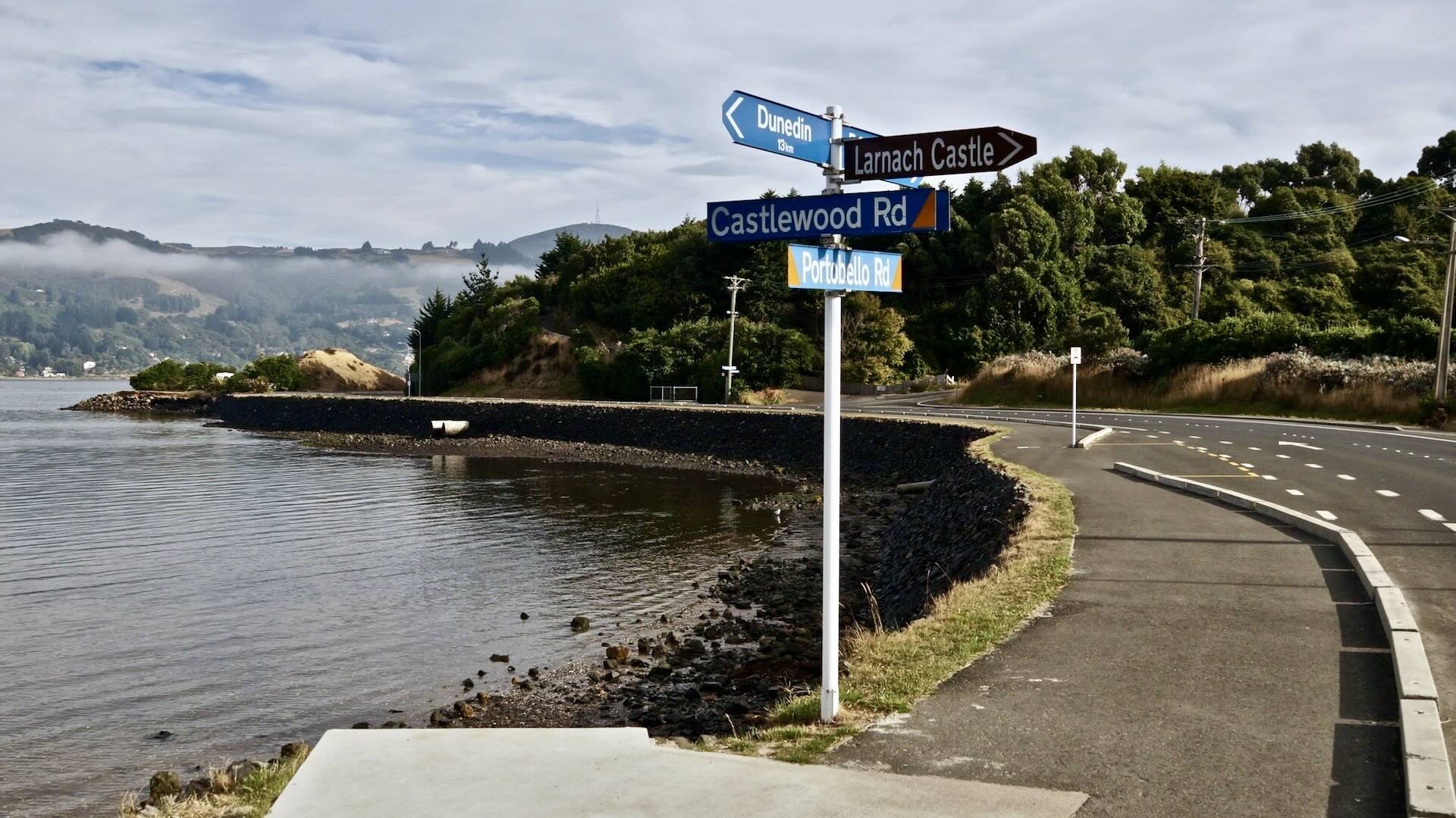
Introduction And Overview Map

Snake Falls on the Albany River

Eskakwa Falls on the Albany River

Our 2013 Wabakimi-area canoe trip was a 350-kilometre paddle around the edge of Wabakimi Provincial Park,

  • beginning with a 100-kilometre ride down the Misehkow River,
  • then going with the flow of the Albany River to Petawanga Lake, and
  • finally heading south via Petawa Creek and up a couple of river systems (the Witchwood and the Raymond) to access the south-flowing Pikitigushi River system

The first five days of our trip are described in Canoeing Wabakimi’s Misehkow River.

Canoeing Wabakimi’s Misehkow River

This second post will look at the Albany stretch of our trip. The map below shows the four campsite locations of our down-the-Albany paddle.  This section was memorable for the four sets of impressive waterfalls that we got to see and inhale.

the-albany-river-section-of-our-canoe-trip

————-

Topo Maps & Portage/Rapids Info:

Federal Government (Natural Resources Canada) 1:50,000 Topos:

The entire collection of archived 1:50,000 NRC topos can be found (as of Nov. 2019!) at this Fed. Gov’t. website – ftp.maps.canada.ca/pub/rncan.Use the folder and sub-folder numbers below to access the maps.  Of the three files you will see in each sub-folder,  the ones with the URL ending with prt.pdf or prt.tif are the ones you want.

  • Pruner Lake  052 P 06 ;
  • Crerar Lake   052 P 11;  
  • Grace Lake   052 P 07;  
  • Miminiska Peninsula   052 P 10; 
  • Opikeigen Lake  052 P 09;
  • Kawitos Lake 052 P 08.

———

Toporama Canada Online Map:

Toporama is NRC’s modern version of the archived topo sheets.  It is a seamless map of the entire country and allows you to extract additional information and features from the map.

Access the Toporama website here.  Note that in Crawshay’s Topo Canada app mentioned below, you can choose the Toporama option instead of the archived sheets.

———

David Crawshay’s Topo Canada iOS App

David Crawshay’s free Topo Canada iOS App for iPhone enables you to download all of the above to your iPhone.  While leaving the iPhone on all day to use as your primary GPS device would require a power bank for daily recharging, it is very useful to make a quick confirmation that you are indeed where you think you are! Download Crawshay’s app here.

———

ATLOGIS Canada Topo Maps for Android OS

There is an Android OS app from a German app developer similar to Crawshay’s Topo Canada iOS app. However, it costs US$14.  Given its usefulness, the one-time cost is a worthwhile investment that will save you time and aggravation. Click here to access the Google App Store page –

Note: The free version of the app may be enough for your purpose.

———

Ken Kokanie’s 2012 Albany River Trip report

We also had a copy of Ken Kokanie’s Albany River pdf file on the Albany. He and his crew started off from the side of Highway 559 at Osnaburgh Lake and paddled the Albany down to Mininiska Lake. His website went dead in 2018, but he said it was okay for me to host his report. You can download the 74 Mb pdf file here – it has maps, info on rapids, portages, campsites … all you need to get started!

———

Paddle Planner

The Paddle Planner website – see here for access levels which range from free to outfitter– has the Wabakimi Canoe route Maps information available.  Here, for example, is what you will find if you zoom in on the Albany River system stretch with the three sets of falls.

Paddle Planner portage and campsite info

On a Paddle Planner map, you will find portage information, campsite and outpost locations, access points, and points of interest. For the Wabakimi area, much of the Paddle Planner info comes from the Wabakimi Project maps, though it will also have data from paddlers who have contributed trip reports.  Note: on less travelled routes, the portage info may well be out of date.

————-

Day Five (continued):   From The Mouth of the Misehkow to “Birchview” Camp 

  • distance: 8 kilometres from the Misehkow/Albany junction
  • weather: sunny with a bit of headwind
  • portages: 0
  • See the Misehkow Post for the first half of Day 5. (here)

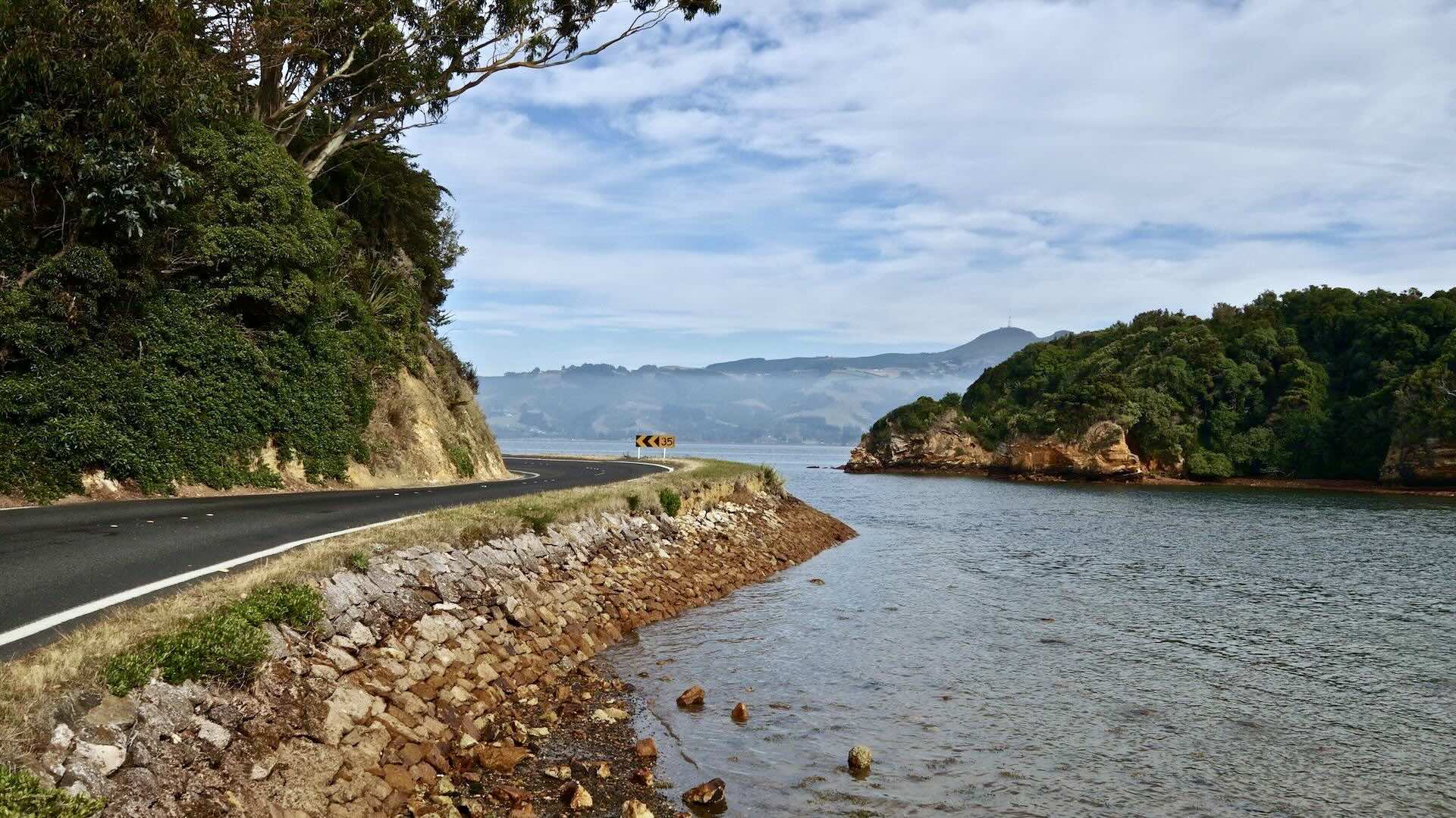
As mentioned in the post on the Misehkow, we were on the Albany before I even realized it.  Given the sometimes dramatic descriptions of the series of swifts in the two kilometres before the Misehkow River merges with the Albany, I was expecting more.  Perhaps higher or lower water levels would have given me what I was looking for!  So there we were at noon on the historic Albany River, once a major fur-trading route from James Bay.

These days it is but a shadow of its former self, given the impact of significant water diversion projects at various points along its length. Still, Ontario’s longest river has much more of a flow than the Misehkow – it is wider and has a less-enclosed feel. The following two images capture some of the differences:

dusk on the Misehkow below the rapids Day Four camp

dusk on the Misehkow River from below the rapids – our Day Four camp

————-

Our Birchview CS on The Albany

the floodplains of the Albany River below the mouth of the Misehkow

the floodplain of the Albany River below the mouth of the Misehkow

We stopped for lunch two kilometres later on the north banks of the Albany and then continued on for another two hours of paddling before pulling in at the site pictured above. With a bit of work, we created a decent albeit completely open-to-the-elements spot for our Four-Person MEC Wanderer tent.  We called it the Birchview because of the stand of trees on the other side of the river that we got to contemplate for the evening –

the view of the stand of birch trees on the Albany

the view of the stand of birch trees on the Albany

————-

Day Six: Birchview to Snake Falls Campsite

  • distance: 29 km
  • weather: sunny
  • portages: 3

We were on the water at 8:30 and approached the first set of swifts about one kilometre into the day; there would be more as we made our way down to our first portage.  At times they doubled our usual travelling speed!  By 10:00, when we stopped to stretch our legs on a striking volcanic rock dome on the side of the river at the bottom of one of these swifts, we had already covered thirteen kilometres!  While we sipped on the Gatorade-flavoured Albany Nouveau from the Nalgene bottle and munched on the Clif Bars, we watched a plane overhead on its way to the landing strips at Miminiska or Fort Hope – a rare reminder that we were not alone in Wabakimi.

——–

Upper Eskakwa Falls

A couple of kilometres south of our rest spot, we ran a straightforward set of rapids and then headed for Upper Eskakwa Falls, the first of three falls that we would portage around this day. The 330-meter portage trail was easy to find. It begins fairly close to the falls on river right (N51°28.729   W088°  58.205).  [Click on the coordinates to access a Google Earth view.]

Upper Eskakwa Falls on the Albany River

An awkward take-out with a bank to hoist the packs and canoe to the top of and then the trail, showing signs of occasional use, runs through a large tenting area with room for four or five tents. The put-in is another twenty-five meters further. We stopped here for lunch, sitting on the logs by the fire pit.

the view from Upper Eskakwa Falls campsite

the view from the Upper Eskakwa Falls campsite

——–

On To Eskakwa Falls

On leaving the put-in at  Upper Eskakwa Falls, we faced a choppy but easy stretch of water that we figured was Class 1 but could become somewhat worrisome with more or less water. And then it was on the next portage of the day – that of Eskakwa Falls. Paddling down a set of swifts, we got out just before the falls on river left.

Swifts below Upper Eskakwa Falls and Eskakwa Falls coming up

This time we would be heading to river left for the trailhead and take-out point. Again, the 150-meter portage trail was easy to find and showed signs of use. See here for a Google Earth view of the Eskakwa Falls area –51°29’36.0″N 88°55’08.0″W

Eskakwa Falls – Albany River

About an hour after leaving our lunch spot, we were at the put-in below Eskakwa Falls.  A small fire pit and a potential make-do tent site would make this a possible campsite, though we did see a couple of better tent sites nestled in the spruce between the trail and the river as we walked the gear across.

Eskakwa Falls from the put-in

Eskakwa Falls from the put-in

We did make one excellent decision at the put-in point.  We decided to slow down and pull out the too-precious-to-be-out-during the day cameras from the Watershed duffel.  Had we not done so, we would not have had any pix of perhaps the most scenic falls of our entire route.  (Usually, I just content myself with using a Canon Elph P&S for daytime pix, but I would lose it and 250 images of our progress a few days later.)

As it is, Eskakwa Falls lends itself perfectly to scampering and rock hopping. We walked along the side of the river almost all the way back to the top of the falls, feeling the energy of the tumbling water and inhaling the mist.

Max looking down the last bit of Eskakwa Falls

Max looking down the last bit of Eskakwa Falls

looking up river at the top of Eskakwa Falls

looking upriver at the top of Eskakwa Falls

Max going long on the banks of the Albany at Eskakwa Falls

Max going long on the banks of the Albany at Eskakwa Falls

looking-down-river-at-the-top-of-eskakwa-falls

——–

Snake Falls Portage and Campsite

By mid-afternoon, it was clear that a new weather system was moving in; it was already clouding up.  Since there wasn’t really a great campsite at Eskakwa Falls, we decided to push on to Snake Falls, thanks to reports of a scenic campsite there.  In about thirty minutes, we had paddled down the Albany to the take-out spot and, in another hour, had the short portage done and the tent up.  The campsite is 30 meters above the put-in area and is accessed by a side trail just before you start descending somewhat steeply to the shore.

Snake Falls – Albany River

This site was definitely the best up to this point in the trip.  The tent was nicely sheltered in the bush, with a great cooking/lounge area on the top of a rock outcrop that slopes down to the put-in spot, and easy access to views of the falls themselves. We would get a bit of rain during the late afternoon and evening. The tent and the 10′ x 14′ tarp were up pretty quickly to keep everything and everyone nice and dry.

looking-down-the-albany-river-at-the-bottom-of-snake-falls

looking downriver from the bottom of Snake Falls

————-

Day Seven: Snake Falls to Miminiska Wind Camp

The Day’s Basic Data and Map

  • distance: 18 km
  • weather: a grey day with noticeable NW wind which got increasingly worse
  • portages: 0
Day Seven- Snake Falls to Miminiska Lake Wind Camp

Day Seven – Snake Falls to Miminiska Lake Wind Camp

We were on the water by 9 and headed down the river; on the way, we passed a rocky point with a fire pit and room for a tent or two. It would be okay in a pinch.

We continued on towards Miminiska Lake. (Minis is the Ojibwe word for island. It may be the source of the lake’s name, given the islands at its east end.)  The wind from the NW had already picked up, and we could feel the effect as we paddled north and then east towards the open section of Miminiska Lake. [A massive peninsular almost divides the lake into two parts, as the map above shows.]

————-

A Futile Search For A Graveyard

Kokanie Map with grave site

Ken Kokanie’s topo map with the graveyard location

Continuing toward Miminiska, we headed east into a side wind and then up Howells Lake to visit the Cree burial ground on the lake’s east side.  (See the map above for the reported location.)  We walked along the shore and checked out various possible trails. We scanned the area from a hilltop in the general area of the supposed site. I had pictured a burial site, something like the one I remember visiting on the banks of the Yukon River in the late 1970s – small 4′  high spirit houses enclosed with 2′ high picket fences.

Unfortunately, we were not rewarded for our effort! We saw no evidence of human activity and figured the entire site – if it even existed – must have been forgotten and overgrown over the years.

The burial site was perhaps connected with the Anglican chapel located on an island on the other side of the lake.  Its services and visits to the burial site likely stopped when the community it served moved to Fort Hope or down to the CN tracks by Armstrong or Collins. A more likely place to put the graveyard would have been on the island with the chapel.

We picked up a large eagle feather on the beach near the supposed burial ground. Over the years,  we have taken the presence of eagles as a sign that we are being watched over.  We took the feather as a good omen and positioned it at the front of the canoe as we headed back to the Albany River. For the first time that day, we paddled with the wind as we made our way to Miminiska Lake.

Albany River Grave Site

Reid/Grant map showing gravesite

Update: More research has turned up no information about that supposed Howells Lake graveyard! However, examining the maps included in the Misehkow chapter of the 1980s Ron Reid/Janet Grand book Canoeing Ontario’s Rivers did indicate a gravesite on the Albany River not far from the reported Howells Lake site. We were unaware of this site as we passed by on our way to Howells Lake.  I wonder about the difference between a “gravesite,” which could have as few as one grave and a “graveyard,” which in my mind implies several graves.

Miminiska Lake Wind Camp

Miminiska Lake Wind Camp

————-

Our Miminiska Lake Wind Camp:

By the time we got to the entrance to the lake, the wind had picked up even more and made paddling a challenging proposition.  I must compliment the stern paddler for his skill at hitting the 2′ + waves at just the right angle.  I was relieved when we hit a sandy stretch of shore –  a veritable beach that only needed some sun umbrellas and deck chairs to look like Carib North.

It was just before 1 p.m., but we decided that the day was done, given the strong wind and the waves.  Amazingly, we found a flat and reasonably sheltered 15’x20′ area just in from the beach behind a 40′ high white spruce and some poplars.  Fifteen minutes of site rehabilitation and the use of the canoe as an additional windscreen and we were all set.

Miminiska Lake west end Wind Camp

Miminiska Lake west end Wind Camp

Miminiska Lake beach

Miminiska Lake beach

golden sunset on Miminiska Lake

sunset on Miminiska Lake

sunset on Miminiska Lake – red sky at night…a good omen for the next day?

————-

Day Eight: From Miminiska Wind Camp to Petawanga Lake

The Day’s Basic Data and Map

  • distance: 29 km
  • weather: sunny; NW wind picked up as the day unfolded
  • portages: 1
Day Eight- The Albany from Miminiska to Petawanga

Day Eight – The Albany from Miminiska to Petawanga

We were up at 6:30 and on the water without having breakfast. There was little wind, and the water was much calmer than the previous afternoon and evening.  By 9:00, we were about 10 kilometres further along, having that needed cup of freshly filtered coffee and our usual oatmeal concoction on a small island.

——–

Picnic Island and Miminiska Lodge

We nicknamed it  Picnic Island thanks to the tables we found. We figured it is probably used by the folks of nearby Miminiska Lodge as a lunchtime fish-fry spot.  We were expecting to see or hear lodge guests in fishing boats as we paddled towards the falls – but nobody was around.

The Lodge itself is up at the north end of the lake; the original plan was to paddle up there to say hello and check things out. (Click here for info on the lodge.)  We had also planned to visit the Anglican chapel (named St. Andrew’s and operational from 1895 to 1959) on the small island on the way up there.  However, the NW wind made paddling the five kilometres up to the lodge an unattractive proposition – so we gave it a pass.

——–

The Two Miminiska Falls Portages 

the two portages around Miminiska Falls

We avoided the 800-meter portage with the take-out point on river/lake right just behind the small island. (See the above map for details.)  The portage is meant for upriver travellers who want to avoid the swifts below the falls and the falls themselves.

Instead, we headed toward the falls. We first had to deal with a set of swifts as we approached. Below them on river left just above the falls is the beginning of a short 100-meter carry.  The trail takes you around the ten-meter drop of Miminiska Falls.  It showed signs of recent use; laid along its length at regular intervals were logs that motorboats had been hauled and rolled over. The falls themselves were pretty scenic – and the short portage sure beat walking the 850-meter portage on the other side!

——–

Swifts Below The Miminiska Falls

Once at the put-in, we looked down at a series of swifts that promised a nice ride.  Glancing down at our Garmin unit a few minutes later, we noted a speed of 14 kilometres/hour in the middle of one of them!  The water level was ideal – enough but not too much. It was not low enough to be a rock garden or high enough to turn the ride into something snarly. Before continuing downriver we did a brief detour to the put-in point of the long portage that we had avoided.  Sitting there were a couple of motorboats ready to be used, perhaps by guests of the nearby Miminiska Lodge.

——–

Checking Out The Tin Emergency Shelter

Petawanga Lake Campsites

Petawanga Lake Campsites

A couple of hours later we stopped for lunch on a small island/point just off the south shore of Petawanga Lake and then finished off the day by paddling through the narrow channel that divides the lake into two halves.  We spotted a tin hut tucked in the bush on river right on our way. (N51 29.296   W88  24.654) We checked it out and found a serviceable shelter in pretty good shape; it would make a great emergency refuge on a rainy or stormy day.

the tin shack on Lake Petawanga appears on a sat image

On the wall was a message left by a fire crew that had been here in 2005 dealing with a 360-hectare burn.

We Head For A Wabakimi Project CS

The signs of that burn were still visible as we continued on to our campsite for the night  (N51 28.621   W88  23.959)  The Wabakimi Project crew had worked on it the previous summer and Phil Cotton had mentioned it to me during a break at the Canoe Symposium in Waterloo in March.

Day Eight Camp on Petawanga Lake

Day Eight Camp on Petawanga Lake

As with most sites, some rehabilitation was necessary to clear blowdown and deadfall. By 4 the tent was up and the water was on the stove; soon, we’d be sipping tea and contemplating tomorrow’s adventure – the eleven kilometres of Petawa Creek.

  • On the plus side was the very word “creek”, which brought up images in my mind of a minor and relatively tame tributary.
  • On the negative side was Chuck Ryan’s description of a day and a half spent in canoe trippers’ hell as he and his partner Dave Phillips fought their way up to Auger Lake.

As is usually the case, time would reveal all!

the view from our Petawanga Lake front porch

the view from our front porch on Petawanga Lake

Like all the other daytime shots I had taken since the beginning of the trip, the ones for this day can be found somewhere at the top of the very same Petawa Creek; I was to lose my camera at the end of the next day and my brother his cherished 1985 Auggie Lolk paddle.

The result so far has been a couple of posts with very few pix to illustrate the proceedings!

Petawanga Lake sunset - one more attempt at getting THE shot just right!

Petawanga Lake sunset – one more attempt at getting THE shot just right!

If you want to continue the adventure, the next installment of our trip can be accessed by clicking on the following title- Up Wabakimi’s Petawa Creek Without A Paddle

Up Wabakimi’s Petawa Creek Without A Paddle

————-

Useful Links For More Info

The Misehkow chapter in Canoeing Ontario’s Rivers (published in 1985) by Ron Reid and Janet Grand details a canoe trip from a put-in off the CN tracks near Collins to the Albany River.  It includes coverage of the Albany from the mouth of the Miminiska to Fort Hope.  As well as route maps, it has well-researched natural and cultural history of the river and environs which adds another dimension to the journey.   See here for a PDF copy of the Misehkow chapter.

Ken Kokanie’s website is dead as of 2018, but I am hosting his Albany River map set here with his kind permission.  The 77.4Mb pdf file has all the info a paddler would need to get a handle on the upper stretch of the Albany River.  His trip report and accompanying 1:50,000 annotated maps and even GPS waypoints cover the river from Highway 599 at the Osnaburgh Lake put-in all the way to Miminiska Lake.

  • He and his partner had a bush plane pick them up once they reached Miminiska Lake;
  • You could continue on to Fort Hope and fly out from there.
  • You could make the epic journey all the way to James Bay!
  • You could also do what we did, which was head south from Petawanga Lake, the lake below Miminiska,  via Petawa Creek to the Attwood and Ogoki River systems. The following post has the details on our choice of route.

Really, the only limits to alternative routes and possible floatplane pick-up spots are how much time and money you have! Whatever you choose to do, you can be sure you will be paddling through an incredible slice of the boreal forest and will probably not see anyone.

————-

Next PostUp Wabakimi’s Petawa Creek Without A Paddle

Up Wabakimi’s Petawa Creek Without A Paddle

Posted in wilderness canoe tripping | Tagged , , , , | 4 Comments

The Pictographs of Wabakimi’s Cliff Lake – Part Two

Last update: August 29,2020.

cliff face to the south of Dewdney's Site #219

cliff face to the south of Dewdney’s Site #219

Part One in this tour of the pictographs of Wabakimi’s Cliff Lake, which is a part of the Pikitigushi River system in northwestern Ontario,  ended at a site Selwyn Dewdney labelled #219.

(Click here if you’d like to read The Pictographs of Wabakimi’s Cliff Lake – Selwyn Dewdney Takes Us On A Tour Part One first!)

Site #219 is a part of what Dewdney, our guide for this tour, considered to be the central section, in spite of the quality of the pictographs found at the south end of the lake and shown in Part One.

Dewdney's Cliff Lake Sites

Dewdney had made two visits to the lake in the mid-1960s and included his observations in the second edition of Indian Rock Paintings of the Great Lakes, the book which established the systematic recording and study of Anishinaabe pictographs of the Canadian Shield.

See here (pp.135-141) for a downloadable pdf copy of his account of the Cliff Lake visits.

Of this main site, he writes: “By far the largest number of paintings was along the thousand feet of rock wall which, we learned, Chris and I had not thoroughly covered the year before.” Paddling up to the site,  we passed the following ochre-covered section of rock –

ochre on rock south of Dewdney's Site #219

ochre on rock south of Dewdney’s Site #219

While many of the pictographs at the south end of the lake are easily discernible, what you see as you paddle up the lake are often just smudges of blurred ochre, as in the above image.  Here are some other examples of pictograph remnants you’ll paddle by –

ochre on rock - the remnants of a pictograph on Cliff Lake

ochre on rock – the remnants of a pictograph on Cliff Lake

Dewdney was thinking especially of the ones in this area when he wrote –

 …the overriding impression of the Cliff Lake setting is one of an age-hallowed place, where paintings were made at intervals over long periods of time.  More than half of them are indecipherable and many more nearly so.”

rock wall corner with a cross image

Paddling closer to the above corner of the rock face, we were rewarded with another small image – perhaps four inches long but clearly visible.

the cross image close up

the cross image close up near site #219

Other times we were left contemplating sections of the rock with ochre remnants as in the following image –

ochre smudges on the rock

ochre smudges on the rock

Dewdney provides a couple of possible explanations for the smudgy nature of many of the pictographs. On the one hand, as indicated in the quote above, he concludes that the blurred nature of many of the pictographs is a sign of their great age. He also proposes the following explanation:  while the rock face at the south end of the lake is granite,  the rock on the east (and west) sides of the lake as you paddle north is basalt. He suggests that perhaps the ochre/fish oil bonded better to the acidic granite than to the basic basalt.

the canoe motif on basalt on Cliff Lake

a close-up of the canoe motif on basalt on Cliff Lake

faded pictographs on the east side of Cliff Lake

faded pictographs on the east side of Cliff Lake

moose image detail from the above rock face

woodland caribou or moose image detail from the above rock face – some flaking has occurred

Cliff Lake - fading ochre remains - is it a human figure?

Cliff Lake – fading ochre remains – is it a human figure?

Paddling further north on the east side of the lake – up from site #219 with the large woodland caribou/moose image that  Part One ended with – we came across this section of rock face, what we thought was Dewdney’s site #221 –

Cliff Lake's fading pictographs

Cliff Lake’s fading pictographs – see below for a close up

paddling closer to an ochre smudge

paddling closer to an ochre smudge – a close-up of the above image

Just north of these images, we came across a small trail at the north end of the rock wall. Getting out of the canoe, we scampered up and were soon up on top of the cliffs and looking at an excellent campsite that would be worth the effort of getting the gear up there. This shot of my brother standing near the edge doesn’t really capture the sense of being up there but it will give you a rough idea!

Max looking south from the edge of a great camp site on the east side of Cliff Lake

Max looking south from the edge of a great campsite on the east side of Cliff Lake

Also,  as the above image makes clear, many sections of the lake do not have sheer vertical rock face!  However, with your tent up and your small campfire having boiled the water for your cup of filtered coffee, here is what you get to contemplate as you lean back on your camp chair at this campsite –

rock face across from the camp site on Cliff Lake

rock face across from the tent site on Cliff Lake

Now that we are back in the city, I am left asking myself the question – Why didn’t we spend another night on Cliff Lake?  We could have moved down from our other campsite to this one and revelled for another night in the privilege of just being there, two of maybe ten visitors the lake will see in a given year!   Looking at the cliffs in the above image, it is clear that a brief scramble from the south end and we would have been on top looking back at the campsite and at each other and saying for the umpteenth time that day – Wow!  A missed opportunity – and yet another reminder for us to slow down just a little!

relaxing up top another section of Cliff Lake rock

relaxing up top another section of Cliff Lake rock – looking north at the top end of the lake

looking south from the cliifs across from our campsite

looking south from the cliffs across from our campsite

There were still more pictographs to be discovered.  Dewdney had taken the time to sketch the following panels:

Dewdney sketches of Cliff Lake pictograph panels

Dewdney sketches of Cliff Lake pictograph panels

We were hoping to have found one of the faces as we paddled towards this rock.

Cliff Lake rock face with ochre

Cliff Lake rock face with ochre

As we got closer we saw the panel illustrated by Dewdney on the top left hand.  Here we were in 2013 and it really did not look all that different!

Cliff Lake pictograph panel from Site #263

Cliff Lake pictograph panel from Site #263

From the photo, it is clear that Dewdney (uncharacteristically)  left out some of the ochre marks, probably because he did not know what to make of them. The animal form on the left is followed by various abstract lines. Or perhaps the zig-zag line is what remains of a snake figure, possibly with horns if we connect the line with the two isolated ones above it.  (In Reading Rock Art  Grace Rajnovich has a section on the serpent motif  in which she includes images of horned snakes.)

Nearby was this indecipherable bit of ochre – may be a woodland caribou or moose or two?

unclear pictograph on Cliff Lake Rock face - two moose standing next to each other?

unclear pictograph on Cliff Lake Rock face – two woodland caribou standing next to each other?

Another of the panels that we did come across was the one with what looks like the figure 8 and, at the bottom right, a smudge that only looking at Dewdney’s sketch helped me to make it into something readable. Look more closely and you’ll find other ochre markings –

figure 8 and animal image on Cliff Lake rock face

figure 8 and animal image on Cliff Lake rock face – Dewdney’s site #264

Of this face, Dewdney writes –

“The one strong painting begins with a fairly definite head, but trails off into a vagueness that fails even to achieve the distinction of being called an enigma. And the one small but pleasing design above it to the left is partly obscured by lichen.”

Not captured in the above image, but sitting on top of the geometric figure is the faint image of a canoe –

geometric figure and canoe from site #264

geometric figure – a double snake? – and canoe from site #264

On the west side of the lake across from our campsite, we paddled by this panel of a dozen or so ochre smudges.  Looking at Dewdney’s sketch certainly helped to bring out the images. (The hope is always that you are being programmed with the right interpretation!)

Cliff lake West side - most northernly rock face

Cliff Lake’s west side – #264 – the most northerly rock face

Of this site Dewdney writes:

“The fourth site is more extensive, with four groups of paintings, on the last of which are the charming little drawings of an animal – likely, at this latitude, a woodland caribou – and a man. The man is very like two figures I found In Saskatchewan, both of which had a similar projection from the head that I took for a pipe. Here the alternative might be a bird’s bill, though I regard this as unlikely. All the rest on this site is abstract and vestigial, except for the tally marks, canoe, and stick figure reproduced from Face I.”

Zooming in a little brings us closer to the woodland caribou and the human image Dewdney refers to.

woodland caribou and human figure from Cliff Lake Site #264

woodland caribou and human figure from Cliff Lake Site #264

Closer still and here is what you see –

Cliff Lake Site #264 human figure

Cliff Lake Site #264 human figure

the woodland caribou figure from Cliff Lake Site #264

We also found the stick figure and the tally marks referred to in the above quote and illustrated in this Dewdney sketch –

Dewdney sketch of stick figure from Cliff lake site #264

Dewdney sketch of stick figure from Cliff lake site #264

What is remarkable looking at this sketch from almost fifty years ago is how little has changed – except for the fungus, which is not a part of the sketch but which can be seen below –

Cliff Lake Stick Figure, tally marks, and canoes

Cliff Lake Stick Figure, tally marks, and canoes

Cliff Lake pictograph of a snake - Dewdney site #264

Cliff Lake pictograph of a snake – Dewdney site #264

the vertical rock of Cliff Lake -

the vertical rock of Cliff Lake – “Look up, look way up…!”

faded ochre canoe image from Cliff Lake - Site #264

faded ochre canoe image from Cliff Lake – Site #264

Our camp for the one night we spent on Cliff Lake was about forty meters in from this fire pit on the breezy point.  Of all the campsites of our seventeen-day paddle, it was the best.  Standing at the point you are looking at the north end of the lake where it narrows.  To the left of the fire pit is the first of the really dramatic rock face sections on the west side of the lake.

Of the campsite itself, the only other one on the lake that could have improved on it was the one down the lake a bit.  We should have stayed there a second night!  Don’t make our mistake when you visit – linger and savour!

the fire pit on the point of our campsite - Selected #1 by TripAdvisor

the fire pit on the point of the campsite voted #1 by CanoeTripAdvisor

We spent about five hours scanning the cliffs for evidence of pictographs and were definitely rewarded for our efforts as the images above attest.  On other occasions, you end up staring at the rock face and, even while not seeing any trace of ochre, you can’t help but saying -“Man, Would you look at that! That is a work of art!” The one below served as my screensaver last week!

Cliff Lake Stick Figure, tally marks, and canoes -

some Cliff Lake rock  without ochre- “Don’t know much about modern art, but I know what I like!”

I have yet more pictographs which I could upload but I’m hoping I’ve made my case, which is quite simply this – Cliff Lake is a paddler’s dream lake that has to be visited.

Given the evidence on the rock faces of the lake, I’m only restating something that generations of Anishinaabe shamans (aka “medicine men”) and young men on vision quests knew to be true. Yes, there is a price to be paid to get to this special place – there are some gruelling portages, no matter which way you come –  but you will be rewarded!

A Technical Note – Sometimes posters of pictograph images are tempted to help the images out a bit by playing with contrast and saturation levels.  While this may make the pictographs “pop”, it also creates a false impression about the colour, the tone, and strength of the images.  The results in some cases are downright cringe-worthy.

I resisted the temptation and have let the images, in all their faded glory,  speak for themselves. Ultimately you just have to go to Cliff lake and let them speak to you.

Postscript: I must thank Ismo Luukkonen/Jann Kinnunen for getting in touch and providing a link to his incredible site on pictograph sites in Finland.  It makes me reconsider my rather categorical rejection of touching up the pictograph images.  Click on the following link to see what he has done – it works!

http://www.ismoluukkonen.net/kalliotaide/suomi/index.html

Reading Dewdney’s Indian Rock Paintings Of the Great Lakes

In 2014 the University of Toronto made available an online copy of the first edition of Selwyn Dewdney’s Indian Rock Paintings of the Great Lakes.

Click on the book title to access the book at the archive.org website.  However, Dewdney only got to Cliff Lake after it was published. Five years later a second edition was published with 140 more sites, Cliff Lake among them. Dewdney organized the results of his 1965 and 1966 findings into five different sites. See my map at the start of this post for approximately where they are.

Given how difficult it is to find the book, I’ve scanned the additional material found in the 2nd edition. Click here for a 7 Mb pdf file. Pages 135-141 cover the Cliff Lake pictographs.

In 2018 we paid a return visit to the Cliff Lake pictographs at the start of our trip down the Pikitigushi to Windigo Bay on Lake Nipigon and then a three-day paddle down the NW corner of the Lake to Echo Rock and the site of the Hudson Bay Co. post named Nipigon House.

Check out the two following posts for more on the rock paintings of Cliff Lake –

From Cliff Lake To Lake Nipigon:  Logistics. Maps, and Day 1 – Cliff Lake

From Cliff Lake To Lake Nipigon:  Days 2 & 3 – From Cliff Lake to The Bear Camp


Posted in Pictographs of the Canadian Shield, wilderness canoe tripping | Tagged , , , , , , | 2 Comments

The Pictographs of Wabakimi’s Cliff Lake – Selwyn Dewdney Takes Us On A Tour!

Last update: September 25, 2022.

Previous Post: Up Wabakimi’s Raymond River To Cliff Lake

Table of Contents:

Sources To Help Understand The Pictographs

Enlisting Dewdney As Our Guide To The Lake’s Six  Major Sites

The Decade-Long Search for Mclnnes’ Cliff Lake Pictographs

The Dewdney Tour Continues – The Other Four Picto Sites

——————-

Cliff Lake’s Dramatic Physical Setting

a small stretch of Cliff Lake's vertical rock face

A short stretch of Cliff Lake’s many stunning vertical rock faces/  that’s my 6’5″ bro pointing his camera at me!

With the 1270-meter portage from Butland Lake done, we knew we were in for something special as soon as we paddled into the lake. Along the east shore was the first of many stretches of the vertical rock face that give this lake its current English name – Cliff Lake. We would spend a few hours over the next day paddling kilometer after kilometer as close to the rock walls as we could.

rock face at the south end of the lake across from the first of the portages to Bad Medicine Lake

rock face at the south end of the lake across from the first of the portages to Bad Medicine Lake

The rock face reminded us of the previous summer’s paddle in the small lake on the Kopka River’s dramatic gorge section. There too, we had marvelled at the energy the rock face seemed to exude.  But it was dialled up to a remarkable new level at Cliff Lake.

on top of the rock face across from our campsite

on top of the rock face across from our campsite

cliff lake rock face

our canoe heads to yet another stretch of Cliff Lake rock face

west side of Cliff Lake across from our campsite

west side of Cliff Lake across from our campsite

——————-

Map of Cliff Lake – and Ways To Get There

We had paddled into Cliff Lake on Day 15 of our canoe trip around the edges of Wabakimi Provincial Park. Click here to see the Google map version of our entire 350-kilometer route.

As for Cliff Lake, the following map lays it out –

pikitigushi-headwaters-and-cliff-lake1

The lake runs north/south and is about seven kilometers long. It is a part of the Pikitigushi River system, which has its headwaters just west of Butland Lake.  Referred to as Mud River on older maps, the Pikitigushi flows south to Lake Nipigon. Even though the top part of the lake welcomes you with some eye-catching vertical rock, the real action starts a couple of kilometers further down.

First, we set up camp on a small point on the east side of the lake.  Then we paddled across to the first of the really dramatic cliffs (see the map below for the location). At the south end of this 250-meter section of the cliff face, we found the beginnings of a trail that took us up to the top. Sitting in the canoe or on top – not a bad seat in the house!

——————-

A Major Pictograph Lake of the Canadian Shield

As dramatic as the rock faces are, another thing is going on here that elevates the lake to an even higher level. Selwyn Dewdney, the man most responsible for the systematic and academic study of Indigenous pictographs in the Canadian Shield area, writes that on the rock faces along the shores of  Cliff Lake we find –

…a concentration of petrographs that is exceeded only  by the Hickson-Maribelli sites north of the Churchill River in Saskatchewan  and by the Bon Echo sites on Lake Mazinaw in southeast Ontario.

That puts Cliff Lake in remarkable company.  Even though my brother and I had already made three canoe trips in the Wabakima area,  I had never even heard of Cliff Lake or the other sites, for that matter, until I started doing research on this year’s canoe trip route.

  • First, I read this thread (here) on the Canadian Canoe Routes website forum dealing with portages in the Cliff Lake area.
  • Then I stumbled into another thread (here) on pictograph locations in Wabakimi.

I was getting very interested. To cap it off,  I found Chuck Ryan’s (aka CIIcanoe) trip report detailing a route that we ended up making our own. His post dealing with Cliff Lake (here) had some pix of the pictographs they had paddled by.

——————-

Why The Rock Images Were Painted

what Dewdney labelled as Face III, site #219

What Dewdney labelled as Face III, site #219

So there we were – four months later, paddling slowly down the lake, looking from the water line up about two meters or so for any sign of the iron oxide powder/fish oil substance that the Anishinaabe used to create their images on the rock. Given the trouble of finding the raw materials to make the wunnamin (i.e. “paint”) to think of the pictographs as simple graffiti is misreading them.

canoe with nine people in it

pictograph of a canoe with nine people in it

Clearly, there was something on a higher level happening here. Explanations having to do with vision quests or the placating of spirits at the onset of some great venture or perhaps as an acknowledgment of a mission survived – seem to be the best starting point for understanding the pictographs.

The science-based, magic-free, but hopefully still full-of-wonder frame of mind that I walk around with is not the same as that of a Paleolithic hunter. While I live in a world without gods, his world was thoroughly infused with animistic elements to the point where supernatural and natural are the same.  However,  I can still recognize a fellow human as I paddle by and try to enter what remains of the painted images he took the time to create.

the fading remains of another canoe image: some of the rock seems to have broken off

The fading remains of another canoe image: some of the rock seems to have broken off

——————-

Sources For Understanding The Pictographs

To help me understand the purpose and the meaning of the pictographs, I turned to three sources:

Selwyn Dewdney

I’ve already mentioned Selwyn Dewdney’s Indian Rock Paintings of the Great Lakes, whose first edition was published in 1962. In the second edition (1967), he added another 156 sites to the original 108, the result of another four years of following up leads. Most of Dewdney’s sites are located in Ontario and Manitoba and a few are across the border in Minnesota.  In the second edition, he includes the results of his two visits to Cliff Lake in 1965 and 1966.

the front cover of a classic

the front cover of a classic

This book has been out of print for forty years, and hard copies are difficult to find. The Toronto Public Library system has five copies of the first edition and two copies of the expanded second edition.  If you have a Toronto library card, you can order it here.  It may be found in other Ontario public libraries or even further afield.

archive.org header

In 2014 the Royal Ontario Museum contributed a digital copy of the first edition to the Internet Archives Project. You can access it here.  More recently, the Toronto Library made available online a digital copy of the second edition. See here for the details.


Finally, I created a PDF file of the additional material from the 1967 second edition to provide access to all of Dewdney’s work. Download it here and scroll to pages 135 -141 for the Cliff Lake material.

——–

Grace Rajnovich

Grace Rajnovich, in her 1994 study Reading Rock Art: Interpreting The Indian Rock Paintings Of The Canadian Shield, delves into the meaning of the pictographs using the material from various surviving Ojibwe birchbark scrolls. Dewdney had also done work on the birchbark scrolls in the early 1970s but never did unite the two in a more comprehensive study before he died in 1980. Rajnovich’s book is a must for anyone interested in the subject. reading rock art

Oddly enough, Cliff Lake is never mentioned in her book. Nor does she use a single Cliff Lake pictograph to illustrate her point. Still, she provides a  detailed thematic examination of a wide-ranging selection of pictographs.  It can be ordered from Amazon in both print and ebook form! You can find some of the book’s content here – just enough to convince you that it would be a good investment!

——–

Thor and Julie Conway

3.   Thor and Julie Conway and any of a number of their articles and books but two in particular –

a. a paper in Ontario Archaeology from the mid-1980s on the pictographs on Temagami’s Obabika Lake. The full name is “An Ethno-Archaeological Study of Algonkian Rock Art in Northeastern Ontario, Canada”.  It is available for download here.

Thor Conway Spirits on Stone 2010 front cover

b.  the  2010 second edition of Spirits on Stone,  an expanded update of a book that was first published in 1990. While focussed on the collection of pictographs at Agawa Rock, what he has to say can be applied to the images at other sites scattered across the Canadian Shield. Conway has a website here with contact information, and the book can be purchased directly from him.  The Lake Superior Provincial Park interpretative center not far from Agawa Rock often has copies of the book available. It should also be noted that all three researchers show great sensitivity to and appreciation of the Anishinaabe elders. The latter shared their knowledge of their culture’s traditional elements.  The result is that their work probably reflects as accurately as possible the motivation of those who had painted their dreams on the rock faces a few hundred years ago.

——————-

Enlisting Dewdney As Our Guide

I used Dewdney’s words and the sketches from the second edition of Indian Rock Paintings of the Great Lakes  (pages 135 to 141) as the organizing principle.  We’ll look at what Dewdney saw on his two visits to Cliff Lake and follow up with some additional pictographs he did not mention.

Dewdney's Cliff Lake Sites

——————-

Dewdney’s Site #262

We begin with the pictographs in the best shape – they are at the south end of the lake at the site labelled #262 by Dewdney.  You’ll find them on the SE-facing rock face across from the first portages to Bad Medicine Lake. Dewdney describes the rock as “one of the few outcrops of granite on the lake.”

thunderbird pictograph on Cliff Lake south end

Thunderbird pictograph at Cliff Lake’s south end

When I first saw the Thunderbird, I thought it was a recent – i.e. in the past twenty years – addition to the other older ones.  The ochre (that is, iron oxide) colour is stronger than that of most other pictographs we examined. However, look at this sketch by Dewdney from 1965, and you’d have to agree it is at least forty-eight years old!

[Note: Dewdney mislabeled these pictographs. They are all at Site #262; you will not find them at Site #264 at the north end of the lake!]

Dewdney sketch of Cliff Lake pictographs136

Dewdney sketch of Cliff Lake pictographs – page 136

the three

the three “horseshoes” and the canoe pictographs from Cliff Lake – mislabelled as site #264 in Dewdney’s notes but actually from site #262 at the south end of the lake

Nearby was another collection of pictographs that I had initially made into one big happy face!  Dewdney had a different take. He writes: “The three ‘horseshoes’ by contrast seemed strong and presumably recent.”  Below the “horseshoes” (an odd choice of word to describe a pre-European contact image),  a piece of the canoe image seems to have flaked off – if it was a canoe image at all.  Nearby is this pictograph of a human figure which Dewdney contrasts with the “horseshoes” –

the three

a human figure with spine pictograph from Dewdney’s site #262 but mislabeled above as #264

Of this pictograph, which you would have to think is much older,  Dewdney writes:

Yet weathering had taken its toll, too, on other paintings nearby, particularly the figure barely recognizable as human with its unusual centre line.

Perhaps it is a different formulation of the ochre/fish oil “paint,” which explains why some seem to age better than others?

the pictograph site at the south end of Cliff Lake

the pictograph site at the south end of Cliff Lake

The site at the south end of the lake is the only one where, for most of the pictographs, we could get out of the canoe and walk a few feet up to the rock face. Here is another panel of pictographs not far from the one shown above:

pictographs from Site #262 Cliff Lake south end

Pictographs from Site #262 Cliff Lake’s south end

Applying his keen artist’s eye to this panel of pictographs, Dewdney draws these conclusions :

Nowhere had I seen such contrasting styles within a small group, their separate origins emphasized by the distinct variations of pigment. The dreamlike ‘legs-that-walk-by-themselves’ and associated symbols in a bright orange ochre emphatically different from the ‘lone Indian’ in a dull ochre so impure that it cold only be described as dirty brown; and whereas the former was painted with course, finger-width lines, the latter showed detail, as in the fingers of one hand, so fine they at first escaped my notice. The ‘double-cross’ painted over the canoe also differed in colour, and the canoe was painted in a fourth hue of the ochre common to them all.

I would almost have missed the human figure (bottom middle) if not for Dewdney’s sketch-

a photo of the Cliff Lake pictos at site 262 by Dewdney

a photo of the Cliff Lake pictographs at site 262 by Dewdney – missing is the “double cross” on the right

Other pictographs on the rock face do not draw comments from Dewdney. Here are a few we noticed –

Cliff Lake canoe pictographs near the human with a spine image

Cliff Lake canoe pictographs near the human with a spine image

a view of the entire rock face -see above for the close-ups

a view of the entire rock face – see above for the close-ups

Look closely at the above rock face (all photos enlarge with a click!), and you will see the canoe in the middle (the same one I used in close-up form at the start of the post) – look to the left of the canoe, and you’ll see what Dewdney was pointing his camera at for the image two above this one.

I’d estimate that there are at least one hundred pictographs at Cliff Lake.  Unfortunately, the passage of time has not been kind to most of them, and their best-before date has long come and gone.  Here is one not far from the strong and vibrant Thunderbird image –

an ochre smudge with evidence of flaking

an ochre smudge with evidence of flaking near the Thunderbird pictograph

Here is a shot of the “horseshoes” and canoe pictographs with the surrounding rock.  You can see evidence of other pictographs, but they are indecipherable.

Cliff Lake rock face with

Cliff Lake rock face with “horseshoes” and canoe and other indecipherable ochre marks

Five horizontal lines - another pictograph from Dewdney's site 264 at Cliff Lake

Five horizontal lines – another pictograph from Dewdney’s site 262 at Cliff Lake

——————-

Dewdney’s Site #219

It is not all rock faces with pictographs at Cliff Lake – but it is still mostly pretty stunning.  Rounding the corner to paddle up (though Dewdney writes “down”) the lake to what he calls “the main site,” you get to glide past scenes like this –

about as ho-hum as it gets on Cliff Lake

about as ho-hum as it gets on Cliff Lake

Heading to what Dewdney has labelled as Site #219,  we’ve got the sketch below as our goal –

Dewdney's sketch of the moose pictograph on Cliff Lake

Dewdney’s sketch of the moose pictograph on Cliff Lake

And there it is – on the east side of the lake a couple of kilometers north of Site #262. The initial impression is of one big blurry smudge –

Cliff Lake Pictograph Site #219 overview shot

Cliff Lake Pictograph Site #219 overview shot

We paddle in close and can discern images in the blurred ochre.

Cliff Lake site #219 up closer

Cliff Lake site #219 – Face III –  up closer

Of this particular face (Face III), Dewdney writes:

Both III and VIII were smoothed by glaciation, but the former face seemed to have been grooved vertically by glacial action, which I still regard as impossible.  With so little contrast we came back to work on it after the sun came out, only to find…that it threw the glacial grooving into relief and made the paintings almost invisible.

——————-

The Decade-Long Search For McInnes’ Pictographs

What stands out the most is the animal image on the right – the same pictograph that the Geological Survey of Canada’s William McInnes sketched in 1902.  Dewdney had seen the drawing but could not locate the pictographs even though McInnes noted that they were from Cliff Lake.

Cliff Lake in Kenora District Ontario

Kenora District’s Cliff Lake – 330 km as the crow flies from the one in Thunder Bay District!

It turns out that there is more than one Cliff Lake in northwestern Ontario!  Dewdney had originally looked for the source of McInnes’ drawing on a Cliff Lake near his childhood home in Kenora District. He noted somewhere that he must have paddled by thirty kilometers of shoreline on the Cliff Lake in Kenora District looking for that moose!

Cliff Lake pictographs - human figure without a head and other indecpherable marks to the left of the moose

Cliff Lake pictographs – human figure without a head and other indecipherable marks to the left of the moose

If you want to continue our tour of Cliff Lake and look at the remaining pictograph sites discussed by Dewdney in the 1967 edition of his Indian Rock Paintings of the Great Lakes, here is the link –

The Pictographs of Cliff Lake – The Second Half Of The Tour

The Pictographs of Wabakimi’s Cliff Lake – Part Two


Finally, if you’re curious about other pictograph locations in the Canadian Shield area, check out this post for a general introduction and links to posts on specific areas –

Anishinaabe Pictograph Sites of The Canadian Shield.

Anishinaabe Pictograph Sites Of The Canadian Shield

Posted in Pictographs of the Canadian Shield, wilderness canoe tripping | Tagged , , , , , , , , , | 11 Comments