
Table of Contents:
- Day 1: From Christchurch to Springfield – 60 km
- Day 2: From Springfield to Arthur’s Pass Village – 82 km
- Day 3: Arthur’s Pass Village to Greymouth via Kamaka – 107 km
The Search For Graeme Stuart of Stillwater-Kamaka
Previous Post: Post-Jet Lag In and Around Christchurch
Bicycling New Zealand’s South Island – Post-Jet Lag In and Around Christchurch
———————–
Day One: From Christchurch to Springfield – 60 km
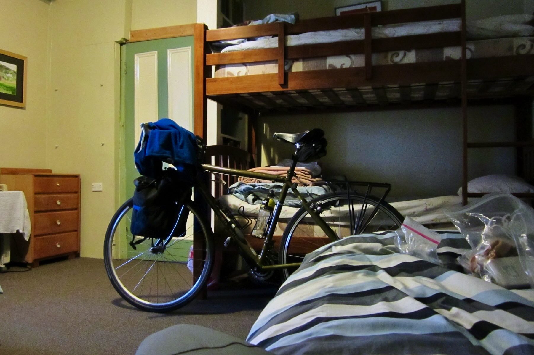
Finally – the ride begins! I am the engine that will move the 14.5 kg. (32 lbs.) bike and 23 kg (50 lbs.) of bags and gear that I have decided were essential for me to bring along. It is far from my bike touring ideal, which would be something like this – just me and the bike, a handlebar bag, and a credit card! Still, it is time to get this show on the road!

my loaded bike at the start of my South Island ramble
Click here for the Google map of the day’s route.
My 1400-kilometer ride began with a very easy first day. It is about 60 km to Springfield, a small community (maybe 200 people) in the eastern foothills of the Southern Alps. I spent most of the four hours pedaling slightly uphill since Springfield is at 400 m, and I started at close to zero.

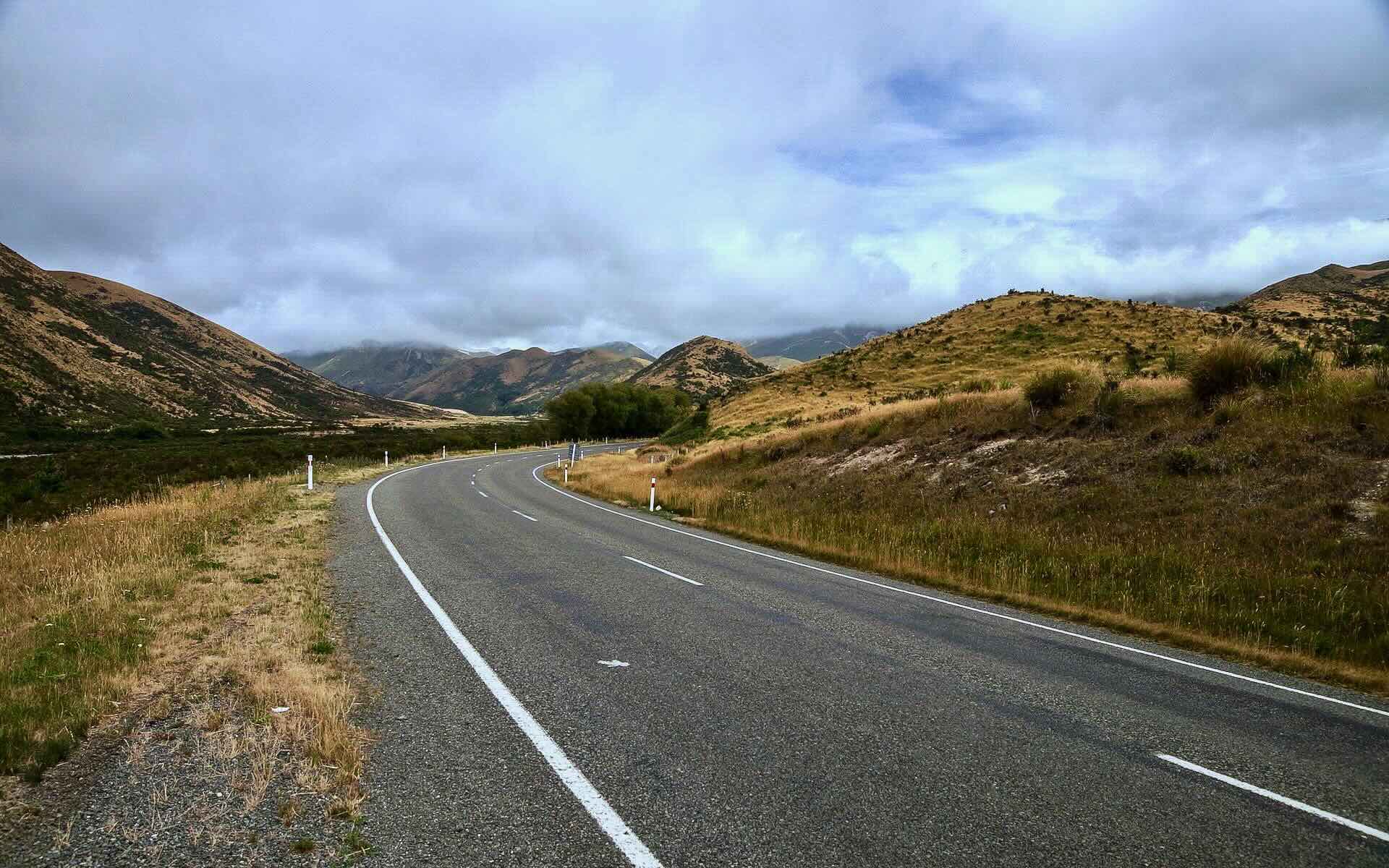
The Old West Coast Road – a typical stretch
As it was a Monday, workweek traffic was evident as I left Christchurch via Riccarton and Yaldhurst Roads. Soon I was on the Old West Coast Road, choosing it instead of SH73 (the new West Coast Road). I had visions of seeing the river as I cycled along, but a strip of farmland along the river prevented this. Views are scarce, given the trees and shrubs lining much of the road, but it was still a nice, easy start to the trip and gave me time to get a feel for the fully loaded bike.
Notice the paved shoulder that took the edge off of any passing traffic, of which there was very little until I got to Sheffield and joined SH73.

another stretch of the Old West Coast Road to Sheffield


break time in a shady grove on the side of the Old West Coast Road to Sheffield

seeing hints of the foothills of the South Alps on the quiet Old West Coast Road to Sheffield
I took a short break in Sheffield, where I stopped for a coffee and a mini cherry pie at the Sheffield Pie Shop while watching the steady stream of customers picking up their favourites. (Unsurprisingly, not a lot of veggie options are available!) Then it was back on the saddle on State Highway (SH) 73 all the way to Springfield. Early afternoon traffic was a bit heavier, but the paved shoulder made a difference.

approaching Springfield and the foothills of the southern Alps
There are a couple of accommodation options in Springfield. I had put my Hostelling International card to use and pre-booked a private single room at the YHA hostel (aka Smylie’s). (Click here for some travellers’ reviews.) As I would do for every night of my tour, I kept the bike in the room with me.
Keiko, the co-owner of the hostel, had informed me that there was a shed out back where I could store it overnight, but I will admit that I basically ignored that bit of information and brought the bike in. Call me paranoid or overly suspicious – I feel better when I can see it!
There isn’t a lot in Springfield- but there is a decent cafe/restaurant and a convenience store where you can find what you need – and like most hostels, Smylie’s had a fully-equipped kitchen for travellers so inclined.
I chose the restaurant option and headed to The Yello Shack across the road to see what they might have for a vegetarian. For the one and only time of the trip, I would order the most typical NZ veggie option – the quiche! And since I was still learning the Kiwi coffee lingo, the server was kind enough to make it all clear to me. From then on, I knew that I wanted a Flat White.

The Yello Shack Cafe in Springfield

inviting interior of Springfield’s Yello Shack
Not yet mentioned is the Highlight of any visit to Springfield – the three-meter-high psychedelic pink donut, which celebrates the connection between this place on the map and Homer Simpson’s hometown half a world away. I had a “Duh” moment of my own when it took me a couple of walks past the monument to make the connection.

This morning, as I took a break from uploading images and writing the text for this post, Viggo (our dog) and I went for our morning ramble in Toronto’s Riverdale neighbourhood, and what should we see but this – proof that the wit and wisdom of Homer Simpson is recognized the world over!

back home in Toronto – The Rooster Coffeehouse “bon mot” for the day
———————–
Day 2: From Springfield to Arthur’s Pass Village – 82 km

From Springfield to Arthur’s Pass Village – 82 km … the satellite view makes it look not so bad
(Click here for the Lonely Planet description of the route from Springfield to Greymouth. Unfortunately, the graphs do not appear but the text is useful.)
Not all cyclists want to have a detailed knowledge of the route or even of the weather forecast. One guy I met said he just likes to deal with it as it comes up instead of worrying about it beforehand. I’ll admit to being the opposite – I like to know all the details beforehand so that I am entering the situation with information that may help me make better choices given the possibilities and probabilities.
Having said that, take a look at the following maps which illustrate the climb to Porter’s Pass –

Topographical Representation of the Climb to Porter’s Pass

The Lonely Planet Representation of the climb to Porter’s Pass and onward with East on the left!
While both graphic representations of the terrain present the same information, the second graphic has a greater immediate impact. It took me a while to stop thinking of the graph as a literal representation of the situation – and when I did the upcoming road seemed less steep! For the sake of completeness, here is what the Pedallers’ Paradise book does for the same stretch but with east on the right and west on the left –

Pedallers’ Paradise version of the Porter Pass climb and more
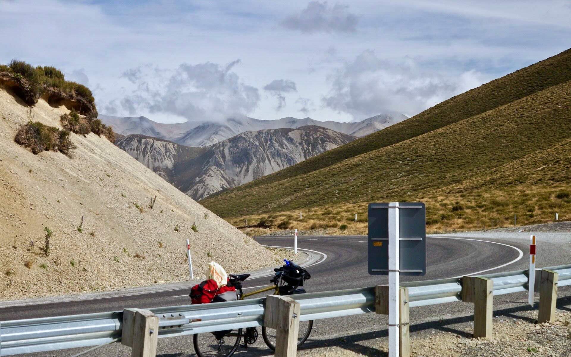
From the above, it is clear that this day’s ride was a bit more of a challenge than the essentially flat terrain from Christchurch to Springfield. The Moon New Zealand Handbook describes the road this way over the next two days- “the highest and most spectacular highway across the Southern Alps.” Sounded pretty amazing! The most difficult part of the day came in the first hour or so as I approached the one serious climb to the top of Porter’s Pass – by the time I was up there taking in the spectacular views, I had gained more altitude than in all of Day One’s ride!

Leaving Springfield at 8 a.m. – a so-so but compulsory sheep shot checked off “shot list”!
Also experienced in this first stretch was my first single-lane bridge; it turned out to be a non-event since the traffic was quite light. For some reason, the Lonely Planet guidebook had made a big deal of it, and I was expecting more. This was just one of the many instances where hyperbole and gushy overwriting seem to characterize the guidebook’s approach. On the other hand, forewarned is forearmed. Obviously, be alert but to sum up the single-lane bridge issue with a common Kiwi phrase – “No worries.”

If you’re coming from Christchurch, Porter’s Pass (942m) will be more work than Arthur’s Pass (920m) because the altitude gain is greater.
On this stretch of road, I finally met my first bike tourist, an English guy in his late 20’s headed for Christchurch who had been on the road in NZ and part of Asia for the past year. For someone who camped most nights and made his own food to keep costs down, he was carrying a negligible load – i.e. less stuff than I had for my little 20-day tour!
He told me I was just around the corner from the limestone rock formation at Castle Hill Conservation Area. Apparently, the Dalai Lama had visited the site and declared it to be “one of the spiritual centers of the universe.” What could that mean, and was he being serious? Perhaps the Springfield Donut had not yet been erected when he passed by, or he would have picked it instead of the Castle Hill Rocks? Whatever the case, below is a shot of the rock formations from a distance –
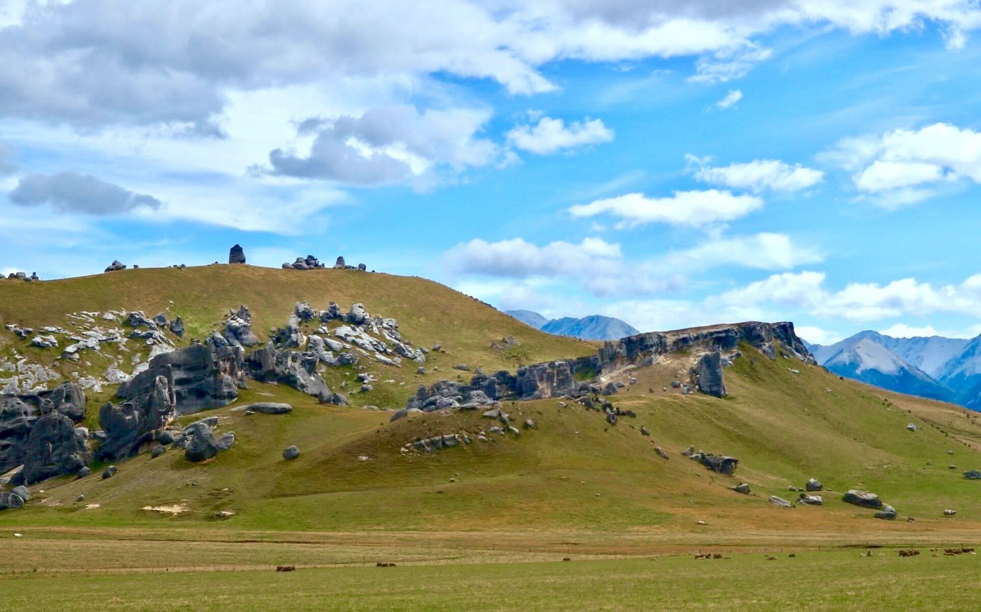
I really should have made the effort to walk up to the hilltop and see the site up close but having walked about 300 meters along the path, I realized that I had left my telephoto lens behind, and I just did not feel right about the unlocked bike. Back I went to get the lens and lock the bike – but when I got there, I decided just to move on down the road. A missed opportunity to contemplate the Dalai Lama’s words.
Here are some shots of the neighbourhood –

Castle Hill area


Castle Hill limestone ready for rock climbing aficionados


Cave Stream Scenic Reserve parking lot
When I got back home, I discovered that the vehicles were parked there because of a limestone cave system that the visitors were exploring. I was keen on getting to Flock Hill Lodge for a late lunch, so I pushed on, but here is a link which explains what the Cave Stream Scenic Reserve offers.
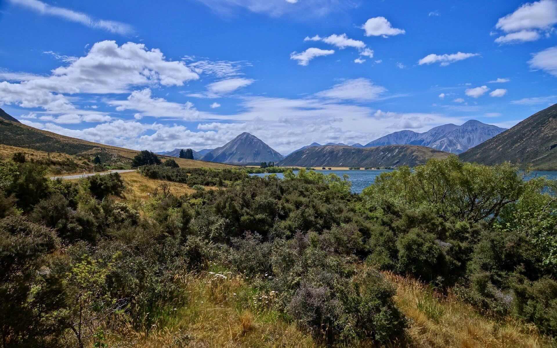
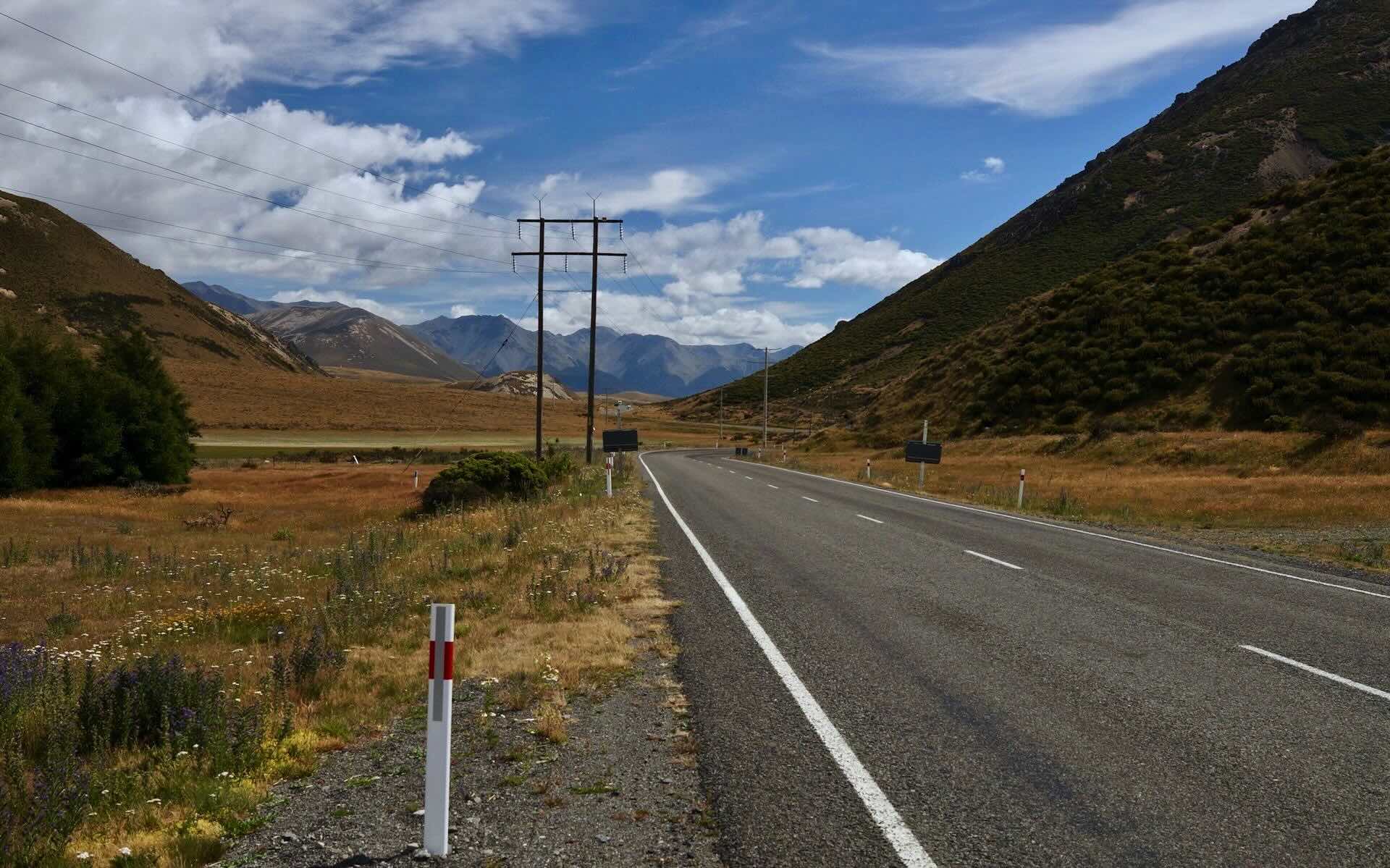
Lake Pearson view on SH73 just west of the Flock Hill Lodge

ooking back on SH73- next up is the Waimakariri River
SH73 view about 15 km east of Arthur’s Pass Village
SH73 view about 15 km east of Arthur’s Pass Village

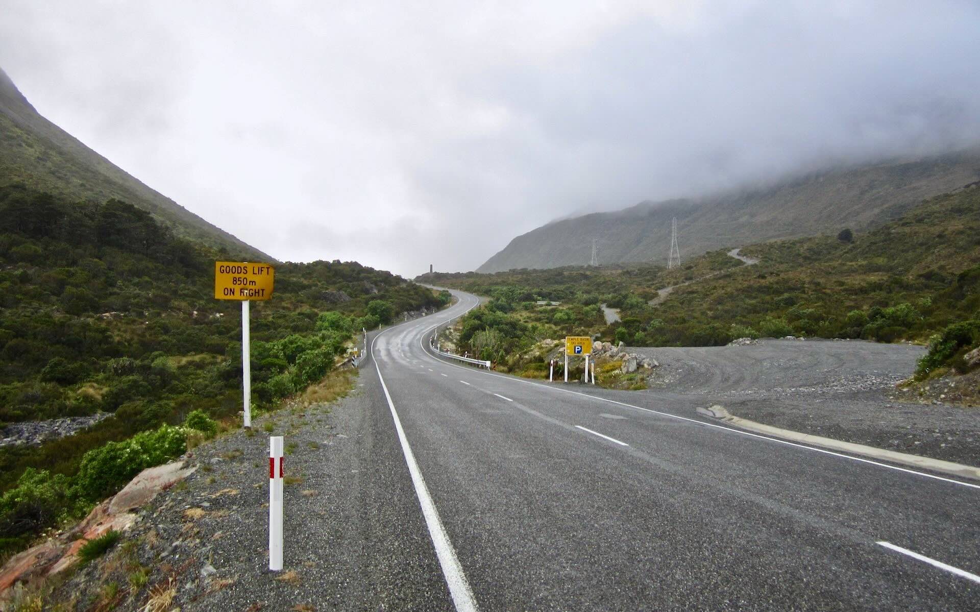
Kiwi Crossing Sign on SH73 east of Arthur’s Pass
My destination this day was the Mountain House YHA in Arthur’s Pass Village, just four kilometers before the pass itself. I got there shortly after six; it had been a long day, and my notion of a twenty km/hr average was being revised downwards to a more realistic fifteen.

Entering Arthur’s Pass from the east – it is about 6:30 and has been a long day!
I found my room in one of the satellite houses the hostel has above the main lodge and checked out the one restaurant open at 7:30 – the Wobbly Kea – and decided that $28 for a pizza was a bit much and that yet more Quiche was not the answer.
I returned to my home for the night, dug out the Backpacker’s Pantry Pad Thai from deep in my pannier, and used the kitchen facilities. Sharing the house with me was a German woman hiking on the area’s trails and an Aussie hopping from YHA to YHA on a two-week bus trip on the South Island.
———————–
Day 3: Arthur’s Pass Village to Greymouth via Kamaka – 111 km

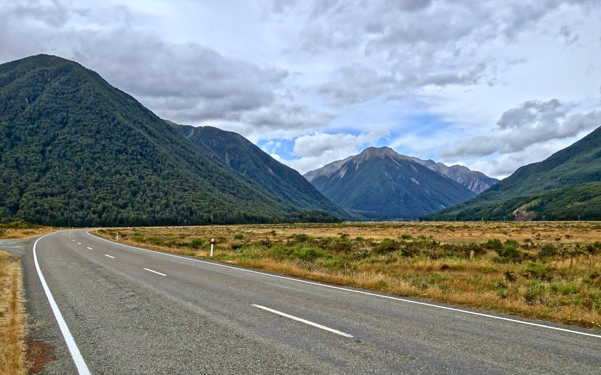
SH 73 from Arthur’s Pass Village to Otira
The reward for a day of mostly going up is a glorious day of going down – but only after getting to the top of Arthur’s pass within the first 30 minutes of leaving the hostel. Then the exhilarating 55-kilometre-an-hour blast down to the Tasman Sea began.
There was one problem – the rain. It started just as I left the cafe/restaurant/convenience store/ across the road from the Wobbly Kea and would continue for the rest of the morning. The rain gear came out – the Gore-Tex jacket, the pants, and the waterproof shoe covers. As for a head covering, I just put the hood on and the helmet on top. My glasses could have used windshield wipers – so they came off.

From Arthur’s Pass Village to Greymouth via Lake Brunner – 107 km
nearing the top of Arthur’s Pass from the east
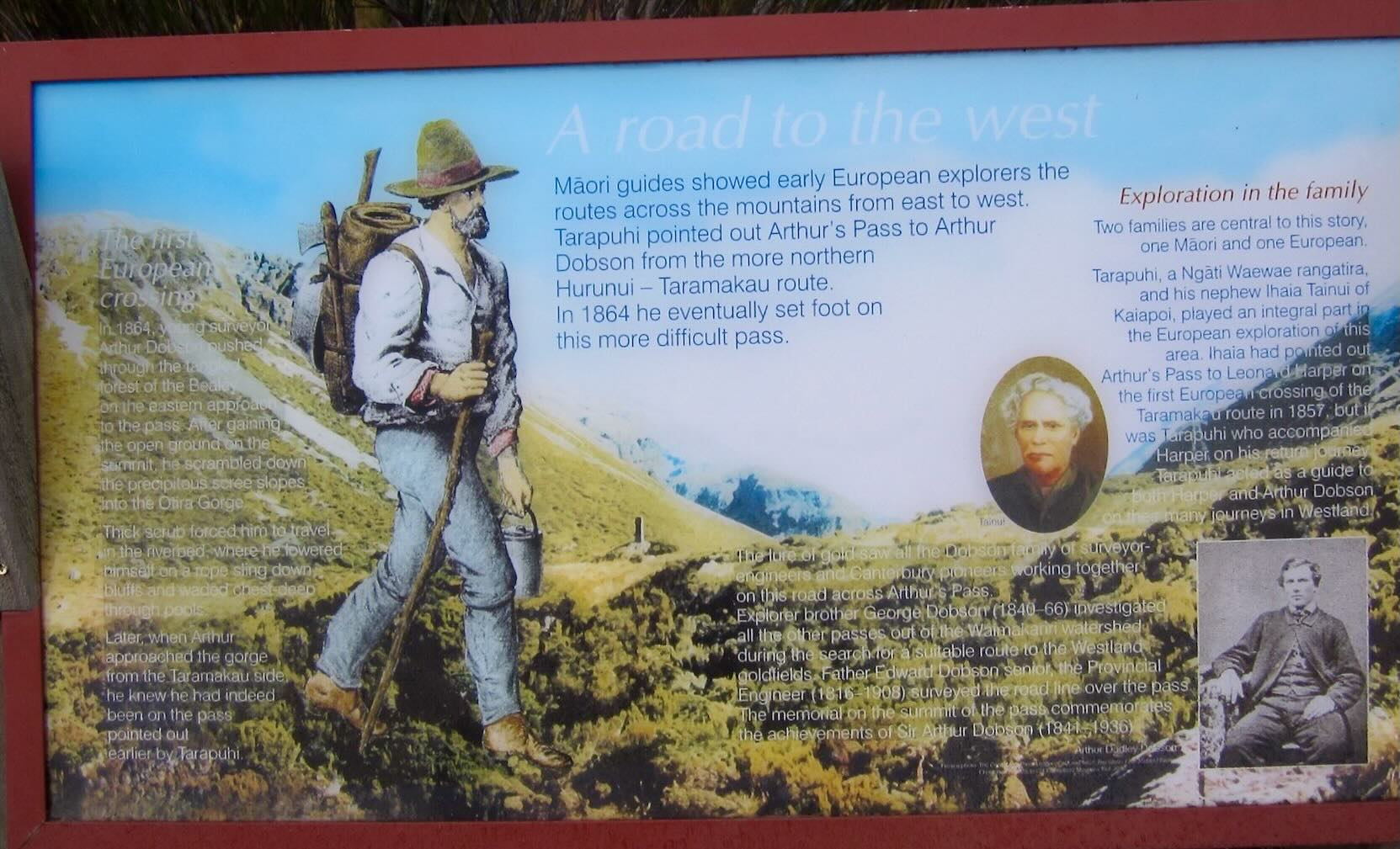
history lesson at a viewpoint to the side of the SH73 below Arthur’s Pass

Arthur Dobson memorial cairn at Arthur’s Pass
Not sure how the loaded bike would handle the wet road, I went down the other side with both hands on the brakes and actually crossed the Otira Gorge Bridge before i realized that I was further than expected. The following is the only shot I got of a spot I had planned to work for a great shot. Maybe next time!
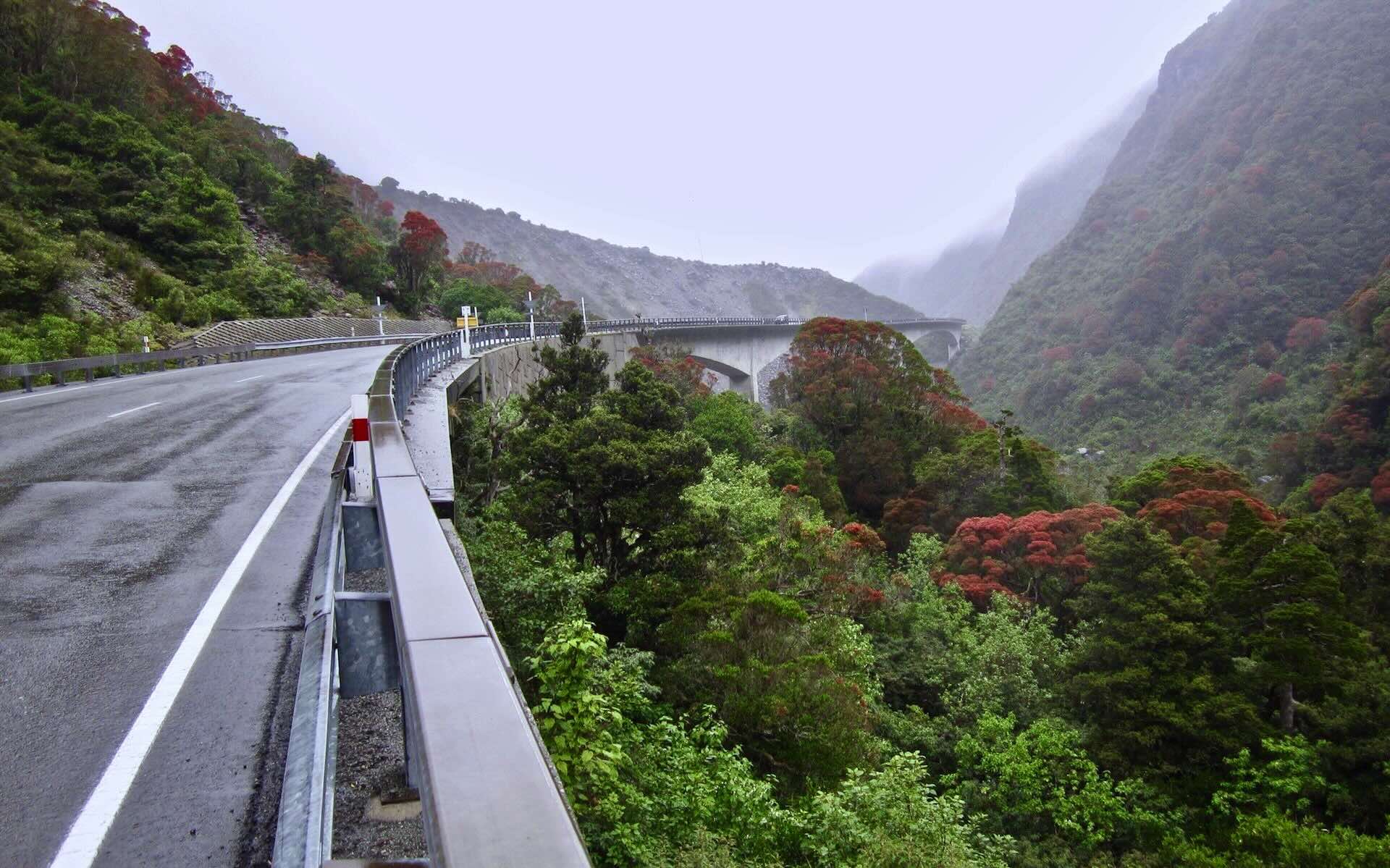
looking back in the rain at the Otira Gorge Bridge

shot from the same location as the above shot – looking forward to a turn in the road below Otira Gorge Bridge

An avalanche shed over SH73 below Arthur’s Pass

Looking back up SH73 from the avalanche shed
As the above pix perhaps show, there was very little traffic on the road the morning I went over the pass. The road can be narrow sometimes, but it certainly is not the horror show that some had said it would be. Visible clothing colours and being attentive should eliminate most potentially dangerous situations. For example, when an oncoming tour bus or trucks came towards me just as another truck approached from behind, I sometimes (especially on uphills) got off the road and off my bike for a few seconds, checking to see if there was a build-up of vehicles behind the large one coming from behind. In any case, I cannot think of one incident during my 1400-km ride that had me looking heavenward in thanks for surviving a narrowly averted disaster.
The goal on the downside was the historic Jackson’s Tavern, where I planned to stop for a bite to eat. This would also be my cue that the turn-off for Lake Brunner Road was coming up very soon. I’d follow that road all the way to Stillwater.

the road to Jackson’s from Arthur’s Pass

the covered porch of Jackson’s Tavern on SH73

Jackson’s Tavern interior – taking a break from the road and the rain
Lake Brunner Road is pretty much flat, with few climbs to elevate the heart rate very much. The two following pix sum it up –

distance signpost on the Lake Brunner Road to Greymouth

the Lake Brunner Road- mostly flat all the way to Stillwater
Running alongside the Brunner Road for a while are the railway tracks used by the TransAlpine, the Christchurch to Greymouth tourist train; you can see the tracks crossing the valley floor in the image below.

Stopping to take off the rain gear – minutes before it started raining again!
This road will take me to lunch at Moana, on the shores of the lake, and then all the way to Stillwater, an industrial suburb about fifteen kilometres east of Greymouth. This is where it would get interesting! I actually had a mission this day! I was looking for a Kiwi named Graeme Stuart!

approaching Moana on the north end of lake Brunner
———————–
The Search For Graeme Stuart of Stillwater – Kamaka
Back in 1978, my university buddy Roy and I, both of us with summers off from our jobs as new high school teachers, spent the summer in the Yukon hiking (the Kiwi term is “tramping”) the Chilkoot Trail from Skagway, Alaska to Lake Bennett, B.C. and then canoeing some 735 kilometers (460 miles) down the Yukon River from Whitehorse to Dawson City.

That is Graeme playing the flute on the left. Jim, me, Barb at my feet, Roy, and Obie complete the group portrait. The Grumman canoes on the shores of the Yukon River were Hudson Bay Company rentals out of Whitehorse.
At Lake Bennett, at the end of the hike, while waiting for the train to take us to Whitehorse, we met a New Zealander named Graeme, travelling solo for a couple of months before he was to join up with his parents in Edmonton for the British Commonwealth Games. Over a big pot of fresh popcorn, a few beers, and lots of laughs, we found ourselves a simpatico fellow traveller who was keen on coming along on our canoe trip.
This worked out great since Roy’s student Jim had done the hike and was also coming along for the paddle. (Two paddlers per Canadian canoe is the norm.) Later that summer – or was it in the fall? – Graeme’s parents actually stayed at my rental flat in Toronto. I was hoping that Graeme could straighten me out on details I’ve forgotten!
It would have been a blast to see him again after 35 years! This is all the address that Roy has for Graeme – Stillwater-Kamaka, South Island.

the road to Kamaka from south of Stillwater
We knew that his family had a farm, and this satellite image seems to suit the description:

Graeme Stuart’s farm (?) at Kamaka on State Highway 7, just three kilometers east of Stillwater
When I passed through Stillwater, I stopped at the hotel/pub to see if the name sounded familiar to anyone. The manager seemed to be relatively new in the community, so she couldn’t help. Off I went up SH7 to the point marked Kamaka on the maps.

Roy’s theory was that Kamaka was the name of the Stuart homestead, just like the name Ponderosa belonged to the Cartwrights of Bonanza fame! Below is what I found when I got there.

Kamaka with railway and house
No Stuart name, though! I checked the mailbox and found this instead –

the Stuart mailboxes renamed by new inhabitants
The next step was to wheel down to the house and see if anyone was home. It didn’t look good as I waited for a couple of minutes and was about to give up when someone came to the door. It was Mr. Hornes, the new inhabitant of the house. He knew little about the Stuarts but did tell me that they had perhaps moved in 2006 or so, after having trouble selling their property and having a farm rental agency take it over for them.
He did add that the dairy farm’s location on the floodplains of the Grey River and the proximity of the rail line were a couple of negatives that might explain why the property hadn’t sold. As for the Stuarts, they might be in Reefton or in Picton, he thought, though he couldn’t say for sure. I left, taking a last look at what Graeme had once known as home and disappointed that things had not unfolded as I had hoped.

the Stuart Home and the Kamaka sign
An upcoming project will involve mailing postcards to all the Stuarts in Reefton and Picton with a simple question – Would you be related to Graeme Stuart?
It was now shortly after four, and I headed for Greymouth, the biggest town I would be passing through until I got to Queenstown about a week later.

vintage car shells at a garage on the way to Greymouth from Stillwater

the road to Greymouth from Stillwater
I had a room waiting for me at the YHA in Greymouth. The guidebooks are a bit rough on this town of 10,000. It does have some decent restaurants and made for a nice easy introduction to the West Coast. I found my way to the Priya Indian Restaurant, not far from the hostel and had a filling curry/rice/naan meal. For lunch, chocolate bars and Gatorade had to suffice – I had cycled past Moana’s business area and was on the outskirts when it became clear that there would be no more restaurants! I was just not motivated enough to cycle back to find an eatery in town.
Three days and my Coast to Coast was done! Hardly a blistering pace, but I felt great and had been rewarded with some fine views and great weather overall. Seeing Graeme would have capped it all off. I walked along the seawall by the water’s edge behind some Japanese tourists, took a few shots of the town at dusk, and called it a day.

Greymouth floodwall at dusk on a cloudy day

Looking up Tanui Street- the YHA hostel is a couple of streets behind the McDonald’s
The next day would be the start of a new leg of my South Island tour – the ride down to Haast.
Next Post: Part 4 – Bicycling the West Coast Road From Greymouth To Haast
Bicycling South Island New Zealand: The West Coast Road From Greymouth to Haast