Canoeing The Bloodvein Day 9 – X-Rock to Just Before Goose Rapids

The Day’s Basic Data and Maps

  • distance: 17 kilometers
  • time: 9:30 to 2:30
  • weather: beautiful sunny day; slight wind from NW
  • rapids/portages: W26 portage finish + W27 rapids – 185 meter carry
  • campsite: an excellent one about 1 km above the start of the Goose Rapids Portage

Previous Post: Day 8 – Moosebone to X-Rock Rapids

Canoeing The Bloodvein Day 8 – “Moosebone” Rapids to “X-Rock” Rapids


X-Rock Rapids to just before Goose Rapids - 1

X-Rock Rapids to just before Goose Rapids - 2

—————-

Finishing Off the X-Rock Island Portage

At a bit over thirty kilometers the previous day had been one of our bigger ones;  This day would be one of our easier ones and would see us on the move for less than four hours. We were in no big rush to get going and sat there sipping coffee and enjoying the rays of the rising sun as they streamed through the trees onto the open campsite area.

The island setting is very dramatic, given that it is framed by two impressive falls/rapids.  I went down to the rapids on river left with my tripod and clicked away for a while.  Most of the shots were variations on this view –

the left-channel rapids at Bloodvein's X-Rock Island

the left-channel rapids at Bloodvein’s X-Rock Island

 After packing everything away, we did the second half of the portage down to the put-in at the bottom of a fairly steep descent to the water.

trail down to W26 put-in on X-Rock Rapids Island

trail down to W26 put-in on X-Rock Rapids Island

Max was good enough to video me carrying the canoe down to the water – and looking super-competent as I managed to ram the canoe between a couple of badly placed trees!

—————-

W27 – Our One Full Portage of the Day

W27P185

W27 P185

Our one full portage of the day came up an hour into the day at W27. The map to the left shows the 185-meter carry on river left.

We took out our cameras and spent some time snapping pics at this scenic spot. A few of them can be seen below.


Bloodvein rapids - W27

a view of Bloodvein rapids – W27 – from the bottom

working on a shot on Bloodvein's W27

Max’s  shot of me framing something  on Bloodvein’s W27  …the shot below is the one I took

Bloodvein Rapids W27

Bloodvein Rapids W27

Max checking out the end of Bloodvein W27

Max checking out the end of Bloodvein W27

And that was it for portaging for the day.

—————-

We Meet Paddlers Headed To Scout Lake

Sometime before noon, we passed three canoes coming upriver.  We had heard bush planes around 7 a.m. and so figured that they may have dropped off the eight guys and their three canoes – either that or they had set out from the lodge nearby.  The only trouble was, even though I had a lodge marked on my GPS map, we did not see any sign of a lodge as we passed by its supposed location.

Basecamp- Bloodvein and Scout Lake map

Basecamp map of the Bloodvein and Scout Lake

As for the paddlers, they said they were headed to Scout Lake to do a bit of fishing – a later check of our maps made us wonder just how they got up to the lake. The red arrow on the map shows our best guess.  The fishing must be out-of-this-world to justify the effort in getting there!

—————-

Lunch By A Hunters’ Blind

We stopped for our customary one-hour lunch at the nice spot you see below. Not too far in the bush was the decaying hunters’ blind overlooking the reedy bay in the background. Either First Nations hunters from Bloodvein Village or hunters staying in one of the lodges in the area made use of it. While Atikaki Provincial Park takes its name from the woodland caribou (Atik in Ojibwe – combined with aki meaning land), in all likelihood it was moose these hunters were expecting.

a Bloodvein campsite above Goose Rapids- but we paddled on a bit

a potential in-a-pinch Bloodvein campsite above Goose Rapids- but we paddled on a bit

moose hunters' raised platform

basic moose hunters’ tree stand – overlooking a marshy area on the shoreline

—————-

A Campsite Above Goose Rapids

Lunch done we paddled through the nearby Class 1 set of rapids (W28) and approached Goose Rapids.  When we saw the campsite on river left we decided the portage could wait until first thing the next morning.  So –  32 km the day before and 17 km on this day,  We figured out the average and knew we could live with it.

Bloodvein Campsite above Goose Rapids

Bloodvein Campsite above Goose Rapids – some signs of a massive windstorm

Bloodvein Campsite above Goose Rapids - different perspective

Bloodvein Campsite above Goose Rapids – a different perspective

looking south to Goose Rapids and the next morning's portage

looking south to Goose Rapids and the next morning’s portage

golden sunset on the Bloodvein above Goose Rapids

Golden sunset on the Bloodvein above Goose Rapids

Next Post:  Day 10 – Goose Rapids to Rapids below Gammon Junction

Canoeing The Bloodvein Day 10 – Goose Rapids to Rapids below Gammon Junction

Posted in wilderness canoe tripping | Tagged | Leave a comment

Canoeing The Bloodvein Day 8 – “Moosebone” Rapids to “X-Rock” Rapids

DAY 8 BASICS:

  • distance: 32 kilometers
  • weather: a great day to be on the river
  • rapids/portages:  rapids W15 through W26 on the Wilson maps.
  • campsites: many to choose from – we were headed for the island portage at X-Rock Rapids (W26)

Previous Post:  Canoeing the Bloodvein Day 7 – Artery L. to Moosebone Rapids 

Canoeing the Bloodvein Day 7 – Artery Lake to “Moosebone” Rapids

looking back at our Moosebone Rapids campsite

a blown-out image as I look east at our Moosebone Rapids campsite

The Bloodvein from east of Bushey to X-Rock Rapids

The Bloodvein from east of Bushey to X-Rock Rapids

Our goal for the day was the island in the middle of the Bloodvein at what Wilson called X-Rock Rapids.  He had labelled the campsite a classic, and we liked the sound of that! A Canadian Canoe Routes forum contributor (jjoven) had also posted an account of his 2004 trip down the Bloodvein from Artery Lake and had mentioned camping at X-Rock. His experience left us thinking it was a popular spot and that we might meet some fellow trippers already camping there.

Eight days into the trip, and we had said “hello” to two other canoeing parties – two paddlers at the portage into Hatchet on Day 1 and the couple paddling east on Artery Lake in the pouring rain.  We had also seen perhaps five fishing boats – all in all, not a lot of people. (During the next ten days, we would meet two parties of three canoes each and two fishing boats near the end! The Bloodvein is not a busy river!)

This day was one of those when we postponed breakfast until we were a bit down the river and the sun was really up. After paddling through the rapids marked #15 in the Bloodvein chapter of Wilson’s book Wilderness Rivers of Manitoba,  we spent 15 minutes on a river right portage at W16.  We were getting used to and expecting the orange tape to provide the heads-up – and, true enough, there it was!  Thanks to whoever refreshed the markers earlier this year! Next up was Nutcracker Falls (W18), a ten-minute carry on river left.

Bloodvein Nutcracker Falls W17

Bloodvein Nutcracker Falls W17

W18 P85 “Nutcracker”

Now we were on Bushey Lake and looking for a breezy flat space for our breakfast stop. We found it about halfway down on the west side of the lake.  This spot would also make a decent multiple-tent  “fair-weather” campsite but it is quite exposed. Luckily there are lots of other more sheltered sites available if you keep paddling.

Bushey Lake campsite on west side of lake

campsite on the west side of the lake – lots of room on mostly flat rock, but little shelter

Below is a shot of Bushey Lake I fluked on our flight back to Red Lake from Bloodvein village ten days later. It was only later, when I looked at the flight path and GPS info, that I realized that I was looking at Bushey Lake. It is about 2.5 kilometres from one end of the lake to the other.

Bushey Lake on the Bloodvein River system

Bushey Lake on the Bloodvein River system – we crossed the lake from the middle left and exited middle right after a breakfast stop down from the point in the centre of the image

W19 P90 “Bruiseasy” Falls

After our usual breakfast – that would be our oatmeal concoction and large mugs of filtered coffee – we were off again. There was a pictograph site coming up – but first, we had to deal with what Wilson nicknames “Bruiseasy” Falls. Doing a fifteen-minute version of our  “beast of burden” routine got us to the put-in spot below the rapids.

Bruiseasy Falls - W19

Bruiseasy Falls – W19

Around the corner from the rapids on river right was the pictograph site.  In terms of the number of images or markings, it would rank third among all the sites we were able to find in our trip down the Bloodvein.

As we paddled away from the put-in, we headed for the rock face on river right and followed it down, scanning above the water line for traces of ochre. Here is our first reward- three sets of vertical marks all by themselves.

the first pictographs below Bruiseasy Falls

the first pictographs below Bruiseasy Falls

three sets of vertical lines - below Bushey Lake siteWith Bruiseasy Falls still visible in the photo above, we stopped to take a close-up of our first pictographs of the day, knowing all the while that this was not all there was to it!

Still recognizable are three sets of vertical lines – a set of four on the top and two sets of three below that. Tally marks of some sort – days fasted, moose killed. Or maybe levels of attainment within the world of the Midewiwin? Who can say for sure?

We paddled on and came to the main site as pictured below.

Bloodvein pictograph site below Bushey Lake

looking back up to the Bloodvein pictograph site below Bushey Lake

getting closer to Bloodvein pictograph site below Bushey Lake

checking out the Dewdney sketch of the Bloodvein pictograph site below Bushey Lake

We had with us selected bits of the writings of Selwyn Dewdney, whose visits to the many pictograph sites in the Canadian Shield in the 1960s had initiated the systematic recording and analysis of these mostly Anishinaabe cultural expressions. Of this particular site, he wrote in a pamphlet  [Stone Age Paintingpublished by Manitoba’s Department of Mines and Natural Resources in 1965 –

dewdney on Bushey Lake site:Stone Age Painting. 1965.

Bloodvein rock paintings below Bushey Lake - close up on panel

Bloodvein rock paintings below Bushey Lake – close up on face A on the left and face B on the right

Dewdney - sketch of site below Bushey Lake

the sketch that Dewdney refers to as Figure 14 in the quote above

Dewdney makes an interesting point about the image he names “the bow and arrow on Face B” (but note – according to his own sketch he meant Face A). The point is that it might be used to date the painting to pre-contact times since it depicts the bow as a symbol of power.  This assumes, of course, that it actually is a bow. It could be a turtle!

Dewdney’s “bow and Arrow on Face A” at the site below Bushey Lake

Bloodvein pictograph site below Bushey Lake- - different angle of rock face

Bloodvein pictograph site below Bushey Lake-

Tramping Lake, MB picto of human figure

Dewdney refers to the human figure below as “the bird man”  and compares it to a similar image from Tramping Lake that you can see on the right.  Its colour is not the same as that of the other pictographs, probably because a different formulation of ochre and fish oil was used in its making.

Bloodvein pictograph site below Bushey Lake- human figure with outstretched arms

Bloodvein pictograph site below Bushey Lake- a human figure with outstretched arms

For some reason, Dewdney does not comment on the two crude figures at the bottom of Face A.  A cross and a Thunderbird perhaps?

Bloodvein pictograph site below Bushey Lake- cross and thunderbird figures

Bloodvein pictograph site below Bushey Lake- cross and thunderbird figures

That was it for the site.  We continued on, totally taken in by the beauty of the river and the day itself.

Bloodvein River paddling - truly beautiful

Bloodvein River paddling – truly beautiful

a stretch of the Bloodvein before Stonehouse Lake

a stretch of the Bloodvein before Stonehouse Lake

Shortly before entering Stonehouse Lake, we passed yet another pictograph site – our eighth since Red Lake.  While none of them are as awesome as the one at the east end of Artery Lake with its shaman and bison figures, they all elicit a sense of wonder and an appreciation to be able to paddle by and see them.

Bloodvein Pictograph Site about 1.7 km up from Stonehouse Lake

Bloodvein Pictograph Site about 1.7 km up from Stonehouse Lake

pictograph site just above Stonehouse Lake on the Bloodvein

pictograph site just above Stonehouse Lake on the Bloodvein

Bloodvein Pictograph Site about 1.7 km up from Stonehouse Lake - detail

Bloodvein Pictograph Site about 1.7 km up from Stonehouse Lake – detail

Bloodvein Pictograph Site about 1.7 km up from Stonehouse Lake - different angle

Bloodvein Pictograph Site – different angle


Perhaps more time spent with Grace Rajnovitch’s book will help me make some sense of what we were looking at here. The white granite face certainly provides a striking “canvas”.  On the left is what seems to be a thunderbird; the H figure with the line across the top could be a version of the “bird man” that Dewdney identified at the site a few kilometres upriver.


pictograph site at the north end of Stonehouse Lake

site at the north end of Stonehouse Lake

Next up was what should have been our ninth pictograph site –  it is apparently located at the bottom (ie, the north end)  of Stonehouse Lake.  We paddled down the right side of the lake all the way to where we thought we’d see some ochre.  No luck.  We continued another 200 meters but came up empty.  Turning south and rounding the point to enter the channel leading to our next portage, we figured lunch was in order. After all, it was 2 o’clock! An hour later, we got back to work, and over the next four hours, we dealt with five portages that brought us to our campsite at “X-Rock” Rapids.

chart of Bloodvein portages before X-Rock

the bottom of Bloodvein Rapids #21

the bottom of Bloodvein Rapids #21 – See Wilson’s drawing for the rock on the middle left edge!

Max firing up the ol' Etrex Legend at the put-in at Bloodvein W23

Max firing up the ol’ Etrex Legend at the put-in at Bloodvein W23

W24 portage

W24 portage

W25 P255

W25 P255

W24P180 C3

W24P180 C3

looking down from W25 portage trail

Looking down from the W25 portage trail – dramatic! It reminded us of the Bad Medicine Lake portage on the Pikitigushi.

x-rock-island and rapids

X-Rock-island and rapids

Shortly before seven, we floated down a Class 1 set of rapids and approached the island. It sits in the middle of the river with a set of Class V rapids on either side.  What we found is a site that could host a canoe trippers’ convention! There is room on the flat top of the island for fifty tents. Of course, we had the entire site to ourselves and made ourselves at home.

W26 campsite

our campsite on the island at X-Rock Rapids.

It had been a long day and the 32 km we had knocked off were more than double the distance we had done the day before – even with the two hours added to deal with the portages.  Still, it had been an A+ day of scenic river paddling with a couple of bonus pictograph sites thrown in.

W26 camp set up

W26 camp set up

As luck would have it, a few days later during our flight from Bloodvein First Nation on Lake Winnipeg to Red Lake, our de Havilland Beaver flew over the island, and I got this shot –

X-Rock Rapids and Island campsite

X-Rock Rapids /Island campsite – the view from our de Havilland Beaver – upriver is at the top

Wilson and Aykroyd attached nicknames to some of the rapids they sketched and described in their guidebook.  We did puzzle over the name “X-Rock” for this location, but had that “Aha” moment during our post-supper ramble around the perimeter of the island.  Down below at the start of the river right set of rapids, we saw this –

The X-Rock at W26 - where the name comes from!

The X-Rock at the top of the right channel of W26!

The campsite capped off a terrific day on the Bloodvein.  We counted ourselves fortunate to be there.  The next day would present us with another great day which would make us question our grading system.  Where do you go after A+?

W26 falls on river left

W26 – the falls on river left

Looking down the Bloodvein from X-Rock Island

Looking down the Bloodvein from X-Rock Island

Next Post: Canoeing The Bloodvein Day 9 – X-Rock Island to just before Goose Rapids

Canoeing The Bloodvein Day 9 – X-Rock to Just Before Goose Rapids

Posted in Pictographs of the Canadian Shield, wilderness canoe tripping | Tagged | 4 Comments

Canoeing the Bloodvein Day 7 – Artery Lake to “Moosebone” Rapids

Table of Contents:

FIRST POST: Canoeing The Bloodvein River System: Introduction, Planning, and Map Resources.

Canoeing The Bloodvein River System – Intro, Maps, Planning and Access

PREVIOUS POST: Bloodvein Headwaters Day 6: Barclay Lake to Artery Lake

Bloodvein Headwaters Day 6: Barclay Lake to Artery Lake

————–

Artery Lake:Both The End & The Beginning

Artery Lake – the Bloodvein River

Artery Lake with its pictograph sites sits on the Ontario side of the border in Woodland Caribou Provincial Park with just a bit of it in Atikaki Park on the Manitoba side.  For canoe trippers doing the entire length of the Bloodvein, it represents both an end and a beginning.

our route from Douglas Lake off Red Lake to Bloodvein First Nations village on Lake Winnipeg

our route from Douglas Lake off Red Lake to Bloodvein First Nations village on Lake Winnipeg – Artery Lake sits right on the Manitoba-Ontario border. Click on the image to enlarge!

It is the end of the headwaters section of the Bloodvein River.  We had spent almost a week paddling across Woodland Caribou Provincial Park from Douglas Lake. The six kilometers or so of portaging in the first three days and a wind that was often blowing east meant we had paid some dues to get to Artery. The hours spent on some very scenic flatwater stretches had been our reward and paddling by two major pictograph sites of the entire Canadian Shield was an appreciated bonus.  But now we were in for a different trip.

Bloodvein - looking down W27 rapids

Artery Lake is also where the Bloodvein as a river, as opposed to a series of lakes joined by the occasional narrow channel,  begins. From Artery Lake to Bloodvein Village there are 80 sets of rapids to deal with.  Sloping or vertical granite rock face lines the shoreline – sometimes on one side and occasionally on both –  and creates that closed-in feeling that makes river paddling special. As for portages, we would do half as much during the ten days from Artery Lake to Lake Winnipeg as the six kilometres we did in the first two and a half days of the trip through the headwaters. We were looking forward to the change!

————–

The Day’s Basic Data and Map

distance: 15 kilometers

weather: cloudy with a wind from the NW in the  morning with a bit of sun later on

rapids/portages: W10 (the marine railway!)  through W14 (“Moosebone” Rapids)

campsite: above W14.  We called it the Fineview; it was our best campsite so far.

Artery Lake to %22Moosebone%22 Rapids (W14)

————–

Checking Out A Minor Pictograph Site

In the original plan,  Day 7 had been set aside as a spare/rest day on Artery Lake.  We decided that instead of sitting around for the day on Artery we would put in a leisurely day on the water and see how far we got.

Before we headed downriver we had one more Artery Lake pictograph site to visit. We paddled up the north arm of the lake about two kilometers, passing a battered cabin on the east shore –

cabin on north arm of Artery LakeAs we looked up the lake shoreline we were not seeing much of that essential ingredient of any pictograph site – a bit of a rock face!

looking up the north arm of Artery Lake

looking up the north arm of Artery Lake

We had the location for the site – taken from the Wilson map – entered as a waypoint on our GPS units.  We eventually did paddle up to a section of rock that definitely stood out from the reeds and otherwise flat shoreline.  Scanning along the rock we noticed the following –

Artery Lake north arm pictograph rock

Artery Lake north arm pictograph rock

A bit closer and it looked like we had found what we were looking for. To the right of what almost seemed like an entrance into the rock face for the maymaygwayshi who were believed to live there, were a few ochre markings. The images were barely discernible  – see below for what looks like a crudely drawn Thunderbird (?) and an arch with lines or figures standing on it.  There were a couple of other vague marks but that was it.

pictograph site on Artery Lake - north arm

pictograph site on Artery Lake – north arm

This humble site was more in line with the site on Red Lake and the one at the east end of Murdock Lake that we had seen earlier in the trip.

————–

We didn’t know it at the time but the site at the east end of Artery Lake that we had visited the day before would be the #1 site of the trip.  This makes it that much more of a “must-see” for those canoe trippers flying to Artery Lake for the beginning of their down-the-Bloodvein adventure. The post below has the pix and discussion.

Anishinaabe Pictographs On The Bloodvein: The Artery Lake Site

————–

Paddling By Other Possible Picto Sites

Artery Lake North Arm rock face sans pictographs

Artery Lake North Arm rock face sans pictographs

Wanting to make sure we hadn’t missed something, we paddled another half-kilometer up the arm,  checking out a couple of other rock faces but we came up empty. Then it was time to paddle back down the shore across from where we had camped the previous night and on to the Ontario/Manitoba border as it crosses Artery Lake.

pictographs at Artery Lake central

pictographs at Artery Lake central

canoe pictos below two most visible ones

canoe pictos below the “star” – click on images to enlarge

close-up of pictographs at Artery Lake Central location


As we rounded the corner and headed west we noted the vertical granite on our right and remarked that this would make a much more obvious – and dramatic – place for someone to place a pictograph than the dead-end north arm of the lake we had just checked out. Sure enough – we paddled by the rock paintings you see above. Perhaps the small stick figure represents a maymaygwayshi? The very common canoe image is faded but visible, even if half the canoe seems missing!

————–

The Marine Rail Portage Into Lower Artery

Artery Lake’s marine rail portage – satellite view

Note: the Garmin topo map, as well as others like the NRC topo, give an incomplete view of the rapids and the mini-islands which frame them.

W10P50Three hundred meters further on we came to our first portage of the day – W10.  We had been curious about exactly what the fifty-meter marine rail involved and now we got to make use of it.  In a little more than a minute, we had dragged our canoe over and were on the west side of the island in Lower Artery Lake.  There we saw a couple of fishing boats.  We waved as we paddled by but they were some distance away. They were probably staying at the Jackson’s outpost about 2.5 kilometres further down the lake which we paddled by a half-hour later.

W10 - the marine railway - the view from the bottom

W10 – the marine railway – the view from the bottom

rapids to the north of the island with the marine railway

rapids to the north of the island with the marine railway

————–

Crossing the Ontario-Manitoba Border

A bit more paddling and we came up to the Ontario/Manitoba border; it was marked with the signs below.

Atikaki sign on the ON:MB border

Woodland Caribou Park sign

Jackson's Lodge on Manitoba side of Artery Lake

the Jackson’s outpost on the Manitoba side of Artery Lake

————–

Info On Upcoming Rapids And Portages

W12P250

W12 P250

We relied on the Wilson/Aykroyd maps for all of our rapids/portage info. As I have noted elsewhere we’ve numbered the rapids the way they appear in the Wilson book (that is where the W comes from).

Also appreciated on the entire Manitoba stretch of the river was the orange prospector tape which indicated 95% of the upcoming take-out points.  While the Wilson book provides the info and it was usually pretty obvious, it was still reassuring to know that we were on the right track.  Unlike the purist who huffs and puffs as he takes down all the orange tape he sees, we are not offended by these “heads up” indicators!

Using the Wilson drawings of the various rapids as a starting point and adding our own assessment of the situation after a quick look, we came up with one of three or four answers:

  • at one end was  “let’s run it”;
  • at the other was “let’s hoof it”.
  • Lifting over, lining, running/lining and other combinations filled the in-between options.

After the first three days in WCPP, it was mostly a piece of cake.  (Spoiler alert: we would make a lazy call a week later at W84 and get to test our new Kokatat life jackets, as well as the “waterproof” pack liners and Pelican cases!)

down the Bloodvein - lining W12

down the Bloodvein – lining W13

————–

Stopping At “The Jumping Rocks”

Near the end of this day’s paddle, we approached “The Jumping Rocks” on river left. It is a 15-meter high rock face with a vertical split separated by about 3 meters of empty space. According to Wilson’s trip notes, there are Ojibwe stories of people jumping the gap. Maybe a test of manhood in the tradition of bungee jumping in Polynesia? More likely just a tall tale told by a local to a gullible non-Indigenous listener just to see how much he would actually believe.

the split rock

coming up to the split rock

approaching the split rock

approaching the split rock with the gap visible

looking back upriver through the gap

looking back upriver through the gap

ooking downriver from the top of Split Rock

looking downriver from the top of Split Rock

the view west from the top of the rocks

the view west from the top of the rocks

————–

W14 And The Fineview Campsite

W14 P50

W14 P50

Not long after our brief pause to take in “the Jumping Rock” we were back on the river for the last stretch of paddling. Fifteen minutes later we pulled up to the take-out spot above the set of rapids you see in the pic below. Our first day in Atikaki was done and it had turned out to be a nice day after a not-too-promising rainy start.

The excellent campsite (we called it the Fineview for the vista it provides) sits on the flat top of a hill and is a 40-meter walk along a trail above the rapids named “Moosebone” by Wilson/Aykroyd.

Moosebone Rapids (W14) on the Bloodvein

“Moosebone” Rapids (W14) on the Bloodvein

Since we had stopped in the early afternoon we had lots of time to scamper about and point our cameras in different directions. A few of the shots can be seen below.

Fineview Campsite

“Fineview” Campsite

checking out the view from the campsite above W14

checking out the view from the campsite above W14

the patio at Fineview

the patio at “Fineview” – looking down the Bloodvein

W14 rock and rapids

“Moosebone” Rapids (W14) …rock and rapids

canoe at rest at Moosebone Rapids on the Bloodvein

canoe at rest at Moosebone Rapids on the Bloodvein

Next Post: Canoeing The Bloodvein Day 8 – Moosebone Rapids to X-Rock Rapids

Canoeing The Bloodvein Day 8 – “Moosebone” Rapids to “X-Rock” Rapids

Posted in Pictographs of the Canadian Shield, wilderness canoe tripping | Tagged | 1 Comment

Bloodvein Headwaters Day 6: Barclay Lake to Artery Lake

Contents:

—————

The Day’s Basic Data And Map

  • distance:  27 kilometers
  • weather: the worst so far – intermittent rain and a north wind put an edge on things!
  • rapidsportages: W08 …125-meter carry
  • campsites: a decent one on a point at the center of Artery Lake

Previous Post:  Day 5: Larus Lake to Barclay Lake

Bloodvein Headwaters Day 5: Larus Lake to Barclay Lake

 Barclay Lake upriver to Musclow Lake Picto Site

From Barclay Lake to Mary's Lake

reported-pictograph-sites-on-artery-lake-and-marys-lake

—————

Impact of the 2021 Fire On the Day’s Route

—————

Deciding To Pass On Two Picto Sites

Musclow River Pictograph 

The plan had been to paddle up Barclay Lake and the Musclow River to the pictograph site near the top of the river; it was ten kilometers from our Day 5 campsite. Morning drizzle and spit which became rain with some North wind thrown in for good measure is what we had to deal with as we broke camp at the start of Day 6.

We decided to pass up on the Musclow pictograph site and the twenty-kilometer detour it would have required.  There was also one portage that we’d have to do twice – once to get up there and once on the way back down.

Dewdney drawing of Muslcow moose

Included in our photocopied pages of Selwyn Dewdney’s book was a drawing of the one pictograph at the Musclow site – that of a moose.  Given the weather and given the meagre reward, it seemed like a long way to go. Instead,  if we just kept paddling down the Bloodvein we would be at the #1 pictograph site on the entire Bloodvein system in a few hours. So off we headed for the famed Artery Lake pictograph site.

The Mary’s Lake Pictograph

The Bloodvein took us southwest from Barclay Lake. The wind and drizzle hit our backs as we made our way to the bottom of the upside-down “U” that would take us back up to Mary’s Lake and then, after a short portage, into the narrow stretch of the river leading to Artery Lake.

But first another decision – yet another pictograph site!  In a bay in the NE corner of Mary’s Lake, the Wilson map indicated a site of interest.  From where we were it was four kilometers up to the site on some pretty open water with rain and  NW wind. We took a Gorp and Bloodvein Nouveau break with Max kind enough to let me make the call.

My good Roman Catholic upbringing reinforced with OCD (obsessive-compulsive disorder) did serve up a generous serving of guilt about not getting done what I said I’d do – that is,  seeing every single rock painting on the Bloodvein!  However, I turned around and said something like, “Max,  paddling four km. into the wind up to the end of the bay – a lot of work for god knows what…probably a very minor site.  How about we pass this one up?”  You can see his response in the image below.

my brother Max - 60 years young on this day

my brother Max on July 13… this is where he got to celebrate his 60th birthday!

As for the Mary’s Lake pictographs, I have since learned that there is one to be seen.  Hap Wilson describes it this way –

Hap Wilson quote

Maybe there’ll be a next time!

—————

The Day’s One Portage – W08

the core of Artery Lake – Lower Artery Lake leads to the Manitoba border

There was only one portage to do this day. We headed for the portage at the north end of the island, W08 in our numbering scheme.   There is another approach if you choose to paddle around the south end of the island.

Bloodvein – P out of “Mary’s Lake”

The pictograph site is another two kilometers down from the W08 portage.

But first – the portage.  Max put the video mode of his camera to use to show a real “pro” getting the job done. I know for a fact that the guy carrying the canoe (it weighs all of 42 lbs.)  was just worried his no-grip  L.L. Bean boots would slip on the moss-covered rock!

W08 P125

W08 P125

—————

The Bloodvien’s Major Pictograph Site

As you will have noticed if you watched the video clip, the rain had stopped!  In fact, except for the occasional drizzle it was mostly dry for the next four hours – long enough for us to visit the famous pictograph site, search for a second one,  and get up our tent and tarp.

First, we paddled up to the imposing rock face pictured below –

Artery Lake Pictographs - looking south to Face II

Artery Lake Pictographs – looking south to Face II

Artery Lake Face III - shaman panel with buffalo panel

Artery Lake Face IV – shaman panel with bison panel

While the pictograph site between Murdock and Larus Lakes had been impressive (see here for some pix), this stretch of vertical granite at the east end of Artery Lake has one of the more famous pictograph faces of the entire Canadian Shield.  The image above shows two of them side by side;  Selwyn Dewdney labelled the one on the left  “the Bloodvein shaman” and the one on the right “the Bloodvein bison”.

Appreciating the turn in the weather, we spent some time here taking in the images and trying to figure out what they all meant. Without a doubt, these images had a spiritual significance to those who put them there. Just as clear is that our paddling up to them three hundred years later elevated our canoe trip for a while to another level.

I’ve created an entire post that looks at this Artery Lake rock painting site in much more detail. If you’re interested, just click on the title below –

Anishinaabe Pictograph Sites On The Bloodvein – The Artery Lake Site 

Anishinaabe Pictographs On The Bloodvein: The Artery Lake Site

—————

Checking Out Another Reported Picto Site

We moved on a half-hour later, heading for the NE arm of Artery Lake and a reported pictograph site there. The pic below was taken from the point on the east side of the narrow entrance to this arm – we had pulled in there to stretch our legs and have a bite to eat.

Break Time - Artery Lake

Break Time – Artery Lake

Up the arm we paddled, not really sure about what we’d find. On the west side of the arm, we approached this rock face, thinking that it might be one that would meet a shaman’s requirements for a spirit rock where he might petition the maymaygwayshi, the underwater spirits who made the rock their home, for the medicine or other favour he needed.

pictograph-sites-on-artery-lake

Artery Lake NE Arm rock face

Artery Lake NE Arm rock face

There really wasn’t another rock face like this on the west side so we were sure we were heading in the right direction.

part of Artery rock face we scanned

part of the Artery rock face we scanned

What We Found

As at the main Artery Lake site we had been at a couple of hours before, there was evidence here of the flaking off of the surface rock face.  What we didn’t find was evidence of ochre on rock. Perhaps any pictographs that had been here were on those pieces?  The fact that someone had chosen this spot to scribble down their notices (I think I am reading the numbers “1973” and “1983”)  would seem to be an indication that there was something else here that drew them here – that is, a pictograph or two.

writing on an Artery Lake rock face – two different handwritings

Picto Fever

One of the weird things that happens if you stare at rock faces enough in search of pictographs is that you start seeing them everywhere.  We called it “picto fever”; I’ll admit that I seemed to have a worse case of it than Max, who more than once went along with a detour knowing full well that there was nothing there that wasn’t a geological feature or rusty red lichen!  Here is a natural streak in the rock face that caught my eye from about forty feet away – I could have sworn it was a human figure with outstretched arms!

an example of what

an example of what “picto fever” can create meaning of

To make sure we hadn’t missed the actual site, we did end up paddling another 700 meters to the end of the arm but came up empty.  Back down the west shore, we paddled, checking other rock faces as we did so. No luck!

—————

Our Center-of-Artery Lake CS

X marks the spot – our Artery Lake CS

By four our campsite located on a point was up; it sat almost in the middle of an Artery Lake which branches out in all four directions like a twisted cross.

Artery Lake Campsite locations

We had just gotten the tent and tarps up when the rain started again. The reprieve of the past four hours was over. Now it came down steady and strong for the next few hours.  From under the “dining room” tarp we watched as a couple, the first canoe trippers we had seen since Day 1,  paddled east towards the pictograph site.

If they got there without pulling over first to get out of the rain, their experience would be very different than ours. We had not really noticed any potential campsites as we had paddled west to our spot and we hoped that their outfitter had applied some accurate and nearby campsite markers to their map. The map above shows three to the east of the point where we were camped.

Time to celebrate a birthday! Out came the bottle of brandy; combined with a Harvest Foodworks “Blueberry Crumble”.  Bro, may you paddle ’til you’re 100!

—————

Campsites on The Bloodvein River System

Maps – online or paper –  indicating campsite locations

  • make it easier for canoe trippers to plan their routes,
  • make them less dependent on local outfitters for information
  • encourage paddlers to choose established sites instead of setting up a new one 200 meters away from an already existing one, thus reducing environmental impact.

It makes no sense that the official park map – since 2015 it has been the Chrismar map – does not indicate these sites. See here for a generally positive review of that map.

For those who like the idea of a map with locations indicated, here are two older ones from Parks Ontario.

The first will give you a  rough idea of where to look in the Artery Lake area –

WCPP established campsites near Artery lake

Also, click here to access a copy of the 2017 Parks Ontario campsites map (a 4Mb pdf file) for most of WCPP.  The map below is just a lower-resolution JPG version of that pdf file.

Click on the header to access the site.

For more info on campsites, the Paddle Planner website is a useful source.  It has compiled all the available data from maps and submissions by paddlers to create an up-to-date resource. Note: the 2021 fire destroyed portage trails and campsites so it will take a few years to recover.

Paddle Planner’s Woodland Caribou Map

—————

Next Post: Day 7 – Canoeing the Bloodvein From Artery Lake to “Moosebone” Rapids

Canoeing the Bloodvein Day 7 – Artery Lake to “Moosebone” Rapids

Posted in Pictographs of the Canadian Shield, wilderness canoe tripping | Tagged | Leave a comment

Bloodvein Headwaters Day 5: Larus Lake to Barclay Lake

Contents:

Previous Post: Day 4: Murdock Lake to Larus Lake

Bloodvein Headwaters Day 4: Murdock Lake to Larus Lake

—————-

The Day’s Basic Data and Map

  • distance:  26 kilometers over 7  hours
  • weather: morning sunshine; afternoon rain and thunderstorm; evening overcast and threatening to rain
  • rapids/portages: 1 set of rapids -W07- which we portaged 135 meters
  • campsites: a nicely sheltered one on a point just below the entrance to Barclay Lake
  • Natural Resources Canada Topo Map052 M 07 (Sabourin Lake)

The Bloodvein Larus to Barclay

Bloodvein River - barclay lake area

—————-

Some Pre-Dawn Wind-Free Paddling

We got up at 4:45!  While we had both gotten some sleep, the bear cub – and its mother – were still on our minds. So too was the wind.  We did not want to be windbound for a second day.  By 5:30 we were off with plans to have breakfast after dealing with the 3.5-km. stretch of open water.

The lake was still very calm and the paddling went easy.  We agreed we should be doing this more often!  When we passed by the lodge on the south tip of the island we left behind the open section of the lake for a more closed-in river feel. If anyone was at the lodge, it was likely too early for them to be up and about!

Larus Island Lodge

looking back after dealing with the open stretch of Larus

sun rises as we look back after dealing with the open stretch of Larus Lake

There are many great things about paddling in the early morning – that coolness, the stillness and tranquillity, and that chance to catch a view of some of the locals getting a bite to eat. This moose just stood there and watched as we paddled by shortly after sunrise.

moose sighting on the way to Barclay Lake

moose sighting on the way to Barclay Lake

moose closer up

moose closer up

post-burn birches along the Bloodvein

post-burn birches along the Bloodvein

—————-

Rapids At the West End of Larus Lake

sat view of W07 at the west end of Larus Lake

W07P135

W07 P135

We stopped for breakfast shortly after seven at the top of W07, our only portage of the day.  By now, the sun was more than up –  as the following pic shows –

sun up on the Bloodvein from W07 Rapids

sun up on the Bloodvein from the top of W07 Rapids

—————-

A Coming Storm Has Us Change Plans

Later in the morning, as we neared the channel going up to Sabourin Lake we met our first fishermen of the trip – a couple of boats which had come down to the Bloodvein from the lodge on the lake.  We left them behind and headed for the next target – Barclay Lake. The plan was to find a campsite on Barclay – the map above has a number indicated – and then head up to Musclow Lake the next morning to see the pictograph site.

Day 5 campsite on spit


We never did get that far.  We could definitely feel some nasty weather coming in,  so at about two when we passed the spit shown in the images above and the map below,  we decided to stop paddling and get the tent and tarp right away.

Bloodvein CS on a spit by Barclay Lake – center of image

The spit has some beautiful fair-weather tent spots on top of the hill. However, we took advantage of the shelter that some trees and the hill itself provided down in the suburbs near the north side shore.

The tent was barely up when it started pouring. We watched as a couple of fishing boats raced by; we wondered how long it would take them to get to the lodge on Sabourin Lake – if that was where they were going. In any case, there is no way they ended up being anything other than totally d.

campsite south of Barclay Lake

campsite south of Barclay Lake

This had been the easiest day of the trip so far with one easy 135m  portage and some nice paddling.  We had also been lucky to get off the river when we did; Barclay Lake could always wait until the next day.

foreshadowing tomorrow's rain

a sky full of clouds foreshadowing tomorrow’s rain

 Next Post:  Day 6: south of Barclay Lake to Artery Lake 

Bloodvein Headwaters Day 6: Barclay Lake to Artery Lake

Posted in wilderness canoe tripping | Tagged | Leave a comment

Bloodvein Headwaters Day 4: Murdock Lake to Larus Lake

last revised May 5, 2024.

Table of Contents:

Previous Day:  Day 3: Knox L.  Portage to Murdock Lake

Bloodvein Headwaters Day 3: Knox Lake Portage to Murdock Lake

—————

The Day’s Basic Data and Maps

  • distance: 20 kilometers over five hours
  • weather: overcast; mid-morning thunderstorm; then sunny with a worsening west-north-west wind
  • rapids/portages:  three sets of rapids W04, W05, and W06.  One portage of 850 m dealt with all three rapids. (A reminder: the W refers to Wilson and the numbers are based on his rapids/falls numbering system for easy cross-reference.)

Day 4 - a

Bloodvein Canoe Trip Day 4 -b

————–

Putting In Some Pre-Breakfast Kilometers

One last look at the small pictograph site around the corner from our campsite on the point and we were off at 7:15.  The goal for the day was to paddle through Larus and find a campsite a few kilometres further downriver. The highlight promised to be the pictograph site on a narrow stretch of the river as it flows from Murdock to Larus. And while there was a portage this day, we knew that the worst of the hauling was done.

approaching the Murdock Lake pictograph site

the Murdock Lake pictograph site at the east end of the lake – the campsite is on the point to the left

This day was one of those when we just broke camp and did some paddling before having breakfast.  We covered a bit over ten kilometres to the north end of Murdock Lake,  looking for a nice spot to pull over. The flat rock and potential campsite on the shores of a small island we were approaching were just what we needed as we heard the sound of thunder in the distance. We soon had the tarp up and the food bag out. We used the butane stove to boil a liter of water, enough for the usual oatmeal and the mugs of filtered coffee. In the hour that we were there, the storm blew over and when we left it was sunny and a bit windier than it had been.

breakfast stop with lightning and thunder as a back drop

breakfast stop with lightning and thunder as a backdrop

————–

Paddling Past The Results of The 2011 Wildfire 

The beautiful light that bathed the lake after the mini-storm gave me every reason to haul out the DSLR and frame a few shots of the scene.

looking south on Larus after the storm passed

looking south on Larus after the storm passed –

taking advantage of the light on Lake Murdock after the storm

taking advantage of the light on Lake Murdock after the storm

We then paddled along a stark shoreline lined with blackened tree trunks which had seen a major fire three years ago. What we saw was the result of 2011’s massive Red Lake Fire #124 in the Murdock/Larus area illustrated by the map below.

Murdock Lake - evidence of fire...and new growth

Murdock Lake – evidence of fire…and new growth

Bloodvein Headwaters Fire History Map

Bloodvein Headwaters Fire History Map with 2011 Fire in red

Already the new growth blankets the area and you can see that a new cycle has begun.

Fire 124 impact on the west shore of Murdock Lake

Red Lake 124 impact on the west shore of Murdock Lake

——————–

A History of Wildfires Along The Bloodvein 

2022 Update: The 2011 Fire was followed by yet more severe ones, with 2021 being the worst one of all.  Here is a fire map showing forest loss up to 2021. On it, the 2011 Fire is indicated in orange and the 2021 Fire in red.

Fire Map 2010 to 2021 – from pale yellow to orange (the 2011 fire) to deep red (2021)

Visit the Global Forest Change website to zoom in or out of the above view.

For more background on the 2021 WCPP Fire see this section of my Bloodvein planning post –  A Decade of Wildfires in WCPP.

——————–

The Murdock-Larus Pictograph Site

At the north end of the lake, we headed west.  Ten minutes later we were face to face with the most dramatic and extensive pictograph site we had ever seen.[It would only be topped by the one on Artery Lake and the Mazinaw Rock site.]

Here are a couple of the pix we took during the time we spent scanning the vertical granite rock face for any ochre-coloured images put on the rock by Anishinaabe medicine men and still discernible after 150 or more years of exposure to the elements.

Bloodvein Pictographs (Murdock-Larus site)

Bloodvein Pictographs (Murdock-Larus site)

human figure holding small human(?) in oustretched right arm

human figure holding a small human(?) in outstretched right arm – most likely interpretation is that of a shaman holding an otter skin medicine bag

I’ve put together about twenty images in the sequence you would see the various pictographs if you were paddling down the river.  Also included is some related material (text and drawings) by Selwyn Dewdney.

 Anishinaabe Pictographs On The Bloodvein: the Murdock – Larus Site 

Anishinaabe Pictographs On The Bloodvein: the Murdock – Larus Site

——————–

Dealing With The Portages Into Larus

After our time with the pictographs, we continued on. The pics below show the take-out of the one portage of the day, an 850-meter carry which would take us around three sets of rapids. The photo also shows me standing next to our empty 42-lb. Swift Dumoine. I left it there while I did my first carry – one of the Hooligan packs, a duffel and the paddles – halfway across the portage.

Bloodvein W04 to W06 P850

W04 take-out on the Bloodvein River

W04 take-out on the Bloodvein River

one empty canoe waiting to be portaged!

the start of the day's one portage

the start of the day’s one portage


Max carrying his 90 lb load to the other end

Unfortunately, deadfall across the trail meant some trail maintenance. It was a while before I got back to the canoe.  The Garmin in my pocket graphically captured the WTF moment when I returned to get the canoe! It had floated upriver about thirty meters, and I waded out to fetch it, feeling pretty stupid – and very lucky – at the same time.

Our Dumoine on the loose!

Our Dumoine on the loose!

a cross-river view from the portage trail

a cross-river view from the portage trail

The portage done by one, we had a leisurely lunch at the put-in point below the Class IV rapids nicknamed “The Cauldron” in Wilson’s book.

W07 - lunch at the end of the portage - notice the burn

lunch at the end of the 850-meter portage – evidence of  Red Lake Fire #124 all around

the bottom of

the bottom of “The Cauldron”

The 1:50000 topo has a water level of 339 meters for Murdock Lake; at the bottom of W06  and the start of Larus Lake, it is 331 meters.

An eight-meter (26 feet) drop in less than a kilometre of river will definitely remind you that you’re paddling a river and not just a series of interconnected lakes, which I’ll admit is my overriding impression of canoeing in Woodland Caribou Park.

the wind and waves of Larus

the wind and waves of Larus

——————–

Strong Winds Mean an Early Campsite

While we indulged in a noontime cup of filtered coffee, the west wind had continued to pick up.  Noticeable on Larus were whitecaps as the waves came rolling to the east shore.  With lunch done, we set off.  As the day’s maps show, we really didn’t get very far before deciding that doing a four-kilometer crossing of  Larus to the west end could wait until the next day.

We ended up at a campsite that Wilson had recommended if the wind on Larus was of concern. – It is located on the tip of the spit just a kilometer from where we had stopped for lunch!

Larus Lake CS on the spit – see Paddle Planner for map source

Tent up and canoe put into use as a windscreen, we rambled around the spit. A bit of bushwhacking and we were on the east side of the spit with a view of where we had lunch a couple of hours ago. Looking back was also the last reminder of Fire 124’s impact on the area we had just paddled through. As the fire map above makes clear, while we would be seeing some more evidence of fire, Day 4 presented us with the worst of it.

The Cauldron as viewed from the Larus Lake spit to the west

The Cauldron as viewed from the Larus Lake spit to the west

checking out Larus Lake as the sun sets

checking out Larus Lake as the sun sets

——————–

A Bear Cub Pays A Dusk Visit

Our evening on the spit on the east end of Larus Lake ended with our first bear sighting of the trip.  It was a bit after dusk when we heard a racket in the mess of deadfall down the spit a bit. I popped out of the tent to see a bear cub – but no mama – about twenty-five meters away.  A few shouts and hand claps and it was gone – hopefully scared after her first human encounter; to reinforce it, I fired off a Bear banger.  We’ll admit to sleeping with ears wide awake that night – but also on our minds was the west wind.  We hoped to get across Larus the next day nice and early.

looking west on Larus Lake at sunset

looking west on Larus Lake at sunset

Next Day: Day 5: Larus Lake to Barclay Lake

Bloodvein Headwaters Day 5: Larus Lake to Barclay Lake

Posted in Pictographs of the Canadian Shield, wilderness canoe tripping | Tagged | 4 Comments

Anishinaabe Pictographs On The Bloodvein: the Murdock – Larus Site

Last update: June 18, 2018.

Selwyn Dewdney As Our Guide

A  highlight of the six days we spent on the headwaters of the Bloodvein River system was the chance to see several Anishinaabe (that is, Ojibwe or Chippewa) pictograph sites.

As he had been on our visit to the Cliff Lake/Pikitigushi River pictographs, Selwyn Dewdney would be our guide on the Bloodvein. His book -see the cover below – is the first systematic cataloguing of the pictograph sites of the Canadian Shield country. Dewdney also delved into the meaning behind the various morphs and images of which he took photographs or made exact drawings.

The Pictographs of Wabakimi’s Cliff Lake – Selwyn Dewdney Takes Us On A Tour!


Researched and written over fifty years ago, the first edition of his book  Indian Rock Paintings of the Great Lakes (click on the title for a downloadable copy) was published in 1962. It included an account and drawings from his visit to the #1 pictograph site on the Bloodvein River system, the one at the east end of Artery Lake.

In the following four years, Dewdney would continue to add to a growing collection of documented pictograph sites. By this time his reach had clearly outgrown the subject area of the book’s title!  In the second edition of the book (1967), another 160 sites were added.  Included were his drawings and observations from his 1963 visit to the Bloodvein site which is the focus of this post. (Download here a pdf file of the new material Dewdney added in the second edition. His coverage of this site is on pp.118-119.)

————–

Where Is The Site?The Bloodvein River - Murdock To Larus

The site is located on the narrow section of the river which connects Murdock Lake to Larus Lake.  It is one kilometer west of the north end of Murdock and about three kilometers south and east of “The Cauldron”, the Class IV  set of rapids that tumbles into Larus Lake. (The “W” on the above map refers to Hap Wilson and the numbers – 04, 05, and 06 – refer to the specific sets of rapids he illustrates and numbers in the Bloodvein chapter of his essential “book of maps” for canoe trippers ( The Wilderness Rivers of Manitoba.)

Dewdney’s text says this – “About thirty-five miles upstream [from the Artery Lake site] just west of Larus Lake…” (p.118)

He then goes on to describe in great detail the site that is actually located east of Larus Lake!  In the summary list of all sites at the end of the book, it is Site #154 and is correctly situated east of Larus Lake.

Dewdney. site list. 1963 (partial)

Given that three sets of rapids separate the site from Larus Lake,  the site is not on Larus Lake, even if my Garmin Topo Canada v.4  map (see above) labels the water above the rapids as “Larus Lake”!  I’ll just label it the “Murdock-Larus site on the Bloodvein” and leave it at that.

The pictographs were on river left as we paddled west towards Larus Lake.  This is unusual since it means that they are facing north, as does the Artery Lake site.  Most sites face SE or S. Dewdney makes the following comment on this –

Dewdney Quote

While there are many spots along the river where the Anishinaabe shaman could paint his images, this section stood out as special. It had a higher, more dominating rock face, long stretches of white granite, and what could be interpreted as underwater entrances to the rock face used by the resident water spirits (the maymaygwayshi) which the medicine men have come to acknowledge or petition.

We saw this as we paddled slowly along and inhaled the moment. When we reached the end we turned back to the beginning of the pictographs and took out our cameras to record some of what we saw.  The first pictographs appear a few meters before (that is, east of)  the main site.

Bloodvein pictographs (Murdock-Larus site)

Bloodvein pictographs (Murdock-Larus site)

The lowest figure – in a different pigment than those above – looks like a moose or caribou. Some indecipherable drawing sits above his pronounced ears. Above that seems to be a human figure with a central spine drawn in; he seems to be holding something in his stretched-out right arm.  Given the presence of a similar figure on another rock face meters away, it may be a shaman holding out his medicine bag, sometimes depicted as an otter skin.

Murdock-Larus pictos - different angle

Murdock-Larus pictographs – slightly different angle

Two caribou and shaman holding medicine bag?

Two caribou and shaman holding medicine bag?

And then we paddled back down a few more meters to the core of the site where the remaining pictographs are. They will appear here in the order one would see them if paddling down the river. At the same time, I will try to connect the various pictograph panels or faces to the comments which Selwyn Dewdney makes.

canoe image and tally marks

canoe image and tally marks

the main stretch of the Murdock-Larus pictograph site on the Bloodvein

the main stretch of the Murdock-Larus pictograph site on the Bloodvein

Bloodvein Pictographs (Murdock-Larus site)

Bloodvein Pictographs (Murdock-Larus site)

Murdock-Larus Pictograph Face Ia

Murdock-Larus Pictograph Face Ia

human figure - Face Ia

human figure – Face Ia

Detail from Face III of Murdock-Larus Pictograph site

Face Ia

Murdock- Larus Pictograph Site - Face III and Figure with Outstretched Arm

Murdock – Larus Pictograph Site – Face III and Figure with Outstretched Arm

Face III - "The Hand"

Face III – “The Hand”

Murdock-Larus picto site up close

Murdock-Larus pictograph site up close

Murdock-Larus pictographs

Murdock-Larus pictographs – Face III on left

A figure which stands out, partly because of the different colour of the “paint” compared to other pictographs in the area, is the one you see below.  Of it Dewdney writes:

Dewdney quote 118-119

human figure holding small human(?) in oustretched right arm

human figure holding small human(?) in outstretched right arm –

Artery Lake shaman pictograph

Artery Lake shaman

I am surprised that Dewdney did not consider another interpretation – and to my mind the correct one.  The drawing is of a shaman holding out an otter skin bag in which he keeps his  “medicines” and various cultic objects.  Further downriver at the main Artery Lake site is another such shaman/otter skin drawing.  The one difference – meaningful or not – is that while the arms are outstretched in both human figures, one is holding the bag in his right hand while the other has it in his left.  Both shaman figures have canoe images nearby.

Bloodvein Larus Site - human figure holding something in outstretched arm

Next we come to a couple of images of canoes and smudges of ochre with tally marks or hands visible.

Bloodvein (Murdock-Larus site) detail

Bloodvein (Murdock-Larus site) detail

Murdock-Larus rock painting face labelled IIb by Dewdney

Murdock-Larus rock painting face labelled IIb by Dewdney

Murdock-Larus Face IIb

Murdock-Larus Face IIb

Murdock-Larus Face IIb - fox and human figure

Murdock-Larus Face IIb – fox and human figure

Face just before Thunderbird and Face IV

around the corner from the main section of the Murdock-Larus pictographs

around the corner from the main section of the Murdock-Larus pictographs

Face IV of the Murdock-Larus site on the Bloodvein

Dewdney’s Face IV of the Murdock-Larus site on the Bloodvein

Face IV details of Murdock-Larus Pictograph site

Face IV details of Murdock-Larus Pictograph site

Face IV close-up of Thunderbird and moose

Face IV close-up of Thunderbird and moose

And then it was time to re-enter the mundane world, the world of canoe strokes and portages. The west wind had picked up as we made our way to the day’s portages which would take us into Larus Lake.

See here for a PDF file of Dewdney’s brief discussion of this Bloodvein site. It can be found in the second and expanded edition (1967) of his classic work Indian Rock Paintings of the Great Lakes.

Next Post:  Day 5: Larus Lake to Barclay Lake

Bloodvein Headwaters Day 5: Larus Lake to Barclay Lake

Posted in Pictographs of the Canadian Shield, wilderness canoe tripping | Tagged , , , , , , , , , , | 2 Comments

Bloodvein Headwaters Day 3: Knox Lake Portage to Murdock Lake

Contents

Previous Post: Day 2: Crystal Lake to Knox Lake Portage

Bloodvein Headwaters Day 2: Crystal Lake to the Knox Lake Portage

————–

The Day’s Basic Data and Map

  • distance: about 17 km.
  • weather: sunny in the morning; noticeable WSW wind once on Knox Lake
  • rapids/portages  3 – all portaged around + the one into Knox L; distance: 1935 m
  • campsites: our best one so far at Pictograph Point at the east end of Murdock Lake
  • Natural Resources Canada Topos052 M 01 (Pipestone Bay);  052 M 02 (Murdock Lake).

Bloodvein headwaters Canoe Trip Day 3 map

Topo Canada view of the day’s portages – data from Paddle Planner

————–

2021 Fire Impact On The Day’s Route

Note: We did this trip in 2014, three years after a wildfire which affected a section of our Murdock to Larus.  However, that fire was minor compared to 2021’s far-reaching impact. The map below shows its effect on the Knox to Mary Lake stretch of the Bloodview.

The 2021 Wildfire’s Impact – from Knox Lake to Larus to Mary Lake

The Park office should have up-to-date info on the state of portage trails and the safety of campsites along the route. Seeing new growth and some green along with the charred tree trunks and scorched rock will make for an interesting experience in 2024, three years after the great burn.

————–

Our Taking-Down Camp/Bkft. Routine

Day 3 - getting breakfast ready - tent spot was behind the canoe

Day 3 – getting breakfast ready – tent spot was behind the canoe

The empty area behind the canoe is where the tent had been; now it was tucked away for the day and the canoe was put into temporary service as a table.

Our breakfast is definitely low-fuss.  A serving of instant oatmeal, supplemented with cranberries, raisins, chia seeds,  hemp seeds, and walnuts – individual servings all prepackaged at home in small plastic zip-lock bags – is the daily fare.  While we’re taking down the tent we put a liter of water to boil on the butane stove. After the tent is down and packed away, one of us takes care of the breakfast – preparing the oatmeal and setting up the coffee filters and mugs for the main course!

Meanwhile, the other person is getting the lunch bag ready – instant soup packages, Wasa bread, different spreads (peanut butter, dehydrated black or pinto bean spread, or mushroom pate). Also laid out on the table are the snacks for the day – a Clif Bar and another zip-lock bag with mixed nuts and fruits for each of us.  It means that during the day there is no need to go “furkling” (Thanks to the mountain guides in the Canadian Rockies for teaching me that word!)  through every bag to find a snack or to put lunch together.

————–

A Messy Start To the Portage Into Knox

In a few minutes, we were at the start of the day’s major undertaking – the big portage into Knox Lake. We would spend two hours getting everything to the shore of Knox Lake.  Our usually efficient portage system broke down pretty quickly.

The first 500 meters or so looked pretty much like what you see in the image below. Carrying a 60 lb. canoe pack and then a 30 lb. duffel on top of that was not possible, given the absence of any sort of predictable footing!  After about thirty meters we were down to one bag per carry – and even that was a challenge.

Knox Lake portage - the first stretch

Knox Lake portage – the first stretch

Eventually, we got the packs beyond the initial muddy stretch.  That still left the canoe! Impossible to walk up the middle of the trail with it and impossible to walk along the side of the trail, we were reduced to dragging it through the mud.

hauling the canoe through the mud

hauling the canoe through the mud

The other two-thirds of the trail was quite walkable and helped us forget the mud pit we had just experienced.  At the end of the portage, there is room for a couple of tents if a campsite is required for paddlers who take on the portage at the end of the day.

the put-in at the end of the portage into Knox Lake

the put-in at the end of the portage into Knox Lake

————–

Using Hap Wilson’s  Rapid Number Count

And then it was north to the outlet of Knox Lake and the first three of the eighty-nine rapids we would face for the rest of the trip.  The “89” comes from the Wilson/Aykroyd guidebook Wilderness Rivers Of Manitoba.  Their chapter on the Bloodvein is in the essential category for planning a trip down the river.  In it, they identify 89 different sets of rapids that paddlers will face in getting to Bloodvein Village on Lake Winnipeg. For most of these rapids, they provide a grading system (using the Class 1 to Class V system), accurate drawings of rocks and channels to be dealt with,  information about what to look out for and what to avoid, as well as various portage options.

We’ve used their numbering system – and the names which they gave to some of the rapids – in our posts.  So – W01 125 refers to the first set of rapids described in the Wilson/Aykroyd guidebook.  We added our estimate of portage length at the end.  The length is in meters – one meter equalling 1.1 yards if you want to make the conversion into a measure you understand better. For the Headwaters section of the river you can also find rapids/portage information on the official WCPP Map and on the Chrismar Adventure Map for the park.

————–

W01 – W02-W03 Portages Into Murdock L.

the bottom of W02

the bottom of W02

We will admit to really liking the feel of being on a river, as opposed to paddling a series of lakes connected by portage trails, which is what the first couple of days from Douglas Lake to Knox Lake mostly felt like.

the middle section of W03

the middle section of W03

Looking SW on the Bloodvein after W03

Looking SW on the Bloodvein from the put-in spot at the bottom of  W03

Lunch at the end of W03 and then it was time to move on. We had a stretch of actual river to paddle down – being able to see both sides of the river as you move down creates a sort of intimacy that you don’t get in the middle of crossing a big lake.

outpost:cabin on Murdock Lake

outpost/cabin on Murdock Lake

————–

The Murdock Lake East End Pictographs

Coming out into Murdock Lake, we soon paddled by the outpost (nobody home!) on our left.  Our eyes were on the lookout for a pictograph site indicated in Wilson’s book. We realized later that he only provided a general indication of where they were.  The first one ended up being maybe 200 meters further south than we had estimated from looking at his map. Perhaps this is his way of making sure that everyone still gets to experience the thrill of discovery!

Screenshot

approaching the Murdock Lake pictograph site

approaching the Murdock Lake pictograph site – our campsite would be on the point to the left

Murdock Lake pictographs

Murdock Lake pictographs

Murdock Lake pictographs - the enitre panel up close

Murdock Lake pictographs – the entire panel up close

Murdock Lake pictographs - two up close

Murdock Lake pictographs – two up close

————–

Our Murdock Lake Campsite

We got to the point just south of the pictographs around 4. Thinking that it might make a good place to stop for the night, I scrambled up to the sheltered area above the sloped rock face on the shore. I found the best campsite so far!  Had I looked closely at the WCPP Campsite Map I would have seen that it was on it! It is the red dot on the map snippet below.

See here for the full 2017 WCPP map

The significant SW wind that we’d have to deal with if we continued down Murdock Lake convinced us to call it a day – and take on the next stretch early and well-rested the next day instead.  it was an excellent choice.

Murdock Lake campsite - tent is up on the top

Murdock Lake campsite – tent is tucked away on the top of the hill

Day 3 camp on Pictograph Point

Day 3 camp on Pictograph Point

looking up Murdock Lake at sunset

looking up Murdock Lake at sunset

sunset on Murdock Lake

sunset on Murdock Lake

————–

Next Post: Day 4: Murdock Lake to Larus Lake

Bloodvein Headwaters Day 4: Murdock Lake to Larus Lake

Posted in Pictographs of the Canadian Shield, wilderness canoe tripping | Tagged | 2 Comments

Anishinaabe Pictographs On The Bloodvein: The Artery Lake Site

Last update: May 5, 2022.

Previous Post: Bloodvein Headwaters Day 6: Barclay Lake To Artery Lake

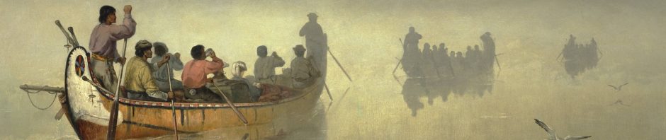
Paddling by the series of rock face with rock paintings made by Ojibwe shamans perhaps three hundred years ago, we seemed to slip into another dimension.  We weren’t canoe tripping anymore – maps, portages, campsite search, all forgotten.  Now we were pilgrims searching for meaning in the ochre images, hoping to hear the stories of those who came to this very same place in their birchbark canoes.

The highlight of our paddle through the headwaters of the Bloodvein River in Woodland Caribou Provincial Park was the time we spent at the various Anishinaabe pictograph sites.  Two stand out – the one between Murdock Lake and Larus Lake – and the one we came to as we approached the east arm of Artery Lake.

Reported Pictograph Sites on Artery Lake and Mary's lake

Reported Pictograph Sites on Artery Lake and Mary’s Lake

What we discovered was not a surprise. Many had been here before us and provided accounts in words and pictures.  Selwyn Dewdney, the man most responsible for the systematic recording and analysis of the pictograph sites of the Canadian Shield, had found his way here in the summer of 1959. He wrote:

The Bloodvein River site was one of those rare experiences                                   that  are the supreme reward of pictograph-hunting.”  

Using the pictures we snapped during our time there – a Sunday morning in July of 2014 and my brother’s 60th. birthday no less! –  I hope to give some visuals for the notes and drawings which Dewdney made while at the site.

approaching the Artery Lake site from upriver

approaching the Artery Lake site from upriver

All images enlarge with a click; all blue text leads to more info with a click.

The first notable thing is that – like the Murdock-Larus site further upriver –  this one faces north.  Wrote Dewdney –

The northern exposure was unexpected, and the question arises how the rock came to be lichen-free at the time it was chosen for a site.  Peter and I scrubbed off whole yards of the fuzzy green species that had grown over a good half of the paintings.

Look at some of the overview images I have included and you can see that “the fuzzy green species” is alive and well!  We did wonder if someone in an official park capacity should be doing what Dewdney and his son did and scrub the stuff off or whether nature should just be allowed to take its course.  To what extent should the park staff get into site management? The current policy does not seem to go further than not publicizing the locations of the various sites for fear of vandalism.

[Daniel Arsenault, the leading Quebec researcher of aboriginal pictographs, states that his team used a biocide-fungicide  at the Nisula Site on Lac Cassette in the early 1990’s and that, as of the early 2000’s when he wrote the article included in the book The Rock-Art of Eastern North America: Capturing Images and Insight,  

“this approach was successful, since there is no evidence of new parasitic growth or deterioration appearing thus far on the decorated panels.”  

See here for the quote source – p.354.  Perhaps WCPP needs to embrace a similar strategy?]

The north end of the site – Face I in Dewdney’s organizational scheme – has a few fairly vague markings; the two following images show some of them.

Artery Lake Pictographs - Face I

Artery Lake Pictographs – Face I

Panel 1 - fish and snake with horns

Panel 1 – fish & snake with horns at Agawa

Dewdney refers to the above images as “the two curious ‘wigglers'”;  they may be representations of the medicine serpent, usually depicted with two horns. The serpent figure from Panel I at Agawa Rock shown to the left has a similar appearance.  In the Anishinaabe worldview the serpent was involved in the transfer of “medicine” or good favour to the shaman who has come to the site.

Artery Lake Pictograph Site - Face I ochre smudge

Artery Lake Pictograph Site – Face I ochre smudge

As we paddled on we approached the core of the site. First up was Face II, a five-meter stretch of rock face showing a significant amount of flaking.

Artery Lake Pictographs - looking south to Face II

Artery Lake Pictographs – looking south to Face II

Artery Lake Pictographs - Face II

Artery Lake Pictographs – Face II

Artery Lake Pictograph Site- Face II closer up

Artery Lake Pictograph Site- Face II closer up

Dewdney’ sketch of the human figure with the outstretched arms is a bit reminiscent of the Murdock-Larus one holding out a smaller human figure. Perhaps it is a variation of the shaman holding the otter skin medicine bag? Also noted on Dewdney’s sketch is his indication of the crack which corresponds to the flaking.  One wonders if the piece was still attached when he was there over fifty years ago.

human figure

The image below is a closer-up shot of the same figure with outstretched arms.

Artery Lake Face II pictograph detail

Face II - canoe with lone figure

Face II – Dewdney’s sketch of canoe with lone figure

Artery Lake Pictographs. Face II detail - canoes and thunderbird

Artery Lake Pictographs. Face II detail – canoes and Thunderbird

Next up was Face III  – at least I think this is Face III given Dewdney’s description of it –

Face III is a puzzling conglomeration of overpainting and abstractions in which little can be deciphered.  I would guess that the animal on the upper left is a porcupine.

Artery Lake Pictograph Site - Face II to III

Artery Lake Pictograph Site – Face III?

Dewdney Sketch of Artery Lake Face III

Dewdney Sketch of Artery Lake Face III

Artery Lake Pictograph Site - Face II to II detail of canoe

Artery Lake Pictograph Site – Face III detail of canoe

Somehow we did not get a shot of the entire face – but here is the porcupine he refers to. From the details, it looks like it was sitting just above and to the left of the rest of the “puzzling conglomeration of overpainting and abstractions”.    

Artery Lake Pictograph Site- Face II closer up - Face III?porcupine?

Artery Lake Pictograph Site-  Face III porcupine

And finally, the pictographs for which the site is best known. (I have labeled it Face IV, though the number is not mentioned in Dewdney’s account.) While the pic below shows me looking at the flip-out lcd screen – a newly-acquired approach to image framing for someone who has spent the past forty years staring into viewfinders! –  and focussing on Face III and one of the pix you see above, the main event is to the right.

Artery Lake Pictograph Site - Face III overview

Artery Lake Pictograph Site – Face IV overview

On Face IV  the image on the left is known as “the Bloodvein Shaman”. Dewdney explains why he gave the image that name –

Dewdney. shaman figure explanation.

Artery Lake Face III - shaman and buffalo pictographs

Artery Lake Face IV – shaman and bison pictographs

Artery Lake Pictograph Site- Face IV pictoraphs above the bison

Artery Lake Pictograph Site- Face IV pictographs above the bison

Artery Lake Pictograph Site- Face IV bison and canoe above shaman?

Artery Lake Pictograph Site – Face IV bison and canoe above shaman?

Artery Lake Pictograph Site - Face III shaman close-up

Artery Lake Pictograph Site – Face IV shaman close-up

Shaman Riding Thunderbird

Looking at the “power” or “interconnectedness”  lines coming out of (or into) the shaman’s head, I can’t help but think of Norval Morrisseau.  He is the Ojibwe painter who often used exactly the same visual vocabulary in his paintings.  Also, note that his human figures are usually painted in the same ochre colour of the pictographs! This may be the origin of the term “redskin”, given that warriors made use of the same ochre in preparation for battle.

Artery Lake Pictograph Site - Face IV detail below shaman

Artery Lake Pictograph Site – Face IV detail below shaman

In front of the shaman figure is what Dewdney interpreted as a porcupine – perhaps a clan totem or a symbol of fighting prowess. Below the war canoe – the number of people in it maybe a sign of great military strength –  we see a snake, often associated with Mishipeshu in pictographs elsewhere. (See Agawa Rock.)

Artery Lake Pictograph Site- Face IV Shaman figure

Artery Lake Pictograph Site- Face IV Shaman figure

And then there is the bison image.  It may be the single-largest pictograph we have seen. You are left to wonder – a bison? Here? Wrote Dewdney –

Dewdney buffalo explanation

Artery Lake buffalo pictograph

Artery Lake Pictograph Site – Face IV bison pictograph

Dewdney also made note of two particular features in the drawing. One was what he called “a vague indication of a heart”, referring to the circle on the bison’s body emphasized with extra paint by the painter.

The Bloodvein bison… Dewdney sketch from 1959

The Bloodvein bison… Dewdney sketch from 1959

Another detail has to do with the feet drawn in as ovals. By chance Dewdney had been looking at some of the Lascaux Cave paintings around this time and noticed a similar treatment.  Coincidence?  Well, of course it is.  What else would it be?  The Lascaux Cave paintings date back 20,000 years. The Bloodvein bison is maybe 300 years old.

While Hap Wilson has clearly read Dewdney’s description of the Artery lake site, he provides a more mystical and fanciful explanation for the similarity in his Trails and Tribulations: Confessions of  Wilderness Pathfinder .  (Open this Google Books  link to read most of  the chapter on the Bloodvein  and scroll to p.132 for his explanation.)

Wilson on the Bloodvein Bison hooves

Artery Lake Pictograph Site- Face IV bison up close

Artery Lake Pictograph Site- Face IV bison up close

Underneath the bison image is the one you see below. It appears to be a structure with a human figure inside. What comes to mind is the Ojibwe ritual involving the “shaking tent” into which the shaman would go for conjuring purposes.

Artery Lake Pictograph Site - Face IV detail below bison

Artery Lake Pictograph Site – Face IV detail below bison

Beyond Face IV

Beyond the shaman and bison images are yet more pictographs.  How could I have framed the image below so that only the rear half of the moose figure on the right-hand side is visible? That’s what zoom is for!

Artery Lake Pictograph Site- Beyond Face IV

Artery Lake Pictograph Site- Beyond Face IV

Beyond the moose and fairly close to the water line is the following row of pictographs –

Artery Lake Pictograph Site- a collection of images south of Face IV (The Bison image)

Artery Lake Pictograph Site – a collection of images south of Face IV (The Bison image)

Artery Lake Pictograph Site- detail from collection of images Beyond Face IV

sphere from collection of images beyond Face IV

sphere after Face IV

Dewdney sketch of sphere with rays

Artery Lake Pictograph Site- more detail from collection of images Beyond Face IV

Artery Lake Pictograph Site- more detail from the collection of images Beyond Face IV

Artery Lake Pictograph Site - approaching the south end

Artery Lake Pictograph Site – approaching the south end beyond Face IV

Artery Lake Pictograph Site - south end

Artery Lake Pictograph Site – south end

Artery Lake Pictograph Site- looking back up to where we've come from

Artery Lake Pictograph Site- looking back up to where we’ve come from

Artery Lake Pictograph Site - near the south end

Artery Lake Pictograph Site – near the south end

More questions than answers as we take in the images but it is undeniable that we felt something special as we paddled away from the famed Artery Lake pictograph site. During the first three days on the Bloodvein headwaters we had joked that the aches and pains that come from doing six kilometers of portages at maximum travel weight to get to the pictographs was the price of admission. As we moved on to the next pictograph site we agreed it had been worth it.

Links To More Information:

Dewdney’s book on the pictograph sites of the Canadian Shield is available for online reading or download here. The Artery Lake site is discussed on pages 59 to 61.

discovering-rock-art-cover_300x454

Over the past 35 years, Thor Conway has continued the work of Dewdney to record and understand the pictographs, taking special care to listen to the Anishinaabe elders and incorporate their understanding of their traditional culture and the place of the rock paintings in it.

His website and contact info can be found here.

In the fall of 2016, Conway published a new book – Discovering Rock Art – which examines in some detail a dozen Ontario pictograph sites. Included is a chapter on this Artery Lake site with a number of insights that will one day force me to reconsider – and rewrite – some of the contents of my post!

If you click on  “Ojibwe Pictographs” on my site header, you find a few more posts I have put together on the pictographs of the Canadian Shield.  It all began about a year and a half ago as we prepared for a canoe trip that would, among other things,  take us down Cliff Lake on the Pikitigushi River system. It turns out that Cliff Lake is one of the premier pictograph sites of the Canadian Shield. Who knew! Certainly not me.

I was excited to have this additional element added to our adventure; I was also struck by how little I knew about those enigmatic rock paintings in a canoe country I have spent thirty years paddling and was keen on blowing away the fog of ignorance.  It has been an interesting journey, but there is still more than a bit of fog to blow away!

Posted in Pictographs of the Canadian Shield | Tagged , , , , , , , , , , | 5 Comments

Bloodvein Headwaters Day 2: Crystal Lake to the Knox Lake Portage

last revised May 6, 2024.

Contents:

—————

The Day’s Basic Data And Maps

  • distance: about 25 kilometers
  • weather: a beautiful sunny day in WCPP – lots of sunshine and no wind
  • rapids/portages: seven in all,  totalling about 2045 meters; also a beaver dam approaching Indian House Lake
  • campsites: again, scarce and average at best.
  • Natural Resources Canada Gov’t. Topos:  052 M 01 (Pipestone Bay);

Previous Post:  Day 1: Trout Bay to Crystal Lake

Bloodvein Headwaters Day 1: Trout Bay to Crystal Lake

The day’s paddle starts at the bottom of the second map page!

Indian House Lake to Knox LakeCrystal Lake to Indian House Lake

Crystal Lake early morning sunshine

Crystal Lake early morning sunshine

—————

Our Route After the 2021 Wildfire

Our trip down the Bloodvein was three years after the 2011 fire. Its impact was minor compared to the massive 2021 wildfire. I’ve sketched our route on the map below to give you an idea of what to expect in 2024.  Park officials should be able to give you up-to-date info on the state of portage trails and the safety of campsites.

our route roughly sketched on top of the wildfire history map

—————

From Crystal Lake To Indian House Lake

We were on the water before 9:30 for what promised to be a big day.  We were hoping to be at the far end of the Knox Lake portage by the end of it.  By noon, we were at the A09 put in and paddling across the small lake (mistakenly labelled “Indian House Lake” on the Garmin map) and Indian House Creek into the Indian House Lake itself.

portage time - Max hauls a double load

portage time – Max hauls a double load

A07 P275

A07 P275

A08 P380

A08 P380

A09 P450m

rock face on the shoreline as we approach Indian House Lake

rock face on the shoreline as we approach Indian House Lake

The pix above and below convey a little of the terrain as we approached Indian House Lake. As you can see the weather was our friend on this particular day!

beautiful easy paddling before Indian House Lake

beautiful easy paddling before Indian House Lake

one stern paddler - my bro Max!

one stern paddler – my bro Max!

like paddling in a dream - the south end of Indian House Lake

like paddling in a dream – the south end of Indian House Lake

Lunch on Indian House Lake

Some distance up Indian House Lake on the west side of one of the string of islands that almost divides the lake in half, we pulled over and stopped for lunch.  While lunch is a hurried affair for some paddlers, we actually spend an hour and even take out the butane stove to boil up some water – water for soup and water for tea or coffee.  We also get out the water filter, refill the one-litre Nalgene container, and then add some Gatorade.  Adequate hydration is key when you’re paddling.

—————

From Indian House Lake To Knox Lake

After lunch (3:00!), we continued to the north end of Indian House and Portage A10. I was surprised to see the small creek that the portage trail comes out at was running down into Indian House and not into the nameless lake we had just portaged into.  Looking at the maps that evening revealed that while Indian House Lake does indeed flow into the Bloodvein River system, it does not do so through Knox Lake. Instead,  its outlet is Indian House Creek just to the west of our lunch spot, which then flows down to Murdock Lake.

A10 P105

A10 P105 – out of Indian House L

A11 P160

A11 P160

A12P270

A12 P270

A13 P405

A13 P405


When we got past Portage A12, we briefly considered taking the time to paddle up to the very headwaters of the Bloodvein River itself – it would have meant a three-kilometre detour.  In the end, we agreed that we were getting a bit obsessive about doing all of the Bloodvein and figured that 99% was close enough!

So – off to the day’s final portage (A13).  Given the aches and pains we were feeling for our first two days of paddling – but mostly from the hauling – we already knew we would not be sitting on Knox Lake at the end of this day.  The revised goal was a campsite near the start of the portage, which we would then tackle early the next day instead of late this one.

—————

Looking For A Campsite On Knox Lake

We did scout the south shore for a place to camp but, as the map below shows, we were coming up empty!  The third site we paddled by seemed to be the one we had taken from Harlan’s map at his front desk the previous morning – perhaps in our haste to get going, we didn’t get it quite right. In any case, we paddled across the lake to the other shore and found a rock face backing up into some sheltering trees that did the job. The Thermarest is the great equalizer when it comes to campsites!  Still, neither of the first two campsites of our 17-day paddle would make the top 15 list!

looking-for-a-campsite-fourth-time-lucky2

Day Two camp set up

Day Two camp set up

We were feeling some aches and pains at the end of the day.  Advil time for sure!  Over four kilometres of portaging and 50 kilometres of paddling in two days. However, there was just one more portage and then we would be able to say that we’d paid our entrance fee to the Bloodvein River.  And what a last portage it would be – the 1500 meters into Knox!

Next Post: Day 3: Knox Lake Portage To Murdock Lake

Bloodvein Headwaters Day 3: Knox Lake Portage to Murdock Lake

Posted in wilderness canoe tripping | Tagged , , , | Leave a comment