Since January 1, 2024
Recent Comments
Most Viewed Posts & Pages (last 48 hours)
Tag Archives: Anishinaabeg art
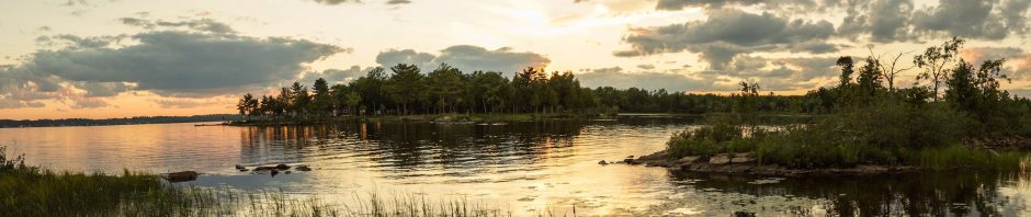
The Little Missinaibi River From Top To Bottom – Intro, Maps, and Logistics
Last update: March 25, 2023. Table Of Contents: Introduction and overview map Missinaibi as An Anishinaabe Territory Missinaibi – “The Place of Pictures” Wildfires Along The Missinaibi River Hap Wilson’s Missinaibi Guidebook Four Approaches To Little Missinaibi Lake & Fairy Point on … Continue reading
The Ojibwe Rock Paintings of Killarney’s Collins Inlet
Last revised on September 5, 2022. Table of Contents: Location of the Collins Inlet Pictograph Site Selwyn Dewdney and Thor Conway Report On The Site Panel I Panel II Panel III Panel IV Wrap-Up: Conway’s Four Panels Other Supposed Sites Near … Continue reading
Posted in Pictographs of the Canadian Shield, wilderness canoe tripping
Tagged Ambush Rock, Anishinaabeg art, collins inlet rock paintings, Conway Collins Inlet, Daniel Harmon serpent image, Dewdney Collins Inlet Pictographs, Ojibwa rock painting, Point Grondine pictographs, thunderbird pictograph
Leave a comment
Anishinaabe Pictographs On The Bloodvein: the Murdock – Larus Site
Last update: June 18, 2018. Selwyn Dewdney As Our Guide A highlight of the six days we spent on the headwaters of the Bloodvein River system was the chance to see several Anishinaabe (that is, Ojibwe or Chippewa) pictograph sites. … Continue reading
Posted in Pictographs of the Canadian Shield, wilderness canoe tripping
Tagged Anishinaabeg art, bloodvein river canoe trip, Bloodvein shaman, Dewdney Larus Lake, Larus canoe pictograph, Larus Lake pictographs, Murdock fox and human figure rock painting, Murdock Lake Pictographs, Ojibway rock paintings, shaman with medicine bag, Thunderbird rock painting
2 Comments
Anishinaabe Pictographs On The Bloodvein: The Artery Lake Site
Last update: May 5, 2022. Previous Post: Bloodvein Headwaters Day 6: Barclay Lake To Artery Lake Paddling by the series of rock face with rock paintings made by Ojibwe shamans perhaps three hundred years ago, we seemed to slip into another dimension. … Continue reading
Posted in Pictographs of the Canadian Shield
Tagged Anishinaabeg art, artery Lake pictographs, artery lake rock paintings, bloodvein bison rock painting, bloodvein pictographs, bloodvein river canoe trip; artery lake rock paintings, bloodvein shaman painting, Dewdney Artery Lake, indian rock paintings artery lake, ochre rock paintings, shaman with otter skin bag
5 Comments
Anishinaabe Pictograph Sites of Manitoba
Previous Post: Anishinaabe Pictograph Sites of Ontario. Anishinaabe Pictograph Sites of The Canadian Shield is my introduction to a series of posts, each dealing with a Canadian province or U.S. area where Indigenous Peoples’ (Algonkin, Ojibwe, Cree, Dene) rock paintings are found. This work in … Continue reading
Anishinaabe Pictograph Sites In Ontario
Last updated: August 10, 2023. Northern Ontario has the most extensive and richest collection of Indigenous pictograph sites in Canada. Any of the following locations would provide a great introduction to Anishinaabe rock paintings. Quetico Provincial Park Lake of the … Continue reading
Posted in Anishinaabek World, Pictographs of the Canadian Shield
Tagged aboriginal pictographs Ontario, Agawa Rock pictographs, Algonquin rock paintings, Anishinaabeg art, Before and After the Horizon - anishinaabe pictographs, Bloodvein rock paintings, Bon Echo pictographs, Cliff Lake rock paintings, Diamond Lake pictographs, First Nations paintings, Lake of the Woods pictographs, Missinaibi rock paintings, native rock paintings Ontario, Obabika rock paintings, Ojibway rock paintings, Quetico master map pictographs, Quetico rock paintings, Temagami rock paintings
29 Comments
Anishinaabe Pictograph Sites Of The Canadian Shield
Table of Contents: The Canadian Shield Defined The Algonkian Homeland The Shield As Canoe Country The Shield As Pictograph Country Essential Reading On Algonkian Rock Images Selwyn Dewdney Grace Rajnovich Thor Conway Posts On Specific Areas Algonkian Pictograph Sites of … Continue reading
Posted in Anishinaabek World, Pictographs of the Canadian Shield, wilderness canoe tripping
Tagged aboriginal rock art, Anishinaabeg art, art ruprestre du bouclier canadien, canadian shield pictographs, Grace Rajnovtich, Indian pictograph locations, indian rock paintings, Selwyn Dewdney and Indian rock paintings, Thor Conway pictographs
19 Comments