
Back in March, I spent three weeks in New Zealand. The lure was the mostly off-road gravel bike trails of the South Island. Over 15 days, I cycled the following –
- The Alps to Ocean Trail
- The Central Otago Rail Trail
- the Lake Dunstan Trail
- the West Coast Wilderness Trail
Meanwhile, my wife, not an avid cyclist, took care of the home front with our Icelandic Sheepdog Skuggi.

earlier this week on the lower Don River’s last set of rapids
Well, it is now her turn for a bit of adventure, and while Skuggi and I do our daily rambles through Cabbagetown and up and down the Don River trails, she gets to spend three weeks in Japan visiting friends and some new places and some favourites. In this post, I’ll upload some of the images that emails back and add maps and links that her pix led me to. Since I have never been to Japan, the next three weeks will become a mini-classroom as I learn some basics about the country.
I’ll also be going on a little Japan journey of my own, thanks to Rouvy, the indoor cycling app built on thousands of GoPro videos of actual bike routes from 88 different countries. My setup, pictured below, includes
- a Wahoo Kickr Core,
- a 1990 Miyata steel-framed touring bike,
- a laptop connected to the internet, and to a
- 27″ monitor for a more immersive experience
- a fan

Here is what it looks like when I am sitting on my saddle:

the view from the saddle
There are currently 73 Japan rides available. When possible, I’ll be riding routes that are in the general vicinity of where Laila happens to be.
Chiba Ride To Naritasan Shinsho-ji
Shinjuku Park (Japan National Stadium) to The Imperial Gardens
Shizuoka Ride – East Side of Suruga Bay
Aomori Ride Around Lake Jusanko
Aomori Ride – Lake Jusanko to Cape Tappi
—————
Day 1 – Narita
Laila landed at Narita and chose to spend two nights in Narita town before heading off to Tokyo Ueno Park district and a hotel she has stayed at before.

Narita and Haneda Airports
Heavy rain all day. Lots of tourists in Narita, a city of 132,000 in Chiba Prefecture.
The Narita-san Shinsho-ji Temple is the main tourist draw. It looks like a wonderful place to wander and sit for a day, especially after a 13-hour flight! Temples and gardens, all with that Japanese aesthetic…

Click here to access the Google Earth view.


—————
A Dawn Ride To Naritasan Shinsho-ji

a 14-km ride from the countryside west of Narita to just SE of the Temple complex
The dawn light and the countryside beginning made for a quiet start. Very little vehicle traffic encountered – perhaps the reason why the person who videoed the route set off when (s)he did.


My pace partner leads the way down the empty country road.


I passed by some teenage students with book bags on the way to school as I approached the Narita-san Shinsho-ji.

The route skirted the southern perimeter of the temple complex, but other than a couple of temple roofs, little of it was visible from the road. There was a nice bit of downhill to finish the ride!

heading south on Shinsando Street with the Temple Complex on the left
—————
Day 3 – Tokyo
A train ride from Narita to the Ueno Park area on what looks like another overcast day. Concerns about heat and humidity can be shelved for a day or two. Everyone seems to be wearing jackets. Given the images, it looks like it was a museum day though the email was titled ” I walked 10 km today”!

Ueno Park and museums
Laila often makes the Ueno Park area her Tokyo home base. It is easy to see why. In addition to the park itself, the area hosts several top-tier museums.


—————
A 20-km Rouvy Bike Ride near The Imperial Gardens:
Ueno Park is in the top right-hand corner of the map below. My Tokyo bike route is indicated on the map below. It started at Shinjuku Park and went east to the Imperial Gardens and then back to Shinjuku.

My 20 km ride north of the Imperial Gardens
Whoever videoed the ride must have done so just after dawn! The streets were mostly free of vehicles for the first twenty minutes, and then, as I got closer to the Imperial Palace area, things picked up. Strange route – not a loop but one that returns to the beginning.


Shinjuku street near the end of this Tokyo City ride
Unexpectedly, the ride ended on the field inside Japan National Stadium (aka the 2020 Olympic Stadium)! Here is an internet-sourced view of the stadium –

And here is where the bike route ends!

Japan National Stadium – end of ride!
—————
Days 4 and 5

Kawasaki train station – off rush hour
Getting over jet lag, Laila heads down to Kawasaki, a city located between Tokyo and Yokohama. Waiting for her are friends she has gotten to know over the past decade or so. No pix while they chill and reminisce – and go over their plans for a north-of-Tokyo trip.
In the meantime, I found an 18-km ride to do in Shizuoka (#22 on the map below). It is not only the name of a city but also of one of the 47 prefectures or administrative districts that Japan is divided into. BTW, Kawasaki is in Kanagawa Prefecture.
Upon seeing the name of the ride, I wondered why they had called it Shizuoka, since the city of the same name is on the other side of the bay. Finding out about prefectures made sense of it!
As a bonus, when I saw that Laila’s friend in Kawasaki was in Kanagawa Prefecture, another aspect of the famous print below was finally made clear. It is The Great Wave off Kanagawa by the painter and printmaker Hokusai.

Sometimes misnamed Tsunami

Always something new to find out!
—————
Shizuoka Ride – East Side of Suruga Bay

Screenshot

Like my first two Japan rides, whoever videoed this one sets off at dawn. No vehicles on the secondary coastal road (Hwy 14 on the map, though not the National Highway #14).


The surprise of the morning was seeing what looked like Mount Fuji on the horizon as I approached the end of the ride. Looking more closely at the map afterwards, I realized that it is actually Mt. Ashitaka. Mt Fuji is about 20 kilometres further inland to the west. It is at the top of the map image, with Mount Ashitaka closer to the water.

Mount Ashitaka and Mount Fuji from the south side of Suruga Bay in Shizuoka Prefecture

Mt. Ashitaka pops up on the horizon!


—————
Days 6 and 7

Tokyo to Karuizawa with Nagano to the NW
Got an email from Karuizawa, a mountain resort town of 22,000 not far from Nagano, the site of the 1998 Winter Olympics. Thanks to the slow internet, a data plan may not be large enough, pix are scarce. This Wikipedia entry on the town includes this point –
Karuizawa was developed as a European-style resort town by a Scottish-Canadian missionary in 1888. In the following decades, the town attracted visitors from across the country seeking to escape the heat of summer and enjoy vacations, as well as a significant number of Westerners. Unlike many other hill stations, Karuizawa was actively open to the natives from the beginning, and many Japanese aristocrats (Kazoku), scholars, artists and others had already built “Western-style” villas in the town by the early 20th century. (Wiki source)
Reminds me of Darjeeling, a hill station we visited back in the 1990s. Laial and her friends do seem to have checked into a fairly posh accommodation!


While I wait for a flood of pix of the town and its attractions, here is a web-sourced write-up that includes several excellent photos –

Click here to access.
Here are a couple of images of a Shinto shrine with a large rope – a shimenawa – draped across the entrance. A Wikipedia article notes this about the rope above the entrance of shrines:
A space bound by shimenawa typically indicates a sacred or ritually pure space, such as that of a Shinto shrine.[2] Shimenawa are believed to act as a ward against evil spirits,

Shinto shrine in Karuwzawa

shimenawa close up – see here for more info on significance

Mika waits her turn to make an offering at the Shinto shrine altar
A couple of images with simple shimenawa with white paper streamers dangling –


—————
Rouvy Cycling in Aomori Prefecture
No Rouvy rides in the Nagano-Karuizawa region, so I had to head to Aomori, the northernmost prefecture on Honshu Island, for a 30-km route around Lake Jusanko.

Lake Jusanko is within the red circle
Unlike a ride in the Nagano area, its elevation profile is very mild. Instead of 1000 meters of probable elevation gain on the mountain roads, it is an almost flat 28 km ride at 115 meters. The lake itself has a maximum depth of 3 meters and is a mix of salt and fresh water, and is famous for its freshwater clams.
Jusan is the Romanized version of the #13 in Kanji. There are said to be 13 rivers and streams flowing into the lake, with the Iwaki River being the main inflow.

Jusanko Circuit
The Rouvy app enables you to take snapshots as you cycle the route. The perspective I prefer is the one that only has a view of the road in front of me. Other views are available, including one that shows your avatar as it moves along the route. You can also create riding companions and pace partners for extra motivation.
Here is a satellite view of the Lake Jusanko circuit. It should take about an hour to do. The goal is an average heart rate in the 120–125 range. Conditions will be ideal –
- no wind,
- no vehicle traffic,
- no potholes
- no flats,
- no chance of falling off the bike!
Here are some snapshots of what you see looking straight ahead over your handlebars! Limited perspective for sure, and of the four Rouvy Japan rides so far, the least variety in scenery. The coast segment was the best part of the ride.
On the plus side, it kept me spinning the pedals for an hour, and I averaged a 122 heart rate, which is the ultimate point of cycling on a bike trainer in a basement!


bridge over the Yamada River, one of Lake Jusanko’s inflow rivers.

a straight stretch of road North of Jusanko Village

entering Jusanko Village after crossing the bridge over the outflow of Lake Jusanko


Rouvy overlays banners and other route markers on the Action Pro videos to give it an augmented reality look
—————
Day 9. Laila in Akita City
Akita, Akita – just like N.Y., N.Y.! City and Prefecture – #5 on the map above. The city has a population of 300,000.
Along with a reminder to water the house plants, I got news that she is in Akita. The one photo so far is of the view outside her hotel window.

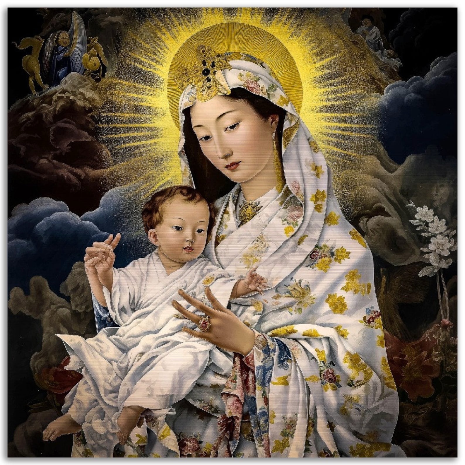
Curious about the Christian presence in the city, I googled my way to an account of a vision of Mary experienced by a Japanese Roman Catholic nun at a convent in Akita in 1973. See here for the account.

I wonder if Akita has become a pilgrimage destination, much like Fatima in Portugal, after three children there experienced a similar mystical experience in 1917.
While 32% of South Koreans belong to various Christian denominations, the Japanese figure is much smaller at 1%.
I turned to ChatGPT for a quick, lazy person’s answer to the reasons for the difference in conversion rates and got this response –
Historical Context of Conversion
Factors Influencing South Korean Conversions
- Association with Nationalism: During the Japanese occupation (1910-1945), Christianity became linked with Korean nationalism. Many Koreans viewed the religion as a means of resisting Japanese rule and preserving their cultural identity.
- Missionary Contributions: Christian missionaries established schools and hospitals, which provided modern education and healthcare. This not only improved literacy but also offered social mobility, making Christianity attractive to many Koreans.
- Post-War Upheaval: The socio-political turmoil following the Korean War (1950-1953) created a fertile ground for religious conversion. Many people sought meaning and community in the face of trauma and loss, leading to a significant increase in Christian adherents.
Comparison with Japan
- Cultural Identity: Japan has a strong cultural identity rooted in Shinto and Buddhism, which has historically limited the appeal of Christianity. The existing religious traditions are deeply integrated into Japanese society, making it more challenging for Christianity to gain a foothold.
- Religious Landscape: In Japan, the combination of Shinto practices and Buddhist beliefs has created a unique religious environment that does not favor the rapid growth of Christianity as seen in South Korea.
On her to-do list in Akita, she mentioned the following:
- Tadao Ando-designed art museum
- various folk museums.
- An Akita dog center
No mention of a visit to the Lady of Akita shrine.


A ChatGPT explanation of the above!
These are stylized masks of Japanese oni — horned ogre/demon figures from Japanese folklore. The red and blue colorings are common: red (aka-oni) and blue (ao-oni). Oni appear in stories, festivals (like Setsubun), and as protective or scary motifs in art.


—————
In the Meantime, Up in Aomori Prefecture…

Akita City and Akita Prefecture are just south of Aomori Prefecture, where i did my previous one-hour Rouvy ride around Lake Jusanko.
Time to hop on that bike again…again in Aomori Prefecture with
- a start not far from the outlet of Lake Jusanko at the Nakanoshima Bridge.
- It is a 37-kilometre route, mostly on Hwy 339.
- which passes through the Tsugaru Mountains for some major uphill and then the reward,
- seven kilometres of downhill to Cape Tappi from the Chokandai Observatory at the high point of the ride.

The Rouvy Ride to Cape Tappia from Lake Jusanko
The ride was a much more scenic – and demanding – ride than the one around Lake Jusanko. The segment from the coastal road up to the high point of the ride at the Chokandai Observatory took me an hour to do at an average speed of 7 km/hr. I was in first gear almost all the way!
Check out this YouTuber’s 3:48 sped-up version of his car ride from Lake Jusanko to Cape Tappi. He got to do it in the rain!
—————
In The Kyoto Area – A Short Lake Biwa Ride

Lake Biwa – japan’s largest lake


—————–
Japanese tourism is booming in 2026 despite the loss of visitors from China. This article provides some background.
