Since January 1, 2024
Recent Comments
Most Viewed Posts & Pages (last 48 hours)
Category Archives: Bhutan
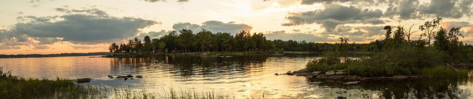
Bhutan’s Snowman Trek: Day 13 – Rodophu To Narethang Via Tsemo La
Previous Post: Day 12 – Laya To Rodophu calendar date: October 10, 2019. time: 7 hours distance: 16 km. start point altitude: Rodophu 4220m (my Garmin device)/ 4215 m (Jordans guidebook) ); 4160m (Lonely Planet’s Guide to Bhutan 2017 – … Continue reading
Posted in Bhutan, hiking/trekking
Tagged gentian Himalayas, laptse Tsemo La, Lunana Trek, Narethang, Rheum nobile, Robothang, snowman trek, Tsemo La
Leave a comment
Bhutan’s Snowman Trek: Day 12 – Laya To Rodophu
Table of Contents: The Day’s Basic Data and Maps Locals Waiting For Dignitaries Arriving Via Helicopter Leaving Laya Reaching The Army Camp/Permit Checkpoint The Side Trail To The Rodo Chhu Varying Trail Conditions Up The Rodo Chhu Trail Approaching Our … Continue reading
Bhutan’s Snowman Trek: Day 11 – Rest Day In Laya
Last revised on November 10,2023. Table of Contents: Laya – Population; cultural background; location Changes To Its Traditional Culture Local Sources of Wealth The Layap Woman’s Traditional Hat Things To Do On Our Free Day in Laya A Walk Up … Continue reading
Bhutan’s Snowman Trek: Day 10 – Limithang To Laya Village
calendar date: Monday, October 7, 2019 time: four hours – 3:15 of actual walking time distance: 13 km. start point altitude: Limithang 4120m endpoint campsite: Laya 3817m high pass crossing: none on this day (see here for the high passes … Continue reading
Bhutan’s Snowman Trek: Day 9 – Robluthang To Limithang Via Sinche La
calendar date: Sunday, October 6, 2019 time: 7:40 from start to finish distance: 16.3 km. (Polar M430); Jordans: 18km. start point altitude: Robluthang 4160m endpoint campsite: Limithang 4160m high pass crossing: Sinche La 5000m Maps: Bart Jordans’ Trekking In Bhutan … Continue reading
Bhutan’s Snowman Trek: Day 8 – Shomuthang To Robluthang Via Jare La
Previous Post: Day 7 – Chebisa Via Gombu La to Shomuthang calendar date: October 5, 2019 time: left camp at 8:00 and arrived at Robluthang at 2 – 6 hours/4 of actual walking distance: 11 km on my Polar M430/10 … Continue reading
Bhutan’s Snowman Trek: Day 7 – Chebisa To Shomuthang Via Gombu La
Table of Contents: The Day’s Basic Data and Maps Our Chebisa Campsite & A Local Shopping Center Up A Steep Path Leaving Chebisa Gombu La – The Day’s High Point On To Our Shomuthang Campsite The Importance of Your Tent! … Continue reading
Bhutan’s Snowman Trek: Day 6 – Lingshi To Chebisa
Last revised on December 3, 2022. Table of Contents: Trip Data For the Day Our Lingshi Campsite (Charhae Thang?) Lingshi Dzong From Lingshi To Goyuk Goyuk “Crazy Wisdom” – Bogus Buddhas Behaving Badly The Goyuk Dzong From Goyok To Chebisa … Continue reading
Posted in Bhutan, hiking/trekking
Tagged Bhutan electricity, Bhutan penis mural, Bhutan trek horses, Bjagoe Dzong Goyuk, Charzi Thang, Chebisa Bhutan, Chha Shi Thang, crazy wisdom Bhutan, Drukpa Kunley, Goyuk dzong, Jhomolhari trek, lingshi campsite, Lingshi Dzong, lingshi village, snowman trek
Leave a comment
Bhutan’s Snowman Trek: Day 5 – Jomolhari B.C. To Lingshi Via Nyile La
Table of Contents: The Day’s Basic Data and Satellite View of The Route Blue Sky – Jomolhari Peak Revealed! To The Bridge North of Jangothang Heading Up Valley To Nyile La The Views From Nyile La The Hydro-Electric Poles and … Continue reading
Bhutan’s Snowman Trek: Day 4 – Jomolhari B.C. Acclimatization Day
Table of Contents: The Day’s Basic Data and Map The Acclimatization Issue Scarce Mountain Views! Acclimatization Hike To Tsho Phu A Shorter Jomolhari Trekking Route Option Back To the Jomolhari Campground Previous Post: Day 3 – Thangthangka To Jomolhari B.C. … Continue reading
Posted in Bhutan, hiking/trekking
Tagged Jhomolhari trek campsites, Jitchu Drake views, Jomolhari Bonte La Circuit, Jomolhari Loop Trek, jomolhari trek acclimatization, Jomolhari trek high passes, Snowman acclimatization, snowman trek, Snowman trek diamox, Tsho Phu, Tsho Phu acclimatization hike
Leave a comment