
Table of Contents:
- A Journey Worth Making
- Accessing Wabakimi Canoe Country
- Our West Side of Wabakimi Route Through The Caribou Forest
- Northern Canada Wildfires And Canoe Trip Planning
- Getting To The Put-In From Toronto
- VIA Rail – Washago To Savant Lake VIA Stop
- Our Shuttle Provider: Jonah Belmore
Maps and Information (Rapids, Portages, Campsites, etc.)
- Natural Resources Canada 1:50,000 Topos
- David Crawshay’s Topo Canada iOS App
- ATLOGIS Canada Topo Maps for Android OS
- Toporama Canada Online Map
- Wabakimi Project Maps – Info on Rapids and Portages
- Paddle Planner
- Our Route GPX and Kml Files – from Max’s Garmin Etrex 20
Day-By-Day Details
- Day 1: Jutten Lake
- Day 2: Halfway Down Savant Lake
- Day 3: Down Savant Lake’s North Arm
- Day 4: Into Jabez Lake
- Day 5: Jabez to Savant Falls
- Day 6: Savant Falls To Velos Lake
- Day 7: Velos Lake to McCrae Lake
- Day 8: McCrae Lake to East Pashkokogan
Next Post: From East Pashkokogan Lake To The Palisade River
Canoe Tripping From East Pashkokogan Lake To the Palisade River and Kenoji Lake
——————
A Journey Worth Making
Head to the northwest of Lake Nipigon and you’ll find a 25,000 sq. km paddlers’ dream canoe country known as Wabakimi. For every 100 paddlers who visit Algonquin or Quetico Parks, this area sees maybe 1! The map below shows its approximate boundaries –
- Highway 599 on the west side
- the Albany River to the north,
- the Little Jackfish River to the east,
- and the Kopka River and Lake Nipigon to the south.

map from the Friends of Wabakimi website
Its core is Wabakimi Provincial Park, which includes most of the upper Ogoki watershed. From its headwaters in Endogoki Lake, the Ogoki River merges with the Albany some 480 km. downriver. It was back in 2010 that we first heard about Wabakimi. Since then we have made it our destination of choice for a half-dozen memorable two-to-three-week canoe trips.

Wabakimi water we’ve paddled – six trips from 2010 to 2023
——————
Accessing Wabakimi Canoe Country
There are different ways of getting to a put-in on one of the many lakes and rivers, which serve as a starting point.
- It can be accessed by road (Highway 529 from Thunder Bay to Armstrong or Highway 599 from Ignace to a put-in on Savant or Pashkokogan Lakes).
- Since the Canadian National rail line runs across the southern edge of Wabakimi Provincial Park, a VIA train drop-off somewhere along the line is another way to access the lakes and rivers of Ontario’s second-largest park, as well as the surrounding Crown Land and other smaller parks.
- Bush plane service is a third (and the priciest) option. Both de Havilland Beaver and Otter services can be arranged from Mattice Lake or Mackenzie Lake, just south of Armstrong.
——————
Our West Side of the Wabakimi Route
Between the western border of Wabakimi Provincial Park and Highway 599 is a large strip of Crown Land running all the way from the CN tracks north to Osnaburgh Lake. Mineral exploration and continued logging are probably why it is not yet a part of a larger Wabakimi Park. The two major rivers in this area are the Pashkokogan and the Savant. Both flow into the Albany River system and include a series of lakes, large and small.
However, the area is included in a 720,000-hectare (2780 sq. miles) zone designated by the Ontario Government’s Ministry of Natural Resources and Forestry as Caribou Forest. Its boundaries are the CN tracks in the south and Lake St. Joseph in the north, with St. Raphael Lake and Wabamini Park as its western and eastern edges.

Double-click to enlarge
A very positive description in the Canoe Atlas of the Little North was what led us to focus more closely on the Savant Lake area. Published in 2007, the book has provided the seeds of many a canoe trip!

We read this –

It sounded pretty enticing! After studying the topographic maps more closely and following the river system to its headwaters lake, we were also motivated by the thought of paddling it right from the very top to the bottom. A couple of years before, a similar thought had led us to the headwaters lake of the Ogoki River system. The Savant-area satellite images had us thinking that this would be different!
Once at the end of the Savant, we planned to head east on Greenbush Lake and, after a couple of long portages that separate the height of land between the Misehkow and Palisade river systems, paddle down the Palisade to Kenoji Lake. There, we would get picked up by a de Havilland Beaver for a return to Mattice Lake and the next-day VIA train ride from Armstrong Station.
We had 14 paddling days to git ‘er dun!

planned route – Savant Lake Via to Mattice Lake
—————–
Northern Canada Wildfires And Canoe Trip Planning
If May and June of 2023 made clear one thing, it was that you don’t have to be up close to a wildfire to be impacted. Toronto, Chicago, New York City – tens of millions of people living far from western Canada and northern Quebec inhaled the smoke carried thousands of kilometres by the wind currents. Air quality index numbers and images of orange skies over major metropolitan areas became part of nightly weather and newscasts.

Given the fire map above, it appears northwestern Ontario escaped the worst of the fires in 2023. However, our original mid-July departure date had to be pushed back when the Palisade River section of Wabakimi Park that we planned to paddle through was closed. The circle on the above map is where we were headed. Here are the two wildfires of concern up close – the fact that the 263 sq. mile fire (labelled Sioux Lookout #33), which started on June 11, is just a tiny red dot on the Canada map brings home how massive the northern Alberta and Saskatchewan burns were.

map source – lots of additional info, including fire history
Wabakimi Park officials reopened the western corner of the Park in early August, and we were finally able to book our VIA train tickets. Unfortunately, it was so close to our departure time that VIA was unable to fit our canoe in the baggage car! Then Max pulled a back muscle, and to be on the safe side, we pushed our departure date back another two weeks.
A month later, we were finally on our way!
Given that 2023 was likely not a one-off occurrence but rather the beginning of a new, more extreme “normal”, it left us wondering. On the macro end, we wondered what the future held for those northern Canadian communities, some of which are focused on resource extraction and many of which are isolated First Nations. On the micro level, for canoe trippers drawn to the lakes and rivers of the boreal forest, the increased possibility of wildfires adds another dimension to trip planning and emergency preparedness.
Getting The Latest Wildfire Info

The map image above is from the interactive map at the Natural Resources Canada Wildfires website, which provides current wildfire information as well as a historical overview of Canadian wildfires.

The Ontario Government also has an interactive map showing current wildfire locations in the province. See the website Ontario Forest Fires and select the interactive fire map for the latest information.
Having A Satellite Communication Device

We also left home with our Garmin inReach Explorer+ satellite device, which allows two-way email communication. It also provides the folks back home with our every-ten-minute GPS location. The SOS button is a third key feature of the device.
Our local contact would be Don Elliot at the Mattice Lake Outfitters base camp near Armstrong. If not an SOS situation, his float plane would be an email contact away if an extraction were necessary or possible.
The Switchback Travel website has a good review of all the best current device options. Our vintage 2017 Garmin no longer makes the list, but it works just fine at the cost of three ounces of extra weight and bulk, which add up to the equivalent of an extra Clif Bar!
Finally, we had not only our planned route but maps for a Plan B exit off Hwy 599 at Fitchie Lake and a Plan C northward paddle down the Misehkow River.
—————–
Getting to the Put-In
We decided to skip the long drive up (18 hours to Armstrong or 19 to Savant Lake) and take the train to the Savant Lake VIA stop. It leaves Toronto twice a week for Vancouver, and canoes are welcome in the baggage car. For that quintessential Canadian experience, the train will stop and let you off anywhere along the track!
Our past train travel experience had been positive, and we hoped that we would be spared the long waits and delays that passengers can expect on a rail line owned by CN on which their freight takes precedence over VIA, which rents access to the tracks.

The journey begins
However, this time we did something different. Instead of getting on at Union Station in downtown Toronto, we decided to drive up to Washago, the first stop north of Toronto, and put our canoe and gear into the baggage car there. The certainty and peace of mind of seeing everything being loaded before we took our seats was worth the effort. As for our vehicle, a fellow paddler (and one of the very first Friends of Wabakimi!) provided us with the email address of a friend of his in Washago. We soon had a place to park our vehicle for a couple of weeks.

Our rush-hour drive north to Washago had us contemplating the contrast between the sixteen lanes of traffic on the 401 and the absolute stillness we knew we’d have during the two weeks of our trip. [Spoiler alert! We would meet one paddler and two boats with guys fishing at the bottom of a set of rapids, and we would hear four other motorboats on Savant Lake. That was it for traffic on the water we paddled!]
——————
VIA Rail: Washago To Savant Lake
It is a two-hour drive from Toronto to Washago. Max dropped me, the canoe, and the baggage off on the side of the tracks, then drove off to park his vehicle. He was back sooner than expected, thanks to the ride he got from the folks hosting his car!

Washago VIA Waiting Room
As for our VIA tickets, they cost us $ 335 + HST each. So – $750. for the two of us. Another $200 -$100. each way – covered the cost of putting the canoe in the baggage car. [ Note: getting your tickets a bit ahead of time is a good idea. We had to change dates when we were informed that there was no more room for a canoe on our original choice of dates.]
The 25-hour round-trip would mean we would be spared the cost of a couple of motel rooms ($300) and the wear and tear of 18 hours of driving each way. You can drive from Toronto to Banff in 36 hours!]

[See here for the complete Toronto to Sioux Lookout schedule.]
Over the next hour, more passengers arrived at the VIA stop. That small shelter you see in the image above is what passes as Washago’s VIA passenger waiting room these days! One of the arrivals was a fellow paddler and, amazingly, he was also headed to Wabakimi! His solo trip had him paddle down the Nemo River to an endpoint on Burntrock Lake 17 days later.
The following morning, we would watch from our VIA train window as he unloaded his stuff on the side of the tracks about 20 kilometres west of Collins. 14 days later, we would share a campsite with him on the Palisade River! He is the only paddler we saw in our two weeks.

waiting for the train
Also waiting for the train were members of the Stayner Mennonite community. They were seeing off a few of their members, who were on their way to another settlement in the St. Boniface area in Manitoba. I tried my German on one of the elders, but he was quick to let me know that his German dialect was far from the north German that Max and I learned as kids from our mother, who was from the Hannover area. While I had thought that Mennonites spoke Plautdietsch (i.e., Low German), he said that his German was a Bavarian dialect. Some googling may turn up an explanation. But in the meantime…

Waiting for the westbound VIA train
The VIA train arrived at Washago Station, only a half-hour late. Within five minutes, the two canoes, gear, and packs were in the baggage car, and we were ushered to our economy-class seats. Having done the ride before, we came prepared. Our carry-on duffels had our sleeping bags and synthetic down jackets for the overnight chill of the often-set-too-low air conditioning. Since the dining car is now limited to passengers in the sleepers and berths, we also had a bag filled with snacks, drinks, lunch and supper. We were ready for the 25-hour ride!

Parry Sound – a shot from the train/ the second VIA stop from Toronto
——————
Shuttle Provider: Jonah Belmore
We only arrived 2 1/2 hours late to the Savant Lake Via stop. Waiting for us was our shuttle provider, Jonah Belmore of the Ojibways of Saugeen First Nation, north of the small community of Savant Lake at the junction of the VIA Rail Stop and Highway 599. We had been put in touch with him by John Kehayas, the current owner of the Four Winds Motel.
Jonah would get to spend 3 1/2 hours driving us on logging roads to the southwest of Savant Lake as we figured out just where we wanted to be dropped off. It turned out that the area had been his grandfather’s trapping territory. We could not have had a better and, as you will find out if you keep reading, a more patient guy to get us started on our adventure.
Jonah’s email address: j_belmore@outlook.com

——————
Maps and Info About The Route:
We used the Natural Resources Canada topographic maps – both the archived maps and the up-to-date ones found on the Natural Resources Canada Toporama website.
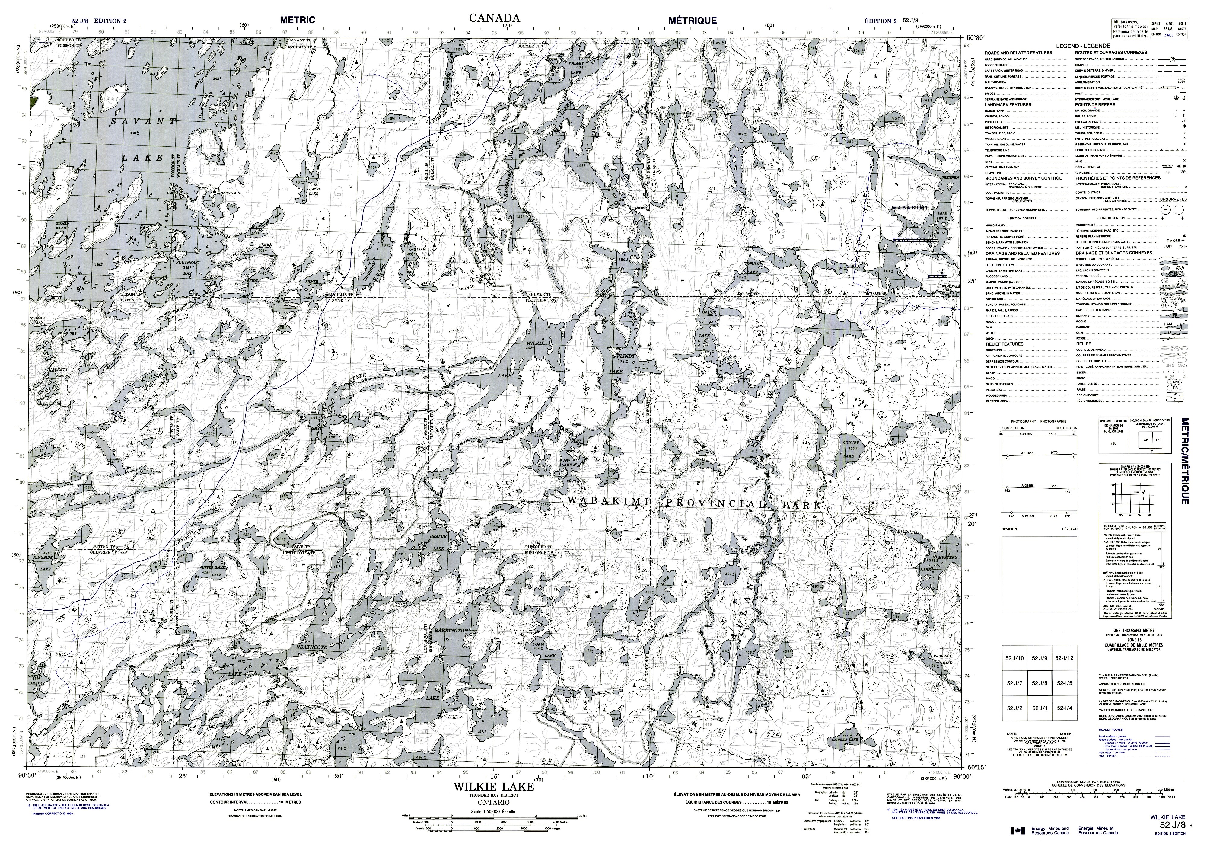
Natural Resources Canada 1:50,000 Topos

Access the 052 J folder here on the Natural Resources Canada server for the full TIF files – from 18 to 40 Mb!
Or – click on the topo map sheet titles below to see a reduced size 4 Mb jpg –
- 052j07 Kashaweogama Lake 1991 b&w
- 052J08 Wilkie Lake 1991 b&w
- 052J09 Neverfreeze Lake 1991 b&w
- 052J16 McCrae Lake 1978 b&w
——–
David Crawshay’s Topo Canada iOS App

David Crawshay’s free Topo Canada iOS App for iPhone enables you to download all of the above to your iPhone. While leaving the iPhone on all day to use as your primary GPS device would require a power bank for daily recharging, it is very useful to make a quick confirmation that you are indeed where you think you are! Download Crawshay’s app here.
———
ATLOGIS Canada Topo Maps for Android OS
There is an Android OS app from a German app developer similar to Crawshay’s Topo Canada iOS app. However, it costs US$14. Given its usefulness, the one-time cost is a worthwhile investment that will save you time and aggravation. Click here to access the Google App Store page –

Note: The free version of the app may be enough for your purpose.
———
Toporama Canada Online Map:

Toporama is NRC’s modern version of the archived topo sheets. It is a seamless map of the entire country and allows you to extract additional information and features from the map.

Access the Toporama website here. Note that in Crawshay’s Topo Canada app mentioned above you can choose the Toporama option instead of the archived sheets.
———
Info on Rapids and Portages – Wabakimi Project Maps
For specific portage and campsite info, we turned to the Paddle Planner website; its data is mostly taken from the Wabakimi Project maps, a few volumes of which we have bought over the past decade.
 Volume 2 of the Wabakimi Project Map collection covers the Savant River. [See here for an overview of the entire set.] My copy (labelled version 1.1) was published in 2011 with individual map pages showing a 2010 copyright. It is not clear if any updates have been made since then. The cover of the internet-sourced image on the left has a 2015 publication date and version 1.0!
Friends of Wabakimi has a PDF-formatted copy of Vol 2 available for CDN$39/US$32. The money supports the group’s various Wabakimi Park initiatives. I have been a member since its inception.

If you’re new to Wabakimi, the Friends website is a comprehensive resource which should answer most of your questions and provide you with the contact info to get answers to the rest! This Wabakimi Park page introduces the area; the Resource Links page points you to useful contacts in planning your own trip. It is definitely worth checking out.
———
Paddle Planner

The Paddle Planner website (see here for access levels, ranging from free to outfitter) has information from the Wabakimi Canoe route Maps. Here, for example, is what you will find if you zoom in on the Savant River system headwaters that we had Jonah Belmore shuttle us to:
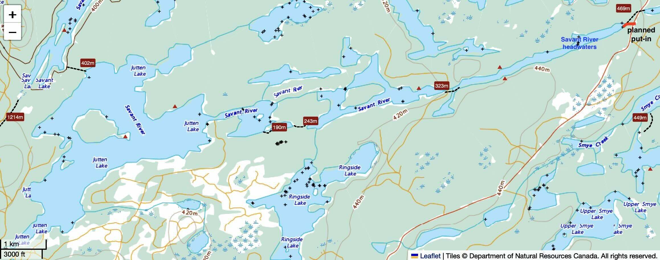
paddle planner map view – portages and campsites indicated
On a Paddle Planner map, you will find portage information, campsite and outpost locations, access points, and points of interest. For the Wabakimi area, much of it comes from the Wabakimi Project maps, though it will also have data from paddlers who have contributed trip reports.
Note: on less-travelled routes, the portage info may well be out of date. As our Day 1 notes will show, this was the case for our proposed put-in from logging road 702 to access the headwaters lake of the Savant River system!
———
Our Route GPX and Kml Files:
You can see the route on the Caltopo website. To download the file, click on the Export option on the top left-hand and then choose the format in the Export Selection window.
Note: the NR Canada map does not work. Go to Base Layer (top right) and choose Scanned Toposs or Mapbuilder Topo to get a clear map view.
———
—————–
Day 1: To Jutten Lake Island Campsite
- Date: August 31, 2023
- Distance: 78 km. shuttle / 2.7 km paddle
- Time: ~3 hours of shuttle time / 25 min to campsite!
- Rapids:Portages: 0
- Weather: sunny and warm
- Sightings: boat shell at the south end of Jutten Lake
- Campsite: Jutten Lake Island site; room for multiple tents of all sorts, plus hammocks
- Natural Resources Canada archived 1:50000 topo maps: 052j07 Kashaweogama Lake
- See NRC’s Toporama (here) for its current interactive coloured mapping and print what you need.
- Caltopo map: https://caltopo.com/m/78CJN
Our Muddled Approach To A Put-In!
- The best-laid schemes of mice and men
- Go often awry,
- And leave us nothing but grief and pain
- For promised joy!
Well, maybe not “grief and pain” but let’s just say things did not unfold as planned!

To The Unnamed Headwaters Lake(#1)
After loading our canoe and packs in the back of Jonah’s truck, we headed up Highway 599 to access Logging Road 702. Our destination was the spot (#1) at the top right of the map above. Our route started in the nameless headwaters lake of the Savant River system. From there, we would make our way down to Jutten Lake before portaging into Savant Lake.
As we drove up, we learned of Jonah’s family connection to the area – his grandfather’s trapping grounds – and that whatever trails used to be there were quite overgrown or gone completely. Jonah was not familiar with most of the portage trails we were counting on. The only one he did confirm was the one we were most concerned about – the 460-meter carry from Jutten Lake to the south arm of Savant Lake.
When we arrived at the proposed drop-off, we looked for possible trails that paddlers or fishermen had used to reach the lake. Finding nothing, we walked through the bush – really the boreal version of a jungle! – to get to the shore of the headwaters lake. A half-hour or so of hauling would have gotten us, our canoe, and our gear down to the shore. However, given that we had just spent 28 hours on the train, I suggested an alternative – i.e., maybe easier – put in at its southern end where a minor logging road crossed.
To the bridge between the Top Two Lakes (#2)
Back we went southwest on 702. Jonah knew the spot to turn off, and we were soon close to the alternative put-in spot, with the side of the truck taking a whipping from the overgrown alders on the side of the road. Deadfall forced us to walk the last 50 meters to reach the bridge. When we got there, we got to peer into still denser bush with no water in sight! This was not the alternative that two tired canoe trippers were hoping for.
To Jutten Lake’s South End Bay (#3)
Recalling Jonah’s comment about the usable portage trail into Savant Lake from Jutten, I asked him if he could get us to Jutten Lake. The answer was a “yes”. The maps above and below show the seldom-used side roads that he used to get us there!
Three hours after leaving the VIA stop at Savant Lake, we were sitting on the south shore of Jutten Lake next to a boat shell. We thanked Jonah for his patience and noted that he now had all the necessary details for a believe-it-or-not story that began with “These two guys from Toronto…”
Note: Jonah Belmore [j_belmore@outlook.com] does shuttles along Highway 599 for canoe trippers. A recent one had him drop off paddlers at the north end of 599 for an Otoskwin River trip. We were fortunate to have had him do the shuttle.

Jutten Lake – Day 1
There I sit, looking at a map to find the nearest campsite on Jutten. It was on the eastern tip of the island, just 2.5 kilometres from where Jonah had dropped us off.

the put-in on Jutten Lake
Paddling over, we found a well-used camping spot, and soon our tent was up. We hadn’t had anything to eat since 7 a.m., and it was past 3, so we decided to have an early supper. As we went over the snap decision to scrap our Savant headwaters route, we recalled our misadventure on the upper Ogoki just a couple of years before. It may be that we made the right decision to forego the probable slog our original put-in entailed. This is not to say that I don’t look back with regret at having dodged the challenge. Maybe some keen reader of this post will do what we didn’t!
It was an early night on Jutten Lake, and by nine, we were dealing with our sleep deficit. The 2.5 inches of my new Thermarest NeoAir pad were a definite upgrade from that VIA train seat.

Jutten Lake CS
—————–
Day 2: To Island Campsite Across From Lodges
- Date: September 1, 2023
- Distance: 21 km.
- Time: 8:00 a.m. start/3 p.m. finish
- Rapids:Portages: P01 ~460m
- Weather: sunny and windy, Alberta and NWT smoke haze during the day
- Sightings: boat traffic coming from or returning to Cliff & Rona’s Lodge; don’t forget the eagle (we see at least 1, sometimes ,2 each day for the first 5 to 7 days)
- Campsite: 1 x 4p; easier to find 2p areas plus possible hammocks.
- Natural Resources Canada archived 1:50000 topo maps: 052J08 Wilkie Lake
- See NRC’s Toporama (here) for its current interactive coloured mapping and print what you need.
- Caltopo Map: https://caltopo.com/m/78CJN
The day’s two maps start at the bottom and end halfway down (i.e., at the north end of) Savant Lake.

Day 2 – Savant Lake up to Trading Post Bay

Day 2 – Jutten to S of Lodges
We set off from our Jutten Lake campsite in good spirits shortly after 8 a.m. A solid night’s sleep certainly helped, as did the knowledge that the 460-meter portage into the South Arm of Savant Lake that we had worried about was actually a well-used trail. The afternoon before, it had been our shuttle driver Jonah’s knowledge of the portage and of how to access Jutten Lake from logging road 702 that had finally gotten us to a put-in spot.
P 01 took a bit more than an hour. Since we were travelling at maximum trip weight, we did not do the 460m (or so) portage in our usual carry-and-a-half mode. This mode has Max take one canoe pack, a duffel, and the paddles to the end, while I take the other canoe pack and duffel halfway, then return for the canoe and my canoe bag. If we arrive at the spot where I left my packs, we know our halfway-point estimate was fairly accurate.

P 01 – Jutten to Savant Lake
The GPX track above shows a less ambitious approach to P 01! – i.e. more short hauls and breaks!

P01 – 460m from Jutten to Savant Lake
Savant Lake’s South Arm (396m a.s.l.) is 11 meters lower than Jutten Lake (407 m).

When we got to the put-in on Savant Lake, we knew that our only portage of the next couple of days was done. We were at the top (i.e., south end) of a 43-kilometre-long lake that we would have to paddle down before having to portage around any of the dozen or so sets of rapids we couldn’t run or, at least, line.

Savant Lake top to bottom
The lake hosts four fishing/hunting lodges or outposts. The first one, Wildewood, is located at the top of a deep, narrow bay, which we crossed about a half-hour after pushing off from the end of the portage into the South Arm.

The original plan had been to get to the narrow channel at the north end of the South Arm and look for a campsite there. The thinking had been that the first day and a half getting to Savant Lake would be enough of an effort to make a campsite there an early-afternoon reward. Well, since we had decided to forego the first ten kilometres of the original route, we kept going for a few more kilometres.

Halfway down the lake, there are a couple of lodges on the west shore:
We were within a few kilometres of the lodges when the NW wind picked up, and the sky got darker. Some bad weather was approaching. We headed for a nearby island campsite indicated on our map and set up the tent with the insurance tarp over it. We had also rigged up the second tarp over our camp chairs and our canoe/dining table. And then the rain came down – torrential sheets of it that blurred our view of the lake.

Nice and dry underneath our tarp, we tended the pots on top of our two butane stoves and watched as three motorboats passed by from the south. The soaked fishermen had lingered just a bit too long and had paid the price!

under the tarp on Savant Lake – note the rain pounding the lake!
Later that evening, the rain would stop, and the sun would appear. So too would the fishermen heading back to their favourite walleye or pike spots! This boat traffic on Savant Lake would be the most activity we would see and hear in two weeks.

—————–
Day 3: Down Savant Lake’s North Arm
- Date: September 2, 2023
- Distance: 16 km
- Time: 5 hrs (10 am – 3 pm
- Rapids:Portages: none
- Weather: sunny and windy, NWT smoke haze
- Sightings:
- Campsite: 1 x 4p; 2 x 2p; hammocks?; comes with a front porch!
- Natural Resources Canada archived 1:50000 topo maps:
- See NRC’s Toporama (here) for its current interactive coloured mapping and print what you need.
- Caltopo Map: https://caltopo.com/m/78CJN

Looking Over Towards The Lodges
As we headed down the lake to the North Arm, we looked across to Cliff & Rona’s Wilderness Camp. It includes the main lodge building, four cabins (indoor washrooms and electric lights), and the usual fish-cleaning hut.

This satellite image of Cliff and Rona’s Lodge gives a full view of the infrastructure:

Cliff and Rona’s
There is another lodge – the Cat Track – not far from Cliff and Rona’s, but we were not able to see it as we paddled by. The satellite image below shows that it is a lot more than a solitary outpost.

Cat Track
Trading Post Bay:
An hour’s paddle north of the lodges, we came to a small bay with the name Trading Post. Our map indicated a campsite on the west side of the bay. A quick look convinced us we would not have camped there! A small creek comes out at the northwest corner of the bay. We walked along the shore and went inland a bit to check out the flat area to the east. We found no evidence of human activity, not really a surprise given the two centuries nature and the occasional wildfire has had to reclaim the space.

Savant Lake – Trading Post Bay
The trading post must have been a very minor one, probably set up by the upstart North West Co. or an independent fur trader to intercept furs going down to the Hudson Bay Co. post at Osnaburgh House. The trader would then have to get the furs to Fort William, the NWCo’s inland headquarters on the western shore of Lake Superior. From there, the voyageurs would haul the season’s trade back to Montreal in their canots du Maitre.

With the merger of the two fur trading companies in 1821, this post no longer would have served a purpose. The 1930 Ernest Voorhis report on fur trading posts mentions 612 major and minor forts and posts across the country. This Savant Lake location is not one of them.

See Voorhis report for full details on trading posts
Savant Lake must have two hundred islands, large and small, speckled across its length. We stopped for lunch on the shady side of one island on our way down the lake. A couple of hours later, we would find our home on the east side of another island in the lake’s north arm. Along the way, we paddled past Turtle Island and its outpost, with one cabin which can accommodate four guests.

Day 3 shady lunch spot

our loaded canoe
All day, we had noticed the smoky air blown our way from the wildfires in northern Alberta and the NWT. The left side of the image below hints at the hazy sky we saw as evening approached. The island campsite – labelled Falcon Island on the Wabakimi Project map – was a decent one, nicely tucked away with ample room for our four-person tent.
Day 3 was in the books, and we were slipping into trip mode.

Another Route To Access Savant Lake:
Over the years, I have more than once watched a series of YouTube videos posted by Wintertrekker (aka Hoop at the Canadian Canoe Routes forum). It describes a canoe trip he did in the Savant area in August 2013 and was posted the next year. It is probably the dormant seed that finally resulted in our Savant trip in 2023!
The first two parts of the series cover his accessing the North Arm of Savant Lake from what must be the Fitchie Lake put-in, though he does not specifically mention where he left his vehicle.
The remaining episodes detail his canoe trip down the North Arm of Savant Lake and then a portage into the Little Savant River system, which he followed down to Velos Lake before returning via the Savant River to Fitchie Lake and his vehicle.
It was the initial stretch of his route that sounded somewhat brutal, involving way too many portages for the first few days of a canoe trip! According to the Paddle Planner calculations, that would be 11.2 km of portage trails and 33.4 km of paddling to get to the North Arm of Savant! [When I tabulated the distances, I came up with 2.5 km of portage trails and 19.3 km of paddling. While the PP portage figure probably factors in multiple carries, the paddling distance seems somewhat high.]

Paddle Planner data on a Topo Canada map – Fitchie Lake to Savant Lake
Our Day 3 campsite was not far from Neverfreeze Bay, where you come out onto Savant Lake if you take this route. The Paddle Planner data comes from Volume 2 of the Wabakimi Project’s Wabakimi Canoe Route Maps (2011). Not only did the W.P. crews map the route, but they also reestablished or created portages and campsites. Their work had probably been done in 2008.
Reading this Friends of Wabakimi trip report about taking this route the very next year (2009) makes it clear how difficult it was to find some of the portage trailheads. Four years later, Hoop noted blowdowns already impacting the portage trails.

Closer to the present, it sounds as if those trails have disappeared, in part because few canoe trippers are using them. One Canadian Canoe Routes forum member, Darl_h commented about his 2020 experience –
Glen (i.e. Hoop) was the inspiration for last year’s trip and we were flummoxed at Fitchie Lake (off Hwy 599). We scouted three different ways out of Fitchie towards Neverfreeze through Shallow Lake and deemed it too much for us. The old HOOP videos make it look so clear, not anymore.
The major attraction of Fitchie Lake is being able to leave your vehicle at the put-in. It also eliminates the need for a shuttle, since you can (as Hoop did) create a loop that brings you back to the start point. The only negative is the rough portages to reach Savant Lake. Worrying about your vehicle sitting there for two weeks unattended is also not a plus! Somehow our Jutten Lake insertion on Day 1 didn’t seem so bad.
—————–
Day 4: Into Jabez Lake
- Date: September 3, 2023
- Distance: 16 km
- Time: 8 hrs (8:30 – 4:30)
- Rapids:Portages: P02 – lined/ran
- Weather: overcast with more smoky haze from the west
- Sightings: fishing boat below P02 on Jabez Lake
- Campsite: uphill, required some clean up due to deadfall, nice mossy bed with room for 1 or 2x4p, more 2p, hammocks possible, nice front porch
- Natural Resources Canada archived 1:50000 topo maps: 052J09 Neverfreeze Lake
- See NRC’s Toporama (here) for its current interactive coloured mapping and print what you need.
- Caltopo Map: https://caltopo.com/m/78CJN

DAY 4 Savant Lake North Arm to Jabez Lake
Our goal on this day was a modest one – to deal with one set of rapids or a possible portage and set up camp on Jabez Lake. The tent is already down in the image below and the canoe packs are being readied for loading.

packing up at CS 03
As we headed down the North Arm of Savant Lake, we could not help but notice the lingering smoke. In the image below, it is the smoke and not blown-out highlights that you are seeing! Also noteworthy were the vast wild rice fields in shallower stretches of water on our route.

wild rice bed in Savant Lake North Arm
An early version of the lake’s name was Savan, a Canadien (i.e. French Canadian) word for “swamp”. While most of Savant Lake certainly does not fit the “swamp” image, perhaps the association with the rice fields was the source of the name?
————–

1857 Thomas Devine Map of Northwestern Canada – Savan Lake
Re: the 1857 map. The CPR was still twenty-plus years in the future, and the Geological Survey of Canada had yet to do any work in the region. The Albany River system is fairly accurately drawn, thanks to its importance as the location of several Hudson Bay Co. posts and as one of its major water routes into the continent. Lake Savan is drawn equivalent in size to Lake Nipigon. The map shows the Savant River flowing into Pashkokogan Lake. White Earth Lake, that is, Wabakimi (from Waab white + aki earth), is located far to the east of Lake Nipigon. Also on the map is the Tickameg River, which Robert Bell of the Geological Survey of Canada would call the Ogoki in a mid-1870s field report.
————–
The wild rice fields would also explain the number of migratory birds we saw in the vicinity; the grain makes an excellent food source. This was something the Ojibwe families living in the area certainly knew. The wild rice – manoomin in Ojibwe – even figured in some versions of the Ojibwe Migration myth. One account from Minnesota reads like this –
Ojibwe people arrived in present-day Minnesota in the 1600s after a long migration from the east coast of the United States that lasted many centuries. Together with their Anishinaabe kin, the Potawatomi and Odawa, they followed a vision that told them to search for their homeland in a place “where the food floats on water.” The Ojibwe recognized this as the wild rice they found growing around Lake Superior (Gichigami), and they settled on the sacred site of what is known today as Madeline Island (Mooningwaanekaaning). source
The Migration story and the focus on seemingly miraculous food bring to mind the Exodus myth and the manna, which sustained Moses and the Israelites for forty years as they wandered around the Sinai desert.
————–
An Alternate Route To Velos Lake
As we approached the day’s only possible portage, we passed by a bay on river right from which you can access an alternative route to Velos Lake. A 550-meter portage leads to Little Savant Lake, the headwaters of the 30-kilometre-long Little Savant River system.

the portage into Little Savant Lake, the Little Savant River’s headwaters
The Little Savant River ends at Velos Lake. Accounts of canoe trippers going up or down the river are scarce to non-existent. The series of videos by Wintertrekker mentioned earlier is one. Part 5 of his YouTube upload provides the details.

the Little Savant River system from top to bottom
————–
Our One Possible Portage of the Day!
Since our portage into the south end of Lake Savant at the start of Day 2, we had been spared the potential drama and extra work that rapids and a portage often provide. Well, just after the possible turn-off to the Little Savant portage, the outlet rapids at the north end of Savant Lake were coming up.

We approached the portage marked P02 on the satellite image above. Perhaps it was the late-season water levels but we did not see a CII set of rapids as we scanned downriver from the top. We were down in a few seconds and, after a wrong turn to the left channel, headed back to the main channel and continued on down the river. It is always a plus when you can avoid a 100-meter portage!
The thing to remember is that often the portages are meant more for those coming upriver than those, like us, going down. Historically, upriver travel on the Savant would have been done by locals or by fur traders wanting to access
- Sturgeon Lake and the English River system to get to Fort Garry/Winnipeg
- Wabakimi Lake and then the Wabinosh River to Lake Nipigon

P02 on the Savant River.
A highlight of the day was spending some time with a few trumpeter swans – or maybe they were tundra swans – in the area of the rice fields. This was the first time on all our Canadian Shield canoe trips that we had seen these birds. Back in 2020, another bird highlight had been paddling into a white pelican convention in Wabinosh Bay on Lake Nipigon. We watched from afar as the swans flew ahead of us, perhaps leading us away from vulnerable young ones. Over the next day, we would see more of them.

tundra or trumpeter swan and reeds on Savant Lake
————–
Our Jabez Lake Campsite

Jabez outpost with a dock
As we entered Jabez Lake, we encountered a motorboat with a couple of fishermen who were staying at the lake’s outpost. They were, as is 99% of the time the case in northwestern Ontario, vacationing Americans keen on fishing. It turned out that Max had dined in the small-town restaurant of the guy from Ohio! They were staying with their wives at the outpost, just across the water from where we decided to stop for the day. While we were only a kilometre away from their camp, our view was blocked by the islands in the way and the outpost’s tucked-away location away from the shore.
There are two campsites on Jabez Lake. We headed to the more northerly one and eventually figured out where it was. The actual site is a bit in from the shore, so it is not immediately obvious. The GPS track shows that we landed in four different spots before finally locating it on landing #5!

The site is a bit of a scramble up the hill to access a fairly flat area with a nice covering of lichen. Our hand saws took care of some deadfall, and we soon had a clear path to the tent from the shore with our canoe/dinner table set up in between.
That lichen-covered and mostly flat spot you see at the end of the video is where our four-person tent ended up for the night.

Videoed later that evening, here is the walk up from the shore of Jabez Lake – note the hazy sky thanks to smoke from out west – to the flat area where we had pitched our tent:

The smoky haze of Day 4 continued into the evening. The images below capture the scene after 7:00 p.m.

Jabez Lake at 7 p.m. sun and smokey haze
A couple of hours later the sun was gone but the haze remained

—————–
Day 5: From Jabez Lake to Savant Falls
- Date: September 4, 2023
- Distance: 22 km
- Time: 8.5 hrs (8:30 – 5:00 pm)
- Rapids:Portages: P03 to P11…we lined and ran all but P11, the portage around Savant Falls
- Weather: Overcast and cloudy
- Sightings: swans, eagles, ducks
- Campsite: 1x4p; more room for 2p; good for hammocks
- Natural Resources Canada archived 1:50000 topo maps: 052J09 Neverfreeze Lake; 052J16 McCrae Lake.
- See NRC’s Toporama (here) for its current interactive coloured mapping and print what you need.

Day 5 – Jabez to Savant Falls
I walked back up to our tent spot for a last look for any stray tent pegs before we started a full day of rapids and potential portages. Still visible this morning was the smokey haze from the west.

Our objective for the day: Savant Falls and a possible tent spot there.
First up was the set of rapids and a reported portage labelled P03 on our map and on the satellite image below. Our hasty and failed attempt to find the beginning of a portage trail led us back to the river.

What we found were three separate ledges and a not-so-easy-to-line boulder garden thanks to the low water level. According to the two fishermen we had talked to when we came into Jabez Lake, water levels were 2 feet lower than usual though it was unclear what their time frame was. The GPX track below shows our route down this section of the river.

In the image below, Max is looking back at the top of the rapids. We had lined our way down to that point on river left by hopping from boulder to boulder. No wet feet yet!

the top of the rapids (P03) below Jabez Lake
In the next image, you can see the middle section – about 100 meters or so – that we were able to float down. Now we are faced with another boulder garden and not enough water. Some scraping, pulling, and pushing would be required!

Max looking at the next stretch of the rapids below Jabez Lake –
Here is the final section of the rapids that we faced before we got to the bottom. The canoe bottom we had fixed up and painted in July was paying the price of being hauled over and past the rocks you see below. On the plus side, our socks were still dry! It had taken us about 35 minutes to deal with P03 with the most time on the last stretch.

At the bottom of the rapids on river left we spotted a boat with a motor and a full can of gas, undoubtedly left for the guests of the Jabez Lake fishing outpost. We followed the 125-meter trail from the boat back up to the top of the rapids we had just come down. It was in good shape and would be used by canoe trippers coming upriver. It would also have been a less stressful way for us to make our way downriver!
Our 35 minutes with P03 were followed by a few seconds on P04, an easy 5-meter run. The portage trail indicated on the sat image above may be for those coming upriver.
Noted on the first map are a few swifts. The low water level meant we often did not know we had floated through a set. As we paddled through a narrow section of the river, we passed by the best campsite of the trip so far. A fire pit is visible from the water and a quick visit revealed an elevated site with a nice view and room for multiple tents.

nice campsite on the Savant River
Then it was on to the next rapids. P05 avoids a narrow top channel with a 2 1/2-foot drop and some badly placed boulders. We lined our way around and then floated down to the boulder garden at the bottom.

P05 and P06 Savant River
After a failed search for a potential portage on river left, we went back to the river. Twenty-five minutes later we were through the turbulence indicated in the satellite image below and back to cruising speed.

P05 and P06 Savant River
We stayed with the river and floated right past the next two indicated portages – P06 and P07, both of which were easy Class 1 runs. The blue-coloured dot in the image below is the campsite we saw as we paddled by.

P07 Savant River
By now it was about 12:30 – we had started around 8:30 – so we were thinking lunch spot. But first, we wanted to deal with two more potential portages – P08 and P09. We spent five minutes lining the C1 stretch with just not enough water past P08 and then another ten to avoid P09.

P08 and P09 Savant River
On a point just around the corner from these rapids we finally stopped for lunch. We were happy with the way the day had gone so far. We had avoided doing any portaging and figured that we had come out ahead by staying with the river and lining our way down.

Savant Falls and P11 – the portage around it – was still about 10 kilometres downriver so we knew we had two more hours of work before we got to a campsite there. Halfway there was a set of rapids and P10. Also on our map were notes about a few swifts along the way. When we got to P10, Max stood up and took a quick look. We were down in a few seconds and heading to a nearby set of swifts.

P10 Savant River
On to the one portage of the day which was not optional – P11 around Savant Falls. The satellite image below lays out the neighbourhood. We found a well-used trail and a half-hour later we had beached our canoe in front of a boat shell a bit down the shore from the portage put-in.

P11 Savant Falls
Up went the tent – a tight squeeze thanks to its four-person size and the four trees framing it. The second tarp also went up shortly afterwards and a good thing too, since it started pouring not too much later.
We leaned back in our Helinox chairs and watched the rainwater drip off the edge of the tarp. With a 35mm film canister shot of whisky each we celebrated the fact that we had avoided all but one of the potential nine portages of the day’s route.

Savant Falls CS area to the east of the Portage trail
As a bonus – the next day was allocated as a rest day! We could take some time to check out the Falls and follow its course from the top to its dramatic bottom.
—————–
Day 6: Savant Falls To Velos Lake Via Shortcut Portage
- Date: September 5, 2023
- Distance: 5 km
- Time: 1 hr (10 a.m. to 11 a.m.)
- Rapids:Portages: P12 90m – the shortcut portage
- Weather: thunder/lightning/rain/strong wind from the NW.
- Campsite: so-so site; iffy 1x4p; better for 2p and hammocks; exposed depending on wind direction, front porch
- Natural Resources Canada archived 1:50000 topo maps: 052J16 McCrae Lake
- See NRC’s Toporama (here) for its current interactive coloured mapping and print what you need.
- Caltopo Map: https://caltopo.com/m/78CJN

Day 06 to Velos L.
It was supposed to be a rest day but the decent weather had us change plans. Instead of staying put, we decided to head over to the “shortcut” portage which would have us camping on Velos Lake that afternoon.

Savant Falls on the Savant River system
But first – some time to walk up the path on river left to to see Savant Falls from various perspectives. There is a 7-meter drop over a 120-meter distance from top to bottom with the most dramatic drop being the very last one.

trail alongside Savant River by Savant Falls
The rough trail led us to the top of the falls section and the very first ledge, a gentle half-meter drop.


Savant Falls from above – the last chute

Savant Falls – the final drop

Savant Falls – the bottom
And here is a photo from August of 2008 of those same falls taken by a member of Phil Cotton’s Wabakimi Project trail-cutting crew. There is definitely a higher volume of water tumbling down!

A YouTube video from August 2013 by Wintertrekker also provides some excellent Savant Falls video – and keep watching to hear his assessment of the Savant River as a canoe-tripping destination.
Note: Anything by Wintertrekker (aka Hoop on the myccr forum) is worth watching. This 17-part series is all about the Savant and Little Savant Rivers and first alerted me to paddling possibilities just west of Wabakimi Park.
The changing nature of Savant Falls serves as a reminder that the low water we faced this September – and the amount of lining and running we were able to do on the river – may not be the case next year or the year after. As always, let present conditions be your guide and do not rely solely on some account from the past.
—————-

With our tour of the Falls done, it was time for the 5-km paddle over to what we called the “short-cut” portage. It knocks off a few kilometers of paddling and trades one possible portage for the definite 90m- one that we took to get to the south shore of Velos Lake.
At the Velos end of the carry, I approached the gently sloping rock outcrop along the shore in the image below with the canoe over my head. I had one thought: “Let’s make this an elegant and bump-free put-in”. Down to the water’s edge, I went – and then in a bit further to make sure the nose had some water to break the drop. The green slime lining the shore should have provided me with enough of a warning. As I dropped the canoe to my right thigh, my right leg slid on the algae and I skidded down the very slippery slope and collapsed into the water. So much for that elegant put-in!
For the next few hours, I could barely put any weight on my right leg. Whatever it was – a severe strain, a ligament sprain, a muscle pull – it was worrisome.

Day 06 Velos Lake CS
We set up camp and took advantage of some sun to lay out a few things on the rocks to dry, including my boots and clothes! Shortly after my fall, I swallowed an extra-strength Advil while we had lunch and sipped on some fresh, filtered coffee underneath our dining area tarp. And just like the afternoon before, by 4 p.m. the rain started falling fairly heavy for a couple of hours.
Depending on how I stepped down on it, the right leg was feeling very weak. For the first time ever on all our canoe trips, we considered
- a possible extraction back to Mattice Lake courtesy of Don Elliot’s Beaver bush plane service or
- a route change that would have us get to the Fitchie Lake take-out by Hwy 599. We figured we could send Jonah an email and see if he could pick us up there and bring us back to the VIA stop at Savant Lake.
On the plus side – nothing seemed to be torn, and no swelling or bruising. We figured we’d wait until the morning and go from there. More Advil and a Robaxin 750 and the headlamps were turned off – and I got to play out the various trip scenarios in my dreams overnight! I didn’t sleep that well.
—————–
Day 7: Velos Lake to McCrae Lake
- Date: September 6, 2023
- Distance: 9 km
- Time: 4.5 hrs (11:30 – 4:00 p.m.)
- Rapids:Portages: P13 to P17 …ran/lined them all.
- Weather: Cloudy, overcast and then stormy
- Sightings: 3 moose!
- Campsite: 1 or 2x4p; multiple 2p; hammocks; exposed depending on wind direction, front porch
- Natural Resources Canada archived 1:50000 topo maps: 052J16 McCrae Lake
- See NRC’s Toporama (here) for its current interactive coloured mapping and print what you need.
- Caltopo Map: https://caltopo.com/m/78CJN

Day 7 – to McCrae Lake
We woke up to a very windy morning. The northwest wind was blowing across the lake and walloping our tent and tarps. The foam had blown right up to our tent from the shore. The tent is usually the first thing to get packed away at the start of each day. This morning it stayed up since we were not yet sure what we would do after breakfast.

Velos Lake – windblown foam
We hunkered behind the canoe and tarp, which we had set up as a windbreak, and had breakfast. My walk to the other end of the portage trail and back to test my leg was encouraging; I was not feeling the pain of the afternoon before. The light calf stretches and the Robaxin/Advil combo were helping.

canoe as a windbreak on Velos
Increasingly concerned about that wind, on our way back along the portage trail from our second walk, we looked for a more sheltered tent spot. On a positive note – our inReach weather app forecast subsiding winds in the afternoon. We sat comfy in our Helinox chairs behind that windblown tarp, had more coffee, and bided our time. Every once in a while I would do some stretches and walk a few meters to see how the leg was doing. It was holding up pretty well!
At 1:00 we finally set off, having decided that the NW wind was no longer an issue. We were itching to cover some distance after the previous half-day that had seen us move less than five kilometers, an uncharacteristically slack day on the river for us. We are canoe trippers at heart – and not canoe campers!

five sets of rapids – and possible portages – from Velos into McCrae
A short paddle down Velos Lake brought us to the four-kilometer stretch of river with five potential portages that would take us into McCrae Lake. The first one was indicated as 274 meters (we are always amazed at the very precise measure!). Given my gimpy right leg, hopping in and out of the canoe or lining it would be awkward. We were hoping to be able to stay with the river and stay in the canoe as much as possible. As our GPX track above indicates, we mostly did that, occasionally lining to deal with low water.
As with most of the other portage info in this report, the following info comes from the Paddle Planner website. It, in turn, has borrowed heavily – if not exclusively – from the Wabakimi Project maps which were produced fifteen years or so ago.
P13
There is apparently a 274-m portage trail on river right as you leave Velos Lake. We took a standing look from the canoe and decided to stay with the river. The highlighted section of our track was the 300-meter stretch through the rapids which we spent less than 15 minutes on. Complications at the top and bottom gobbled up most of the time; we floated down the middle section at 5 k/hr. The few times we had to line, Max was able to git ‘er dun with little help from me, intent as I was on not slipping on a rock and aggravating my leg further!

Next up were a couple of sets of rapids in a narrow stretch of the outlet on the way to McCrae.
P14 was easily dealt with. We spent a minute at the top and then floated our way down toward P15.

P15 required a bit more effort. We spent about ten minutes lining/floating down this short 60-meter-long set of rapids, with the end stretch taking up most of our time. Not enough water and badly arranged rocks – the bain of a paddler’s plans for an easy day!

P16 – Savant River above McCrae
At the next narrowing of the river, we came to more rapids and a potential P16. Again, staying with the river we instead spent five minutes on a mix of lining and running this 80-meter stretch of river. From the bottom, it looked like it may have been easier had we taken the left channel around the island instead. We never did look for that 21-meter portage trail which would certainly be handy for those coming upriver.

Finally, just one more set of rapids and we would be in McCrae Lake! Things had gone surprisingly well, given the support Max was getting from me!
Our luck held out. It was a bump and grind mostly down the middle of the river to the bottom of the rapids. Sitting in a fishing boat was an American couple: we had provided them with some entertainment. In our brief chat, we learned that they were one of four couples staying at the McCrae Lake Outpost with its two cabins. They said they had been coming here on and off for 40 years!

While we could have paddled a few more kilometres before calling it a day, our paper map indicated a couple of campsites not far away. On the way to the island site, we changed our minds and decided to head for the one on the point instead. It was a good choice. The site looks like it has been used by locals for fish harvesting and comes with all the usual amenities – the fish gutting tables, drying racks, etc. Unlike a couple of other similar sites, it was also fairly litter-free.
We set up our tent in a sheltered spot on the edge of the site and then wandered down to the shore with our Helinoxes. While it was cool and windy enough to slip on some warm jackets, the sun was out.

As we sat there and took in some late afternoon sun, 200 meters across the lake we spotted a couple of moose munching on the grasses and reeds. My 200mm lens got the first shot; Max’s HX80 with its 720mm reach, snapped the other two.


Early that afternoon when we set off for McCrae Lake, the state of my right leg was foremost in my thoughts. We had come into the lake with so little drama and minimal effort that I was feeling much more positive about any upcoming challenges. Time for another Advil!
Other than the moose photos, we also got a couple of shots of these old guys on the shore. They seemed to be contemplating something as they stared to the west where the moose had been.

catchin’ some rays on Lake McCrae

—————–
Day 8: From McCrae Lake Into East Pashkokogan Lake
- Date: September 7, 2023
- Distance: 17 km to Greenbush Lake Portage
- Time: ~ 5 hrs + 3 hrs to Greenbush Lake campsite
- Rapids: Portages: 1 x 20 meters over ledge + 1 into Greenbush
- Weather: sunny and cloudy, a bit cool
- Sightings: usual menagerie of waterfowl, nothing 4-footed
- Campsite: on Greenbush Lake – next post!
- Natural Resources Canada archived 1:50000 topo maps: 052J16 McCrae Lake
- See NRC’s Toporama (here) for its current interactive coloured mapping and print what you need.
- Caltopo Map: https://caltopo.com/m/78CJN

Day 8 route from McCrae to Greenbush
The Savant River system ends at the outlet of Lake McCrae; a set of rapids and a set or two of swifts and you are in East Pashkokogan Lake. We set off for the north end of McCrae; on the way, we stopped to check out the island campsite. It is located about 25 meters from the shore and is nicely sheltered. Then it was on to the bottom of McCrae Lake and a possible portage.
Had we wanted to, we could have headed for the portage locals call the Icehouse to access Pashkokogan Lake and Highway 599 or the Pashkokogan River. (See here for a 1970s Fed. Govt topo which indicates the portage.)

the Icehouse Portage option to access Pashkokogan Lake.
The map above shows the location of the Icehouse Portage to access Pashkokogan Lake. However, we were headed to the Savant River’s final potential portage (P22 in our trip count) which would bring us to East Pashkokogan Lake.

We never did look for the indicated portage. Instead, we paddled up to the rapids and saw that a 20-meter mini-portage would get us around the top ledge and we could line and run the rest. 35 minutes later we were in East Pashkokogan Lake.
The images below capture the top of the rapids out of McCrae Lake:

the end of the Savant River as it tumbles down into the channel leading to East Pashkokogan Lake

P18 – from McCrae into East Pashkokogan L

the rapids and swifts into East Pashkokogan Lake from McCrae
The rapids are followed by a couple of swifts. An easy float down the stretch you see in the image above, a lining job through a shallow boulder garden, and we were in East Pashkokogan Lake. We stopped for lunch and celebrated our descent of the Savant.
We also revisited our decision to bail out on the first eight kilometers from the headwaters lake off of Logging Road 702. We would have to be content with having done most, but not all, of the river! Doing that initial stretch would have made it complete. Here is a snippet of the Wabakimi Project(Vol. 2) map with what is involved – and what we decided to pass up on:

the first eight kilometers of the Savant River system to Jutten Lake
Perhaps this trip report will inspire some paddlers to embrace the challenge!
—————–
Route Options From East Pashkokogan L.

Sitting in East Pashkokogan Lake, there are dozens of trip possibilities. A few are listed below:
- Into Pashkokogan Lake and an exit at Hwy 599
- Into the Saint Raphael Park area after crossing Hwy 599
- Up The Pashkokogan River To Fitchie Lake & a Hwy 599 return to Savant Lake
- Down The Pashkokogan River to Osnaburgh Lake and The Albany River
- Into Greenbush (The Misehkow Headwaters) and Down The Misehkow
- Into Greenbush and On To Burntrock Lake and The Palisade River
See the Paddle Planner website for an overview of the possible trip extensions. The trip reports posted on the Canadian Canoe Routes forum will also provide valuable info.
Where We Were Headed
Our route would take us into Greenbush Lake, the headwaters of the Misehkow River system, and then, after a couple of rough one-kilometre portages, into the Palisade watershed.
Canoe Tripping Wabakmi From East Pashkokogan Lake To the Palisade R. and Kenoji Lake
Canoe Tripping From East Pashkokogan Lake To the Palisade River and Kenoji Lake
- Route Overview Map and GPX file
- Day 8: From East Pashkokogan Lake To Greenbush Lake
- Day 9: From Greenbush Lake To Metig Lake
- Getting a Wabakimi Park Backcountry Camping Permit
- Day 10: From Metig Lake To Muskiga Lake
- Day 11: From Muskiga Lake To Burntrock Lake
- The Headwaters of the Palisade River system
- History of Wildfires in the Burntrock to Kenoji Area
- Day 12: From Burntrock Lake Down The Palisade River
- Day 13: Down The Palisade Almost To Kenoji
- How The Palisade River Got Its Name
- Looking For the Palisade Pictographs
- Day 14: Bush Plane Pick-Up On Kenoji Lake
- Day 15: A Visit To Armstrong Station’s NORAD Radar Base/The Train Ride Back To Southern Ontario
—————–
Next Post: From Pashkokogan Lake To The Palisade River
Canoe Tripping From East Pashkokogan Lake To the Palisade River and Kenoji Lake
I was just thinking of you guys and your trip this morning. Thanks, the report is a seasonal gift. I’ll read it after dinner.
Ken
“Hell is other goats” Jean-Paul Satyr
>
Tigger, given that it is Christmas Eve, just after I pressed the publish button I did wonder who would even notice for the next week, which is probably the slowest of the entire year! I can now change that zero to one! It was a most enjoyable first half of this year’s Wabakimi ramble. The Part 2 report is a new year project. All the best as you plan your next adventure!
I just got my second of two knees replaced 6 weeks ago. Planning with friends to do parts of the Caribou Forest in August. Maybe from Harris lake up to Velos Lake, then west, back down the Pashkokogan and out at Hamilton lake near Minchin.
Two knee replacements – Yikes! I hope the rehab goes well over the next six months before you subject those knees to a few portages!
We had an alternative route up the Pashkokogan River from Pashkokogan Lake all planned in case the fire situation turned bad again. Our planned exit was Fitchie Lake close to Hwy 599. We may do that route one of these summers, the wildfire situation permitting!
If you need, our shuttle provider Jonah Belmore could put you in or get our out of any spot from Savant Lake up to Osnaburgh and beyond.
Wow, the water was really low…. or as we used to say to tease Phil Cotton, “The water isn’t low Phil… the rocks are high!” The flow over the Savant Falls in 2008 was about 4 times as much as pictured by you. The roar was deafening.
The Savant Falls were nice to experience but they’re not Brennan Falls or Granite Falls or Ogoki Falls impressive! With four times the water volume they may have been!
Other than our portage into Savant Lake from Jutten, the Savant Falls portage was one of three we did. The other two were the “shortcut” 80-m portage into Velos and the 20-m lift-over at the McCrae outlet. More water would have made our lining jobs easier! The rocks were high indeed. More work on our canoe bottom next spring!
Nice to have found a guy up there keen to do shuttles from the Savant VIA station. Finding one was our biggest problem. Makes planning another route on the west side of Wabakimi and maybe into St. Raphael Prov. Park that much easier!
Amazing report. Thank you for sharing this valuable information!
J.L., thanks for the positive review! I figure my detailed canoe trip posts will make potential paddlers a bit less apprehensive about embracing a new destination. Wabakimi/Caribou Forest is a great spot to embrace!
Peter and Max, once again a great report . We have planned to do a trip into Greenbush in August. You have opened up another option for us.
Thanks for contact info . Looking forward to the second half of your trip
Good to hear there is some info in our report that you can use.
So many excellent route options along that Hwy 599 corridor!
Part II of our report is in production and should be up in a week or two!
Fantastic, as usual, True North! Everytime I think about planning a trip somewhere else, you release yet another Wabakimi area report that entices me back that way again. Now… On to part 2….
Steve (Canoe Daddy)
It would be nice if Wabakimi was closer to us but of course then it wouldn’t be Wabakimi. It would be Algonquin! Our trip down the Savant has me looking a bit further west into S. Raphael Park after going down the Pashkokogan River from Fitchie Lake. Always happy to hear my posts are helpful to fellow paddlers looking for new water to paddle. Given your own recent trip reports you are have having no trouble finding it! All the best in 2024 as you plan your next one…
Nice. Thanks for posting. It was a fun read.
Your reports are always so phenomonal and have been such a resource in my past trips in the Wabakimi Area. I had been planning to start in a smiliar area for a trip in 2023 that I ended up bailing on with the fires and instead did the full Missininaibi River to Moosonee which was awesome!
I was curious what your shuttle from Savant Lake cost roughly. I’m doing some high level planning for a few potential options out there again for this summer hopefully.
Thanks,
Dustin Van Heck
We waited until the fire situation had settled down and went ahead. The trip report has all the details. Jonah charged us $400. for the put-in for our September 2023 trip. Given that there is no one else in the Savant Lake area who does shuttles, we were not going to argue. In the end, I keep reminding myself that $400. these days is like #$200. in 2000.
The train was two hours late so he sat there waiting for us to arrive – and then he drove us to the very headwaters of the Savant River system and was very patient as we decided where we wanted to put in. The Jutten Lake entry was fine. Jonas probably knows other entry points that would put you right on Savant Lake or wherever it is you want to start your own trip.
BTW – great choice on the Missinaibi! That Misinaibi top-to-bottom trip remains one of my favourites. Max and I did it a couple of times in the late 1970s/early 1980s – it along with the Mattagami were our first epic river adventures right down to Moosonee.
Thanks! Must have missed the cost in your write up.
Ya the Missinaibi was my first good whitewater trip, and managed to run most of the rapids. That was an expensive car shuttle though from Lake Missinaibi to Cochrane at ~$2000 but when I rationalized that one being a 10 hour shuttle one way.
How did you find the Mattagami, all the things I’ve been reading on it seem to not reccomend from all the dams and not having a lot of water in the summer typically.
I’m looking at more James Bay rivers (ideally to the ends) but I’m not if the logistics/costs of getting back (with a canoe) will be realistic, if I can’t end in Moosonee. Trying to see if the entire Albany would be feasible. Need to reach out to Air Creebec as I found this 2024 document that may indicate flying a canoe with them at only ~$400, but I may not be interpretting it correrectly (see the last page)
https://www.aircreebec.ca/wp-content/uploads/2024/12/CARGO-TARIFF-1st-Edition-2024-English.pdf
Dustin, in the early 80s, we used the Algoma Central or the still-running Budd car from Sudbury to get to Dog Lake and the start of the Missinaibi. On the way back to Toronto, we’d take the Ontario Northland to North Bay, and then I would wait at the train station with the canoe and gear while Max hitchhiked to Sudbury and the vehicle! We’d leave Moosonee at dawn and be rolling into Toronto at dawn 24 hours later!
The Mattagami was our first big trip, and we were pretty clueless. We started in Timmins, and a friend drove our vehicle up to Cochrane on the day we came down on the Polar Bear Express from Moosonee. The portage around the dam would have been a nightmare had we not paddled into a Canadian Armed Forces crew with a large truck that took our canoe and their four to the put-in at the bottom of the portage.
For more information on a trip down to Albany, I suggest you contact recped, a myccr forum contributor. He made the trip in 2017. He started off the CN tracks just east of Savant Lake and paddled down the Savant to enter the Albany.
https://www.myccr.com/phpbbforum/viewtopic.php?f=108&t=46004&hilit=+albany+river
He will have lots of useful information to help you plan.
Max and I did a short section of the Albany back in 2013. Included in the report was a link to a copy of Ken Kokanie’s Albany River trip report, which would help plan the stretch from Osnaburgh Lake to Miminiska Lake.
https://albinger.me/2013/09/27/going-down-the-albany-river-misehkow-river-to-petawanga-lake/
Have fun with the planning phase of your next adventure! If you have any other questions, send them this way!