
Last update: Sept. 2024.
Table of Contents:
- Whitefish Bay Seasonal Campsite On Missinaibi Lake
- Missinaibi Lake’s Four Pictograph Sites
- The Whitefish Bay Pictograph Site
- The Reva Point Pictograph Site
- Reva Island Archaeological Site (DbHw-1)
- Approaching From the South End
- The Mishipeshu and Caribou Panel
- A Possible Explanation of the “Circle” or “Face”:
- Continuing North At Fairy Point
- Dewdney’s Face VIII
- The Stick Figure
- Dewdney’s Face VI
- The Moose and Stars Panel (Dewdney’s Face IV)
- Tappan Adney and His 1930 Sketches of The Fairy Point Site
—————
Related Posts:
The Pictographs of Little Missinaibi Lake
—————
Whitefish Bay On Missinaibi Lake
On a recent canoe trip, we spent a couple of days checking out the pictograph sites on Little Missinaibi Lake in the Little Missinaibi River system. Then we paddled down the river to its dramatic merging with Missinaibi Lake at Whitefish Falls and tented at the fantastic site not far from the bottom of the falls.

For the Ojibwe of old, the shelter of Whitefish Bay and bountiful fishing made for an excellent summertime gathering spot. The west side of the bay would have been where they put up their wigwams. There is a “Sensitive Area” sign but no indication of precisely what is sensitive about it. Presumably, Ontario Parks wants to discourage artifact hunters from messing with the site. However, you’d think an archaeological survey team has already cleared the site of any and all significant artifacts.

This map was published in 2022. It replaced a map published in 2010.
On Whitefish Bay’s east side is another reminder of the Ojibwe who once lived here on a seasonal basis. “Painted” on vertical rock surfaces with hematite powder mixed with fish oil are pictographs derived from their culture’s mythological image bank. It makes sense of the very name of the Lake. Like the Mahzenahzing River by Collins Inlet or Mazinaw Rock in eastern Ontario’s Bon Echo Provincial Park, the name Missinaibi comes from the Ojibwa word muzzinaw meaning “painted image.”
Update 2024: I have always assumed that it was the Ojibwe, from the Michipicoten area on Lake Superior, who painted the images at Fairy Point. This may not be the case. The reality may be more complicated.
A Wikipedia article on Missinaibi Lake attributes the pictographs to the Cree families, presumably from the James Bay area, whose fall/winter hunting grounds these may have been. The article notes that the name Missinaibi derives from “(masinâpôy sîpiy, ᒪᓯᓈᐴᔾ ᓰᐱᔾ) meaning “pictured waters” in the Cree language“.
The conflicting claims to the area stretching from Missinaibi Lake to Dog Lake are reflected in the negative Ojibwe reaction to the land grant given to the Missinaibi Cree First Nation. See here. Reading a study titled Travel Routes of the Chapleau Cree: An Ethno-historical Study by Christine Schreyer (The University of Western Ontario) also brought to light facts I had not known.
In any case, both the Ojibwe and the Cree belong to the same Algonkian family, as can be seen by a shared cultural image bank and the similarities of their languages, including their words for “painted waters”.
—————
Missinaibi Lake’s Four Pictograph Sites
Whitefish Bay is one of three pictograph sites at the west end of the lake that we would visit over three hours. Along with another minor site at Reva Point and perhaps north-eastern Ontario’s most dramatic site at Fairy Point, it makes for a great introduction to Anishinaabe pictographs. They are an expression of the Woodlands culture of the past two thousand years that the Anishinaabe – the Ojibwe, the Algonquin, and the Cree – were a part of.
Note: A fourth pictograph site on Mary Island to the northeast of Whitefish Bay was discovered in 2015. Had we known about it when we made this trip, we might have paddled around the island looking for the exact spot.

—————
The Missinaibi Lake pictographs have obviously been the subject of study by archaeologists keen on better understanding traditional Ojibwe culture and beliefs.
 Selwyn Dewdney initiated the systematic recording and analysis of pictograph sites in Canada in the late 1950s and devoted the rest of his life to aspects of this study. His book, Indian Rock Paintings of the Great Lakes (first edition – 1962), has a few pages dedicated to the muzzinaw of the lake. (Click here to access an online copy of this edition.) By 1967 and the book’s second edition, he had added another 160 sites! (Click here for a 7Mb pdf file of the additional material in the second edition.)

Thor Conway worked as an archaeologist for the Ontario government in the 1970s and 80s and, along with his wife Julie, recorded and analyzed dozens of pictograph sites in northern Ontario. His recent book, Discovering Rock Art: A Personal Journey With Tribal Elders, has a chapter on the Missinaibi Lake site at Fairy Point; another chapter deals with the Pothole site on nearby Little Missinaibi Lake. Both he and Dewdney made a point of seeking out Ojibwe elders for their understanding of the pictographs and the stories behind them. See here for a link to the book on Amazon. You can also order the book directly from Conway – see here.
—————
The Whitefish Bay Pictograph Site:

2010 Park map with two incorrect picto locations
We paddled along the east shore to the first pictograph site. Had we been using the old Ontario Parks map from 2010, we would never have found it! It had the location on the other side of the bay – i.e. where the traditional Ojibwe seasonal camp would have been!
Amazingly it also had the next pictograph site – the one on Reva Point – incorrectly located. The site is definitely not south of Reva Island! How many people over the past decade were left scratching their heads as they used the 2010 official Park maps to locate the rock paintings?

the last drop of Whitefish Falls into Whitefish Bay and Missinaibi Lake

Whitefish Falls – the Little Missinaibi River empties into Missinaibi Lake
The photo shows the Whitefish Bay site near the end of the bay as we paddled towards it. The site is a minor one and sometimes had us wondering if we were looking at ochre images or natural reddish veins in the rock. We had to ensure we did not succumb to “picto fever,” that urge to see pictographs where none existed!

the east side of Whitefish Bay

Morrisseau – Mishipeshu
The image below is an overview of the rock face and locates various images and natural rock veins that caught our attention. Some paddlers will be disappointed with what is on view – small, finger-wide images from five to ten centimeters in length. They were often done very crudely by “painters” whose “careers” may have only involved the creation of the one or two images on display. This is far from the artistry of the Lascaux Caves – or of the pictograph-inspired work of the great Ojibwe artist Norval Morrisseau. (See here for more on his work.)

Missinaibi Lake’s Whitefish Bay Pictograph Site
We could not decide whether 1. was just some underlying red granite exposed through the white calcite covering. It could be a series of vertical slash marks, often called tally marks implying that something is being counted. What do you see?

1. – pictograph-like markings – red granite under calcite cover – at the Whitefish Bay site
——–
2. is another “difficult to say” bit of red peeking out of/painted on top of the whitish rock. Is it a bird figure with a V figure underneath? Or is that a head I see inside the V which could turn it into a human figure with outstretched arms?

2. – Whitefish Bay – bird figure and human with outstretched arms?
See below for a page from Tappan Adney’s 1930 sketchbook where he drew the above images and more. It is reassuring to see that he thought they were pictographs!
——–
We agreed that 3. is an actual pictograph or two. On the left is an animal or fish figure, and to the right, three tally marks or – if that is an arc that the three tally marks are on top of – a canoe with three people in it.

3. – Whitefish Bay – animal figure and canoe
A post-trip discovery of 1930 sketches by Tappan Adney of the Whitefish Bay pictographs included the following. If so, there has been significant fading! My photo may show his top left animal figure; there is perhaps a hint of Adney’s circle figure to the right of the animal figure. I saw it as a possible canoe image with several paddlers!

Whitefish Bay- Lake Missinaibi – pictograph site
extract from the image above
If I’ve correctly isolated the faded remains of the circle image which Adney drew almost 100 years ago, then it is one of the three similar images in the vicinity, along with
- the one at the Pothole site on Little Missinaibi Lake and
- the one at Fairy Point.
——–
4. has slash marks – or are they just rock veins of a reddish colour?

4. – Whitefish Bay rock markings – or just rock veins
See the Adney sketch below for what he saw as he looked at this rock face in 1930!
——–

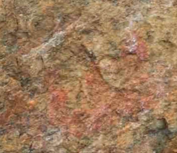
Mishipeshu and the snakes
5. has what looks to be an animal figure with a horn protruding from its head. Behind it are a couple of oblique slash marks. Are we looking at a crude drawing of Mishipeshu, a lynx-like reptilian creature and the snakes, the same combination of pictographs as that famous panel more skillfully drawn at Agawa Rock? It is easy to see how you can get into trouble trying to make sense of what you see!

5 – a close up of a Whitefish Bay pictograph panel
This Tappan Adney sketch of the rock face – a part of the McCord-Stewart Museum collection of Adney artifacts – would have been useful to have as a point of reference! It illustrates bits of #2 (the bird and the v-shape), #4, and the detail of #5. Adney – or the Museum – locates the pictographs on the face of a cliff on the White Falls River. We know the Falls as Whitefish. The cliff face is on the east side of Missinaibi Lake’s Whitefish Bay.

With our slow paddle along the east shore of Whitefish Bay done, we headed up Missinaibi Lake in a south-westerly direction. While it was gently raining, we were still lucky this day – no west/south-west wind! We have been on the big lake a few times and have seen the winds blow up some serious waves. Luckily, on those occasions, we were heading down the lake to the start of our trips down the river and could use the wind with the impromptu sails we set up.
—————
The Reva Point Pictograph Site:
A little under seven kilometers from Whitefish Bay is the next pictograph location. Like the Whitefish Bay one, it is very minor compared to the Fairy Point site.

the Reva Point pictograph site as seen from the north end of Reva Island
As we paddled closer, we noticed a Canadian flag on a stick to the site’s left. You can actually get out of the canoe and step on the rocks as you view the pictograph panel. It comprises seven or eight ochre images, most more apparent than any on the Whitefish Bay site. Slash marks predominate, but there are other more representational images as well.
A figure with six “arms” and a “tail” on the top left, a simple Thunderbird image, and some other difficult-to-interpret markings. Underneath the Thunderbird (if that is what it is!) is the panel’s most significant single splash of colour. I started verbalizing a feline Mishipeshu-like figure on the left with a canoe with six paddlers on the right and snakes underneath – just like at Agawa Rock – but Max remarked that I was maybe getting overly enthusiastic!

an overview of the Reva Point Pictograph Site on Missinaibi Lake

the Reva Point Pictograph Site on Lake Missinaibi

Reva Point pictograph panel
We paddled to Reva Island and the second “Sensitive Area” sign. We had considered beaching the canoe and spending some time with the old grown white pines still found on the island – some apparently as old as 350 years – but the “you are not welcome” sign and the lack of any clear path had us looking towards Fairy Point instead.
—————
Reva Island Archaeological Site (DbHw-1)

the white pine at the north end of Reva Island
A possible explanation for the “No Access” sign may be that archaeological work on the island in the 1960s and 70s uncovered evidence of a Terminal Woodland /early post-contact site with a date of about 1590 A.D. Along with the usual stone artifacts – mostly scrapers and projectile points – were gun parts and a possible gunflint. A ceramic fragment found at the site is seen as evidence of contact with groups in Wisconsin or Michigan.
See here for a summary of the site’s significance by the archaeologist John Pollack. As with the seasonal traditional pre-European- contact campsite on the west side of Whitefish Bay with the “Sensitive Area” sign, park visitors are discouraged.
Reva Island, as an Indigenous site, is also mentioned in Hap Wilson’s Missinaibi: From Lake Superior To James Bay By Canoe (2004 reprint of 1994 first ed.) guidebook. We read:
…the island may have served the Anishinabeg as an ancient burial site where corpses were perched in prominent trees in order to watch family members passing by….Occupation and activities of the island date back as far back as 5000 years. (p.50)
The details don’t agree with the archaeological record. Instead of 500 years, Wilson has it as far back as 5000! Instead of a seasonal habitation site, it is (maybe) a site where tree burial was practiced, thus making it “sacred” ground, warranting a “Sensitive Area” sign.
See here for a description by G.F. Speck of Temagami burial rituals from his 1913 study. This may have been the source of Wilson’s tree burial suggestion, which he has projected onto Reva Island. Bone fragments – human or other – were not mentioned by those who examined the site. Given the nature of the soil, this is not really a surprise.
Click on the image below to see the locations of both Reva Point and Fairy Point pictograph sites from the north end of Reva Island.

Fairy Point and Reva Point Pictograph Sites as seen from the north end of Reva Island
—————
Fairy Point Pictograph Site:
Along with the Diamond Lake pictograph site in Temagami, the Fairy Point site must be one of the most visited in northern Ontario. The annual influx of canoe trippers coming in from the Crooked Lake portage on the start of their journey to Mattice or Moosonee pass right by the pictographs. That is if they know they are there and have lucked into some calm water as they make their way south to the Point. Given its location, even moderate winds from the south-west can have some nifty waves crashing into the Point. Sitting there with a camera and contemplating Ojibwe rock paintings becomes less important than just getting down the lake!
If they stop, they will be looking at the most impressive stretch of vertical rock on the entire lake, a point not lost on the Anishinaabe shamans and vision questers who came here two and three hundred years ago – and maybe longer ago than that.

Norval Morrisseau’s early 1960s drawing of maymaygweshi
The rock face was to them the home of the maymaygweshiwuk, the “little men” who served as go-betweens to the manitous, the spirits who could grant the visitors the medicines and favours they sought. From this traditional Ojibwe understanding of the Point comes the English name “Fairy” -“small imaginary being of human form that has magical powers.”
The earliest use of the name (that I have found) is in a 1876 report by Robert Bell of the Geological Survey of Canada. He had paddled past the site on his way up the Missinaibi to Michipicoten from James Bay the previous fall. He made no mention of the pictographs! (See here – p.331)
—————
Approaching From the South End
In our visit to the pictographs of Fairy Point, we came at it from the south and paddled north for 900 meters before heading over to Red Granite Point and a campsite.
Faces and Panels
- In Selwyn Dewdney’s 1958 visit, he recorded his impressions in a north-to-south order in terms of various “faces” (his term for what others now refer to as panels), with the most northerly one being Face I and the most southerly one being Face IX.
- According to Conway’s count, there are 236 “paintings” on thirty panels. Unclear is precisely what makes up a painting. Does each line in a row of 11 tally marks, for example, make up one or 11 paintings?
We would not see IX faces or 30 panels in our slow paddle along Fairy Point. However, what we saw far surpassed the one and only panel we had been familiar with in our four previous fly-bys of the site!

approach from the south end of Fairy Point – the first stretch of the rock face
Our visit began with the following stretch of rock at the south end. The image below shows the first two ochre paintings we saw – two slash marks, with the one on the right having “arms” or fins. It reminded us of a similar fish image at Agawa Rock.

the first of the Fairy Point pictographs – the south end
On we went until we came to the bit of vertical rock surface in the photo below. “Move along. Nuthin’ to see!” Well, there were a few splashes of hematite, including a J figure and a series of vertical lines. We had been to Fairy Point before, so we knew there was more in store for us, although, to be honest, the only panel of images we could remember was the most obvious one, the one with the animals and the circle with a smile in it.

another pictograph panel as we paddle north at Fairy Point

a close-up view of the above pictograph panel
—————
The Mishipeshu and Caribou Panel:
And there it was! In the early 1980s heading down the Missinaibi had been an annual thing, and each time we passed this rock face. Once Max even took out his Nikon EM and snapped a photo; the other times, we were keen to get down to the river itself for the thrills and spills of the rapids. Now we had lots of time, and the water was relatively calm thanks to the light wind.

approaching Fairy Point’s most well-known pictograph panel
Dewdney labelled this pictograph panel Face IX; his book includes a sketch – see below – of most of the images.

Fairy Point Mishipeshu and Caribou Panel

Not included in the Dewdney sketch is the row of nine tally marks on the right side of the panel next to the caribou; also missing is the small bear image located below the inverted Y (or whatever it is). Given the rudimentary skills of the “painter(s)” and the assumed presence of Mishipeshu, the inverted Y as the horned serpent would seem not to be totally farfetched!

Little Missinaibi Lake image
And what to make of the circle that emoji culture will have us see as a smile? And what is with the seven “legs” or “rays” attached to the bottom of the circle? A common explanation is that it is a sun symbol with the lines representing rays of spiritual power transmitted by the manitous to those who have come to this site.
A similar pictograph is on Little Missinaibi Lake (Site #2). It also has lines below the circle – at least four or more. Inside the circle are what look like eyes and a mouth! The best explanation? It once had the same semi-circular arc seen on the Fairy Point pictograph, but bits of it have eroded over time to create what some will see as facial features.
—————
A Possible Explanation of the “Circle” or “Face”:
In her book, Reading Rock Art, Grace Rajnovich includes a Dewdney illustration of Agawa Rock’s Panel X. It shows a horse and rider, and in front of them a megis (cowry shell) presumably leading the way. On my visit, the megis was not visible. At most, it was a faint unreadable smudge to the horse’s right.

Agawa Rock – Panel X – Horse and Rider
However, having seen Dewdney’s sketch (and Thor Conway’s), I am reminded of the Missinaibi and Little Missinaibi circles and a possible explanation. The relative proximity of Agawa Rock to Fairy Point and Little Missinaibi Lake makes the connection even more compelling.

Conway tracing – the 1970s

Dewdney sketch – late 1950s
The Fairy Point circle may represent the Megis shell. This cowrie held a  special place in the Ojibwe religion and the ceremonies of the Midewiwin, the secret society of “medicine men.” According to one of the Midewiwin’s central myths, the Megis led the Anishinaabeg from their homeland on the Atlantic coast to the Lake Superior region. William Warren, in his History of The Ojibway People, published in 1885, recounts a speech he heard delivered in a Midewiwin lodge which began like this –
While our forefathers were living on the great salt water toward the rising sun, the great Megis (sea-shell) showed itself above the surface of the great water, and the rays of the sun for a long period were reflected from its glossy back. It gave warmth and light to the An-ish-in-aub-ag (red race)…
The cowrie with the inner line to indicate the opening and the lines on the bottom as rays of light – as an explanation, it sure beats the happy face emoji I first saw! Chapter IV of Warren’s book has the best account of the Anishinaabeg migration I found. You can download a copy of Warren’s early 1850s study of the Ojibwe here and read the entire account of the Great Migration.(Note: it is an 8 Mb download in pdf format.)

Fairy Point’s Mishipeshu and Caribou Panel – portrait orientation
Given all the animal imagery – moose, caribou, and bear – you would have to wonder if the paintings are related to hunting trips. Could the images serve as petitions to the Manitous for success or as thanks for making the animals available? Conway considers this possible purpose of the pictographs and concludes –
The elders who had inherited family traditions about pictographs insisted that this permanent sacred imagery was not related to hunting magic. While Ojibwa and Cree hunters performed many rituals to honour the eternal spirits of animals taken for food or fur, no accounts have been collected about rock art used for this purpose. Indeed, animals, whether fish, birds or mammals, were harvested so often that not enough rock art could exist to equal these rituals. (Conway 217)
—————
Continuing North At Fairy Point:
Just north of Dewdney’s Face IX, we paddled by the four slash marks seen in the image below. That brought us to Face VIII, another of the panels that Dewdney made a drawing of and which appears in Indian Rock Paintings Of The Great Lakes.

paddling north from the Mishipeshu and Caribou panel
—————
Dewdney’s Face VIII:
In the sixty years between Dewdney’s visit and ours, lichen growth has obscured much of what is there. If not for his drawing, we would not have even seen over half of the pictographs! Little could be made out except for the cross and the animal with the two prominent ears or horns. Click on the images to enlarge and see if you have better luck!

Dewdney’s Face VIII


close-up of pictograph panel N of the Mishipeshu and Caribou panel
—————
The Stick Figure – Continuing North
The vibrant colour of the “stick man” makes him jump out as you paddle by. Next to him are some faded ochre markings, an upside-down Y and the remains of an arc.

continuing north – another Fairy Point pictograph rock face

close-up of previous pictographs

Tappan Adney drawing from his 1930 visit
—————
Dewdney’s Face VI:
This may be the panel Conway refers to as The Nanabush and the Black Wolf (i.e.Myeengun) Panel. It includes a human figure and a canine animal. Of the human figure, he writes –
The human figure comes across as quite large by Ojibwa pictograph standards. But Nanabush the cultural hero, trickster, and first ancestor to the Ojibwa, often stood larger than life. (Conway 222)
The lean elongated figure may be what he is referring to though we did not recognize it as such at the time. The clearest image was the moose figure at the top of the panel.

Fairy Point Picto Panel – Face VI in Dewdney’s book

Dewdney. Fairy Point. Face VI.

a close up of a part of the above Fairy Point rock face

moose figure from the above rock face
—————
The Moose and Stars Panel (Dewdney’s Face IV):
Along with the Mishipeshu and the Caribou Panel (Face IX), this panel had the greatest number of “readable” images – i.e. ones with solid colours and precise shapes. Of course, what they mean and how – if at all – they relate to each other are other issues that won’t be resolved any time soon!

in front of Fairy Point’s second major pictograph panel – Moose and White Crosses (or Stars)

Morrisseau – Jesuit and Ojibwa meet
The white crosses were certainly a novelty. In fact, they were the first pictographs we have seen painted in white. Dewdney writes: “The white crosses… display the only white outside of the Namakan site.”
I am left wondering about the formulation of this white “paint.” The other question, of course, is “Why crosses?” or, more to the point, “Whose cross?” Is it a reference to the symbol that seemed to the natives to be one of immense power to the Jesuits? Is it a reference to a possible Midewiwin (the exclusive Ojibwe medicine society) cross that predated the arrival of the Europeans and their mythology?
The first image below is an overview of the panel; it is followed by others that focus more closely on various sections of the overall rock face. For some reason, Dewdney does not include the bottom half of the panel in his sketch. This includes the distinct white crosses that he makes reference to.

Moose and Crosses panel – north of the Mishipeshu and Caribou panel

Fairy Point’s second major pictograph panel – Moose and White Crosses


Moose and Stars Panel at Fairy Point

the top section of the Moose and Stars Panel

the bottom part of the Moose and Stars Pictograph Panel

Fairy Point – Moose and Stars Panel
We are now about 400 meters from where we started our Fairy Point scan. A few more humble rock paintings are coming up – animal figures, geometric forms, vertical slash marks, and others probably hidden under that black lichen cover.

a minor panel north of the Moose and Stars Panel at Fairy Point

approaching the north end of the Fairy Point pictograph site
A small bear figure can be seen on the right of the rock face e below; the other red “markings” may be exposed red granite. We couldn’t decide.

close up of above Fairy Point rock face

the last pictograph panel at Fairy Point – the north end
We noticed a small German flag placed below the moose pictograph in the photos above and below. Perhaps German paddlers had left something for the manitous at the start of their epic Canadian wilderness adventure?

Moose and tally marks – and a mini German flag!

one last bit of hematite on Fairy Point rock face – a possible caribou figure
Our GPS track tells us that we only spent 35 minutes paddling Fairy Point from south to north! Strange because it felt much longer and more like we had stepped out of time altogether!
—————
Tappan Adney’s Fairy Point Sketches
Montreal’s McCord-Stewart Museum website has a collection of fifteen or so pages from the sketchbook of Tappan Adney, most famous for his meticulous preservation of the traditional canoe-building skills and techniques of the Algonkian Peoples, in particular, the Wolastoqiyik (more commonly known by the Mik’maq name for them – Maliseet) of New Brunswick’s St. John Valley.
While in the Missinaibi area in 1930 to further his research, his guides – an Ojibwe and a Cree – also took him to some pictograph sites. The following post takes his Fairy Point sketches of those rock images and, when possible, shows what they look like through the lens of a digital camera 90 years later.
Tappan Adney And His 1930 Visit To Missinaibi Lake’s Fairy Point
—————
Looking For A Campsite
As we came to the end, our thoughts turned to a campsite for the night. Our initial trajectory to an island campsite 1.5 kilometers to the north was changed when we saw the closer – and inviting – Red Granite Point site, complete with some horizontal rock frontage. It was only on paddling around the corner the next morning that we saw the red granite band along the shore that gives the site its name.

the-red-granite-that-gives-the-point-its-name
As an added bonus – as the afternoon turned into the evening, we were treated to the view of Fairy Point glowing as the setting sun lit it up. Had we been more on the ball, we would have paddled back over there for some “Golden Hour” shots of the pictographs. It would have allowed us to see some of the many panels and rock images that escaped our view.
Instead, with Helinox chairs in service, we sat on that rock patio of ours and sipped on our maple whisky. We had paddled less than ten kilometers and visited three pictograph sites, and the wind and rain never dialed it up beyond “gentle” – what a great day it had turned out to be!

Fairy Point site from Red Granite Point campsite about 8 p.m.
We ended our canoe trip with a day-and-a-half paddle from Red Granite Point to the village of Missanabie on Dog Lake. The following post has the maps and details – the red granite the Point is named after is actually around the corner from the campsite.
Canoeing The Little Missinaibi River: Day 8 – From Red Granite Point To Crooked Lake Island Site
_____________________
More Info On Fairy Point:

Bill Steer (aka Backroads Bill) has an excellent article on the Fairy Point site. Click above on the header to Steer’s website to access the report – or click on the title – The Rock Fairies – Spiritual Pictograph Site.
My post relied heavily on Dewdney’s research and drawings. To provide easy access to the pages of Dewdney’s Indian Rock Paintings Of The Great Lakes that deal with Fairy Point, I created a pdf file of the relevant pages. You can download this 1.6 Mb pdf document: Dewdney on Missinaibi’s Fairy Point Pictographs.
_____________________
Where To Next For Pictographs?
130 kilometres south-west of Fairy Point is another major Anishinaabe pictograph site, and it is one of the most accessible. It sits on the shore of Lake Superior between Wawa and Sault Sainte Marie:


After Fairy Point, Selwyn Dewdney was off to Agawa Rock on the eastern end of Lake Superior. He was overwhelmed by what he found. Click here to read his account!
Twenty-five years later, Thor Conway and his wife Julie would do significant work on the pictographs of Agawa Rock, combining the then-novel use of acetate sheets (instead of the rice paper previously used) to copy the images underneath.

They also spent hundreds of hours interviewing local elders about traditional Ojibwe culture. His book Spirits On Stone (the 2010 edition of a book first published in 1991) presents the pictographs through the eyes of the descendants of the Ojibwe Shingwaukonse (“Little Pine”) who painted a sample of some of them for the Indian agent Henry Schoolcraft.
It is a book worth getting if you’re keen on exploring the topic further.
Dear true_north,
This is Kathryn again (the scholar writing an article on two persons who canoed along the Missinaibi River before World War I): I thought that I had located a good image of the Mishipeshu and Caribou Panel at Fairy Point (Missinaibi Lake), but the quality is not as good as yours on this site (the landscape version of the pictograph). I am hoping that you will kindly permit me to reproduce that image in my scholarly article as well. I would be most grateful! And I forgot to ask you two days ago: to whom should I credit these photographs? In a scholarly article I always provide a photo credit.
Many thanks!!
Kathryn, feel free to use any of the pictograph shots. They were all taken by me so attaching the name Peter Albinger will do as a photo credit.
BTW – (if you don’t mind me asking!) just who are these “two persons who canoed along the Missinaibi River before World War I”. How come you honed in on their story? What do you hope to get across in your article?
Pingback: Here's your guide to these fantastic provincial parks | IGNITE
Are there any pictures of the pictographs on Dog Lake?
There undoubtedly are – but not online! I have not been there to check it out. See this map from my Dog Lake entry in Pictograph Sites In Ontario post.I put Dog Lake in the NE Ontario section.
The annotated map has some info from someone who saw them.
Dog Lake Map and notes
I was there last weekend at our annual gathering. Here are a couple of pictures…
Thank you for your reply
Melvyn Ling
i just wanna say thanks for compiling this. I will be checking all this out for sure
My brother and I first paddled by the Fairy Point pictographs – the Mishipeshu and Caribou panel – back in 1980 on our way to Moosonee. We knew nothing about them and their significance. We’ve been back a few times since, a little bit more knowledgeable and always thankful that we are fit enough to paddle up to and spend time with them. Best of luck with the wind on the day you choose to visit!