Last update: January 28, 2024.
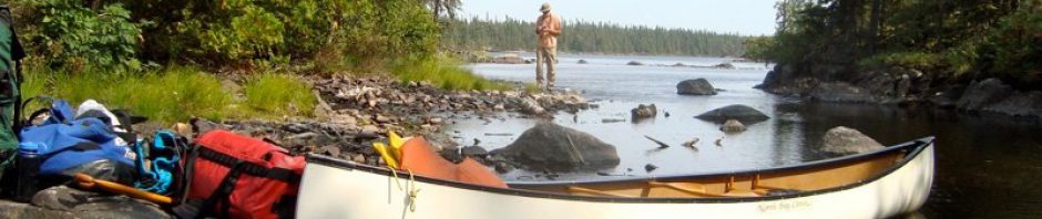
My brother Max and I grew up in the Abitibi region in northwestern Quebec, and yet we hadn’t really paddled in Quebec since we left La Belle Province in our late teens for university. We’re talking forty+ + years! This summer, we thought we’d do something about that! A shuttle by our good friend Cyril from Stittsville near Ottawa to Lac Larouche in La Réserve Faunique La Vérendrye off Highway 117 (the Trans-Canada) got us started.

We spent ten days paddling the Coulonge River system and once we hit the Ottawa River, we kept on going through the Rocher Fendu stretch – we did the Middle Channel – past Portage du Fort and Arnprior right to the foot (or maybe that should read “rear end”) of the Parliament Buildings in Ottawa. Thanks to the P.M. popping up in unexpected places across the country that summer, the joke was “Where’s Trudeau?”
—————
The pix – in chronological order – that follow are some of the many that we snapped along the way. Along for the ride were a couple of point and shoots – Max’s Canon SX280 and my Canon Elph 330 – as well as a much more capable Sony A77 DSLR with a variety of lenses from ultra wide to fairly long. Occasionally, we made use of a tripod to help justify bringing it along!
Canoeing Quebec’s Coulonge River System – Introduction, Maps, Day-By-Day Reports
Canoeing Quebec’s Coulonge River System – Introduction, Planning, Maps
We only met one other party of canoes – five canoes to be exact – during our fifteen days on the water. The eight girls in their mid-teens belonged to a summer camp and were led by a female and a male in their late teens. It is always good to see a new generation of paddlers on the water. Other than this group, we had the Coulonge – and the Ottawa – to ourselves! We had expected to see more paddlers on an easily accessible river.
—————
We did get to experience that famous Ottawa Valley hospitality.
- Jim Coffey and Dennis Blaedow of Esprit Rafting went out of their way and smoothed over some complications and filled us in on Ottawa River rapids.
- The manager of the Lakeside Hotel at Portage du Fort insisted we camp for free on their riverside lawn;
- Maureen Baskins refused any money to camp at her beach property, some 35 km from Ottawa.
We’ve got some “paying forward” to do!
—————
Later this month, we’ll have a more detailed day-by-day report of our trip, along with maps, as well as essential portage and rapid info. We’re glad to have made the journey. On the ride home to our Toronto/London base camps, talk turned to finishing off the Ottawa by paddling from our hometown of Noranda in the Abitibi down to Pembroke or Fort Coulonge.
So many rivers, but always one summer less!

moon over Lac Grand on Day 1
Down The Coulonge: Day 1- From Lac Larouche (Km 271) to Lac Grand (Km 253)

Looking towards Lac D’arcy from the west end of Lac Desty

Lunch time on Lac D’Arcy
Day 2: Headwater Lakes – To Lac Ward (Km 217)
Down The Coulonge: Day 2 – The Day Of Headwater Lakes – To Lac Ward (Km 217)

Lac Ward campsite – and boat launch area!

gravel bar on the upper Coulonge

The start of “Tall Pine Rapids”
Day 3: From Lac Ward To “Tall Pine Rapids” (Km 187)
Down The Coulonge – Day 3: From Lac Ward To “Tall Pine Rapids” (Km 183)

a sunny end to a rainy Day three – Tall Pine Rapids camp

morning mist below Tall Pine Rapids on the Coulonge

getting close to the flora on the Coulonge

checking out Perly Falls (below Les Cascades du Batardeaux)
Day 4: From Tall Pine Rapids (Km 183) To Km 157
Down The Coulonge: Day 4 – From Tall Pine Rapids (Km 183) To Km 157

The Bros chillin’ at the end of Day 4 on the Coulonge

Moon over the Coulonge – Day 4 camp

A sand beach on a meandering Coulonge section

File under “Fauna”: curious Coulonge local checks out the visitors!

Boulder garden – shallow water at the confluence of the Corneille and the Coulonge

Humble sandbar fire ring on the Coulonge below Chute Gauthier

approaching Chute Au Diable on the Coulonge River

Sandbar campsite on the Coulonge – do people camp here?

The view from the sandbar back up river
Day 5: Km 156 to The Corneille Confluence (Km 121)
Down The Coulonge – Day 5: Km 157 to The Coulonge/Corneille Confluence (Km 121)
Day 6: Km 121 to Km 99 (across from Carmichael Creek)
Down The Coulonge – Day 6: Km 121 to Km 99 (across from Carmichael Creek)

our newly-created campsite at the bottom of Die Hard Rapids on the Coulonge
Day 7: Km 99 to “Die Hard” Rapids (Km 81)
Down The Coulonge: Day 7 – Km 99 to “Die Hard” Rapids (Km 81)

Looking downriver from Die Hard Rapids

under the tarp in a torrential downpour that lasted 30 minutes

rocks and water in the rapids

boreal forest floor – along the portage trail at Les Rapides Enragés
Day 8: From Die Hard Rapids to Rapides Enragés (Km 60)
Down The Coulonge – Day 8: From Die Hard (Km 81) to Rapides Enrages (Km 60)

Max gets a shot of me framing a shot of the bottom of Les Rapides Enragés

The falls at the bottom of Les Rapides Gallinotes

perhaps our favourite Coulonge campsite – the one at the top of Chute a L’Ours (Bear Falls)
Day 9: From Rapides Enragés To Chute A L’Ours (Km 43)
Down The Coulonge – Day 9: From Rapides Enragés (Km 60) To Chute A L’Ours (Km 43)

Taking in the bottom of Chute a L’Ours

staring into the fire at Chute a L’Ours
Day 10: From Chute A L’Ours To Chutes Coulonge (Km 15)
Down The Coulonge – Day 10: From Chute A L’Ours (Km 43) To Chutes Coulonge (Km 15)

the first two drops at Les Chutes Coulonge – part of the 43-meter drop

Another view of the Coulonge Falls

our camp site at Esprit Rafting base Camp in Davidson near Fort Coulonge

sunset on the Ottawa from Esprit Point
Day 11: From Chutes Coulonge (Km 13) To The Ottawa River (km 0)
Down The Coulonge – Day 11: From Chutes Coulonge (Km 13) To The Ottawa River (km 0)

the bottom end of the gorge at les Chutes Coulonge –

Flora and fauna in the sand on the Coulonge shore near Fort Coulonge

The Marchand Covered Bridge – now closed – over the Coulonge River near its mouth
Canoeing The Ottawa River: Introduction, Maps, Campsites and More
Canoeing The Ottawa River From Fort Coulonge To Ottawa’s Rideau Canal – Introduction, Maps, and More

The top of McCoy Rapids – portage on River right across Cedar Island
Day 1: The Rocher Fendu’s Middle Channel

The top of Chutes a Desjardins (known locally as Butterfly Rapids)
Day 2: Rocher Fendu To Portage du Fort
Canoeing The Ottawa – Day 2: Rocher Fendu To Portage du Fort

Our tent site in Portage du Fort – thanks to the Lakeside Hotel

Portage du Fort’s Catholic Church – St. James the Greater

Portage du Fort sunset

deer on the east side of the Ottawa River near Arnprior
Day 3: Portage du Fort To Baie Du Chat/Arnprior
Canoeing The Ottawa – Day 3: Portage Du Fort to Baie du Chat/Arnprior

a view from our island campsite near Arnprior
Day 4: Baie du Chat To Baskins Beach

Dusk view from our campsite on Baskins Beach – thank you, Maureen Baskins, for the incredible hospitality!

The Ottawa River Shoreline – a mix of camps, cottages, and mansions like this one

The Deschenes Rapids – and the suburbs of Ottawa!

After our bicycle path portage on the Quebec side, we followed this side channel down

Whimsical rock art catches our eye on the Ottawa, Ontario side

approaching our last obstacle – the Chaudiere Falls Generating Station
Day 5: Baskins Beach To Ottawa (Rideau Locks)
Canoeing The Ottawa – Day 5: Baskins Beach To Downtown Ottawa

brief rain stoppage – getting ready to finish the trip

The view from the put-in below the Mill Street Eatery – a torrential storm moves in!
The great close-up shots of Parliament we had been framing in our heads for the past two weeks? While you can see the dome of the Library and the Peace Tower in the middle of the above panorama, that was it for photo ops!
A few seconds later, it started raining – a torrential downpour that soaked us to the bone and went on for about 45 minutes. Cameras tucked away, we shifted into survival mode and paddled to the dock where the water taxi and the tour boat pick up passengers. It was not the ending we had envisioned, but we certainly won’t forget it!
Below is a shot I found on the Wikipedia site, which shows the Ottawa River from the Peace Tower. Our put-in at the end of the 1150-meter portage was approximately where the red arrow is.
The portage had us crossing Booth Street and – a first – had me standing at the crosswalk underneath the canoe waiting for the light to turn green! We had to laugh when one of us vocalized the image of a couple of homeless bearded geezers with assorted bags and a canoe – instead of the usual shopping cart – making their way through Ottawa!

See here for the image source – shot by Andrijko Z.
Canoeing Quebec’s Coulonge River System – Introduction, Maps, Day-By-Day Reports
Canoeing Quebec’s Coulonge River System – Introduction, Planning, Maps
Canoeing The Ottawa River: Introduction, Maps, Campsites and More
Canoeing The Ottawa River From Fort Coulonge To Ottawa’s Rideau Canal – Introduction, Maps, and More
It is Labour Day, and I would wish nothing better than some time in the wild, paddle in hand and the sweet smell of nature. I am sitting at my ‘desktop’, admittedly with a verdant eastern view, overlooking treetops in downtown Toronto. As I travel with you ‘virtually’ through this lovely blog, my heart explodes.Thank you for this sojourn.
Nice to hear someone is looking at the pix! Thanks.
Hop on your bike – or put on your walking shoes – and head for Toronto’s Don Valley ravines or, if you’re really keen, find your way to the Rouge Valley and its hiking trails. Take your camera along to capture some memorable views that you can turn into screenshots for your ‘puter! You could always set up your own blog – send me the link when you do!
Very nice trip, enjoyed your excellent photos and descriptions. I sometimes visit friends in the Cobden area while coming home from canoe trips and will make a point of staying at the Lakeside and mentioning your camping on the lawn.
You mention Noranda I visited Noranda in January 1968. Rev Manlif Mitchell and his daughter Joan (Frank), It was -25 F, coldest I ever saw..haha
Anon – I had never heard of Cobden until Dennis Blaedow of Esprit Rafting mentioned he had grown up there but left 25 years ago for Davidson on the Quebec side. He quipped that if being in Cobden is like living 20 years ago then Davidson is yet another decade behind! He is obviously loving it in Davidson!
At Portage du Fort we met an aging baby boomer couple from Renfrew showing a visiting friend around the war memorial and the boat launch area. When the woman started talking about Donald Trump we begged her to stop immediately – we did not want to spoil our two week reprieve from the insanity. Well, she laughed and stopped and we talked about other stuff! And then he started reminiscing about the Lakeside Hotel. It was apparently THE place to party in the late 60’s and into the 70’s and attracted folks from both sides of the border for its raucous scene. So much so that he assured me you could drop in at 8:00 a.m. on a Saturday morning and there’d still be dancing.
The Lakeside is a quieter place these days. The main draw seems to be the slot machines that people stare into, to the detriment of people looking at each other and socializing!
Haven’t been in Noranda since maybe 1978 but am sure that the winter cold you got to experience was not that unusual. We still went out and played hockey on the outdoor rinks or tunnelled into the snow piles on the side of the street to make our own snow caves.
Looks like a great route! Enjoyed the photos!
Cobi, all we need to do is get motivated and prepare some of your great recipes. That black bean chili looks like a great place to start. We usually take some Harvest Foodworks pouches along but your homemade version is definitely an upgrade. BTW – nice blog which I visit from time to time for the pix and ideas.
true_north, the black bean chilli is amazing and super lightweight! You should try making it and let me know how it turns out!
I find that dehydrating our own meals is a lot cheaper and I know the food is going to be good.
And, thank you so much for visiting! I’m glad there are resources and photos to share!
:)
It’s going to be my project for this week. I’ll let you know how it goes!