Last revised: August 21, 2022.
Table of Contents:
Previous Post: Argentina’s Hiking Capital – El Chalten and Monte Fitz Roy
- Puerto Natales – the Town Where You Start
- Day 1 – From P.N. To the Park and Up To the Torres
- Day 2 – To Camping Seron
- Day 3 – Camping Seron To Refugio Dickson
- Day 4 – Dickson To Los Perros To Los Guardas
- Day 5 – Los Guardas To Refugio Grey
- Day 6 – Refugio Grey To Campamento Italiano
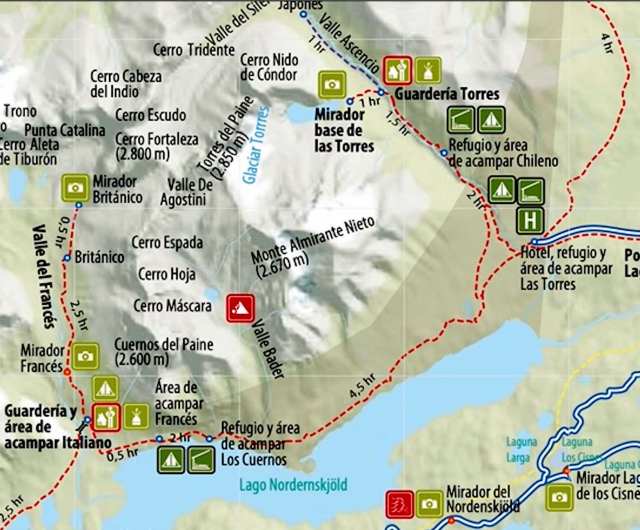
- Day 7 – Italiano To Refugio Torres Central
2018 Trail Update – Another WordPress Blogger does TDP
2022/2023 – Up-to-Date Info on the Stingy Nomads website on the TDP Circuit and how to book it
———————
Three TDP Hiking Options
Parque Nacional Torres Del Paine in southern Chile is the location of one of South America’s great hikes. Some would go so far as to call it the #1 hike in the world. The creators of this website combed through several books that dealt with the topic of “the world’s best hikes” and recorded the frequency with which various hikes were mentioned. According to their calculations, the Torres del Paine Circuit came out on top!
Southern Patagonia: Hiking Adventure At “The End of The Earth” has background information on how I got to the park.
All images enlarge on a new page with a click; all blue text leads to a new web page with a click!
The satellite map below outlines two possibilities for anyone drawn to dramatic granite spires, the massive glacial end of the Hiele Sur Icefield with El Glaciar Grey and glacier-fed lakes. What visitors to Chile’s finest national park choose to do will depend on how much time, what sort of equipment and supplies, and how much interest they have.
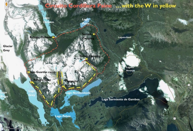
Torres del Paine satellite map with the red Circuit and the yellow W – the yellow rectangles show the six tent spots of my seven-day Circuit.
———————
Option #1 – a day visit to see the Torres
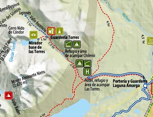
For some visitors, a walk up the Valle Ascencio to view the Torres del Paine (as shown in the picture above) would be enough. They would have to get to the park entrance from Puerto Natales or El Calafate and then take the shuttle bus to the end of the road in front of the Hotel Las Torres. They could leave the bulk of their stuff at either the Refugio Torre Central or the Hotel Las Torres if money is not an issue. (Rates at the Hotel range from $290 to $540 a night during high season.)
Then they could do the hike up to the dramatic granite towers. There is also another Refugio (Chileno) on the way to the Torres, where they could bed for the night. If they have tents and sleeping bags, there are tent spots by the Refugio Torre Central, at Refugio Chileno, and at the base of the Torres. This visit would take two days.
———————
Option #2- the W
Another option is the W Hike, which gets its name from its shape on a map. See the satellite map above for a yellow W. To do the W requires more time than the first option described. A good thing about the W is that you do not need camping equipment; you can use refugios each night and have supper and breakfast there. (Please note that TDP is not inexpensive!)
There is no one way to do it- you could hike up to the Torres del Paine on the first day when you arrive if the weather is good and then move on to Refugio Cuernos and the Valle Frances. Your last stop would be at Refugio Grey, where you could catch a boat ride back to Refugio Torre Central and transportation out of the park. The W could take four to six days, depending on how driven you are to get from place to place. You will be rewarded with most of the best of Torres del Paine Park.
———————
Option #3- The TDP Circuit – aka the O
If you have lots of time- that is, a week to ten days- and are equipped to do some camping- i.e. tent, sleeping bag, enough food for at least four days, cook stove, etc.- then maybe the Circuit is for you. It was the option I chose- and I am happy I did. It gave me four days of walking the less-travelled part of the park. Perhaps it appeals most to those obsessed with going all-in when they do anything.
A warning, however- It could become a real adventure in a hurry if you walk into some nasty weather. If you decide to do it, do be prepared for the worst. Ensure you have the right gear, enough supplies, and an adequate fitness level. In the quieter back section of the trail, there will be few, if any, people around to bail you out. Between Refugio Dickson and Campsite Los Guardas, there is only the keeper of the Los Perros Campsite you can count on.
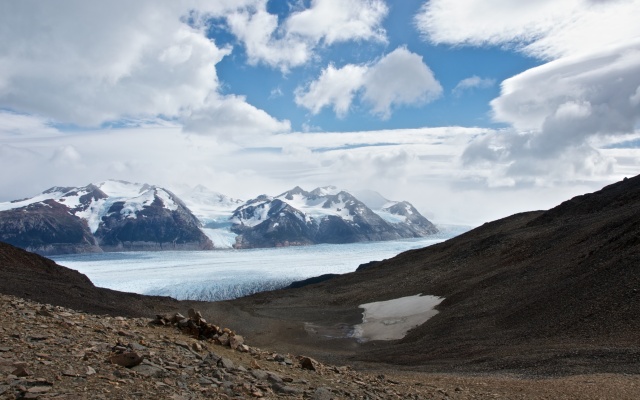
The reward- standing at the Gardner Pass and taking in the view below- was the high point of the Circuit, along with walking up to the Torres themselves. The image below does not really convey the total “wow” of the moment!
Take a look here if you want to see a fantastic 3D recreation of an eight-day TDP Circuit. It will give you a great idea of what you plan to do.
Some months are a better bet for a park visit than others. Check here for the historical monthly averages for the particular month you were thinking of going to TDP – but realize that there are no guarantees, even in the prime stretch from November to April!
If you want to get an idea of accommodation options in TDP, click here for a comprehensive list.
———————
Doing The Torres Del Paine Circuit
Puerto Natales – the Gateway Town To the Park
What follows below is an account of the seven-day Circuit hike I did – although most of it may be of use to someone contemplating the W, a worthwhile second choice.
I started from the Chilean town of Puerto Natales, the gateway town to the park. The stores in town are used to hikers looking for supplies for their treks- food, gas canisters, etc. If you have forgotten anything from home, you can probably find it in P.N.
After a night at the Erratic Rock, a budget backpackers’ hostel with very helpful hosts who provide a useful information session on hiking in the park most afternoons, I was ready to go. While I would be doing the Circuit independently, I was not at all apprehensive. Unlike hiking in the Canadian Rockies, for example, there are no wild bears to worry about in TDP! The trails are pretty obvious, and on the W section, at least there is always someone just behind or ahead of you, so there is a built-in safety mechanism. The stretch over the Paso Gardner is one section where you need a partner; it is easy enough to join a hiking group at Camping Los Perros before you head up to the Pass.
———————
Day One: From P. N. To The Park and Up To the Torres
The morning bus ride from Puerto Natales to the park entrance at Laguna Amarga took over two hours. (Click here for up-to-date info on bus schedules and park entry fees.) Unlike hiking the trails around Monte Fitz Roy, doing the TDP requires an entry fee, currently, 21,000 Chilean pesos for non-Chileans.
By 10:30, I was standing in front of the Hotel Las Torres, ready to start. The usual approach is to do the Circuit counter-clockwise, with Camping Seron as the first day’s objective. Since it was a fantastic sunny day, I decided to use the good weather to walk up to the Torres that very day after setting up camp at the base of the final climb; that way, a potentially rainy or overcast day a week later would not ruin my chance to see the iconic granite towers. It turned out to be a good decision because it was indeed overcast when I came by seven days later on the trail from Refugio Cuernos.
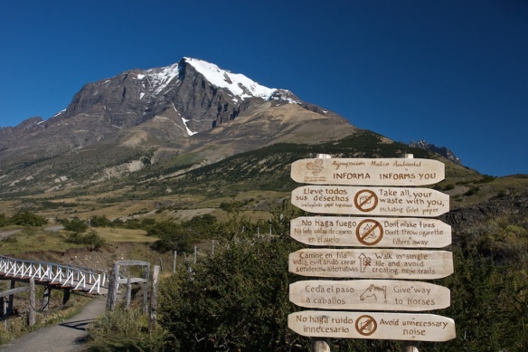
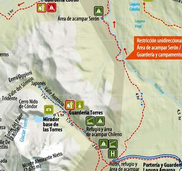
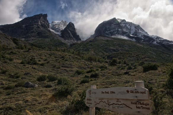
Crossing the bridge over the Rio Ascencio as in the image above, the trail to the Valle Ascencio goes to the right of the pictured mountain (Monte Niete). It is about ten kilometers from the start by the deluxe hotel to the Torres Lookout and took me about three hours with a few rest breaks. It was early March, a bit past prime season, but I was definitely not the only one on the trail!
As you walk up the east side of the valley, you eventually come to Refugio Chileno, where you could potentially get a bunk for the night or pitch your tent before you continue up to the towers. The picture below shows my first sighting of the Refugio from the trail-
There was also a restaurant at the Refugio but it was closed when I passed by, so I opened my pack and got out the water bottle and an energy bar. Then it was up the valley further, crossing back to the east side of the river over another bridge. the trail goes through some lush forest before arriving at a junction, with one trail going up to the Torres and the other going down a bit to the campsite.
I put up my tent at the Campamento Torres and then took my camera gear for the final 45-minute walk up to the “mirador” (viewpoint).
The view below is what greets you as you finally get to the top. It is a grand scene that reminded me of a natural cathedral with me as the pilgrim! I inhaled the atmosphere for almost an hour on a beautiful afternoon in TDP, occasionally changing seats for a different angle. I now regret not walking all the way down to the laguna and setting up some more original shots. Still, the following images convey a bit of the majesty of the Torres.
I walked back down to the Campamento and met some other hikers there, had supper, and was enjoying the warmth of my sleeping bag by nine.
———————
Day Two: To Camping Seron
My first full day on the trail started with 10 km back to the start and then 16 km to the next camp spot for a total of 26 k. I left at7:30 and got to Refugio Torre Central by 11:00 for lunch at the cafeteria. An hour later, I was on my way to Camping Seron, a 16.5 km walk (fairly flat and easy) from the Refugio Torre Central.

the building at the start of the afternoon’s walk to Serron campsite- Monte Niete behind and the Torres sticking up and visible- another nice day in TDP!

looking back at Eco Camp (extreme left side), Refugio Torre Central (left to middle), and Hotel Torres (on the right bottom)…trail to Torres del Paine starts to the right of the Hotel
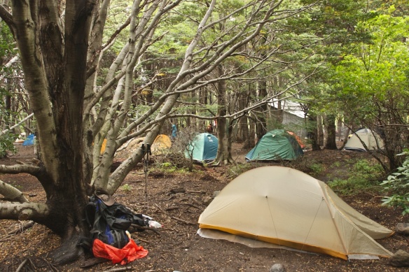
I got to Camping Seron about 4:00 p.m. There were already a dozen tents, most with hikers who were heading up to Dickson the next day. The tent you see in the foreground is my Big Agnes Fly Creek UL1, which weighs about a kilogram! It is not the roomiest of tents, but when travelling light it does the job.
Camping Seron has a food service where you can order something to eat. I think I had a pasta and veggies dish. Since I had only brought four days of food on the hike, I took advantage of the food available at the refugios whenever I could. Do note that it is not cheap!
If you are on a tight budget, you may want to buy more food in Puerto Natales- and cook it on the stove you will need, along with the fuel, pots, plates, etc. Unfortunately, greater independence comes with a price- more stuff to carry!
I had a Primus Trail stove which weighs 230 grams and screws in on top of a butane canister (which you can buy in Puerto Natales).
———————
Day Three: Camping Seron To Refugio Dickson
Day Two of the classic TDP Circuit (but my third day since I had done the hike up to the Towers right away on the first day), takes you from Camping Seron to Refugio Dickson.
It is a nineteen-kilometer walk through grass fields and bush alongside the Rio Paine; the scenery is pleasant as opposed to dramatic and jaw-dropping. Having mostly walked in the rain at Fitz Roy for four days the previous week, the sunshine was a much-appreciated change.
And finally, after about five hours, the Refugio appeared- as in the photo above- seemingly on a spit jugging out into the Lago Dickson. I walked down the ridge to the clearing where the Refugio sits. After setting up the tent, I made use of the shower facilities and then rambled around the area looking for interesting photo possibilities.
The Refugio has a number of dormitory-style beds and a very cozy eating area where meals are available. I would have both supper and breakfast there. I found the food to be quite acceptable, given where we were and my vegetarian requirements.

Refugio Dickson price list- note that it is for 2010-2011. See here for a chart which shows the fluctuating value since 2012. $1US = about 650 Chilean pesos on March 23, 2017
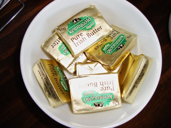
I was amazed to see the following on the breakfast table. It makes you realize how small the world has gotten in the past one hundred years. What is also amazing is that this would make any economic sense!
I spent the evening chatting with a couple from California at Refugio Dickson. They were also heading up over the Gardner Pass the next day. Since you are not officially allowed to go over the Pass on your own (although I have no idea how they could enforce that), I asked if I could tag along with them.
———————
Day Four: Dickson to Los Perros to Guarderia Paso
We left Dickson at about 8:30 the next morning and about three hours later had walked the nine kilometers up the trail along the occasionally turbulent Rio de Los Perros to the camping site Los Perros.
(Refugio Dickson is at 220 m (above sea level); the Los Perros campsite is at 580 m, and the Gardner Pass is 1421 m- so there is some gain in altitude as you approach the Pass!)
Crossing a moraine at the bottom end of the glacial Laguna Los Perros, I looked back and spotted one of the California duo on the top of the ridge-
I got to the Los Perros campsite about 11:30 and pulled out the stove and pot and the day’s lunch. I would have a hot Thai noodle soup along with a couple of slices of Wasa bread covered with my favourite peanut butter. Water was available out of a tap but I still treated it with my Steripen. Here is a self-portrait while I was getting water at the camp sink-
My fellow hikers from California soon arrived, and we had lunch together in the hut pictured above. Many people stop here and start over the Pass early the next morning. Given that it was only 12:30 and we felt fine-, and the weather looked good too, we decided to head for the Pass and make our next campsite Los Guardas, about fourteen kilometers and six hours of walking away.
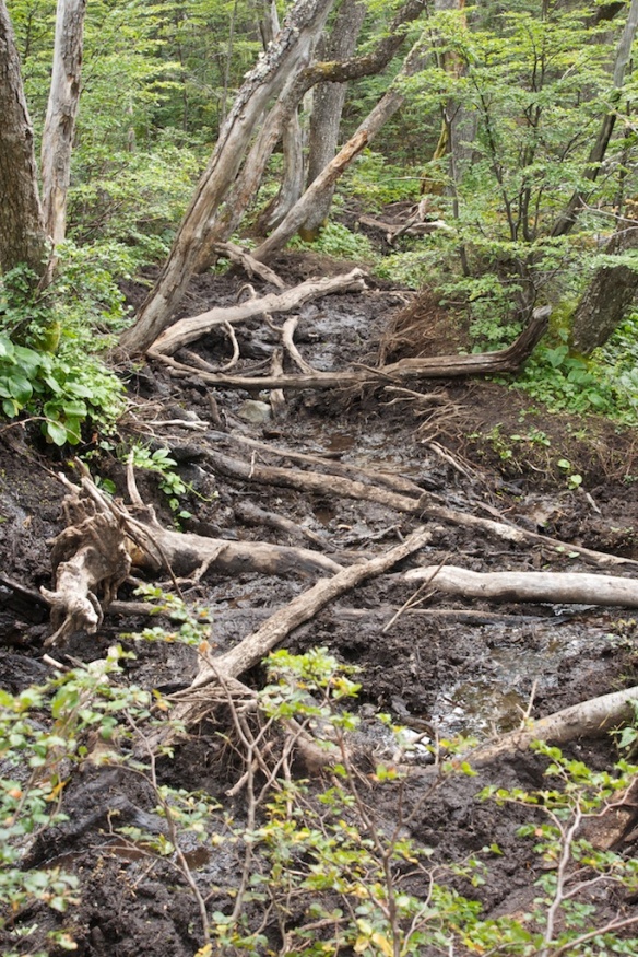
We left the campsite together- as per the rules!- but within a few minutes, we had all settled into our preferred paces- and mine was a bit faster than theirs. The trail up was initially a bit sloppy thanks to recent rain- at first on the east side of the Laguna Los Perros and then along the Rio Paso.
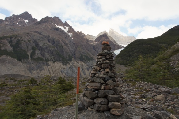
Eventually, the trees are gone, and you are walking on exposed moraine and scree. The trail is indicated by orange stakes, cairns, and occasional circular dabs of orange paint. The photo above showed a marker with all three indicators at the same time!
It is all pretty obvious – in good weather. Imagine what a snowfall or visibility-reducing fog could do to your trail reading skills, and you realize that a straightforward walk over the Pass could become a mountaineering adventure in a hurry.
It took about three hours to reach the Pass from the Perros Campsite with an altitude gain of 841 m. When I got up there, I joined a Chilean from Santiago and a couple of guys from Buenos Aires in the wind shelter. They were amazed that I had started from Dickson that morning – something that didn’t seem that big a deal to me. After fifteen minutes or so of chatting about the trail and our respective home cities, mis amigos moved out and on to Guarderia Paso campsite.
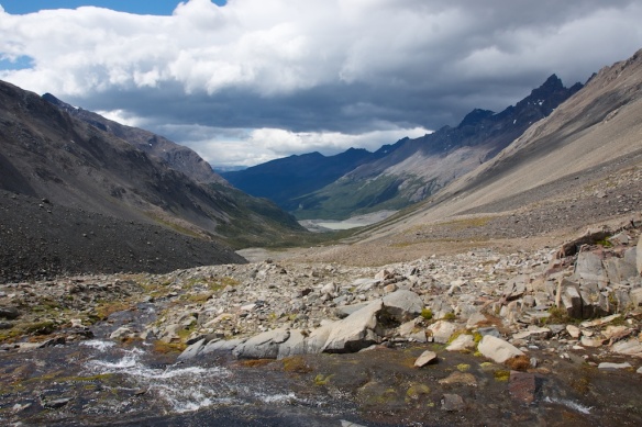
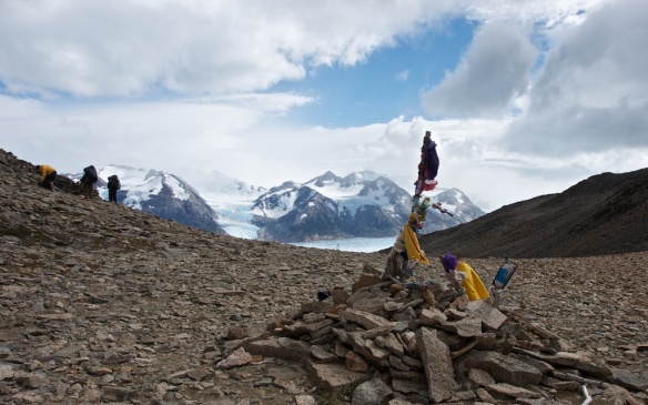
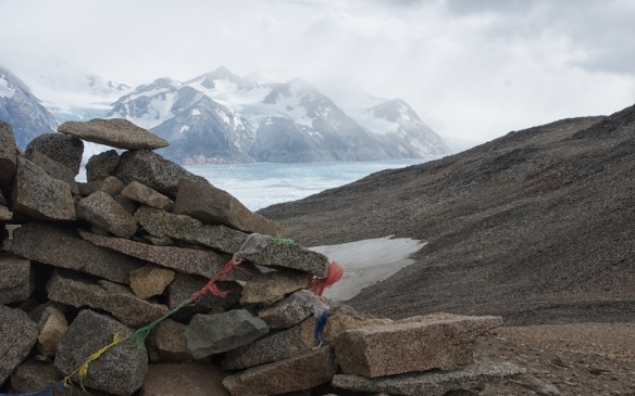
Standing at John Gardner Pass (at 1241 m, the highest point on the trail, was the highlight of the TDP Circuit. Even more so than the lookout by the iconic Towers, which give the park its name, the view from the Pass is breathtaking. Looking back, you can appreciate the effort it took to get up here- and looking ahead, you see what the image below hints at – the epic nature of the view.

almost there- the last of our party approaching Gardner Pass from the valley we have spent three hours walking up!
I stayed for a few minutes and chatted with the American hikers- but I was definitely getting chilled just standing around. We had been very lucky with the weather, but the wind had picked up in the past hour. We agreed to do supper together down at the Guarderia Paso campsite- three hours and over 800 meters down.
Along the way, I passed the three amigos from the wind shelter. Again, they were amazed at how fast I was moving. The secret? None of them had trekking poles! They were hurtin’ as they made their way down a pretty steep path to the campsite, and they got to watch as a guy almost twice as old as them (I was sixty when I did this hike) danced his way down to Guarderia Paso/
The poles- and you need two, not just one- make all the difference. Coming up to the Pass, they made moving over the scree and talus much easier thanks to the massive increase in stability provided. They took much of the pressure off my knees and transferred it into my upper body on the way down. Trekking poles are the answer!
Guarderia Paso campsite has room for at least twenty tents on either side of a stream that comes tumbling down through the site. There is a guardian there but no services that I can remember. There is a hiker’s covered shelter which we used to make our supper and replay the day- and then it was off to my tent, tucked into the most windproof location that I could find. It had been a massive day with incredible views- in retrospect, the best single day of the Circuit- and I slept easy.
———————–
Day Five: From Guarderia Paso To Refugio Grey
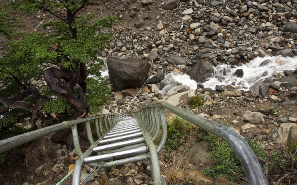
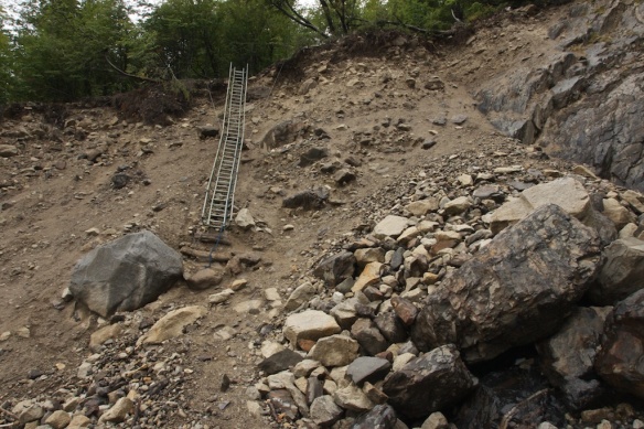
The next morning I had a very simple objective- at most, a half-day of walking and lunch at Refugio Grey. To get there you have to deal with a number of ravines- first climbing down into them and then climbing back up and out to the next one. The next couple of pix show just some of the entertainment provided!
Note: Since I did this hike in 2012 some of these sections have been replaced by bridges!
It took a bit less than three hours to get to Refugio Grey from Los Guardas. It may only be five or six kilometers but it is definitely a good workout. I cannot imagine walking the Circuit clockwise and having to go up to the Pass from Refugio Grey- it is undoubtedly easier from the direction most choose (i.e. from Dickson).
The Refugio Grey has all the basic facilities you would expect- bunks, meals, showers, campsites. I put up the tent at about 11:30- not even noon and I was done! It was my reward for yesterday’s epic march! I would have a quick shower and then the first of three meals at the Refugio restaurant- lunch, supper, and breakfast.
The three meals (but no alcohol) came out to about $50. with tip. Bringing your own food is cheaper but, all in all, it is what I would pay at home for restaurant meals. Chile – and Patagonia even more so – is not Nepal. There are no $1.25 Dal Bhatt lunches on offer.

the Grey II taking on Refugio patrons for the trip to the other end of the lake at Hosteria Lago Grey
I spent a relaxing afternoon and evening watching chunks of the glacier float down the lago while I chatted with hikers from all over the world- more Americans, an Irish couple, a Dutchman- it was like the United Nations “at the end of the world”!
———————
Day Six: Refugio Grey To Campamento Italiano
The next morning, after a great breakfast in the Refugio, I packed up my tent in the rain and set off.
The good weather had ended. For most of the rest of the trip, it either rained or looked like it was going to. The morning’s goal was the Refugio Paine Grande, an easy three-hour walk (11 kilometers) from Refugio Grey but without the epic views of the previous two days.
After seeing almost no one on the trail since leaving Refugio Torre Central four days previously, I was now in the land of the “W,” the shorter version of the TDP hiking experience that most people choose. Now there were hikers every ten minutes- and it would only get busier!
After a filling lunch at the Refugio cafeteria- the biggest I had seen since Refugio Torre Central- it was time to move on. My plan was to put up the tent at Campamento Italiano and then spend the afternoon walking up the Valle Frances. Along the way, the trail passes by Lago Skottsberg, shown in the picture below-
When I got to the Campamento Italiano, I found a fairly flat but, thanks to the rain, muddy spot to put up my tent. There were already dozens of campers there. Complicating matters was the fact that the toilet facilities were shut down. This meant that everyone was on their own when it came to basic body functions. Add the rain and the whole thing was not a situation I wanted to be in. Reluctantly, I put the tent up and stashed most of my gear inside.
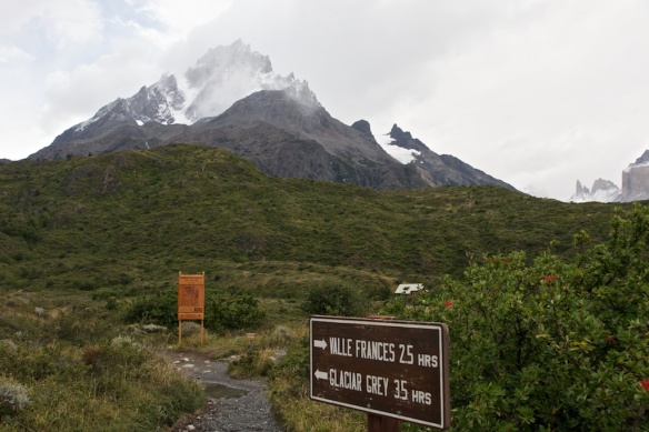
Then I went for a walk up the Valle Frances, which I would have made with my pack on a sunny day so that I could tent at the Britanico Camp Site. I made it as far as the entrance of the upper valley as shown in the pix below- even in the mist, it was stunningly beautiful.
The walk up the valley and a tent spot site at the Britanico have the potential to rival Paso Gardner for the #1 stop on the TDP hit parade. If I could change one thing about my TDP visit, it would be this. Instead, I shielded my camera from the rain, took a few shots, and reluctantly headed back for the mess that was the Italiano campsite.
If you have better weather than I did and you find yourself at Camp Site Italiano in the morning, spend the day going up the valley to Britanico and beyond. You will be rewarded with one of the finest days of hiking in your life! Even better yet, take a tent and sleep up there.
———————
Day 7: Italiano To Refugio Torre Central
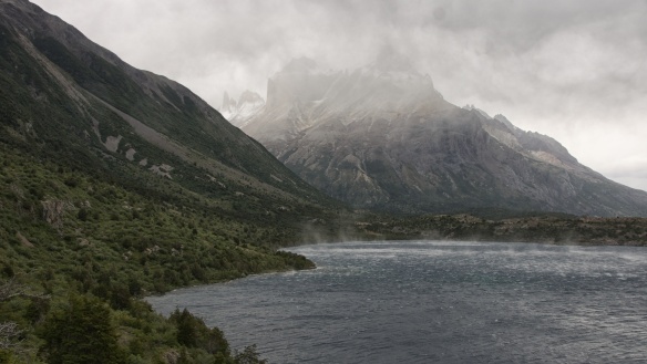
The next day, again a mostly wet and rainy one with unexpected bits of sun thrown in just to completely confuse me, I fled the dirty campsite. This would be my last day on the Circuit; I got to Refugio Torre Central by 2:30. On your right all the way is Lago Nordenskjold. I watched the wind as it whipped up the water. For half of the walk, the Cuernos del Paine was on the left-hand side. Clouds and sun came and went and created endless variations of Cuernos photos for me to contemplate- and even take. For some reason, I kept thinking of Lord of the Rings as I walked by. The next time New Zealand is busy, Peter Jackson could move his gear here for some dramatic film sets.
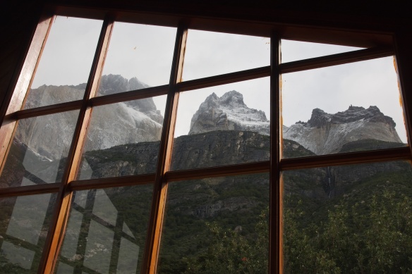
I arrived at Refugio Cuernos too early for lunch but sat inside the hostal for a few minutes and enjoyed the view (see the photo below) below while I sipped on my powdered Gatorade-enhanced water and second-last energy bar.
Rock and cloud continued to combine in magical ways, and I enjoyed the show as I continued my walk, knowing that it would be a very different kind of enchanting on a bright sunny day.
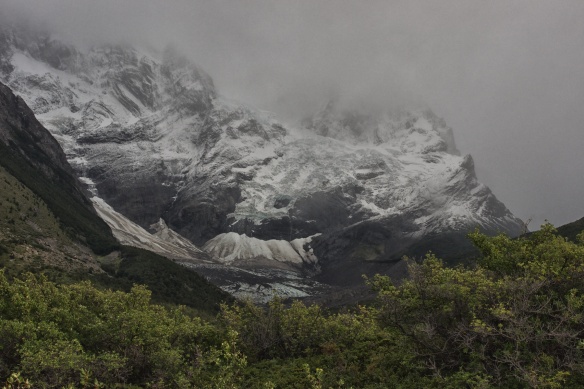
Seeing Monte Niete again was a reminder that I was almost done. Six days ago, I had walked up the Ascencio valley with Niete on the east side. Now I came at it from the west. Soon I saw the view you see in the image below- the collection of buildings belonging to the Hotel Las Torres and the Refugio Torre Central.
Some lines of T.S. Eliot I had memorized as a younger man popped into my head as I got closer to the place where I had started my walk a week before-
What we call the beginning is often the end
And to make an end is to make a beginning.
The end is where we start from…
We shall not cease from exploration
And the end of all our exploring
Will be to arrive where we started
And know the place for the first time.
What a fantastic walk! Seven days around the mini-cordillera that is the Torres del Paine, with six nights of camping. More time and better weather in el Valle Frances would have made it perfect. And now I sat in the dining area of the massive Refugio Torre Central with some other hikers- Israelis and Spaniards this time.
We were all waiting for the 4:30 shuttle bus, which would take us to the park entrance, where we’d transfer to the bus returning to Puerto Natales. And in the meanwhile, the cooks in the kitchen were good enough to prepare some food, even though it was not yet the official opening time.
———————
2018 Update – Another WordPress blogger does TDP!
For a current – and comprehensive – guide to planning your own TDP hike and a day-by-day account of what you will see and need to know, check out this trip report by a fellow WordPress blogger who goes by the name of Jon.
The Torres Del Paine Circuit – December 2017
He did the hike in December of 2017 (high season), and it is clear that things have changed since I was there at end-of-season in March 2012. His post will bring you up-to-date. I was struck by how many more tents and fellow hikers I saw in his pictures. I am really glad I went in mid-March!
Since I was there, among other changes, bridges have been built to deal with some sketchy sections and, unfortunately, fires have destroyed some of the tree cover on the trail to Refugio Grey from the Gardner Pass. However, the biggest change I noted in reading Jon’s report had to do with his statement that –
It is mandatory to attain all reservations for camping and refugio shelters prior to entering Torres del Paine National Park.
What a hassle! There was no such requirement five years ago; there was much less monitoring on the trail. Perhaps the greater control is due to some mishap that has occurred since I was there. As with the Annapurna Circuit in Nepal, it is easy to visualize total newbies unprepared for the realities of a hike, even a moderately demanding one like TDP.
Jon’s trip report has lots of great pix to help you plan your own incredible one-week to ten-day hiking adventure.
———————
Stingy Nomads on The TDP Circuit:
This website does an excellent job of planning your TDP Circuit, and it is one of the most current ones that I found in my quick google scan. Click on the header above to access – or see here.
Their post on the TDP Circuit has all sorts of practical advice and covers the following topics –
———————
My Other Patagonia Posts:
While some of the logistics and regulations have changed in the past decade, the stunning mountainscape and hiking possibilities that draw us there have not. See any of the following posts for more on a possible Patagonia adventure.
Chile:
- Southern Patagonia: Hiking Adventure at “The End of the World”
- A Traveller’s Guide To Punta Arenas, The Gateway To Southern Patagonia
- The Torres Del Paine Circuit: Patagonia’s #1 Hike
- Climbing Volcán Osorno In Chile’s Lakes Region (note: only a hike to the edge of the glacier; then it becomes more serious with technical gear and ice climbing required for the summit)
Argentina
Southern Patagonia – El Chaltén and Fitz Roy Hiking Trails
Northern Patagonia – Bariloche and The Hiking Trails of Nahuel Huapi
Base Camp Bariloche & The Hiking Trails of Northern Patagonia
- Day 1: Villa Catedral To Refugio Frey
- Day 2: Refugio Frey To San Martin (Jakob)
- Day 3: Laguna Jakob to Laguna Negra
- Day 4 (Laguna Negra to Refugio Lopez)
- Day 5 (Refugio Lopez to Bariloche)
The Hike To Refugio Otto Meiling – Getting Closer To Cerro Tronador

































I am leaving for Patagonia from NYC in just a few days and have absolutely loved reading about your journey, especially your time in TDP. Thank you so much for sharing your adventure.
I do have one question: were you able to bring your trekking poles aboard your internal flight, or did they need to be checked? Very curious how difficult it is to get around in general, and through airports in particular, with all the gear required of a trip like this one.
Thanks again!
Susan, my trekking poles were the typical collapsible ones; I put them in the checked baggage. I flew down with one large duffel bag and a carry-on bag. In the carry-on I had all my dslr camera gear and other electronics stuff- iPod Touch and the like. In the duffel bag I put my backpack, my tenting stuff, the food I was bringing, clothes, etc. Also in there were the trekking poles. The duffel weighed 45 lbs., including 2 1/2 lbs for the duffel itself.
When you get to Santiago you will have to go through customs with all your baggage. Then you have to haul everything to the domestic check-in counter for Punta Arenas. I think the baggage carts were free; that will be your best bet for moving everythng around. I agree that it is a bit of a pain to lug everything around- but it is only at the beginning and end of the trip. If you have a duffel bag with wheelies that might make things easier- but at the cost of a heavier duffel!
When I got to Puerto Natales I left the actual duffel and a few other things behind at the place I was staying while i did the hike in TDP. Given that everyone is there for the hiking, every hotel and hostel will be used to the idea of keeping stuff for you while you do the hike. When you come back you will probably spend another night at the hotel where your stuff is anyway so it is just good business sense for them to have a left baggage area.
Be ruthless about what you bring- and try your best to keep the weight down! But do bring the trekking poles- they will be invaluable as you negotiate the ups and downs of the trail.
Thanks so much!
My wife and I are from just outside of Toronto, and are looking at a trip to Torres Del Paine in early Feb/2015, so we’ve really enjoyed reading about your trip. Great details and great pictures, which gave us a real sense of the hike. If you don’t mind, we have some questions regarding the trek which we are hoping you might be able to help us with.
We usually bring our own food when we go on hiking trips, and we are wondering if you know of any restrictions with bringing food in to Chile. We usually bring freeze dried meals and packaged energy/sport bars? Do you know if this would be a problem?
We will probably tent on the trek, so do you know if there is a specific number to call or web site that we need to go to reserve camp sites along the route, or do you just book on to the trail and set up when we get to a designated camp site?
Can we use the facilities at the Refugio sites, (the showers and bathrooms), or are these only for people booked in to the Refugio? Can you eat in the Refugio restaurant without being booked in? Do you have to book in to a Refugio in advance, or can you just show up and pay for a spot?
We also noticed that there were grocery stores marked along the trail. Would you know what kind of food they stock, and would you know if there are any places to purchase iso/butane fuel for camp stoves in the park or along the trail?
Sorry for all the questions, but we wanted to plan our provisions and know what to expect along the trail. So many countries seem to manage their hiking trails/parks differently.
Thanks,
John
John – thanks for the positive review!
Re: your questions.
I did not experience any problems bringing my food into Chile from Canada. I landed in Santiago on a direct flight from T.O. and then got a flight to Punta Arenas. I should mention that I did not bring in any meat products or fresh fruits or vegetables – these are the items they are concerned about. Like you do, I did bring in dehydrated meals – the Bachpackers’ Pantry collection! I also brought in my usual oatmeal/hemp seed/chia seed/dried cranberries/raisins mix as well as energy bars and drink mix. Most of it was still sealed in the packaging it came in. Some posters on the net seem to have had issues but this was not my experience.
Tent sites are plentiful and you will not have a problem finding a place to put up your tent. There is not need to book a site ahead of time. You may not always get the choice location! As tenters you will be part of the “hardcore” contingent! It is definitely liberating not to have to worry about accommodation. I think your basic bunk in the refugios is now going for $75. a person. The tenting fee is around $10. Included in the fee is toilet and shower facilities and drinkable water.
I only brought four days of food along and used the refugio restaurant whenever possible – i.e. for breakfast and supper. No reservations necessary but it is helpful to drop in and look at the menu and let them know you’re interested. Again, it isn’t cheap but then nothing in southern Patagonia is so you just bite the bullet. The refugio food itself is nicely prepared. As a vegetarian I had a pretty easy time finding something on the menu to order.
The grocery stores along the trail is a new one to me – unless you mean the items that they may have for sale at the tenting sites or the refugios. Expect a limited selection and high prices. Much better to stock up in Puerto Natales before you set off – the town is used to hikers and their requirements.
I never inquired about a bed or a room in the refugios; given that I did my walk in March they certainly were not fully booked. If it was really miserable out I would have been tempted to make use the refugio but the only night it rained I was in the mud pit known as Campamento Italiano and it doesn’t have a refugio.
I too used a butane stove. You can’t bring the butane canister with you but you can get butane canisters in Puerto Natales. They may not be Primus but the fittings are standard so your screw on stove top will fit. Two tall canisters should last you the seven days on the trail. They may well be available within the park itself but I never asked.
Early February should be- but no guarantees! – a great time in terms of weather on the trail. If you have the 7 to 10 days I’d highly recommend the full circuit; the stretch from Dickson to Grey is much less visited and given your self-sufficiency you will get to experience something that most TDP visitors don’t – next to seeing the Towers of Paine themselves, standing on the Pass and looking at the Grey Glacier was my favourite WOW moment of the circuit.
I hope I’ve answered all the questions you posed. If there is anything else you are wondering about, just drop me a line.
Pingback: Puerto Natales – A Quirky Gateway to Torres del Paine | love.antoinette
This is an awesome resource! We’re doing the trek in November, along with Fitz Roy and Petit Moreno Glacier. We were going to try for Iguazu Falls, but it’s too far, and instead we’re going to find some more trekking/adventure around the south. Question – your pictures are beautiful – you say you brought a DSLR – What about lenses, tripods, etc. And how heavy was your backpack with all your stuff? Thank you so much!
You will have a great time down in southern Patagonia. I spent a week in TDP but could have spent a day or two more had the weather been a bit kinder and had I brought a tent that I had more confidence in to handle the wind. (My Big Agnes Fly Creek UL only weighs 2 lbs. and does a great job but the poles are really not meant for the kind of wind that Patagonia can see. I did manage to find spots to put up the tent where there was some natural shelter from the wind.)
Re: my camera gear. i brought a small point and shoot (a Canon Elph 100S) which I kept in my chest pocket in a zip lock bag. I’d often whip it out for quick shots of something that caught my eye. My Sony Alpha 700 (2007 vintage) also came along with a 16-80 Zeiss zoom and polarizer filter. I also had a Tamron 10-24 zoom which i used maybe 2% of the time. It was probably not worth lugging that extra pound of gear around TDP! I had a gorilla pod (8 oz) which I never used once! I kept my dslr – there are definitely lighter weight ones these days like my newish Sony A57- in a small Lowe Pro bag which sat in front of my chest so that even with my pack on I could pull out the dslr and snap a shot or two. If the camera is not easily accessible it becomes a big pain in the butt to stop and take off the backpack and open it and….
Having said all this, you don’t really need a dslr. I mean, it is great to have a very capable camera but in the end it is how you frame that shot that you’ve walked into that makes the picture pop. Take a look at the comments section of my post on Fitz Roy and El Chalten: Argentina’s Hiking Capital http://wp.me/p25mXk-ML and you will find a link to Kevin’s Facebook site with some stunning shots taken with a Canon point and shoot much like the second camera I had along.
When I flew down I had all my stuff, including my actual backpack, in a large duffel bag. It all weighed about 45 pounds, including 2.5 for the duffel and 6.1 lbs for the 80 liter backpack and maybe 8 lbs for all the camera stuff, including the Lowe Pro bag. I took the camera gear and other stuff in a shopping bag as carry on. BTW I found my ipod Touch very useful. There is wifi everywhere in the towns down there so it was great to be able to skype back home and search for weather info and other info while in Puerto Natales and El Calafate and El Chalten. The tent was another 2.5 with ground sheet, down sleeping bag was 2.5 lbs, enough food for four days was another 10 lbs. All told, on the trail I think my bag weighed about 40 lbs. I left the duffel bag and some odds and ends at the Erratic Rock hostel in Puerto Natales- and in El Chalten i left it with the people where I rented a room for a couple of nights. They are used to the idea of holding luggage for trekkers.
You’ve got a bit of waiting to do before take-off. Have fun planning a (fairly) lightweight pack and do spend the time working on your cardio and doing some strength training – anything for legs, back, and shoulders! The better shape you are in when you go down, the more you’ll enjoy it! You’ll be walking into some incredible photographs just asking to be framed.
motivating story. I am planning this hike. Looking for a map of this route and could not find on internet. can you map one? Also Looking for suggestions on training for this day hike.
Base of the Torres
Difficulty: High Walk length: 7 to 9 hours / 18 km Travel time: Outwards, 45 min. – Return, 45 min.
This world famous hike demands stamina, but the rewards are the impressive views of the three granite towers. This hike ascends strongly for one hour bordering the Rio Ascensio until reaching the Paso de los Vientos. From here it takes 30 minutes to reach Campamento Chileno where we can have a little rest. The walk continues to ascend through the forest for 1,5 hours, gaining altitude very quickly and with amazing views of the geological formations in the area such as folds, fractures and granite intrusions. The last hour is the most challenging and difficult, where the trail winds up thorough a moraine section of loose pebbles, there is exposure to the wind and where the weather is unpredictable. This excursion is hard and strenuous if you are not used to long distance hikes.
Kathy, your day hike is arguably the highlight of any visit to Parque Torres del Paine. You will be starting from the refugio or the pricy hotel at the beginning of the trail. It takes about four hours to walk up to the Towers. After an initial steady up section you come to a point where you see the Campamento Chileno down below you on the other side of the river. You walk all the way down to it on a gentle slope. Then after a walk along the side of the Rio Ascensio you cross the river again and head back up. the last bit is the steepest; the reward comes when there is no more up to do!
Re: training! Anything you do before you go will be a plus. Since it is a day hike you will have a very light backpack with rain gear, water, energy bars and other snacks, sun screen and maybe camera gear. Go on walks in your neighbourhood with 15 pounds on your back just to get used to it. I went up with all my camping gear and four days worth of food. The pack weighed a bit more than forty pounds.
Strength training is never a waste of time. Squats, leg presses, bench presses, lat pulldowns …anything to strengthen your legs, back, and shoulders will make the hike easier. The more time you put into upping your fitness level, the more you will enjoy your day hike to the Towers of Paine. (pronounced pie-nay and not pain as in hurt, which is what you’re trying to avoid!).
I recommend a pair of trekking poles. Learn to quickly change the length depending on the terrain. they should be shorter going uphill and longer going downhill. Check out this instructional video – http://www.youtube.com/watch?v=_x1jrboF3pc
What type of food did you bring down? We are planning a trip in December and are trying to figure out what we can take with us and what we cannot. Also did you make reservations ahead of time for your campsites?
Elise, if you are doing the circuit you will be able to buy meals at most of the refugios and camp sites. You can get breakfast and supper (and probably lunch too but I was always on the move during the day). It is not cheap but it means not having to carry the food. I brought four days worth of food along – oatmeal packs emptied into individual zip lock bags and supplemented with raisins, chia seeds, hemp seeds, cranberries, pecans – they made for a nutritious start to the day. I also had somne instant coffee and Coffeemate to meet my caffeine needs! You’ll also need a small cookset and a stove. I used a Primus screw on top and the butane canisters are available in Puerto Natales.
I brought a dozen Clifbars for energy during the day; I also had Wasa bread and a jar of peanut butter.
My four suppers were Backpackers’ Pantry selections; they are very easy to use and quite high in calories. You just add boiling water to the bag and zip it up again for 15 minutes and that is it – instant meal.
Whenever I could i ate at the restaurants run in the refugios. Check the post for some comments on what is available – I think I posted a pic of the menu at the refugio Dickson.
Enjoy your walk around the park. Best of luck with the weather! Do take a day or two longer than I did. I still regret not walking up the Valle Frances with my tent and spending a night at campsite at the top of the valley but the weather was truly rotten that day – and the camping area at the Italiano campgrounds did not have functioning toilets so I just wanted to get away from the mess.
Thank you!
De nada!
Really enjoyed your blog! I am 65, and my daughter and I are going to do the circuit this coming January. We did the Anapurna circuit a few years ago.
Questions: Was drinking water an issue? ( Did you have to purify?)
Was there electricity to recharge devices? (if so, what adapter is needed?)
Was there any internet in the park (for communicating with family)
Thank you, Tom
Tom, TDP weather in January is apparently the best but do expect a few more fellow walkers. Having your own tent will mean you will always have somewhere to sleep other than the refugios (if they are fully booked).
re: the drinking water. Not an issue. I did have a Steripen Adventurer which I used to zap the water just to be totally sure. http://www.steripen.com/products/
re: electricity. I don’t recall recharging anything in the park, although some of the larger refugios may have outlets. I did bring extra batteries for my dslr. I did buy an adapter for Chilean and Argentinian electrical sockets before I left Toronto and they worked fine.
re: internet in the park. The ultra-pricey hotels will have wifi for their guests but I am guessing that they would not be too enthusiastic about others using it. You will find free wifi in Puerto Natales and in Punta Arenas.
What I would suggest to keep in touch is a SPOT Connect paired with a smart phone or an iPod Touch. It would provide the folks back home with a up-to-the-minute track of your location. It also allows you to send messages of up to 45 characters. All of this costs – about $150 for the actual unit and then another $150. or so for the annual service plan with Globalstar. I’ve had mine for the past three years and I know my wife is really happy to be able to see where I am and receive daily “all is fine” messages while I am on canoe trips.
There is another newer device – the Delorme Inreach – which actually allows two-way communication – i.e. you can receive emAIL messages from home – but it is at least twice as expensive as the SPOT Connect option. I noticed that SPOT has just come out with a Global Phone for $600. + more for connection. Of all the options I know the SPOT Connect is the cheapest while still being effective.
Have a great time doing the circuit. It will be a different trip than the Annapurna Circuit. There is no cultural component to the walk at all but what is there is still amazing. Enjoy!
Very beautiful pictures and place.
I will be in Argentina in December/January and I would like to do the W trekking in Torres del Paine.
Could you give me some information about the difficulties of the trekking?
I’m a good trekkers but I have some problem to walk in path with precipices and I suffer a little of vertigo.
Thanks in advance
elisa
Elisa, the W trail is easy to follow and while there are some ups and downs there are no precipices to worry about. There will be other walkers on the trail if you do have any difficulties – you will not be alone.
If you are not in the best of shape right now, you have four months to improve your fitness level – walking with a loaded pack and some weight lifting (both lower body and upper body exercises) would help. This is not a mountaineering expedition and you will never reach any higher than about 1300 meters so acclimatization is definitely not an issue.
My #1 recommendation is to bring two – not one – trekking poles along and know how to use them properly. They will provide you will extra stability and balance and will transfer some of the stress from your knees to your upper body. Check out this link for some more info –
http://www.outdoorgearlab.com/a/11089/Ten-Reasons-for-Trekking-Poles
Since you are doing the W in high season it might be wise to book your accommodation at the various refugios now; they can be fully booked if you wait too long. If you are bringing your tent this will obviously not be an issue.
Buen viaje y buena suerte!
Awesome post. Thanks a bunch. I am headed there December 25 from Colorado. I fly into Buenos Aires first and then will head for El Calafate to Puerto Natales and to TDP. Awesome. I have a great OR rain jacket; lightweight down; alpine patagonia pants; and other gear. Do you have a list of gear you brought? Thanks,
AB
Andrew, you lucky guy! You’ll be hitting southern Patagonia in prime time – both in terms of weather and the number of other hikers you may see. you don’t mention if you will be camping in TDP – I did. I had a Big Agnes UL tent (2.2 lbs), a Thermarest NeoAir (13 oz) and a down sleeping bag (2.5 lbs). I also had a cook stove and some food. If you plan to make use of the refugio system in TDP you may be able to skip all of the gear I just mentioned, although I would be concerned about the chance of the refugio bunk spaces being all booked.
While you will, of course, have fantastic weather, do be ready for rain! The OR jacket is a must; so too are some Goretex or similar rain pants; the lightweight down will make a nice evening time top. Sun hat, water bottle, Steripen or water purifier…
I flew down with my backpack in a duffel; when I headed for TDP I left the duffel and some other things behind at the Puerto Natales hostal I was staying at (The Erratic Rock). Keep your load as light as possible – but bring everything you need! Dehydrated food you should buy in Colorado – I had some of the Backpackers’ Pantry selections. You can buy the butane canisters in Puerto Natales – there are a number of stores which cater to the hiking crowd.
Enjoy your hike.
Love this page! Great info! I was wondering if you could recommend any brands of clothing and the type of clothing needed? Also, are there any type/brand of shoes you recommend? I have been reading about the best socks to get as a I have Reynauds….where my hands/feet are always cold. So, I have to be extra careful!
Another thing, what did you cook while you were there? We are going to be camping to reduce costs. I figured we could bring nuts/dried fruits. But as far as food-food, what did you bring/eat?
Caitlin, I’m happy to see that my post has you thinking about a hike in TDP. I am hoping that you have already done a bit of hiking/camping near where you live – it is a good thing to have a bit of experience before you tackle TDP.
Re: clothing. Good quality gear is always better than junk. Think of what you’re getting as an investment; hopefully you’ll be using the gear you buy often in the coming years so you might as well get better stuff. Check out this site for good advice – http://www.outdoorgearlab.com
You need a good pair of hiking boots, ones that feel right on your feet. The above web site has all sorts of good recommendations. I am a big fan of Zamberlan boots, which oddly do not get mentioned by the gearlab site!
Re: food to bring along. Breakfast are easy. As I think I mentioned in the post, I brought packs of oatmeal along with nuts and dried fruit. That served as breakfast. I also brought a jar of peanut butter and dried bread (Wasa or Rye Krisp) and Gatorade. Backpackers’ Pantry has a number of quite edible suppers available. You could always eat at the refugios and campamentos when possible but it isn’t cheap! You can easily spend $50. a day per person on prepared meals. Chile is one of the more expensive countries in South America – the prices are pretty much what they are in North America.
In the end, there is nothing you can do about the costs but pay what you need to – the reward is some stunning scenery, which is why you’re going there!
Thanks for your reply and for the advice! One more thing….you think it`s possible to do the W trail in 5 days tops with four people who have never hiked/trekked before? I live directly in the center of Chile so I am thinking to start trekking and hiking around here in the mountains and hills to get my shoes broken in and to get used to trekking with a bag.
Caitlin, it is difficult to say how everyone will respond to the walk! If they didn’t really want to be there in the first place, they could get a bit short-tempered. It isn’t really the place to go to find out if you like walking all day for five days! BUT … if they are in reasonable shape, up for a challenge, have the proper gear, can handle the fact that it may well rain on them for a day ( or two!) and want to experience a wonderful slice of Chile’s natural beauty, then they should be fine.
I did not do the W when i was there but here is what I might do if I were to do the W in the future –
Suggested itinerary for four nights / five days the TDP W
1. take the bus to TDP from Puerto Natales and then the mini-bus to Refugio Torre Central . Check in and leave your bags there. Then hike up to see the torres themselves and walk back to the refugio and a good night’s rest.
You would need to get an early morning bus to get you to the park by noon. It would be a longish walk but you would not be carrying your packs (except for water, camera, rain jackets, snacks)) (6 or 7 hours)
Another way of doing it would be to walk to Refuio Chileno instead of Torres Central and get beds at Chileno and then go see the Torres. Return to Chileno for the night. This would be shorter but you’d have to carry your bags . If you pack right this should not be that much of a problem.
2. short day’s walk to Los Cuernos where you can stay at the refugio for the night (4 to 5 hours)
3. walk to Campamento Italiano, leave your bags there, walk up the Valle Frances for some stunning views, and then back down, collect your bags and walk to Refugio Paine Grande. It is a beautiful hostal with an excellent restaurant. A longer day than Day 2.
4. Walk up to Refugio Grey and then return to Paine Grande for second night…
5. Get the boat to Guarderia Pudeto in the morning and the bus back to the park entrance for buses going to Puerto Natales.
*** You could let someone else take care of all the details for you and pay a bit more money. If you are new at this, it might be the thing to do. Check out this link for a reasonable price – but not cheap…nothing in TDP is inexpensive!….
http://www.fantasticosur.com/en/w-circuit/w-circuit-regular/
Good luck in your planning and your exercise campaign. the idea is to suffer now so that you won’t hurt when you do the hike!
As someone who completed the W last year (and who got a lot of great advice on this blog!), I just wanted to mention to Caitlin below, who’s trying to do the W in 5 days, that the day from Cuernos to Paine Grande, heading up to the French Valley in the middle, is a good 9-10 hours of trekking, so at least double the 2nd day (the walk to Cuernos). Additionally, to Grey and back from Paine Grande is a good 6-8 hours.
Just wanted to make sure Caitlin had some accurate timings on those sections, so she and her group could start doing appropriate practice hikes!
Cheers!
Sue, thanks for the input. You added some needed information that should give Caitlin a better idea of what it is they are taking on. I’d felt a bit uneasy with my initial response and had been contemplating editing it for the past couple of days. Without a doubt the third day will be a long day. What sort of shape they’re in – and the weather – will play a big role in how it goes.
Another thing that I should have emphasized is the need to prebook the bed space in the various refugios to ensure a place to sleep. I was assuming that a group that has never done a long hike before was not planning to camp each night.
In the end, the best thing for the group to do is take a package like the one I provided a link to in my original response. That would eliminate all the organizational worries and let the group focus on doing the walk. Any time they spend before the hike upping their fitness level and feeling of ease with walking with a twenty-five pound (12 kilos) pack on their shoulders will be time well spent.
Thanks for the advice! I really appreciate it! We are planning on camping and eating all breakfast and lunches with the food we bring. We plan on eating dinners at the refugios. Also, we are a group of 4 so, we are planning on bringing 2 two person tents because we are worried that if we get caught in a rain storm in the middle of the trek that we might want to take shelter. Do you think that it necessary? Or would it be better to rent the tents at the refugios? Is it necessary to make the camping reservations now, or can you just arrive and pay? Thanks again for all your great advice and help!!! Caitlin
Caitlin, your trip will require more planning if you intend on bringing your own gear – i.e. tents, sleeping bags, cook gear, food, etc. The more you have already done something like this – and the more of the gear you already have – the easier it will be to do.
Putting up your tent in the middle of the day to escape a rain shower is not the way to deal with bad weather. Much better to have quality rain gear – top and bottom – and walk through the rain to the refugio where you will be spending the night. There you can put up the tents or get beds if they are available.
You do not say when you are going so it difficult to say if reservations would be necessary. If you are going in the December to February period you can expect things to be busy – that is why it is advisable to pre-book your bed spaces. The problem with this, of course, is that you are then committed to being at a certain place on a certain day. This requires a lot of planning – and a little bit of good luck for everything to unfold exactly as you hope.
Also, the later in the day that you arrive at the refugio, the more likely it will be full. In that case the tents – either your own or rented- would come in handy. When you arrive, the rental tents are usually already up and ready.
I went in March and TDP wasn’t quite as busy. I had my own tent and only used the refugios for breakfast and dinner.
If I were you – given the lack of hiking and camping experience of the group – I’d go for the organized fantasticosur option and let someone else handle all the logistics. You will end up spending more money but you will eliminate a lot of potential problems.
Whatever you choose, I hope you have great time on your TDP hike.
your blog is fantastic! I can’t wait! Could you advise if you got any permits in advance or were you able to just show up at the trail head and start hiking?
Ah, lucky you!
Re: the entry permit. You get it when you get off the bus from Puerto Natales at the park entrance. Here is the word from what I think is the official park web site –
The fee for foreigners is $ 18.000 chilean pesos (USD $38), or $ 5000 for chileans (USD $10,5) in high season, in low season the fee is $5000 (USD $10,5) for foreign tourists and $ 3000 (USD $6) for chilean people; this is a one-time fee regardless of how long you stay.
Enjoy your time in TDP and take lots of pix. Send me the link if you upload any of them. I want to see what the park looks like when the sun is out and shining!
OH? so you didn’t get a DIFROL permit in advance? did you have to provide proof of medical insurance?
Christa, the DIFROL permit is for full-out mountaineering expeditions! See here
http://www.difrol.cl/index.php?option=com_content&task=section&id=12&Itemid=27&lang=english
You are going for a long(ish) walk in TDP park. While you need to take certain precautions and be prepared for foul weather, it is definitely not a mountaineering expedition. There are organized campsites and refugios all over the place and the trails are very easy to follow. If you are going in prime time (December-February) you will be sharing the trail with people ahead and behind you – a built-in safety mechanism. The $38. is all you have to worry about, though the refugios and the meals they serve are (to no great surprise) fairly expensive. Make sure you bring lots of pesos or Yankee dollars!
Ah. there is so much information out there it’s hard to distinguish what applies to TDP. This is where i got the information re permits:
http://www.erraticrock.com/information/information-articles-1/torres-del-paine-climbing-permits/
Thank you for all your advice! very helpful!!
No ropes, no ice axes, no crampons, no harnesses… just a trail walk around TDP if you are doing the circuit. The highest you’ll get is Gardner Pass at about 1400 meters (4000 feet) as you walk from Campamento Los Perros to the Campamento Los Guardas.
Erratic Rock is the hostel where I stayed for a couple of nights before doing my TDP hike; I also stayed there for a night on my return. it is an ultra-budget place but very friendly and helpful – a great place to get advice. It is run by some people from Oregon.
Another question for you as we get closer to our January 2014 hike of the circuit! What kind of gloves should I bring. I have a light pair for biking/winter golf and a heavier pair for snow skiing.
I’m thinking that I will only need the light pair at this time of year. Thanks again for your terrific blog. Getting excited!
Tom
Tom – go with the light pair. The heavy-duty winter gloves are overkill. If the light pair are just fleece you may consider getting a light gore-tex or waterproof over mitt just in case it you run into a cold rain- or snow! You’re not mountaineering at altitude but southern Patagonia weather can be a crap shoot. January is usually the best month of all so good luck! In a pinch a wool sock on each hand will keep things warm – even if not dry! Slip plastic bags over the socks and they’ll be okay!
Hi
Great advice! Thanks.
I want to complete the W circuit, but I’m sort of stranded because the only time I can go is between May 7-14. Is that an absolute no? The websites seem to suggest it’s going to be freezing and the trails may be covered up.
Any advice?
Anon, May doesn’t really look very promising. Take a look at the historical averages for TDP –
http://www.myweather2.com/City-Town/Chile/Torres-Del-Paine-National-Park/climate-profile.aspx?month=5
The temperature range, the wind levels, the rain and snow levels all look to be challenging. The fact that the refugios are closed on April 30th should also tell you something! See here for the fantastic sur info –
http://www.fantasticosur.com/en/mountain-lodges/fechas-de-apertura-y-cierre-de-los-refugios-fantastico-sur-2013-2014/
I don’t know if you are planning to do this alone, if you have any experience with cold weather camping, if you have the right gear (tents, sleeping bags, cook gear) for such an undertaking.
Since the refugios will be closed you will have to be self-supporting. Who knows? May be the weather will be perfectly fine and you will have a great time! I would not count on it though.
I don’t know where you are coming from but here is my advice. Save TDP for another year when you can hit it in season. Take a look at the Inca Trail for a fantastic one-week adventure. Or head up to Huaraz in the Cordillera Blanca and hike the Santa Cruz Trail – it offers some stunning views and the weather should be much better! You’ll be at the beginning of the season up there in Peru.
See some of my other posts – this one will be a good start –
if you want more info on the Inca Trail or Huaraz trekking options. A week is not a lot of time. Have fun and be safe whatever you decide.
Hi,
Terrific information. Planning to trek TDP during first two weeks of March, and am trying to prepare for the weather, as it seems it changes quite a bit from February. Regarding clothing, what would you recommend regarding jackets for warmth (fleece, light-weight down, medium/heavier down)? Will have a rain (Goretex) jacket and similar pants, but I am concerned about cold temperatures. You mentioned light gloves to the person traveling in January – true for March too, or a pair of ski gloves as well? Thank you for the tips on trekking poles and camera size (I was thinking of taking a DSLR, but may stay with a Canon Powershot to keep it light, easily accessible, as well as to reduce the risk of damage from rain/weather). Also, how did you protect your gear inside your pack from rain?
Thanks again!
AF, lucky you! I hope the weather gods are kind but it is wise to be prepared for the worst. You definitely want Goretex (or similar quality) rain pants and top in case of rain and wind. Other than that, multiple layers underneath the outer layer is the way to go – base layer, fleece mid layer, fleece or wool hat, and gloves. Ski gloves may be overkill but they will do the trick if need be. I had a double layer Outdoor Research pair of gloves with a goretex outer and fleece inner. Fleece gloves alone do not cut it in the rain! Spare plastic bags will serve to protect your wool-sock-covered hands if you have nothing else. All my gear inside the pack was inside large or extra-large plastic ziplock bags that I got at the local supermarket.
Re: camera. I had a small p&s in my chest pocket inside a ziplock bag. I did also have my dslr – sometimes in my pack and sometimes (in good weather) in a Lowe Pro bag in front of me. How much camera gear you bring along will depend on how obsessed you are about taking pics and how much other stuff you are carrying! I am bringing both my dslr and five lenses as well as a p&s to Sri Lanka next week – but it is an organized tour so I won’t be carrying much except for my camera gear. Plush, eh!
I had a silnylon pack cover; I also had a garbage bag as backup. At the campsite I’d put my pack inside the plastic garbage bag at night and leave it in the vestibule of the tent.
Hi,
Thanks for taking the time to create this blog/post – a lot of useful information, and better yet you keep it alive responding to questions.
We are going in November 2014, for 6 days/five nights “W” hike, camping and avoiding as much as possible the Refugios, as we prefer more of the wilderness type of camping.
With that said, it has been a bit difficult to find information about Campamento Britanico and Japones . The last one seems to be just for climbers, but I read somewhere else that Britanico is closed. Can you confirm anything about both?
our itinerary should place us on day 2 – (starting from Paine Grande), as returning from Refugio Grey, either by PG lodge again or if we indeed leave early in the morning, by the Italiano – should we indeed try to avoid this one and got to the Britanico? 8 hours hiking is not too much, so it’s more related the worth of hiking another 2.45 hours to reach Britanico and overnight there.
On day 5 we should be already at Torres – or Japones if possible, as day 6 will be just a hike down to catch the 2pm bus to Laguna Amarga
last but not least, where you able to find any GPS mapping for garmin units? Yes, I know maps are better and barely needed – I just like to track down my ventures, and create overview maps with it.
Thanks
Anon, I’ve been on the road for the past month – Sri Lanka – so i missed your comment. I’ll try to respond to your questions.
1. November will be the beginning of the season; I was there in March, the end of the season. Prime time seems to be January and February.
2. Camping is only allowed in designated campsites. Making your own camp spot is not a good idea. they still talk about the Czech camper who set up his own camp site and started a fire that burned down 15% of the park! The camp spots are a part of the refugio area. It’ll cost you about $10. per tent each night. If you are doing the W there will be no way to avoid the refugios since that is where the tent spots are. The TDP hike is not really a “wilderness” adventure. A plus will be the fact that it will be the start of the season and there will be fewer walkers on the trail
Britannico was open back in 2011 when I was there but as I wrote in my post, the weather was so rotten that day that I decided against going up the valley with all my gear and tenting there. (i am not sure my Big Agnes Fly Creek UL would have survived given the wind and rain!) Apparently both Britannico and Japanes have been closed to camping since 2012 – they would both definitely be categorized as backcountry locations with no services at all. That was a good part of their allure! Let me know if you find out if they have been re-opened.
3. re: Itaiano or Britannico. Unfortunately, it may not be a choice you will be able to make if Britannico is off limits. That will leave Italiano as your base camp. You will put up your tent there and then walk up the valley to see Britannico with a day pack – best of luck with the weather!
4. re: gps mapping. I didn’t bring my unit with me. It would be nice to have a record of the exact trail you took but is probably overkill for the hike itself. The path is very obvious and if you wait ten minutes in one spot chances are very good some one will be passing by so there is no way you can get lost! They give out useful maps at the park entrance kiosk.
You’ve got a bit of a wait until November! Lots of time to do a trial hike or two with the gear you plan to take to TDP. Have a great walk and enjoy the stunning scenery.
Hello True North!
My daughter and myself (age 65) , fellow Canadians, successfully completed the Torres del Paine circuit in January, 2014 ,thanks to your help. It was a challenging hike…..trails were washed out from too much rain and the pass was “officially” closed because of snow and white out conditions. We managed to do the pass only because we joined a guided group of Brazilians who had a very capable guide that knew the route. Very exciting in the strong wind/white out conditions, but we made it!! We lucked out with some clear weather so we could take in the fantastic scenery. Saw a few avalanches to boot! Thanks again, for sharing your knowledge!
Tom, congrats to you and your daughter on doing the TDP circuit. Great walk, eh!
You definitely got much more challenging weather than the rain I had to deal with. Joining the other hikers to cross the pass was certainly the right thing to do. And just think – it was January! Prime Time in TDP and a white-out!
If you’ve uploaded some pix of your walk and want to share them, let me know the url and I’ll add it to my post.
Have fun on your next hike!
Hello, thanks for the great post.
I’m hiking the W trail West to East just before Christmas this year, I have a slight knee injury so I’m trying to plan staying at the refugios and hiking 5-7 hours a day. I am wondering what your thoughts are about potentially going from Gray > Grande > Cuernos (skipping Valle Frances) all on Day 2 – is that too long/difficult? I’d then go to Valle Frances from Cuernos and back down the next day – just to split it up a bit.
Many thanks,
Ngaire
Ngaire, it does sound like a long day but it could be done. I started at Campamento Grey and ended up tenting at Campamento Italiano and also walked up the Valle Frances and back to Italiano in one day. I remember Italiano being very dirty because of lack of toilet facilities the day I was there. I must say though – what a way to start with the W …doing half of it on Day One!
I take it that you want to stay at a refugio and none is available at Campamento Italiano.
An alternative would be to treat the walk from Grey to Paine Grande – mostly downhill- as an easy first day on the W. It would take you about three hours to do. The next day you would do the Valle Frances and then end at Cuernos. Next to walking up to the actual Torres del Paine, I thought the Valle Frances section was the most stunning of the entire TDP circuit.
Good luck fitting it all in – you still have three months to strengthen your leg muscles to make things easier for your knees. If you do not use them already, get a pair of trekking poles for your hike. They will make a big difference in how your body handles the stress and strain of the walk. See this website for the reasons why! The first time i saw people using them was in the Swiss Alps and I remember thinking – what a bunch of wusses! How wrong I was!
Hello True North!
I am looking to do an extended TDP trek (up to 12 days) and I was wondering if you could enlighten me on a few things.
On the maps that I have of the park, there are certain trails that are marked “with guide only”. After reading your blog post, I’ve been wondering if I really need to hire a guide or not for these trails. I’m specifically referring to the “Valle Escondido/John Garner Pass”. Why do they make them unavailable to hikers without guides? Are there actual dangers, or is it more of a useless precaution?
Thank you!
Alessandro
Alessandro, I’ve got the Zagier & Urruty map of the park and it does have the “with guides only” trails indicated. On the official park map, these trails are not marked. I would take seriously the “with guides only” indication. Given that the official Dickson to Campamento Paso via the Gardner Pass is already the most isolated section of the park, the route up the Valle Escondido and then down along the Rio Olvidado to rejoin the main trail is even more isolated.
I’d say you really have to know what you’re doing to go off on this side trail; having some means of signalling for help (like a Spot Connect) in case of injury would be useful. You would like to get the entire section done in one day. I spent a day going from Dickson to Paso and the Escondido route is a bit longer. I’d suggest you talk to the people at Erratic Rock, the hostel/information centre in Puerto Natales. “Useless precaution” or “actual dangers”? They will steer you in the right direction.
Good luck with your plans.
The one thing you can do – that I didn’t – is spend a night up at Campamento Britannico. The weather was pretty bad when i walked up there and my little Big Agnes UL1 was not strong enough to deal with the wind. Good luck with the weather!
True North: I love this blog post! The detail and information you’ve got in it is fantastic. Thank you for writing it!
I plan on going to TDP February 2015 and I have never done any multi-day trips (only day hikes) and I’m wondering if the full circuit will be too much for me to handle from a physical perspective. I do have a lot of time to get fit, but I’m afraid that having almost no experience may make it too hard for me.
Emily, lucky you! February down in TDP is the tail end of summer and the weather should be okay.
Re: how fit you have to be. You have three months to up your strength and aerobic fitness levels. The better shape you are in before you go, the more you will enjoy it. You do not have to be a super athlete to do this. One thing I would recommend is getting trekking poles and learning how to use them. They will make the ups and especially downs of the walk easier.
A suggestion – if you haven’t done a lot of (or any) camping before, why not this first time join a group. That way you have the leader/guide worry about all the logistics while you enjoy the walk the company of other walkers (or not – it is easy to walk on your own is that is what you prefer). It would obviously cost a bit more but it would be a great introduction to a lifetime of hiking and trekking and maybe even mountaineering that would take you to some incredible WOW places that few people ever get to experience.
A small group adventure travel company I have used before is Gadventures. They used to be called Gap Adventures but the clothing company of that name sued them so they had to get rid of a couple of letters!
Take a look at the Gadventures promo for their TDP Circuit trip to get an idea of a fair price –
http://www.gadventures.com/trips/trekking-the-full-torres-del-paine-circuit/SCPT/2015/
It ain’t cheap! But then again, southern Patagonia may be the most expensive place in all of South America to visit. It is of kind like their equivalent o the north shore of Alaska!
There are definitely other tours on offer out there. I checked the REI website and came up with a longer patagonia hike for almost $6000.!
Check out the erratic rock website. They are a Puerto natales budget hostel but they also offer supplies and guiding service to the park. See here for their offering –
http://www.erraticrock.com/expeditions/programs/torres-del-paine-q/
Of the two guided trips I provided links to, the erratic rock one looks pretty cheap! Chances are you will be expected to do more of the carrying of gear and supplies than with the Gadventures. Oddly, the Gadventures seems to fly you down to Punta Arenas from Santiago but not back at the end of the trip. This may be because travellers could move on to Ushuaia or El Calafate at the end of their TDP trip if they had more time.
It would be easier for you yourself to arrange to fly down from what I assume is the US or Canada to Santiago and then on to Punta Arenas. Two weeks would give you enough time to do the TDP Circuit and spend a day or two in Punta Arenas and get up to Puerto Natales and back.
Have fun on your Patagonia adventure. It will provide you with experiences you will remember for the rest of your life – and on which you can build future travels.
While you are down there I’ll be in Myanmar walking around pagodas and floating down the Irrawaddy River!
Thanks! Myanmar sounds awesome. I’m planning on spend almost a month in Patagonia (going to do TDP first, then travel north).
I haven’t been considering the guided tours mainly because of cost. I think I can get myself in good physical shape by then. I live in San Francisco, walk everywhere and we’ve got some steep hills! Camping-wise, I’ve camped as a kid, so I know how to pitch a tent and start a fire, but it wasn’t super remote.
Thank you for the info – I think I still might be up to tackle the full circuit 🙂 I will definitely get trekking poles!
Emily
You’ve got lots of time to get organized. One thing for sure – you will not be alone. You will meet fellow trekkers in Puerto Natales and on the bus on the way to the park or on the pretty-easy-to-follow trail. As long as you have the sleeping thing figured out you should do fine. Food is available if you don’t want to lug a whole bunch with you – though it is good to have two or three days’ worth just in case. Make sure you fill your packsack with thirty pounds of stuff before you walk up those SF hills!
I am planning to travel through south america. Starting in Santiago and working my way south towards patagonia and then heading north back to the USA. I have done extensive trekking, but debating bringing all of my gear (tent,stove,pad,etc.) as i will be traveling for 6 months or so i do not know how much trekking that i will be doing outside of patagonia mostly because i am not sure of the safety aspect (thieves). So my question to you is it worth carrying all the gear through south america? Do you think getting a camp pad and trap down there when i am ready to hike the circuit and the trail from chile to argentina will be sufficient? Is there other safe places besides patagonia to trek solo?
Matthew, if you’ll be on the move for a long time and if you will be hiking only for short periods, a full camping setup would be nothing but a burden. I’d say forget the pots and pans and all the cooking gear and maybe just take a lightweight compact sleeping bag – I’ve got a 2.5 lb. Western Mountaineering bag which I usually take. A tent and a sleeping pad – I don’t know. I guess it would all depend on how much hiking you are going to do. My Big Agnes Fly Creek UL weighs 2 lbs. and my Thermarest Air 14 oz. – both very light for what you get. As for safety concerns, it is always nice to put up your tent in a spot where there are other campers. In TDP and at Fitz Roy the campsites are all designated; you can’t just put up your tent wherever. While I did both solo I was never really alone unless I wanted to be.
In the hiking areas you can also rent a tent from the refugio connected to the camping area. In the Fitz Roy area you can use El Chalten as your base camp and do day hikes out of the village. The same would be true of Ushuaia, though I haven’t been down there.
Up in Peru there are some great hikes to be done in the Cordillera Blanca range. From what I have seen, Huaraz is the trekking capital of Peru and of all South America and there are a number of multi-day hikes you can do in the region. The Inca Trail in the Machu Picchu area cannot be hiked solo – permits and a tour group are required. The five day classic Inca Trail hike now costs in the $600. range.
I haven’t been to Bolivia yet but hope to get to La Paz one day soon and do some hiking in the Cordillera Real.
Of the areas in S.A. to hike, Peru and Bolivia will be the cheapest; Chile and Argentina are two of the most expensive countries in S.A., and southern Patagonia even more so. Have access to lots of dollars!
Really, for trekking possibilities and much lower cost I’d probably recommend northern India and Nepal. The scenery is if anything even more stunning and a bonus is the fascinating Tibetan Buddhist/Hindu cultural overlay you get to experience. Given your trekking experience you may already have been there and are looking for something a bit different. In the end, I’m sure a six month ramble in S.A. will generate a lot of WOW moments and some great encountered with the locals.
Here is a book that has given me ideas of treks to do – it would a worthwhile investment for you and may convince you to do way more hiking – enough to justify bringing all your gear along!
Andes: Trekking and Climbing: 26 Treks and 18 Climbing Peaks
Sorry for the rambling answer! Happy trails in 2015!
Awesome trip report! We head to Natales tomorrow and will hire tent etc there.
My main concern is food. I’m gluten free and can’t eat onions or garlic. Do you recall what food they served in the restaurants and if we xould buy rice to cook ourselves at any refugio?
Currently planning to take gf pasta but would be good to supplement with something.
Thanks!
Lisa, when you get to PN perhaps visit the Erratic Rock for trail info and for gear rental. They may also be able to point you in the right direction for your food requirements.
The only restaurant in PN I still remember is the El Living across from the cathedral. It is a veg-friendly place that I tried out a couple of times.
the only problem with regular rice is how long it takes to cook. You might want to find a quick-cooking version. The gluten-free pasta sounds like a nice option. Good luck finding it on the store shelves of PN! If you have already been down there for a while you should have a pretty good idea of what is available in most restaurants.
With the coming of March, the park should be a bit less busy since it is outside the prime time at TDP. Bed space in the refugios will more likely be available – but it won’t be as cheap as lugging all your own stuff – tent, sleeping bags, insulating Thermarest pads.
Good luck putting it all together. Enjoy the park and the ten sunny days of rain-free and wind-free weather that you are sure to be given!
Pingback: Torres del Paine: Sangue Suor e Beleza | mulher casada viaja
Pingback: Torres del Paine: Dicas práticas | mulher casada viaja
Thanks so much for this description.
I’m looking to head out there for two weeks in March with some friends, coming from the East Coast USA area. Hoping to do the full circuit as well.
A few questions — would be hugely appreciative of whatever insight you can offer:
(1) I see this was asked previous comments, but I keep reading conflicting reports elsewhere: Do you need to make reservations for camping, and can you camp the whole way through? I see that you referenced using some refugios, but it appears this was only for food (and perhaps showers?) I guess part of my confusion is that, if I’m reading the info correctly, along the full circuit some campsites are public and others are private and therefore require a small fee. So did you have to reserve any of these in advance? Someone on another forum mentioned that Cuernos booked up months in advance last March, and suggested that I reserve a spot now at either Cuernos or Frances (which I take it is the next closest camp site). So, what happens if you arrive and they’re full? Will they really make you hike another several hours to the next one?
(2) Besides the round-trip airfare and airfare from Santiago to Punta Arenas, I’m trying to figure out how much to budget for bus fees, food etc. Since we will just be doing the full loop and then heading home (much as I wish we got more vacation time!), would you say a $300-$400 is probably realistic? We don’t intend to use a guide or be doing any fancy hoteling along the way.
THANK YOU!!
Glad to hear your found my post useful! Other than the posts forcing me to do something with all the pix I take, it is nice to hear that my write-ups are being read by someone!
Re: camping reservations. No need, especially in March which is past peak season (Dec-Jan). expect to pay $10-15. U.S. for the tent spot – there are lots at the designated campamentos. Free camping is not allowed (officially) though I am sure people have put up their tents in non-designated spots.What is booked are the beds in the refugees, though in March you may be able to score a bed if the weather is ready bad. With your tent you will have no problems. It gives you excellent flexibility. I don’t think Campamento Frances has a refugio so there are no beds available; there is a caretaker’s hut and a muddy campsite and a cook shack for the tenters and not much more.
Chile is not cheap. The prices are pretty much what they are here in Canada. the $400. seems a bit low – maybe $600. or $700. would be better. You can always take more than you need and fly home with cash in your wallet! Try to bring as much of your freeze-dried/dehydrated food from home as possible. You can get gas canisters in Puerto Natales. Check out the Erratic Rock hostal for a cheap place to stay and the source of excellent info on the TDP circuit.
You absolutely do not need a guide. The trail is very obvious and there are other hikers walking it with you. I am assuming you have some experience in hiking/camping. Even if not, remember that it is a park and not wilderness area. No grizzlies or wild animals to worry about. The biggest thing to worry about is the weather. As my post makes clear, I ran into some rain and wind the last couple of days which encouraged me to cut the trip a bit short.
Good luck with your plans – It is only August so you have lots of time to get the gear together and up your fitness level a titch if you need to! Maybe learn a few words of Spanish! It is a walk you’ll always remember.
P.S. Send me another email if you have any questions I have not answered.
Hi,
Thanks for this very thorough (and fun!) account.
I’m looking to head out to the full circuit with friends for two weeks this coming March. A few questions that I’d be very appreciative if you could help answer:
(1) I realize this was asked in other comments, but I’m still reading on other forums that it’s advised to make reservations for some of the campsites. In particular, I was told that Cuernos booked up several months in advance last year, so was advised to either book there or at Frances (which I take it is the next closest option). Will they actually turn you away if they are full? It seems like the downside to this is that you have less flexibility regarding when you arrive at certain camps, but obviously we don’t want to get turned away and have to hike several more hours, either. On a related note, is there a difference between the private camps and the others? Are they all free, or do some require a fee? It seemed like you were at some of the refugios, but just used them for facilities and food (and still pitched a tent outside) — so it is feasible to camp the whole way through, then?
(2) Budget wise, besides round-trip airfare from the US and from Punta Arenas to/from Santiago, what do you think is a realistic budget, assuming we bring mostly our own food, camp the whole way, and take buses, etc., rather than cars (ie basically shoe string it)?
(3) Is 2 weeks enough time to fly in, hike the full circuit, and fly out? Wish we had more, but you know how stringent those US vacation policies are!
THANK YOU!!
Pingback: trip report: Torres Del Paine, March 2015 | travel to walk
Thank you so much for this blog. I read all your write ups about Patagonia and I find them very useful. Great details! I am a hiker and landscape photographer from Philippines and I’ve been planning to hike Fitz Roy and TDP circuit. Hopefully I’ll get a visa next year so that and experience this grand adventure on December 2016.
Francis, as my posts hopefully show, the landscape in southern Patagonia can be dramatic! Given that the Gardner Pass at 1421 meters is about as high as it gets, you get to experience the Andes without the altitude issue. And while you plan that, I can dream about a grand adventure in the Philippines!
Love this blog, its really been helpful to read all the commentary. Do you think a 60 yr old guy in decent but not great shape could do the W in 5 days/4 nights? I did a 4 day segment of the AT in Maine last summer averaging 9 miles a day. I’m a bit worried about the 12 hrs / 17 mile segment from Los Cuernos up the French Valley then on to Paine Grande. Would welcome your thoughts. Thanks.
Bill, I was 60 when I did the TDP Circuit! Sounds like you are up to it too. Not sure when you’re going but you probably still have a couple of months to up your fitness level a notch or two. Also the 12 hour/17 mile figures you mention seem a bit long.
One W trek itinerary I checked came up with this description of a day that starts at Cuernos Refugio and ends at Paine Grande –
Note the time and the distance! It seems a bit short!
Another source – the fantasicosur TDP map has the following distances –
http://www.fantasticosur.com/en/torres-del-paine/map/
Refugio Cuernos to Campamento Italiano – 1 hr – 2.5 km
Italiano to bridge to Refugio Paine Grande – 1 1/2 hr. – 3km.
bridge to top of French Valley and back – 5 hrs. – 11 km.
bridge to Refugio Paine Grande 2 1/2 hrs 7.6 km.
Total time: 10 hours to walk 24.1 km. The time estimates are usually pretty generous. I’d say the map figures are the closest to the real ones even if the 10 hours is a bit high.
The stretch from Los Cuernos to Paine Grande with a side trip up the Valle Frances would be a full day but do-able.
When you get to Campamento Italiano you may be able to leave your pack with the guardian there and just walk up the French Valley with your camera.
Bill, best of luck with your hike. Keep that pack light and good luck with the weather that Patagonia decides to dish out during your visit!
Thanks so much for your rapid response, and for the confidence booster! I got the time/distance from fantasticosur’s website http://www.fantasticosur.com/en/w-circuit/w-circuit-regular/ (Day 4: 10-12 hrs / 25.3 k) That is to go all the way up the valley to Mirador Británico, described “as one of the most overwhelming spots in the Circuit.” Wouldn’t want to miss that, but I can always shorten if weather and/or knees give out. Cheers,
Bill
Bill, the motto around here is “git ‘er dun”. I am sure you will too! One reminder – if you don’t use trekking poles yet, get a pair and learn how to use them. I say that as someone whose eyes used to roll when I saw hikers with poles walking by. They provide increased stability and balance and are great for the knees on the downhill.
Thank you for sharing your experience and details! My friend and I are planning to do the full circuit in early December, and doing our trek planning now.
A few questions:
1) We are planning to rent gear at Puerto Natales. Specifically a 2 person tent, trekking poles and sleeping pad (even a decent portable burner stove if we can!). I know you brought your own gear but from what you saw/heard from others/know, how is the quality of rented gear there? I would want a decent tent so I can still get some sleep, and rest among the Patagonia winds. Do you have recommended contacts/local tips who we can rent gear from (despite bringing your own)? Since we’re trekking in December, I would think it is better to reserve /call ahead.
2) Q vs O trek. From what I can find online, the Q trek recommended start is at the south end, near the administration center and then we’d hike up to Refugio Paine Grande (5 hrs). My friend and I could take the extra day to do that tail end (or tail start) but is it worth it? Did you meet hikers who did the Q and what did they think?
That’s all for now…
Thanks!
Santos, it has been a while since I was down there so I can’t speak with confidence about what is available. My one suggestion for solid information – visit the Erratic Rock Hostal. They have a space next door to the hostel where they hold almost daily information sessions about the TDP hikes and options. They also have rental equipment there. This website has the rental price list –
http://www.erraticrock.com/equipment/
December can be busy so you’re taking a chance if you leave it until you get there. If you reserved the gear you’d probably be asked to leave a deposit.
Q versus O? I think it was the folks at erratic Rock who came up with the Q but their website only has a description of the classic circuit (the O). If I had the time I’d do the Q! You could just spend some extra time on a rest day!
The one thing I wouldn’t do is walk the trail counter-clockwise. That stretch from Paine Grande to the Gardner Pass is much more manageable done clockwise – i.e. from Gardner Pass to Los Guardas to Grey to Paine Grande.
Thanks a lot! After doing some more online research, it seems many places rent out gear in Puerto Natales; we’re going to bring our own mostly but will rent a couple items there.
We decided on O trek, and spend the extra day to camp @ Valle des Frances 😉 Hopefully we get decent weather overall.
Cheers!
Nothing’s cheap in P.N. so if you can, bring gear, food, batteries, etc. with you! The O option will give you the most WOW for your time.
Send me the link to your pix when you post them and I’ll add it to my website.
Buen Viaje!
We are tight on time. How fast can we do the full circuit? is 5 nights / 6 days possible? If so, which camps should we skip?
Jeremy, while you could probably do it in 6 days it would depend on a number of factors: 1. how fit you are; 2. what the weather is like; 3. if you are bringing a tent. Let’s assume you both are really fit, the weather is fantastic, and you’re got a tent and all the other stuff you need. Then you could do this –
Day 1- Head right for the Serron campsite on the first day after getting off the bus. Day 2. Dickson; Day 3. Los Guardas; Day 4. Campamento Italiano Day 5. Los Cuernos. That would be five nights and you’d walk out to Torres Central on the sixth day. At the end of Day 4 or start of Day 5 you might (if your bodies don’t rebel!) want to walk up the Valle Frances for a look.
I did it in seven days but that included a first night when I walked from the start at the Refugio Las Torres Central up the Ascencio Valley to the Torres del Paine themselves and then camped at the Torres campsite. The next day I walked from there all the way to Serron campsite. So – had I gone up to the Torres on arrival I would have done it in five nights/six days. I was actually planning to spend longer in the park but the rain on the last two days – and a filthy Campamento Italiano – kept me moving.
A bit of a time cushion just in case would be a good thing. If you could find a day – or two – somewhere else in your itinerary it would take some pressure off. The hike is definitely worth all the time you allocate to it.
Pingback: O trekking: full circuit of Torres Del Paine | Bullet.Points
This is a great post. How much time in total (flight from america, hiking the circuit/Q, flying out) does this take? Also when buying airplane tickets do you have tips on scheduling flights? should i be concerned of missing connecting flights? Should I add an extra day or two as a buffer?
Andrew, I had three weeks for the trip. I flew down from Toronto to Santiago de Chile direct and then, after a four hour wait, I flew down to Punta Arenas. I did not spend any time in Santiago; nor did I go up to Buenos Aires. I spent all my time in southern Patagonia – a bit less than a week in Argentina, a bit more than a week in Puerto Natales and TDP, and the rest in Punta Arenas or in transit.
Re: scheduling flights – I like direct flights if possible because it reduces the chance of baggage going astray – and a duffel bag full of hiking gear and supplies would be difficult to replace once down there.
Re: connecting flights. Just leave enough time if possible between the flights. As I say that I think ahead to my flight to Tasmania on March 1- I have 90 minutes in LAX to transfer from an Air Canada flight from Toronto to a United flight to Melbourne! I sure hope I don’t pay the price for ignoring my own advice. It was not smart on my part- the motivation was saving $250. We shall see!
Re: buffer time. Not a bad idea. I did find myself with more time at the end of the TDP hike than I expected. I had planned to spend a couple of days more at TDP – nine days- but lousy weather had me walk out early. I ended up spending four days in Punta Arenas – maybe two more than I wanted. I got to know the place so well that I even visited the cemetery!
BTW – I’d forget the Q and just do the classic Circuit.
I almost missed my connecting flight from Santiago to Punta Arenas because I had to wait in an enormous line to pay the “reciprocity fee” charged to Americans. I believe it was $65 or so. You may be able to pay it online – I was able to do that for Argentina (which probably was not necessary – keep reading). I did something I have never done – panic, because I did NOT want to miss that flight, and I went up to the very front and said to the people at the front, “Sorry – security told me to come up to the front because my next flight is leaving in 10 minutes – sorry!” and they let me go. Then there was an enormous line at immigration. I figured I’m already going to hell, so I did the same thing. I didn’t miss my flight, but others in our group did and wound up spending the night in the airport. We took the bus to Argentina to hike around Fitz Roy, and the immigration into Argentina was at some in-the-middle-of-nowhere location that didn’t even have computers, and they didn’t even check to see if I’d paid the fee….my other friends (Brits, Colombians, Czech) didn’t have to pay any of this “reciprocity” – only US.
A very interesting blog. I’m leaving March 17 to do the circuit with GAdventures. It’s my 65th birthday present to myself!
What a great way to celebrate #65! Have a great time on your walk. I’ll be 65 in June. I am in Hobart, Tasmania and tomorrow morning I start my bike tour of the island. We gotta keep movin’!. BTW G Adentures does a great job with their trips.
It was indeed a great trip and I agree with you that it’s one of the best treks anywhere. We had great weather for 7 of our 9 days walking – and the other 2 it only rained in the morning. Grey Glacier from the pass is certainly memorable, and the towers were stunning the day we saw them. I’ve enjoyed rereading your blog now that I’ve been there. By the way, they’ve replaced some of the ladders with suspension bridges.
Thank you for fascinating post!
We are planning a trip to the TDP in October and I read that the weather should be fine. Is October a good time to travel? When you did yours?
Thank you!
Marcus, I was there at the end of the summer season in March. You’ll be there in October which is spring time in Patagonia. It may be a bit cooler than the prime months of December to February but there will be less people on the trail and in the refugios. See these two links for more info:
Fantastico Sur
TDP Weather Profile – October
Great planning resource, True North. Thanks for doing the work to post it all here. My wife and I are looking at doing something similar, but wonder just how feasible it is on your own in you don’t speak any Spanish? Can you comment on that?
Ray, while it would certainly be better if you could speak a couple of hundred words of Spanish I’d say you’ll survive! If you’re going in a couple of months you could even work on it a bit before you go!
If I were you I’d do the two following things –
1. Starting now (esp. if you don’t have lots to time!), consider the situations where you will be speaking to someone in Spanish. It will either be because you want or need something or because they want or need something. Learn the words to facilitate the different scenes you will face – airport, passport, help, toilet, room, bus, food …
Install the Google language translator app on your smartphone and download the files that will allow you to access the content when you are not connected to the internet. You type in the English, it provides the Spanish and you show that to the person.
Whatever effort you make to speak their language will be appreciated. It somehow also adds to your security and makes you seem less “the other” to your hosts.
BTW in the airport in Santiago the signs are in Spanish and English. Not sure about Punta Arenas.
The Erratic Rock Hostel in Puerto Natales – even if you don’t stay there (it is a pretty humble place!) – will be a great source of info on buses, trail conditions, route options, etc. They speak English. When I was there some young people from Oregon were running it. In all probability other places in town will also have staff who speak some English and are used to answering questions abut the park.
You won’t be the only ones with limited Spanish visiting TDP!
Enjoy your time in the park. Stunning scenery. Lots of great photo ops. And think of the Spanish you’ll be learning!
Ask away if you have any more questions.
Hi! I am planning to hike TDP together with my GF…we had done quite a few hikes in the US..now we are travelling to El Chalten and to TDP…is there any way I could get in contact with you?…Email? Facebook?…I am looking to get some first hand tips and recomendations.
Thank you SO much!
Francisco
Francisco, given your hiking experience you should have no problems dealing with TDP and the trails to the west of El Chalten. They are both well-travelled parks and you’ll be on the trails with other people.
Re: first hand tips and recommendations – I think I may have said it all in my Patagonia posts! There are also some excellent questions and comments from other hikers – both before and after their trips.You should check them out.
If there is anything not covered then by all means email the questions my way and I’ll answer them. My email address: true_north@mac.com
Hi, Thanks for the amazing post! I plan to do the circuit in March. My question is I have the same tent as you, did you find it sufficient for the weather there? I love how light it is, but I’ve yet to test it in nasty weather (California camping:). Thanks, Craig
I am off to the Bariloche area for some hiking in February and I still have not decided which tent to take – my BA Fly Creek 1 at 2.3 lbs. or my older and more spacious but 5.5 lb. Kelty Zen. I am leaning towards the BA for this hiking trip.
The Fly Creek was fine in TDP when set up in a fairly sheltered space and it will keep you dry. For my ‘Round Tasmania bike trip I decided on the Kelty because it is more spacious. Of course, I didn’t have to lug it on my back!
Given that March is past peak season, you do have a Plan B. If the weather is really crappy you will likely be able to get a bed in the refugio for the night and hope that the next day’s weather is better.
Best of luck with the weather! Send me the link to your pix or blog post when you get back and I will include it in my post.
HELLO
We are planning to go toTDP in March.Is there any bus from TDp to l Calafate rather than going to Puerto Natales ?
Marg
Hi,
Yes, there is a bus from TDP to El Calafate. However, I believe you’ll need to buy your tickets in advance (we did). You can contact a tour operator to secure the ticket for you.
It’s a fairly long trip; if I remember correctly, about 5 hours. So make sure to have some snacks to munch on!
Enjoy!
In any case, Puerto Natales is on the way to Punta Arenas so it is not as if you would be going out of your way. The only possible cost would be an overnight in P. N.
Map of route from TDP to P.A. via P. N.
Susan, do you remember the name of the bus company that did the direct run from TDP to P.a.?
Great post! I just want to share a report describing my trek on the Circuit in Torres del Paine in Dec 2017. It’s interesting to compare the pictures and see how the terrain has changed over the years! Here is my post: https://backpackersreview.wordpress.com/trip-reports/torres-del-paine-circuit/
Jon – Wow! What a great trip report! You’ve got everything from excellent advice and tips, maps, observations … anyone who goes through your post will be well-prepared for their own TDP adventure in 2018, as opposed to the March of 2012 that I think I did it.
Some things have changed but it still is one amazing hiking destination. Thanks for sending the link to your post – I will highlight it at the end of mine! In the meanwhile, keep on ramblin’!
Awesome – thank you and safe travels!
Pingback: Torres del Paine: Dicas práticas - Mulher Casada Viaja