
Table of Contents
Previous Post: The Savant River From Jutten To East Pashkokogan
- Route Overview Map and GPX file
- Day 8: From East Pashkokogan Lake To Greenbush Lake
- Day 9: From Greenbush Lake To Metig Lake
- Getting a Wabakimi Park Backcountry Camping Permit
- Day 10: From Metig Lake To Muskiga Lake
- Day 11: From Muskiga Lake To Burntrock Lake
- The Headwaters of the Palisade River system
- History of Wildfires in the Burntrock to Kenoji Area
- Day 12: From Burntrock Lake Down The Palisade River
- Day 13: Down The Palisade Almost To Kenoji
- How The Palisade River Got Its Name
- Looking For the Palisade Pictographs
- Day 14: Bush Plane Pick-Up On Kenoji Lake
- Day 15: A Visit To Armstrong Station’s NORAD Radar Base/The Train Ride Back To Southern Ontario
More Tripping Possibilities – A Paddler’s List of Wababimi’s Top Six
————–
Route Overview: East Pashkokogan to Kenoji

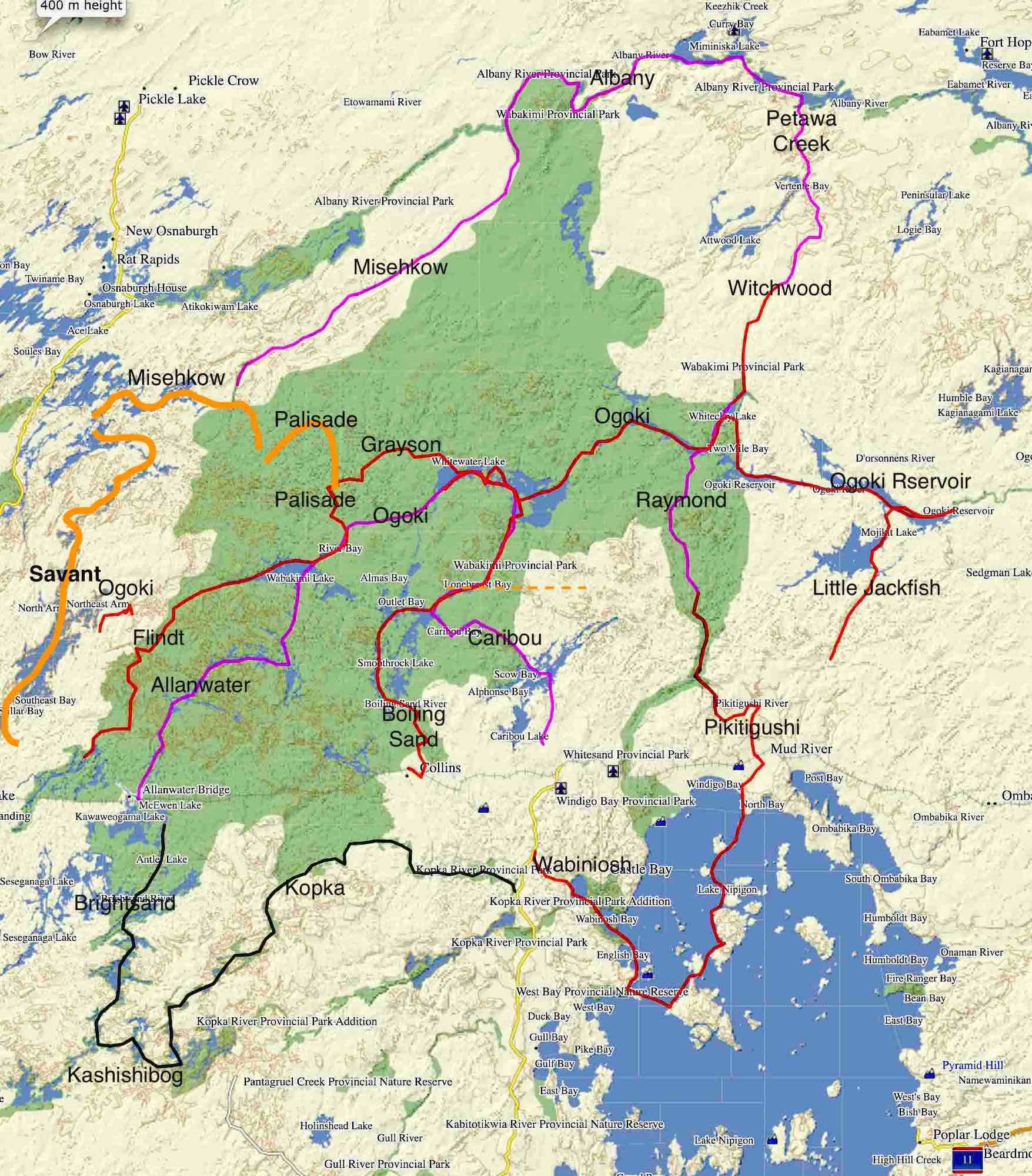
See the Maps and Info About The Route section in the previous post for full coverage. The following 1:50000 topo maps cover the Greenbush to Kenoji route. The links take you to the Canadian Gov’t Natural Resources Canada server.
My Caltopo folder has the entire route. Click on the Export button on the top left-hand side to download the file in various formats (KML, GPX, etc.).
Caltopo Map: https://caltopo.com/m/78CJN
————–
Day 8: From East Pashkokogan Lake To Greenbush Lake
- Date: September 7, 2023
- Distance: 9.5 km (from the start of the portage into Greenbush)
- Time: 3 p.m – 5 p.m
- Rapids: 0 Portages: 1 – P19 (East Pash to Greenbush, ~540m / 50 minutes)
- Weather: Overcast and cloudy, some sun
- Campsite: Greenbush north shore up from dock, inland about 30 meters, not a great site
- See NRC’s Toporama (here) for its current interactive coloured mapping and print what you need.
This trip report continues from where The Savant River From Jutten To East Pashkokogan ended. East Pashpakogan Lake marks the end of the Savant River system; it is also where we turned east. We had started the day in McCrae Lake; we would end the day halfway down Greenbush.

Day 8 – East Pashkokogan To Greenbush CS
As we paddled into East Pashkokogan Lake and into the southeast bay with its portage trail to Greenbush, we remarked yet again on the low water levels. Among other things, it made the start of the portage seem much closer to the end of the bay than it appears on maps. The sandy bottom meant we had a bit of mud to deal with before we got to the grass and the start of the trail. The oil drum is the “Welcome” sign! We stood it up again to make it more visible.
We saw some evidence of mining exploration that the area has seen over the past sixty years. [This page of the Ontario Geological Survey’s Mineral Inventory has details.] The 2.5-meter wide trail to Greenbush from the north end of East Pashkokogan’s SE Bay was one indication. That 40-year-old rusted oil drum at the beginning of the trail was another!


the East Pash side of the P into Greenbush

the portage is visible on satellite images!
It is an Australian company, Midas Minerals, which currently owns the property, which it acquired in early 2023. Describing itself as a “precious metals and critical minerals exploration company”, it has a webpage dedicated to The Greenbush Lithium Project, which covers a 102 sq. km. area. Of the project, the Midas managing director Mark Calderwood notes –
“Planned outcrop sampling should determine vectoring of mineralogy within these pegmatite swarms to prioritise new lithium-bearing targets. The Greenbush Project represents the first move out of Western Australia for the Company as it applies its extensive lithium expertise to identify additional projects.” [source]

The 2.5-meter-wide trail was in excellent shape with very little deadfall to deal with. The image above is of the start of the trail with the alders hiding the trail behind. In less than an hour we were chillin’ on the far side. Some planks line the last 15 meters to Greenbush.
 Zooming in on the above satellite image shows a clearing on the Greenbush side with a couple of light-coloured rectangle shapes. I was expecting to see a structure – a 10’x15′ cabin or a Woods walled canvas tent and perhaps a boat shell. I figured it would have served as a base for the mining exploration crew working in the area.
Well, there was no structure to be seen in September 2023! However, what looks like the frame for the floor remains. A flipped-over boat shell is parked on top of it.

With the canoe reloaded on the Greenbush side, we hauled out the Nalgene bottle and reached into our pockets for the zip-loc bag with our individual daily servings of the ultra-gorp that Max had created for the trip.
Greenbush Lake is the headwaters lake of the Misehkow River system. Back in 2013 we had bush-planed to Rockcliff Lake and paddled down the river to where it merges with the Albany River. The five-day trip on the river remains one of our Wabakimi favourites.
 Now we’d finally get to paddle its very top, beginning with the 9.5 km. from our put-in to a campsite our map indicated on the north shore about halfway down the lake. It took us two hours to get there; we pulled up to a rough dock around 5 p.m. A post-trip look at a satellite view of Greenbush actually showed the dock! The campsite – probably used by locals during moose hunting season – is about 30 meters into the bush from the shore and somewhat sunless and without a view.

It was definitely one of those “it’ll do” sites that you sometimes accept at the end of a long day. The next morning – an hour into the day – we’d paddle by and check out a much nicer site! See the pic below.
————–
Day 9: From Greenbush Lake To Metig Lake
- Date: September 8, 2023
- Distance: 18.4 km
- Time: 9:50 a.m. to 4:30 p.m.
- Rapids: Portages: two possible portages – P20 from Greenbush to Little Metig and P21 from Little Metig to Metig. Unable to spot the portages, we lined/ran both these stretches of the Misehkow River.
- Weather: sunny, cloudy
- Campsite: Metig Lake south shore point, possible for 2-3 x 4-person tents
- See NRC’s Toporama (here) for its current interactive coloured mapping and print what you need.

Day 09 Greenbush to Metig
A late start to the day – 9:40! – saw us paddle northeast for about 4 kilometers before turning to the east and southeast for the Greenbush outlet and its farewell set of rapids. On the way, we checked out the northernmost CS on the map above. Its lake view made it much more inviting than the one we had used the night before. A couple of plywood tables, tin cans, and a toilet seat a few meters in the bush are signs that locals make seasonal use of the spot for fishing/hunting.

We checked out one more marked campsite before leaving Greenbush. It was the westerly one of the two last sites on the lake. It has a fire pit and would make a decent spot to stop for the night.
Shortly before noon, we were at the top of the rapids out of Greenbush. After an unsuccessful search for the portage trail on river right – see the Paddle Planner map below for its supposed location – we did what we had done with almost every set of rapids so far on this trip. We headed down the river. The map needs to be revised to be an adequate guide to what is involved.
- It has the portage bypassing the easiest section of the rapids;
- it does not note the complications of the bottom half of the rapids.
The Friends of Wabakimi portage info has been the source of some confusion. Here is a comment by Jon Ontario from the Trip Reports Forum. He did the reverse of what we did – he came up the river from Little Metig Lake. Here is what he found –
Also didn’t find the portage from Little Metig to Greenbush and waded the river which I wouldn’t recommend. Portage should start where the river comes into Little Metig but I thought it was farther upriver based on the FOW map. [source]
If this section of the river should have a portage anywhere it is around the bottom stretch where we spent most of an hour.

Paddle Planner’s Friends of Wabakimi-sourced P info
Here is a satellite image of the rapids. I’ve annotated it with info from our GPX track to provide some context to what we faced. More water in June than the mid-September water levels we had may change the narrative!

It took us an hour to get down the Misehkow’s first set of rapids to Little Metig Lake. Unfortunately, the image below, taken from the very top, is the only one we took as we made our way down.
The image I wish one of us would have taken is the one where we each put on a 20-kg. canoe pack before we continued wading our way down the river, pulling and pushing our reluctant canoe along. The canoe packs being on our backs and not in the canoe did make a difference; it was also a first for us in all our years of canoe tripping!

the top of the rapids out of Greenbush
So after quite the workout, there we were in Little Metig Lake. Metig is one possible English spelling of the Ojibwe word for wood or tree.

We headed for a campsite indicated on the map below just above the start of two portages, a long one circumventing the entire 1-kilometer stretch of river, and a shorter one that oddly ends up not below but above a set of rapids.

We spent a half-hour looking for the portage but finally gave up. It was about 2:30 and lunch was definitely in order! Despite what we had just dealt with getting into Little Metig, we figured we had little choice but to accept more of the same low water/boulder garden drama in the stretch to Metig Lake. It is about 1 km from the campsite around the corner to the open water of Metig Lake. And then we’d be done.

local garbage dump at Little Metig CS
The CS is located at a spot popular with locals, who probably come here on a seasonal basis for fishing or hunting. The garbage dump on the edge of the site was the worst we saw on this trip. Maybe it will appear in some future archaeologist’s report as a midden.
We pushed off from our lunch spot and headed downriver, expecting the worst. We were down at the bottom in fifteen minutes!

Given our experience, it does make the purpose of a 600+ meter portage seem questionable. Even if water levels were higher and the current swifter, the three spots we lined could still be dealt with the same way and maybe even easier with more water. Most of those 600 meters are made up of the easily paddled mid-section. Turning again to Jon Ontario’s experience, this time going upriver from Metig to Little Metig, here is what he found –
Great route, very enjoyable even in low water. Cleared trails as I went. Most were pretty good except the one between Little Metig and Metig Lake. The Little Metig end was a mess and after looking at the river section it avoids, I would definitely wade the river…it looked quite easy. [source]
It sounds like he was able to find the 600+m portage trail up to Little Metig. He notes that the trail was not one of the better ones! He also refers to what I assume is the garbage dump at the campsite on the Little Metig end and notes that in retrospect, he would wade the river instead of doing the portage since the river “looked quite easy”. We’d have to agree with his assessment, especially for those paddlers going downriver!
 From Little Metig Lake and the Crown Land to the west of Wabakimi Provincial Park, we were now sitting on Metig Lake and in the Park and would be for the duration of our trip over to Burntrock and down the Palisade. See below for info on getting Park backcountry permits.
Not too long after crossing the western half of Metig Lake, we pulled up to a campsite on the southernmost point. We had covered about 18 km. and dealt with two sets of rapids – not a bad day’s work. Off came the L L Bean boots and wet socks; on came the dry stuff!

Metig Lake CS locations


Metig Lake CS
————–
Backcountry Camping Permits

Ontario Parks is responsible for Ontario’s provincial parks. See here for the 2024 Wabakimi backcountry fee schedules – one for non-residents of Ontario and another for residents.
Non-Residents:

Residents of Ontario:

When it comes to Wabakimi, you are not reserving a campsite. Instead, you are registering for a specific number of nights you will be camping in the park. It took a phone call to the Park Super for me to figure out how to make an online booking for Wabakimi since it does not appear in the list of parks under Backcountry.
To register online, go to the Ontario Parks website here. On the top of the page, clicking on Reservations will open the window to various options.
- Choose Reserve Online; the Ontario Parks Reservations page will open with some options.
- Choose the one at the far right of the page – Backcountry Registration – clicking on it will open a list of parks, including Wabakimi. Enter the required info, and you are on your way! Note: you will have to wait until 2 weeks before your arrival to register.
You can also arrange your permit by phone. The toll-free number is 1-888-668-7275.
The current Park superintendent is Shannon Lawr. He can be reached at 807-475-1634.
————–
Day 10: From Metig Lake To Muskiga Lake
- Date: September 9, 2023
- Distance: 13 km
- Time: 8:15 – 6:20 p.m. ( 10h! 4.5h on portages)
- Portages: 5 portages totalling about 2.7 km.
- 1) 325 m Misehkow P on river left
- 2) 255 m / 55 min into Davies L;
- 3) 850 m 1h30m into Timon L;
- 4) 250 m / 35 min No Name Lake
- 5) 1000 m / 1h37m (includes resting time) into Muskiga L
- Weather: overcast, cloudy with sunny periods
- Campsite: Muskiga Lake
- See NRC’s Toporama (here) for its current interactive coloured mapping and print what you need.

We had so far been spectacularly unsuccessful at finding any portages and had stuck to the river, lining, bumping, and floating our way down as gracefully as possible. We knew that this approach would not work on the day we had before us. Of the 5 portages to be done 3 go from lake to lake overland with no river in sight! On the plus side, we were now in Wabakimi Provincial Park. We figured it would mean that the portages would not only exist but be in better shape. The ones from Davies to Muskiga – portages of 800, 243, and 974 meters – were the ones we were most hoping would have seen some recent attention.
———–
Last winter in planning the trip, I sent an email to Bruce Hyer of Wabakimi Outfitters to see if he had a contact in the Savant Lake area who could do a shuttle for us. Unfortunately, he didn’t. And while we did not take him up on his offer of trip notes for our route for a minimum fee of $275 (more for complicated routes), we did note his comment that back in 2020 the portages from Rockcliff to Burntrock had been redone. That was certainly a welcome bit of news!
———–

We set off from our tent spot around 9 a.m. An hour later we were approaching our 1st P of the day. Shallow water slowed things down but we found the trailhead on the left-hand side of a much narrower stretch of the Misehkow River. We may have strung a short length of prospector’s tape on a branch to make it a bit more obvious


Deadfall in the water made the take-out a bit awkward but we were happy to see some evidence of recent chainsaw cuts.
P22 was walkable and 40 minutes later we were on the other side, sitting on the banks of the Misehkow. We figured if the crew had gotten to this one on the very edge of the Park, they would have done the ones leading up to it!

Off we went, paddling a short stretch up the Misehkow to access the next portage trail (P23 in our route count). It starts just a bit up the creek coming from Davies into the Misehkow and it took a few minutes to find.

P23 – into Davies Lake from the Misehkow

looking up the stream coming from Davies Lake

We walked up the stream you see in the image above and found the trailhead on the righthand side. The image below taken 15 minutes later looks down Davies Creek to where we had come from. Our portage into Davies Lake from the Misehkow came out to about 210 meters – the FOW count is 175m. I guess it all depends on what you take as the starting point, which may vary depending on water levels.

Now we were on Davies Lake and it was noon. We paddled over to the south side of Davies and found the start of the next trail, the 800-meter portage into Timon Lake. We were looking at one of the day’s two long hauls, our P24. It is marked on the FOW maps as an 800-meter carry. As before, we saw some reassuring signs of recent trail work.
Before pushing on, we stopped for lunch. I got the water boiling and prepped all the food while Max got a head start on the portage by hauling one of the canoe packs and a duffel halfway to Timon.
———–
What we do not have much of for this day are photos and a video or two. They would have clearly conveyed the current state of the trails. This was one of those days when we slipped into “gotta git ‘er dun” mode and forgot that as well as doing, showing what we were doing was one of our objectives!
———–

With lunch over around 1:30, it was time for more hauling. By 2:30 we would be on the Timon side of the portage.
Our GPX track shows a 916-meter distance for this portage. Knowing how precise and obsessive the Wabakimi Project’s Phil Cotton, was about trail measurements, it seems our number is off by 116 meters! Phil had the measurements done by tape, not trusting the GPS to provide the 100% correct number! Maybe lower water levels meant different takeout and put-in spots.
Still to go were two portages, including the single worst one of the entire trip! A short paddle down to the east shore of Timon and we found the trail which, 250 meters later, had us on the edge of a shallow and small nameless lake. We also found an empty gas can and a paddle, probably left by the Park trail crew.
We spent a bit under an hour to get there from Timon.

the final stretch of trail to no-name lake from Tmon Lake

A quick paddle along the north shore of the nameless lake and we were at the start of our final Portage of the day.
———–
From One Watershed To Another
The Misehkow
On leaving Davies, Timon, and the nameless lake and heading east to Muskiga we were also crossing a height of land. The water from the three lakes just mentioned flows into the Misekhow, which then flows northeast for 100 kilometers to merge with the Albany.
The Palisade
Meanwhile, our portage took us into the Palisade River’s watershed. Muskiga Lake empties into Burntrock Lake and the Palisade River, which flows into the Ogoki River at Kenoji Lake. Thanks to the Waboose Dam at the east end of the Ogoki Reservoir created in the early 1940s, 98% of this upper Ogoki River water ends up heading south to Lake Nipigon and Lake Superior via the Little Jackfish River.
———–
maskêk ᒪᐢᑫᐠ NI muskeg, swamp
The Cree word for “swamp” is muskek and that would describe the wetlands we crossed on our way to aptly-named Muskega Lake from Davies Lake. The portage trail was often no more than a one-foot wide rut in the ground but at least it was there and leading us to the eventual put-in on Muskega Lake.
We had a few reasons for dividing this final portage into three sets of 300-or-so-meter carries, with breaks at each end and further punctuated with short breaks at each halfway point!
- the 1 km. length of the trail,
- our increasing fatigue level,
- a lack of drinking water, and
- my still iffy right leg from a tumble a few days before.
It took us 2 1/4 hours to do. Unable to get the canoe up on my own, we came up with a system that had me underneath the yoke without straining my lower leg. The carries themselves were not a problem.

———–
H.B. Proudfoot And the Route From Kenoji To Osnaburgh House

As for that rut through the muskeg, it has been walked for at least a couple of hundred years. Back in 1900, a Survey Team was commissioned by the Ontario Government to catalogue the resources – mineral, lumber, agricultural, hydroelectric – of Northern Ontario.
Party #7’s leader was H.B. Proudfoot, whose team spent the summer rambling around the north end of Lake Nipigon. Among other routes, his team essentially did our trip from Greenbush to Kenoji in reverse. It was one of their local Anishinaabe – i.e. either Ojibwe or Cree – guides who showed him the way to Osnaburgh House and the Hudson Bay Co. post there.
From Wahbahkimmug (i.e. Wabakimi) Lake we travelled to Osnaburg House. The portage route thither runs from a long bay at the northeast of Wahbahkimmug Lake (referring to the Ogoki Outlet Bay), follows Pike River (i.e. the Ogoki River from Wabakimi Lake to Kenoji Lake) , running out of the above lake. through Pike Lake (Pike is the English translation of Kenoji), up the Palisade River and then by a series of lakes and rivers to the Albany River and Lake St. Joseph. There are twenty- three portages, all of them well marked and good, with the exception of a few muskeg portages, which were very wet and hard to walk over. Between Pike Lake and these muskeg portages the scenery is grand, granite cliffe from fifty to one hundred feet high. (source ,p186)
Proudfoot and his team also produced a map of the area they surveyed. Included is his route from Pike Lake up to Osnaburgh House on the Albany River system. Missing from the map- but used in his report – is the name he came up with to describe the river they ascended from Pike Lake to Burnt Rock Island Lake.

———–
Now we were walking the last of those muskeg portages! Luckily for us, they were dry and fairly easy to walk on. At 6 p.m. we were done and fifteen minutes later we pulled up below the only Muskega Lake campsite indicated by our map –


Muskiga Lake CS
————–
Day 11: From Muskiga Lake To Burntrock Lake
- Date: September 10 2023
- Distance: 7.3 km
- Time: 9:20 – 12:45 (3h 25m)
- Rapids: 2- lined/ran + Portages: 1 x 160 m (20 min) then another 40 m (30 min)
- Weather: overcast
- Campsite: up the hill; usual 1 good 4-person spot maybe 2; room for more 1-2 person tents
- See NRC’s Toporama (here) for its current interactive coloured mapping and print what you need.


the bush behind our Muskiga campsite – a lot of lichen for those woodland caribou
We were expecting an easier day than our five-portage haul of the day before. We took another look at our map with the Paddle Planner/Wabakimi Project Portage info on it. While there were four of them, they were all quite short and bunched together. We figured we’d be sitting in Burntrock by noon.
While we did get the timing right, the reality we were seeing on the river did not always match what the map was telling us. As shown by the actual portages that we did (the red lines on the map), for a couple of them our take-outs and put-ins didn’t really match up. Water levels may have been different; we may have had to take out in a different spot.

—————
The first two mini-challenges of the day (our P27 and P28) took us about 45 minutes to get past.

As we approached the first one of the day we were faced with a long stretch of boulderly river bed with not enough water to float the canoe.

The highlighted section of our GPX track shows the stretch that we ended up hauling our canoe and gear over to get to the other side and some open water.


P27 – the first portage out of Muskiga Lake
Then it was an easy paddle down a floatable section of Muskiga Creek to the 2nd of the mandatory portages (our P28). 20 minutes later we were at the put-in on the downside of P28. On both portages, we had seen evidence of chainsaw cuts on deadfall crossing the trail. We did wonder how long ago the crew had passed through, given the alders on the side of the trail which needed a haircut.

Neither the NRC topo nor the Garmin Topo maps make it clear, but there is a 750-meter stretch of the Creek you can paddle once you put in. It takes you right to the third of the portages into Burntrok from Muskiga.

The red lines on the satellite image below show what we portaged to get to the end of Muskiga Creek and into Burntrock Lake.

our P 29 and P30 into Burntrock Lake

P30!

P29
As you can see, the Garmin Topo Canada map is a bit off on P30! The Portage involves an awkward take-out on the edge of the beaver dam you see in the image below. Then it is up and over a rock dome to the other side and an equally awkward put-in. We got it done fairly quickly and then took some time to take in the view.

We also looked for an alternative 177-meter portage that fit the one that appears on the Paddle Planner map. The thought was that maybe it was meant to avoid the rather steep take-out and put-in of the 35-meter one we had just done. We did not find anything.


our canoe sitting in Burntrock Lake just around the corner from the beaver dam
—————
The Palisade River Headwaters
Whatever the case with that Paddle Planner portage info …we were on Burntrock Lake and only had some flatwater paddling to deal with. Now we were also officially on the Palisade River. Burntrock is the largest of the lakes that make up the Palisade River system. However, the Palisade’s actual headwaters lake (another of the countless no-name lakes of the Canadian Shield!) lies a few more kilometers to the west.

Palisade River headwaters – see here for a view of the entire river
—————
Evidence of Wildfires Past and Present
Coming into Burntrock Lake also brought back memories of a 2011 canoe trip route we had to alter in a hurry because of a massive wildfire which had just started on the east side of the lake. The fire history map shows the extent of that 2011 burn. It also shows that the area has seen many significant fires in the past 30 years, perhaps none as big as the 2023 fire (263 sq. miles or 681 sq. km) which had us consider cancelling our trip until the Park reopened the Burntrock area again in mid-August.

For the remainder of our canoe trip, we would paddle past long stretches altered by one wildfire or another. Along with the still-standing charred trunks of some skinny black spruce, we would also see new growth starting a new boreal forest cycle. However, with climate change, the new normal will see many more fires in the north. Tinder-dry deadwood on the forest floor, more lightning strikes, heat domes, wind storms ….the 2023 fires in Alberta, Saskatchewan, and northern Quebec were not one-off events.

fire history overview of the Wabakimi area – map source
See Northern Canada Wildfires And Canoe Trip Planning in Part 1 of this trip report for some overview maps and more.

burnt rock, burnt trees, and new growth on Burntrock Lake
—————
The map below indicates two Burntrock Lake CS locations, a surprisingly low number for a lake I always figured was a popular trip destination. While we never did get to it in 2011 due to that fire, it was nice to have finally arrived! Five kilometers later – about an hour’s paddle – from our put-in by the beaver dam, we came to the site located on the south side of the lake, not far from the Palisade outlet. It was time for lunch – and we were already done for the day!

————–
Day 12: From Burntrock Lake Down The Palisade River To The Big Bend
- Date: September 11, 2023
- Distance: 16.5 km
- Time: 9:30 a.m. – 5:45 p.m.
- Rapids/Portages:
- 1) P31-P32 290 m (30 min);
- 2)P33 – lined this one
- 3) P34 120 m (40 min); very scenic spot
- 4) P35 290 m (30 min + lunch/rain 1.5 hr);
- 5) P36 280 m (40 min).
- Weather: Overcast, cloudy and sunny plus a light shower at lunchtime
- Campsite: lots of room for 1/2 person tents, some 4’s but not hammock-friendly
- See NRC’s Toporama (here) for its current interactive coloured mapping and print what you need.

Day 12 – From Burntrock to the Palisade’s Big Bend
With its elevated view and room for our 4-person tent, our Day 11 Burntrock campsite scores an A. Now it was time to move on. The day’s moderate goal – a tent spot on the Palisade’s Big Bend where it curves south.

We had five potential portages to deal with on our way there and ended up doing all of them except the one labelled P33 in our numbering scheme. We would see increasing evidence of past wildfires as we made our way, beginning with the fire from 2011.

Burntrock Lake – towards the P out of the lake
—————-
The First Portage(s) Out of Burntrock…290 meters
 We paddled up to the top of the rapids and the first possible portage of the day , hoping that we would be able to line our way down. Low water level and too many rocks to be able to coax our canoe downriver nixed that idea. Figuring the next set of rapids would not be much different, we turned around and went into the small bay and the trailhead of a carry that bypassed both of the portages. At 290 meters, it was a bit longer than the sum of the other two but it meant we’d only have to empty and load the canoe once.

—————-
P33 – Less than two kilometers down from our put-in we came up to another constriction in the river (see the very middle of the sat image below) and another choice to make. This one was easy – we started off on river left and lined our way down. More water would have been nice but we were through in a couple of minutes.

P33 – lined
It looked like there was the beginnings of a beaver dam at the top.

looking down the rapids at P33 – an easy lining job
—————-
Portage #2 of the Day (our P34) ….100 meters
Another kilometer and a ninety-degree turn to the east and we were at the take-out for the next bit of hauling – a 120-meter carry which bypasses a set of ledge falls and an impassible stretch of river near the bottom.

P34 bypasses these ledge falls just to the south of the very top of the portage. The water then flows into a mini-lake before squeezing out through some big boulders at the bottom. This was one of those instances when the Federal Govt topo map did not correspond to the reality on the ground.


We shifted into tourist mode and walked across the rock outcrop to check out the mini-lake and the surroundings. We agreed that if we had more time, this would make an excellent spot to set up camp on a nice sunny day. See the satellite image above for the rock outcrop on the south side of the mini-lake where a tent would fit in nicely! Very scenic with lots of space to ramble around and point the camera at eye-catching views…

a panorama of the mini-lake in the middle of P34

one of the many scenic sections of the Palisade below Burntrock

Max standing on the big boulders near the bottom of what P34 bypasses
—————-
Portage #3 of the Day (Our P35) ….140 meters
We pushed off around 12:10 and decided to knock off one more potential portage or, if there was enough water, a lining job before we stopped for lunch. It was about 4 kilometers down from our put-in and we were there by 1:00.
We found a beaver dam at the top and then what looked like enough water to float down beyond so we went for it. Within three minutes we were at the take-out spot indicated by the broken white line. From there, it was 140 meters to the put-in.

P35 – portage options
The NRC topo map view of the portage seems to have the river too far to the left. Importing the KML file into Google Earth results in an accurate satellite rendition of our route.
The Paddle Planner data indicates two portages – one around the top and a second from the wider puddle section of the river to the end.

I got the canoe while Max did a canoe pack and a duffel. It had started raining during our 140-m traverse, so while I stayed at the put-in, set up a tarp and got the lunch fixings ready, Max went back for the rest of the gear. By 1:30 we were stretched out under the tarp and sitting in our Helnox camp chairs.
Our late lunch and the extended rain shower meant we did not get going again until after 2:30. When the rain stopped, we snapped a few pix of the waterfalls next to where we had lunch. The sun had come out again and we were set to go.

—————-
Portage #4 of the Day (Our P36) ….250 meters

As the photo of the top of the next set of rapids indicates, there was no debate about whether to line or not! After a quick look, we headed back to the spot where the portage began and shouldered the packs, the duffels, the paddles, and the canoe one last time for the day. In forty minutes the 250-meter portage was behind us.

P36 – last P of the day – top end

satellite view of the day’s last portage
As we paddled away we stopped for a moment to look up the river. It was a bouldery mess and would have been impossible to line.

the bottom of P36, the last set of rapids for the day
—————-

We pulled up to the tent site around 5 p.m. There is a solitary tent icon on the map but there is room on the site for a Friends of Wabakimi convention! Most of the sites are on flattish sections of rock outcrop; a few more sheltered spots can also be found. The images below show our setup.

our tent site on the Palisade’s Big Bend

getting the supper fixings out at our Palisade Big Bend CS
Over the past dozen years, we have spent over 100 days canoe-tripping in the Wabakimi area. We have rarely seen other paddlers. At this Palisade Big Bend campsite, we would experience a first-ever – we got to share our campsite with a fellow paddler!
Even more amazing, it was the same solo canoe tripper we had met at Washago at the very start of our journey up to Savant Lake two weeks before!

waiting for the train at Washago
He had gotten off the train just west of Collins and over the past two weeks had paddled down the Nemo River and made his way up the Palisade for an eventual de Havilland Beaver pick-up on Burntrock Lake.
We actually knew he was going to be there because we had exchanged a couple of Garmin inReach emails in the days before. With supper done, we had lots of Wabakimi-related reconnaissance and impressions to share over tea. It is always good to meet a kindred spirit on the river!
————–
Day 13: Down The Palisade To Kenoji Lake
- Date: September 12, 2023
- Distance: 14.3 km
- Time: 10 a.m. – 3:15 p.m
- Rapids: 4/4 – lined all – 1) 200 m (40 min); 120 m (10 min); 3) 120 m (~10 min) Portages: 0/4 – see rapids
- Weather: mostly sunny
- Campsite: at the bottom of Palisade and top of Kenoji Lake, room for 2-3 x 4 person tents, more room for 2 person tents, hammocks welcome; survey marker
- See NRC’s Toporama (here) for its current interactive coloured mapping and print what you need.


We had a fairly light day coming up as we prepared to leave our Big Bend campsite. The weather promised to be clear with some sun in the forecast. We would end up lining and floating past the four potential portage trails on our way to a campsite that we had stayed at back in 2011, the summer of the massive fire that had scorched the east side of Burntrock Lake.

It was a late start – 10:00 – as we headed south down the Palisade.

The three overriding impressions of the day were
- the visible impact of the various wildfires that have scorched the area
- the increasingly dramatic vertical rock lining the river
- the mostly futile search for the reported (reputed?) pictograph sites on the river.
For the first time ever we got a photo of us paddling! There we are with the backdrop of the emerging new generation of tree growth amidst the scorched but still-standing black spruce trucks.

morning on the Palisade – heading south from the Big Bend

impressive vertical rock face on the Palisade
As we approached our first potential portage of the day we deked into a small bay ringed by a ten-meter high rock wall. We figured the spot may have attracted an Anishinaabe shaman or young man on a vision quest. As part of the ritual of seeking medicine or good favour from the manitous, they would “paint” (a mixture of iron oxide powder and fish oil) onto the rock pictures or signs from their cultural image bank. Clan totems, canoes,, moose and other animals, vertical lines, hands…these are a few of the pictograph types we have seen over the years.


checking out the Palisade rock face for pictographs
Our diversion did turn up something that looked to be painted – and not a natural rock stain. A couple of horizontal lines with a vertical line through the middle is what it looks like.

click on the image to access an “enhanced” view
In this case, the painter’s intent was unclear to us. For more information on pictographs and their place in Anishinaabe – mostly Ojibwe but also Cree and Algonkin – see the following post –
We paddled out of the mini-bay towards our first potential portage of the day (P37 in our trip count). The carry is marked as 100 meters. We took a look at the top and decided to line it. It was followed by a paddle-able middle section and then finished with another set of rapids at the bottom. The satellite image below makes it clear.
Note: We did this in the second week of September 2023 in what seems to have been a low-water year. A different year, a different month and the conditions a paddler will deal with will not be exactly the ones we dealt with. Base your decisions on how to deal with the challenges of the river on what you see and not just on what you’ve read!
P37 – after checking out the vertical rock in the mini-bay

P37 – the first rapids of the day
We lined the top on river right, paddled down the middle section, and lined down the boulder garden at the bottom. Low water levels made the lining a bit of a challenge. We got it done in 15 minutes. The 100-meter portage would be a good option.

There we are 15 minutes later paddling away from the day’s first challenge.

—————-
About a half-hour later we came up to our next potential portage – P38. We got out on river right to take a look at what was involved. It was an easy CI ride that we got done without hitting some of the badly placed boulders!

P38 – 15 minutes lining


P38 from the top
Once at the bottom, we paddled for a few minutes before finding a lunch spot on river right. As we sat there, we looked over to the other side of the river and another snapshot of the regeneration of the post-burn forest. Given the height of the new growth, this looks like it was a part of the 2011 fire.

old burn/new growth across from P38
—————-
After lunch, we came up to P39. One of us stood up in the canoe, took a look, and made the call to run it. A minute later we were paddling away from what we figured was a C1 set of rapids. Again, YMNV!

P39
—————-
How The Palisade River Got Its Name
We were now coming to a section of the river where a few pictograph sites are said to be. We were looking forward to finally seeing them. We had paddled up this section of the Palisade from Kenoji Lake in 2011 but were clueless about the presence of rock images on the river. We had either paddled right past them or been on the other side of the river as we headed to Scag Lake.
The reported presence of pictograph sites on this stretch makes sense given the more than usual vertical rock face lining the river. The river got its name because of this. It was H.B. Proudfoot, the surveyor in charge of Exploration Party No. 7 who came up with the name in 1900. In the Report Of the Survey and Exploration of Northern Ontario published the next year, he wrote in his contribution to the report –
At Kenojiwan Lake, the first lake down this river, on the north-easterly outlet of Wahbahkimmug Lake, the route to Lake St. Joseph is encountered. I did not ascertain the name by which this river is known to the Indians, and have called it the Palisade River. [Report, 174]
Elsewhere in his trip summary he wrote – *… we proceeded north up the Palisade River, which flows south, and as its name implies is enclosed by bare steep rocks.” Yet another passage reiterates the reason for the name Palisade and notes the impact of fires –
From Greedy Water Lake we proceeded north up the Palisade River, which flows south, and as its name implies is enclosed by bare steep rocks. The timber has all been burned for some years, with the exception of a few clumps, which have escaped the fire.
—————-
Looking For The Palisade Pictographs
We had a few pictograph locations on our map that I had gleaned from various sources. As we paddled away from P39 we first rambled around the top of the two-kilometer straight stretch of the river. The reason: I thought there was a pictograph site there that we had missed back in 2011.

Palisade pictograph alley
Here is a pic from 2011 of the rock face that I was looking for. I was sure there was a pictograph on that rock that we had not seen because we did not know to look for it. Well, on this day we paddled around actively looking for it. We came up empty!

paddling past the stretch of rock cliff face on one side of the Palisade River
Heading down the river, we paddled very slowly past those stretches of rock face that seemed like probable spots to host rock images. There are two reported sites in this section of the river. See the map above for their supposed locations. We were down at the bottom of that 2-km straight stretch and had yet to see a single pictograph! We even doubled back a couple of times to make sure that our two sets of eyes had somehow not missed anything.

Palisade rock face
 We wondered how we were not seeing what others had seen. We wondered if the purported locations actually existed and if we were looking for something that was not actually there.
Finally, after we made a 90º turn to the south, we came to panel after panel of faded and almost-gone images and morphs. Most were no more than 10 cm, long and 3 cm wide. There were images from just above the water line to up high enough to be beyond the reach of someone standing in a canoe while he applied the red paint.
Most of the following images come from the highlighted section of our GPX track.

Palisade Pictograph site – click on the image for an “enhanced” view

close up of Palisade rock face with pictographs

close-up of the main panel of pictographs at the Palisade site

another nearby pictograph panel

smudges and a hand image at a Palisade rock painting site

more smudges and almost-gone pictographs on Palisade rock

close-up of what may be a caribou image that appears in the previous shot
The images above all came from the main site. A bit further to the south, we noticed this almost completely faded simple rendition of what may be a moose. I’ve exaggerated the red colour to make it pop out of the rock. A rectangular body, horns, and legs seem to be there. Or – maybe my mind has imposed an explanation that suits my expectations?


One last location as we continued our way south along this dramatic stretch of vertical rock –

Palisade River pictographs

close-up of lines drawn on Palisade rock face

two vertical lines drawn on Palisade rock
After the last of the pictographs, we paddled over to the other side of the river to get a panorama of the stretch of rock we had just been examining so intently.

—————-
Just around the corner from the rock pictured above, we paddled to P40. It was the last potential portage of our trip and once past it, we would officially be on Kenoji Lake. We were through in a couple of minutes, running what we could and lining what we couldn’t.
The above-sea-level elevation of Burntrock Lake is 370 meters; Kenoji is 350 m a.s.l. The 20-meter drop in elevation is distributed fairly evenly among the eight sets of rapids in between.

looking back up the last set of rapids on the Palisade
—————-
We pulled up at our campsite shortly after 3:00. It had been an excellent five hours on the river, a nice mix of scenery, mostly easy-to-deal-with rapids, and an occasionally rewarding search for pictographs!
We had camped at this site back in 2011. While it looked different than what we remembered, we found the 100-year-old survey marker soon after arriving.

Our last campsite of the trip was nicely sheltered on the edge of a clearing with a good view of the lake to the east. With our tent up, we converted the canoe into a tabletop and set up our plush (almost 1 kg. each) Helinoxes.
We also got another chance to see the results of pulling and pushing a canoe through one boulder garden after another. Already booked is a May 2024 session in the backyard with West System’s 650 G-flex epoxy and a coat of Interlux white.

camp set up on Kenoji Lake


————–
Day 14: Bush Plane Pick-Up On Kenoji Lake
- Date: September 13, 2023
- Distance: 6.3 km
- Time: 9:30 – 12:00
- Rapids: 0 Portages: 1 – 1950’s era de Havilland Beaver! – the Red Baron?
- Weather: sunny and warm, and not a breath of wind.
- Campsite: Mattice Lake Outfitters cabin – nice and cosy warm
- See NRC’s Toporama (here) for its current interactive coloured mapping and print what you need.

Kenoji to Mattice Lake by De Haviland Beaver

We woke up to a cool but windless day; earlier in the morning the mist over the lake obscured everything. As we sipped on our coffee and broke camp, the mist was gradually lifting and soon the sun would burn away what was left.

morning mist on Kenoji – the view from our CS
We had an 11:30 pick-up on the lake with Don Elliot of Mattice Lake Outfitters, our long-time go-to Wabakimi source for de Havilland Beaver service, vehicle shuttles, occasional accommodation, and advice on conditions in Wabakimi Park.


We paddled with no sense of urgency to the open part of Kenoji Lake, passing the outpost belonging to Pipestone Fly-In Outposts, one of a half-dozen the enterprise owns in the Wabakimi area. Another is nearby on River Bay at the east end of Wabakimi Lake and a third is downriver on Oliver Lake.
If we had three or four more days, we would have paddled almost all the way back to Armstrong Station via Wabakimi Lake, Lower Wabakimi Lake, and then on up the Caribou River to Caribou and Little Caribou Lakes. From the take-out spot, it is a 6 km. gravel road walk back to Armstrong.

87 km from Kenoji to Little Caribou Lake take-out spot with Armstrong a 6 km. walk away
Short on time, we went with the $1000. CDN bush plane option, a seeming extravagance but one every canoe tripper should experience at least once. We’ve noticed that the older we get, the easier it is to rationalize!
- Paddling up to the de Havilland Beaver
- uploading your gear to the plane in the middle of the lake
- watching as the pilot straps your canoe to the pontoon struts
- flying over the terrain you have spent days going through at a much slower speed –
as the credit card commercial says –Priceless!


Kenoji Lake Waiting Room – listening for the sound of the Beaver

the de Havilland Beaver instrument panel

Wabakimi from the air
We were at the Mattice Lake Outfitters Lodge on Mattice Lake shortly after noon. We walked up to the Reception building to say hi to the owners, Annette and Don Elliot. They have taken good care of us over the years, supplying
- shuttles,
- Park backcountry camping permits,
- parking,
- bush plane inserts, and
- pick-ups on various Wabakimi lakes.
This time we had arranged a “cabin” for the night before our train ride back to Toronto the next morning. The cottage had all the amenities, including Wi-Fi. We were no longer off the grid!

under the wing at the MLO dock – The Beaver has landed!
The main focus of MLO is the three fishing outposts it currently owns. They are all located on or near the Ogoki Reservoir to the NE of Armstrong. Guests are flown in from the Mattice Lake airbase for a week or two of amazing walleye and pike fishing.

MLO dock

Don Elliot’s personal plane

the Mattice Lake Outfitters dock, reception building and workshop to the left


The MLO reception building and the workshop on the right
Mattice Lake Outfitters Lodge on the lake includes three or four cottages. In the image below, the one we got for the night is on the left. The fire was on when we stepped inside, after depositing our canoe packs on the porch.

Mattice Lake Outfitters Lodge and our cottage for the night
After a lunch made up of what remained in our food bag, we went back outside and unpacked all the tent pieces, tarps, sleeping bags, empty packs. Instead of waiting until we got home two days later, we would let the sun get everything good and dry before we hopped on the train.

Mattice Lake Outfitters Lodge parking
————–
Day 15: Visiting Armstrong Station’s NORAD Radar Base
- Date: September 14, 2023
- Weather: sunny!
- See NRC’s Toporama (here) for its current interactive coloured mapping and print what you need.
 We woke up to a beautiful sunny day and the news that the VIA train was late coming from Winnipeg. Instead of the 10:57 arrival, it was expected sometime around 2:00. We were not surprised!
After a breakfast of the last of the oatmeal and a couple of cups of coffee, we packed everything in the canoe packs and duffels and tidied up the cottage.
Then we took up the Elliots’ offer of the use of one of their vehicles to go into Armstrong and to visit a site we had long been curious about. That would be the NORAD Pine Tree Line radar station out by the airport.
The Pine Tree Line was a string of 44 radar stations set up after WWII in the early 1950s. It was meant to be an early warning system against Soviet bombers coming across the North Pole. The Armstrong radar station was operational in 1954 and functioned until 1974. By then, improvements in radar technology and the shift from bomber to missile delivery of bombs meant that the radar stations were no longer needed.
We drove up to the entry gate guardhouse, seen in the image below, and then followed the road up to the hilltop where the radar towers were located. After the Canadian Military left the site, a private company D & L Estates, turned the barracks near the entry gate into a housing complex, complete with a restaurant, some hotel units and a grocery store.
By 1993, the D&L Estates was no more and the site was abandoned. Apparently, some salvage work was done and some of the more useful bits and pieces were hauled away. Thirty years later, the rest is still there, derelict, crumbling, vandalized, a forgotten piece of Cold War history.

guardhouse at the entrance to the radar station site

satellite image of Armstrong Pine Tree Line radar station


standing in front of the search radar tower
For a comprehensive look at the Armstrong radar site, check out this report – Canadian Forces Base Armstrong – by Bruce Forsyth. You’ll see where I got my information on the site! Forsyth included some historical photos of the site, as well as ones as recent as 2021. A Wikipedia article – CFS Armstrong – also provides an excellent summary.

On our way back to MLO we stopped at Gail’s Grill and Bakery for a bite to eat. I took the opportunity to examine again the photos on the wall of the restaurant; they feature images of Armstrong from the past. Below is a photo of the CN rail station building that used to be.

Armstrong CN railway station – built in 1932/torn down in the 1980s?
If you’re curious about Armstrong, check out Day 12 – Exploring Armstrong Station from our Kopka River trip report. It has more historical images of old Armstrong and a few of what is there now.

Gail’s Grill
The VIA train pulled in around 2:00 p.m. and after hoisting our canoe and the canoe packs into the baggage car, we bid Don Elliot farewell. We did mention to him that we might not be making the long journey up to Armstrong again – but in retrospect, that may have been too hasty a thought to entertain. There is more Wabakimi to paddle!

A little less than a day later we were in Washago, only an hour late! A quick retrieval of our vehicle from a helpful local who allowed us to park our car on his property for two weeks, and we were on our way to T.O. What a change in scenery!

————–
Wabakimi is a premier canoe-tripping destination definitely worth considering for that next paddling adventure. It is more isolated, less frequented, and less groomed than most other places in Ontario. For some ideas on possible Wabakimi-area trips, take a look a some of the trips we have done over the past dozen years –


mrtigger here… It’s so amazing to see so many rocky rapids. I’ve only seen water (rocks) like that in 2011 in Petawa Creek. The portage from Davies L. to Timon L. was the last one we cleared and measured on our 2008 trip down the Savant River and where you turned west, we went north and east to Davies L. via Redmond L. and Takeoff L.
The team after ours did a two week trip across the park trip to Whiteclay L. They reported the Timon L. to Metig L. to be misery in mid August in a year of pretty high water. Wet and boggy.
The Palisade River and Burntrock L. area was done by the project in 2005-2006. Things have changed a lot since then. The whole region could use a lot of snow pack and a late spring to get the water levels up. It’s always good to check the Mattice Lake Facebook page for updates on snow and ice out in May.
We could have used another three inches of water! As it is, the canoe bottom does not look too bad despite what we put it through.
Re: thngs have changed a lot. I did not even recognize the Kenoji campsite we had stayed at in 2011!
What a beautiful river the Palisade is. I am glad we finally got there.
Is the route to Takeoff L through Redmond L from Velos easy to find? And how is the creek section? I’ve read thats it’s quite bad in low water. I’m planning a trip at the beginning of July.
Curtis.
Curtis, we did not do the route you want to take. We approached Davies Lake via Greenbush Lake. Our post has the details.
The portages outside of the park boundary are not maintained by Park crews. The Wabakimi Project volunteers have not been there in 15 years. Very few (close to zero) paddlers take that route. Information is scarce. There is one thread on the Friends of Wabakimi Trip Forum – the second newest one – that mentions a video posted by someone who passed through in 2018.
https://albinger.files.wordpress.com/2024/04/velos-redmond-takeoff-davies-timon-muskega.jpg
The Paddle Planner map has info taken from the Wakakimi Project maps from 2009. The very precise portage distances you see are an illusion. Seeing 731 meters for a portage length makes you think someone actually walked it and measured it down to the last meter. This is not the case!
Re: your plan to exit via Pikitigushi Lake. It may be more feasible to exit via Whitewater Lake, Lonebreast Bay, up the Caribou River, and take out at the south end of Little Caribou Lake by the road.