
Table of Contents:
Expectations Meet Reality – Wind, Bugs, and Views
Day 4: Greymouth to Harihari – 113 km
Day 5: Harihari to Fox Glacier Village – 82 km
- Heading To Franz Joseph Village
- On To Fox Village
- An Off Day Sightseeing in The Fox Village Area
Day 7: Fox Glacier Village to Haast Junction. – 121 km
Previous Post: Part 3 – From Christchurch To Greymouth Via Arthur’s Pass
Bicycling South Island New Zealand: Christchurch to Greymouth
——————
Expectations Meet Reality!

early morning Lake Matheson view of Mounts Tasman and Cook
Here is what I wrote in my pre-trip post on this stretch –
The stretch of road from Greymouth to Haast promises to be a great ride, right up there with last year’s ride on the south coast of Cuba from Santiago de Cuba all the way to Pilon. The price of the stunning scenery will be a better than average chance of rain and wind going in the wrong direction, as well as the exquisite torture provided by the lowly sand fly.
Well, I had obviously taken the guidebook descriptions too much to heart on this one! Yes, there was occasionally a south wind to deal with, but just as often it came from the northwest. As for the bugs – i.e. sand flies – they were a bit of a nuisance whenever I walked down to the beach.
After a couple of beach visits, I ended up slipping on a pair of long pants and from then on it was “no worries”. When I got to Queenstown, I finally bought some DEET – and used it only once for the rest of the trip.

The peaks of Mount Tasman and Cook in the mid-morning fog
The predicted rain that puts the “wet” in Westland? Well, given that it only rained for half a day during my 24-day visit to the South Island (and that was the morning I went over Arthur’s Pass to Greymouth), clearly rain was not an issue! Except for that one bit of precipitation, my rain gear stayed in one of the front panniers for the entire 1,400-km ride.
The moral of the story? By all means, prepare for the worst. But don’t be surprised when it turns out better than predicted. As for the stunning scenery? Maybe the reverse is true here – expect the best, but don’t be surprised if it is not as spectacular as the guidebook says. As picturesque as my ride down the West Coast to Haast was, this leg of the journey takes second place to the next one, the ride from Haast to Queenstown. Still, second place on the South Island beats first place in most other places!

The view from Knight’s Point just north of Haast on SH6
——————
The West Coast Road
The stretch from Greymouth to Haast makes up most of what is known as the West Coast Road. It is part of State Highway 6, New Zealand’s longest single highway. I spent four days cycling 320 kilometres down to Haast from Greymouth, taking a day off at Fox Glacier Village to do some sightseeing.
- Day 4 116 km Greymouth to Harihari
- Day 5 85 km Harrhari to Fox Glacier Village
- Day 6 Lake Matheson and Fox Glacier views
- Day 7 121 km Fox Glacier Village to Haast

——————
Day 4:Greymouth to Hari Hari – 116 km
Breakfast at a McKay Street restaurant gave me a chance to talk to my second and third fellow bike tourists since the start of my trip. These Kiwis were travelling very lightly. Their trajectory? They were doing a ride from Bluff, the southern end of SH6, back up to Picton on the north end of the island, knocking off about 160 km a day! With the caffeine infusion taken care of, we headed off in opposite directions.
The day’s first aim was the town of Hokitika, 45 kilometres to the south on a road that the two cyclists had described as pretty flat with occasional arrow-straight stretches of 5 kilometres or more. Also included were a couple of single-lane bridges, but as I noted in the post on the previous leg of the trip, this was a non-issue.
a view from SH6 to the south of Greymouth – the road was mostly flat and straight
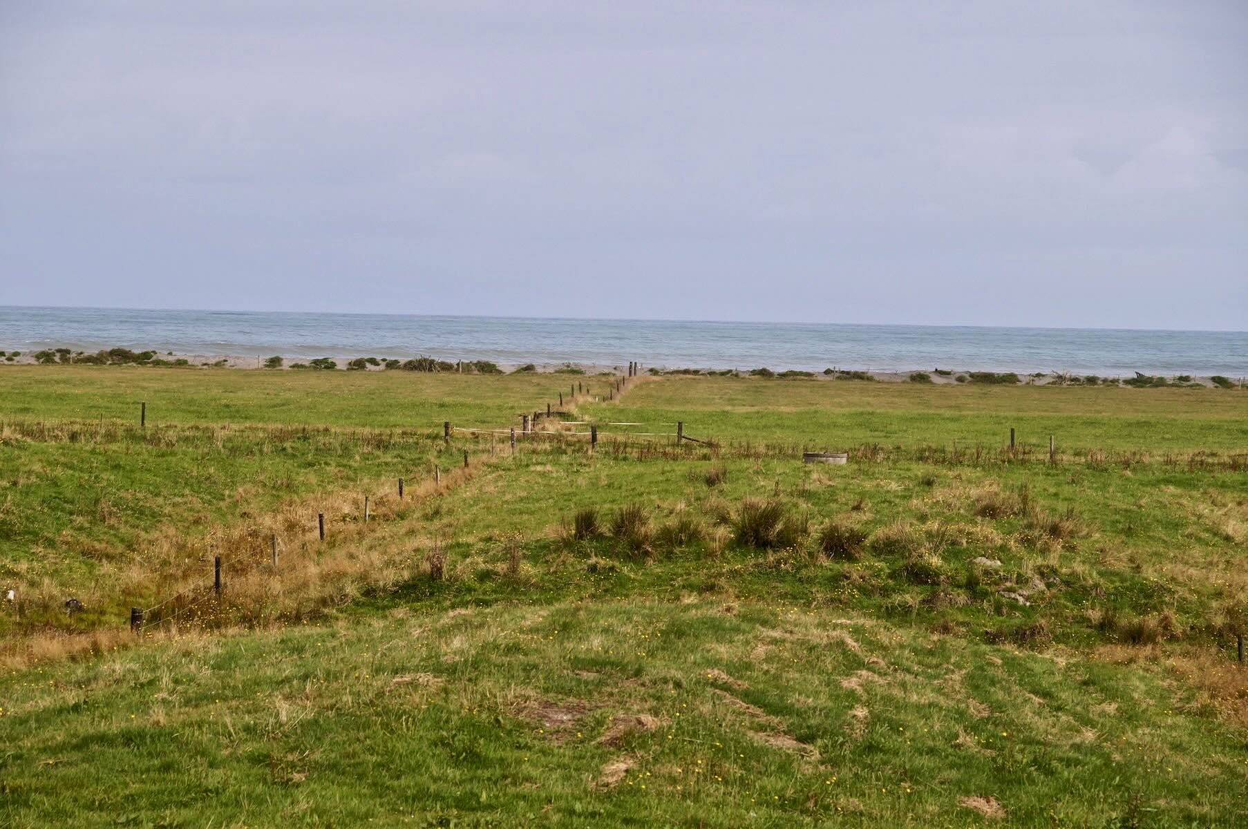
The beach was sometimes visible but usually separated from the road by a strip of private property. Occasionally, I would pass by signs obviously posted by annoyed landowners. They essentially told folks to stay out of what was called a private beach. That ride along Cuba’s south coast mentioned above actually has you right at the water’s edge with kilometre after kilometre of dramatic hurricane-ravaged road. So – in this case at least, no contest.
——————
The Beach At Hokitika:
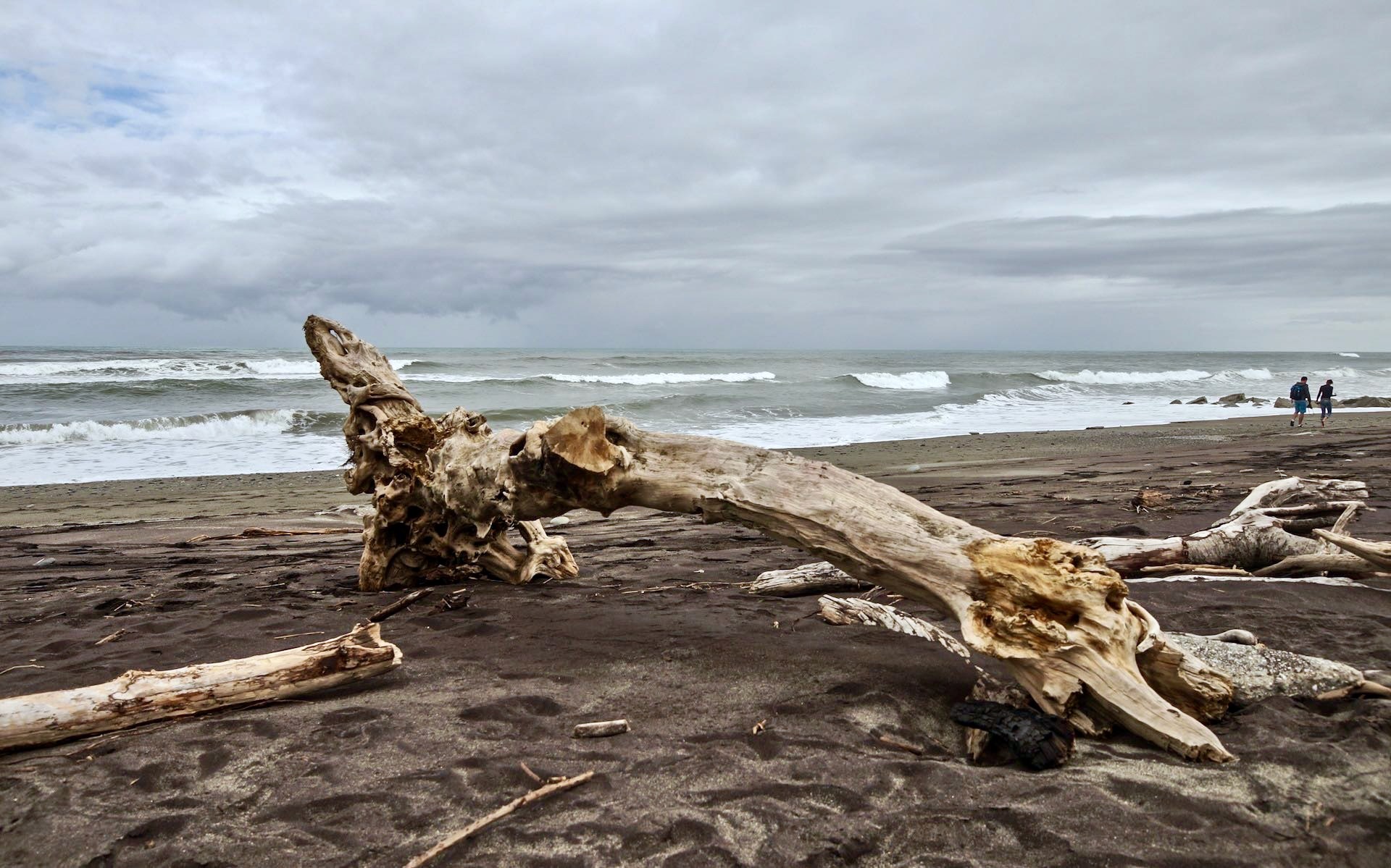
That is what made Hokitika a very pleasant stop – I got to walk right down to the water and take in some of the energy generated when waves meet the shore. And to think I was planning on just cycling by to save a bit of time before lunch at Ross! Sometimes, gobbling up road miles becomes too much of an obsession, and you forget the reason you’re there. The hour I spent chillin’ on the beach was one of my favourite little zen moments of the trip.

a satellite shot of SH6 as it passes through Hokitika – definitely a town worth stopping for

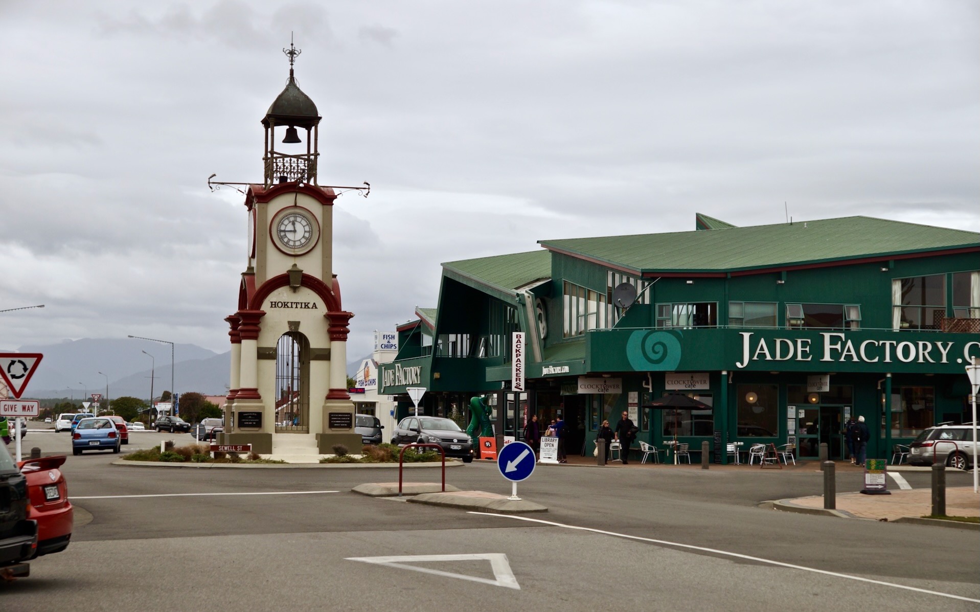
Hokitika clock tower and the way to the beach
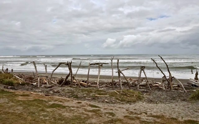


Hokitika beach. driftwood art on display

One of the people I ended up chatting with was the woman in the image above; she was walking along the beach with her yearling to desensitize him to the sound of the crashing waves; not in the picture was her dog Tilley, busy chasing down the waves in crazy bursts of beach running.
——————
On The Way To Ross and Lunch:
Had I not pre-booked a room in Harihari that night, I would have spent the rest of the day on the beach and walking around the town. It just had a nice vibe to it. My immediate goal was to get to Ross for lunch and then deal with the rest of the day’s 112 km.

farm building on the way to Ross from Hokitika

looking inland towards the Southern Alps

a stretch of road north of Ross on SH6 – notice the paved shoulder!

lunch choices at the diner in Ross

lunchtime in Ross, Westland – a Flat White waits to be sipped

Coast To Coast Race article in a Westland Newspaper found at the Ross diner
—————–
The Road To Harihari:

SH6 on the way to Harihari from Ross

approaching Hari Hari from Ross on SH6 – on a relatively traffic-free afternoon
There isn’t a lot at Harihari, but it has the reputation of being a good place to crash! (This reputation goes back to the day in 1931 when the Aussie who flew the first solo trans-Tasman Sea flight from Sydney to New Zealand crashed his plane not far from Hari Hari.) I had booked a room for the night at the Hari Hari Motor Inn.
——————
Day 5: Harihari to Fox Glacier Village – 85 km
Within the first half-hour after leaving Harihari, I had my first bump of the day to deal with – Mount Hercules, a climb of about 200 meters. The reward was fifty-five kilometres of gently rolling road with the Tasman Sea on my right and the rainforest and the southern Alps to my left.

The breakfast room at the Hari Hari Motor Inn

a few kilometres south of Hari Hari on the way to Franz Josef Glacier

in the vicinity of the White Heron Lagoon

sheep in a meadow below the Southern Alps peaks

looking up the Whataroa River towards the Southern Alps

the entrance to Whataroa from the north

coffee break time in Whataroa
—————–
Heading To Franz Joseph Village:

the road from Whataroa to Franz Josef

Kiwi “Greeters” at Franz Josef Village Entrance

satellite view of Franz Josef Village Westland NZ

Franz Josef Village looking south towards the glacier (up the valley on the left)
——————-
On To Fox Glacier Village
The last twenty kilometres to Fox Glacier Village consist of three steep climbs and downhills in a row. I had booked a room at Ivory Towers in the Village, so no time was spent looking for accommodation on arrival. Within the first thirty minutes, I chatted with a half-dozen fellow cyclists and exchanged road trajectories and info.

a warning of hills to come – SH6 just south of Franz Josef Village

a view of the Southern Alps from SH6 about 15 km north of Fox Glacier

rolling down to Fox Glacier Village on SH6

satellite shot showing SH6, Fox Glacier Village, and the Fox River tumbling down from the Fox Glacier
——————
Sight-Seeing In The Fox Village Area

The Ivory Towers Hostel is made up of four separate buildings
I spent a couple of nights at Fox Glacier Village. After five days on the loaded bike, I took the panniers off and cycled around the neighbourhood without the 22 kilograms (50 lbs.) of baggage.
—————–
A Morning Visit To Lake Matheson
Lake Matheson view of Cook and Tasman
In particular, I cycled over to Lake Matheson as early as I could the next morning – 7:45 – to experience for myself “the view of views”, the reflection of Mounts Tasman and Cook on the still waters of the lake. First, you need to get to the Lake Matheson Café; the view from there is already special. Here is what I got from the parking lot –

Tasman and Cook peaks from the Lake Matheson Cafe parking lot
Walking about a kilometre along a well-groomed trail takes you to the lake.

The trail to the Lake Matheson scenic lookout
At a scenic lookout on the edge of the lake itself, you line up with the other “pilgrims” to snap your take of “the view of views”. The one I got is the first image in this post! I will admit that it was my best view of the Southern Alps since cycling over Arthur’s Pass down to the West Coast. I had thought that I would feel the looming presence of the mountains as I cycled down SH6, but it was really only near Franz Josef that I did – and even then, the rainforest between the hills and the road prevents you from seeing much. Bridge crossings over rivers were the exceptions – as one of my shots above shows.
—————-
A Visit to the Glacier Above The Village
In the afternoon, after lunch at the Cook Saddle Cafe (and Saloon), I cycled up the rainforest trail to the glacier.

Fox Glacier Map as you leave the village on the walkway/bicycle way
Then, after locking my bike to a post in the parking lot, I walked as far as the trail went without going into “with guides only” territory. Low-hanging clouds did obscure the view of the upper reaches of the glacier but I did get to see the toe – and watched fellow tourists who have spent NZ$115. as they did their one-hour guided walk on the ice in the provided crampons.

The toe of the Fox Glacier from the walking trail

tourists walking the glacier with their guide

Looking back from the top of the glacier trail

The toe of the Fox Glacier – and the trail that runs up alongside
On the way back to the village, I tried to capture the incredible feeling of cycling along the rainforest trail. I had one hand on the handlebar brake lever and the other holding the camera as stable as possible. The results were unwatchable! I really needed a GoPro action camera with image stabilization or a gimbal for my camera.
————–
Day 7: Fox Glacier Village to Haast Junction. – 121 km
With a fairly relaxing day at Fox Glacier done, the next morning I continued south to Haast. A slight wind blowing my way made the first bit a nice ride. The first eighty kilometres are mostly flat, after a nice bit of downhill on leaving Fox Glacier Village.

the view of the Southern Alps from the bridge over the Cook River (southern Tributary)

Murray’s Bay view of the Tasman Seashore

SH6 cuts through the rainforest on the way to Haast from Fox Glacier
It is with about thirty kilometres to go that the day’s hills appeared; the high point was Knight’s Point. At the lookout there I wheeled over to the picnic table where I thought a couple of English cyclists I’d seen at the Ivory Towers’ Hostel the day before were sitting. But no! These two guys were Belgians on their way up to Picton from Queenstown. I was able to make use of my French as we chatted for a while.

a view from Knight’s Point lookout
While they readied a lunch of macaroni and cheese, we exchanged typical biker road info. One thing we agreed on was that there were more bike tourists on the roads of South Island than anywhere any of us had been before. After seeing three people on the first leg of my trip, I had counted about sixteen since Greymouth. In fact, there were so many that I was no longer feeling guilty about not stopping and chatting with each one that went by.
In my 1990s trans-Canada and recent Cuba trips, fellow cyclists were a relative novelty, and the situation almost demanded a stop to exchange greetings and info. Not on the South Island NZ! Had I been tenting all the way down the West Coast Road, I would have met even more cyclists in the various campgrounds favoured by the hard-core cycle tourists instead of the plush motel option I chose.
Let’s just say that there is no reason not to go cycling in New Zealand on your own – you will meet all the people you want to meet!

The view from Knight’s Point on the West Coast Road – working another angle
The day ended with about 15 km of fairly flat terrain to the endpoint – Haast Township, 4 kilometres past Haast Junction to the Haast Visitor Center. There is a secondary road, one which follows the coast all the way to Jackson’s Bay, which meets SH6 at the Junction. I stayed on SH6 and fifteen minutes later arrived at the Heritage Park Lodge in beautiful downtown Haast (population 40!). Near the motel are a convenience store and a restaurant and, I think, a laundromat.
As seems to be the norm on the South Island, the room also included an equipped kitchenette and, like all the other rooms I rented, was very nicely maintained. All included wi-fi internet access (usually limited to 100 or 200 Mb). The typical cost of a room rental ranged between $95. and $110. a night with prices being a bit higher (i.e. NZ$130) in Christchurch.
Having a cycling partner would have reduced my accommodation costs by 50%. That is the price you pay for going solo! In the grand scheme of things, it really is not that big a deal – and it certainly is nice to have a bug-free, warm and dry place to stretch out after a day on the saddle.

SH 6 down the West Coast to Haast and the Haast River, coming from the Pass of the same name
The next day, I would start the next leg of my South Island ramble, heading over the Haast Pass to Queenstown over three days.
————–
The post highlighted below has more stunning South Island vistas and the strips of pavement that seem to figure so prominently in my photos! The route to Queenstown from Haast – and especially the section from Wanaka to Arrowtown – rates as my favourite of the entire trip!
Bicycling South Island New Zealand: From Haast to Queenstown
———————
More Info On Cycling The West Coast Road
For more information on the West Coast Road, an excellent post by a Canadian couple – their entire travellingtwo blog is a goldmine of information – can be found here.

As noted in my Part One in this series of South Island posts, I also found the 2009 Lonely Planet Cycling New Zealand guide to be very useful in planning my route, not just down the West Coast Road, but also the stretch from Christchurch to Greymouth, and the rest of the trip. The guide will hopefully be refreshed and will then present much more recent information and planning guidance.
The Pedallers’ Paradise set could also use a true update that eliminates the glaring pieces of outdated information instead of the slapdash revision it got.
Next Post: Part 5 – Over The Haast Pass To Queenstown.
Bicycling South Island New Zealand: From Haast to Queenstown
the trip looks absolutely fantastic from these pages peter
Hello! I’ve been reading your blog. Am planning a touring trip to Tasmania East Coast, however after reading your post on NZ South island it looks even more tempting! Where would you advice between the 2? We only have about 1 week to cycle though…
June, while both stretches of road -i.e. NZ’s West Coast road and Tassie’s east coast- make for great rides , I’ll admit that NZ would be my first choice.
In both Tasmania and In NZ taking a bicycle along on the bus is hassle free so you could make use of them as part of your route planning.
The Tasmania ride I did from Hobart to St. Helens took five pretty leisurely days. You might consider just a trip down to Bruny Island from Hobart and spending two or three days on Bruny island. There is way more to see than I got around to during the day and half that I was at Adventure Bay. The boat ride to the south end of the island is also a must!
In NZ the train from Christchurch to Greymouth – the TranzAlpine – would get you to the coast in luxury. NZ’s South Island has lots of bicycling possibilities. Basing yourself in Queenstown would open up a week’s worth of day tours or a couple of overnighters. It all comes down to how keen you are, what gear you’ll have, and how fit you are!
Have fun choosing! P.S. – There is no bad choice!