Table of Contents
- Three Put-In Options
- Day 1: Red Squirrel L. Put-In to Ferguson Bay
- Day 2: Ferguson Bay to Diamond Lake
- Day 3: Diamond Lake to Lady Evelyn
- Day 4: Lady Evelyn to Mattawapika Dam/Montreal River
- Day 5: Montreal River to Anima-Nipissing Lake
- Day 6: Anima-Nipissing Lake – Top to Bottom
- Day 7: Anima-Nipissing Lake to McLean Lake
—————–
Three Put-In Options
A late September mini-canoe trip up in the Temagami area was coming up. I surveyed the old-school canoe packs and duffels on the basement floor one last time as I scrolled down the gear and food list. All set!
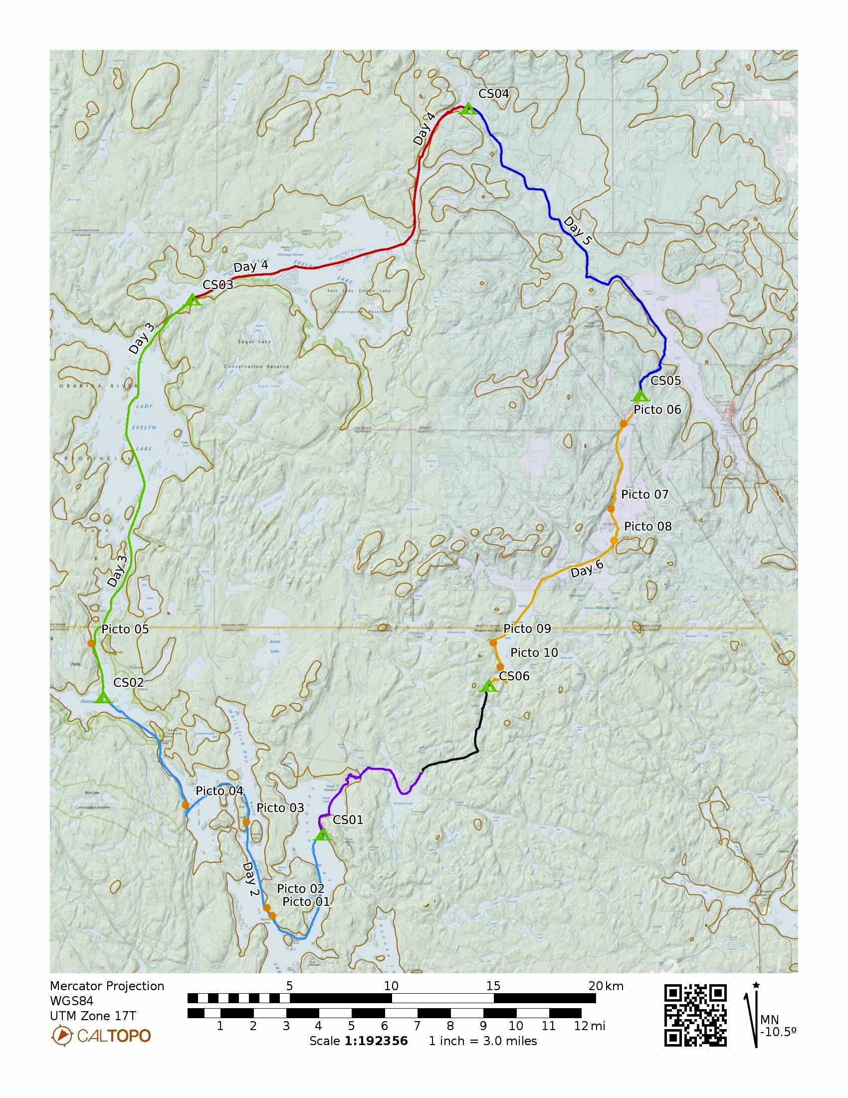
The plan was to drive up to the Anima-Nipissing Lake Road off of Highway 11 and  leave the vehicle in the parking area at the end of the road for a week while we did the loop shown in the map above. It is a route which Hap Wilson describes in his Temagami canoeing guidebook. It had been on the list of possible to-dos for a decade or two. [See Route 13: Anima-Nipissing, Montreal River Loop.]
Our main focus of this trip would be the pictograph sites at the north end of Lake Temagami and on Anima-Nipissing Lake, none of which we had ever checked out.
As a bonus, we also got to paddle by the Diamond Lake Pictograph site, still the most impressive of the sites we have spent time at in northeastern Ontario.

Diamond Lake Pictographs – northernmost grouping
The Anima-Nipissing Lake put-in is not the only option. Many paddlers start and end their loop at Mowat Landing. What we liked about the Anima-Nipissing Lake start is that the 2.2 km portage from the Montreal River to the top of A-N is on the last day of the trip instead of the first one.
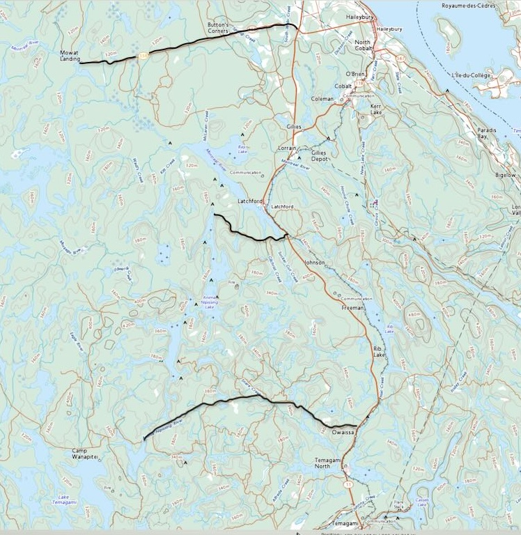
Put-In Options
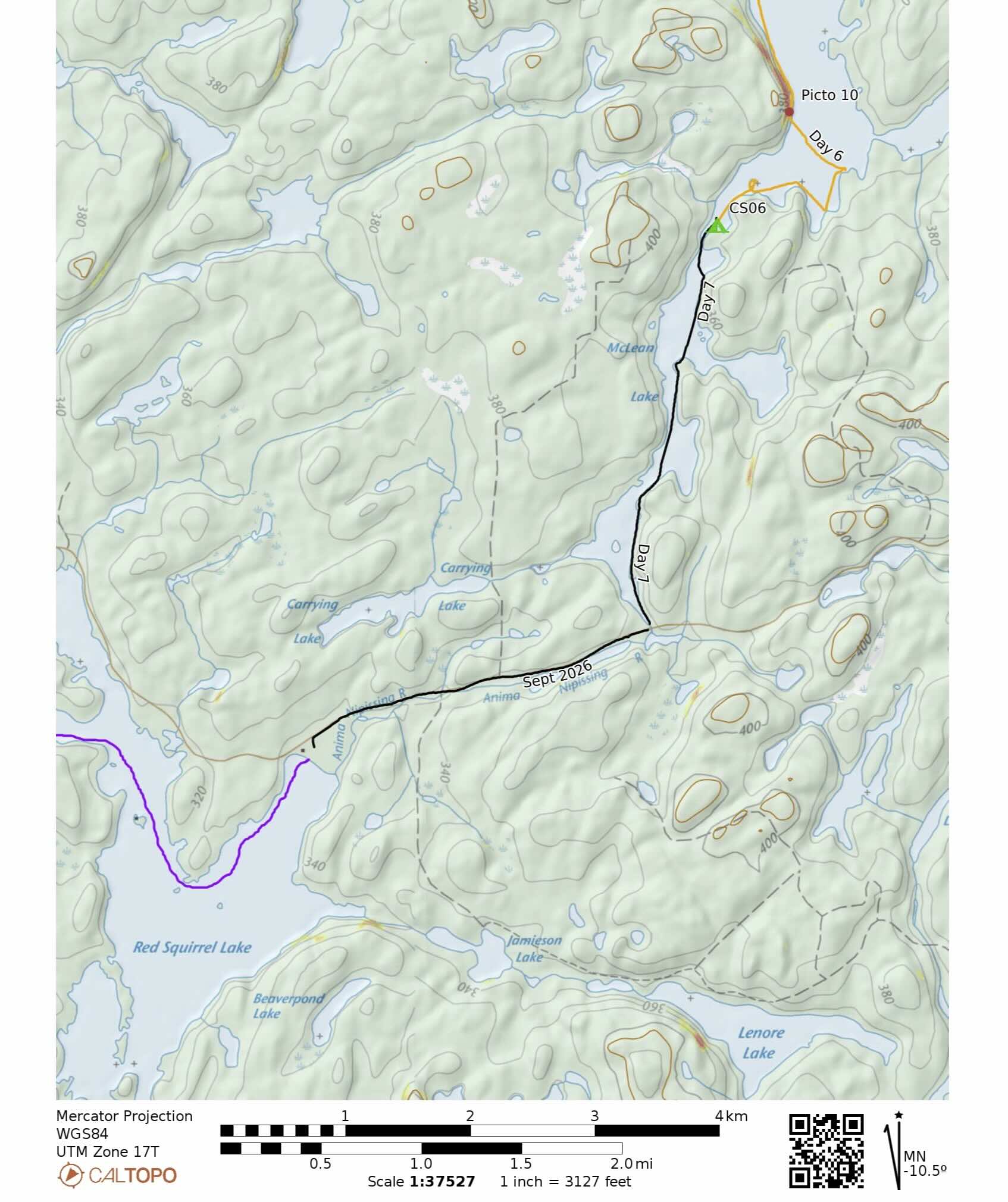
On our drive up went over the various portages and settled on a third option – parking at the top of Red Squirrel Lake. That would eliminate portages of
- 665m from Mclean Lake to Carrying Lake and
- 910m from Carrying to Red Squirrel Lake.
It does, however, mean a 24-km drive up a pot-holed and wash boarded Red Squirrel Road. At the end of the trip, Max would also get to walk back 3 km to his Mitsubishi ( a spry 20 year old vehicle on its last major trip) while I waited with the canoe and gear at the McLean Lake parking area.
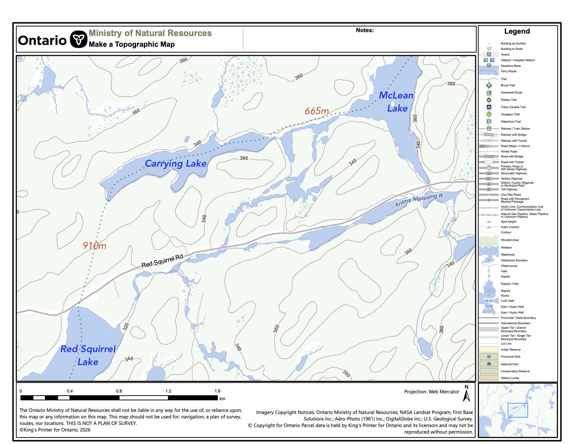
Mclean to Red Squirrel
—————–
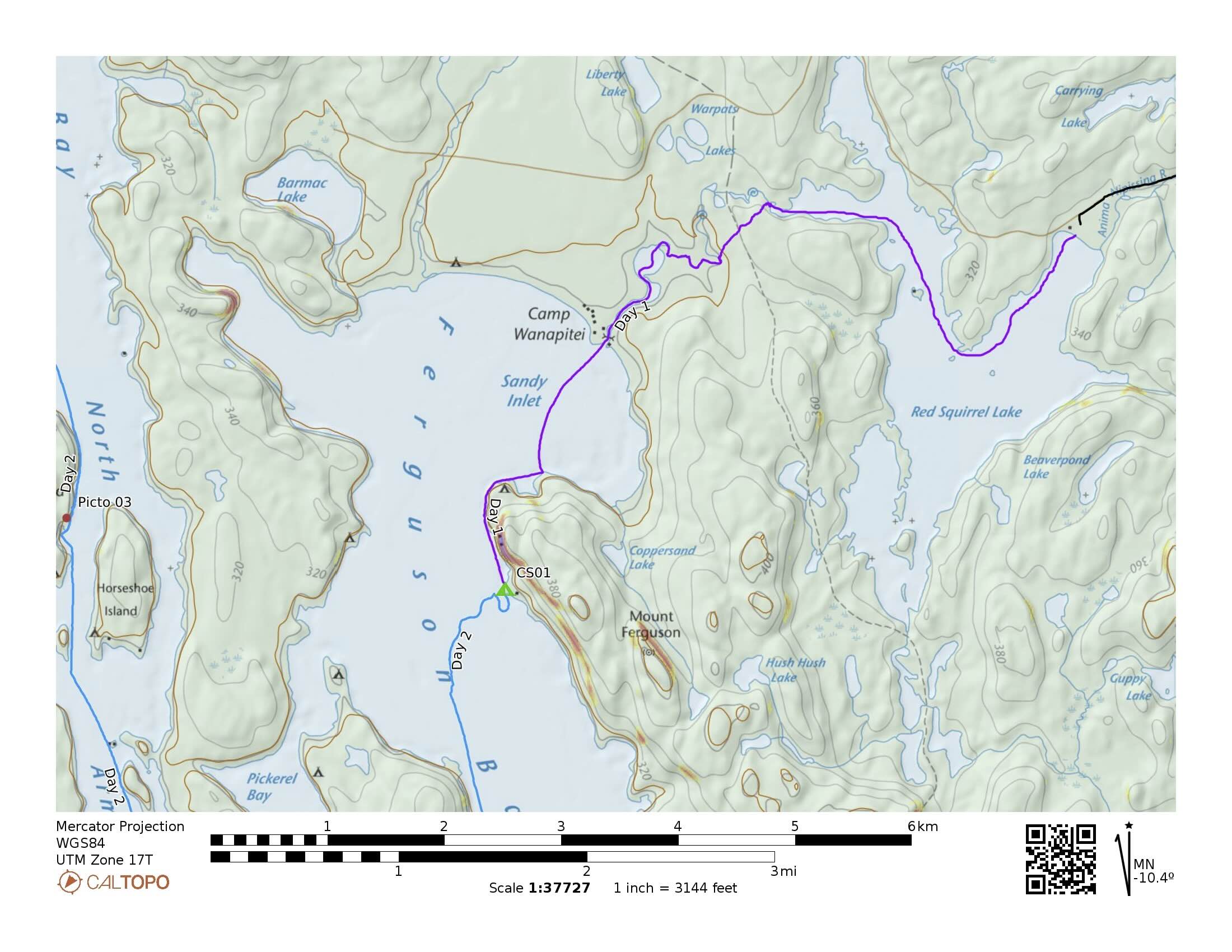
Day 1: Red Squirrel L. Put-In to Ferguson Bay
- Date: September 23, 2026
- Distance: 9.5 ? km
- Time: 2:50–5:20
- Portages: 1, 680m
- Weather: sunny and warm
- Sightings: 4 humans
- Campsite: 1 x 4-person, multiple 1-2 person spots
- CalTopo link : https://caltopo.com/m/MJRVBRN#
- Ottertooth Lake Temagami Atlas Articles: Sandy Inlet; Ferguson Bay.


Red Squirrel Lake parking area
We arrived at the Red Squirrel Lake parking area at around 2:30. Parked there were four or five camper trailers but nobody was around. Within a half-hour we were on the water and approaching the outlet of the Anima-Nipissing River and our first possible portage.
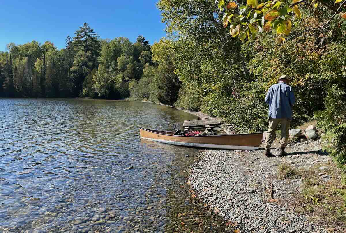
red Squirrel Lake put = in
The impressive collection of boulders at the outlet are an indication of the power of the sub-glacial stream that once flowed by here. We looked down the river, thinking that lining the canoe down would be easier than a 700-meter carry. The low water and boulder garden up ahead quickly ended that thought. When we got to the other end, we met a team from one of the summer camps clearing the trail. When we asked about the feasibility of staying with the river, they said it was not a good idea, even in the spring and early summer.
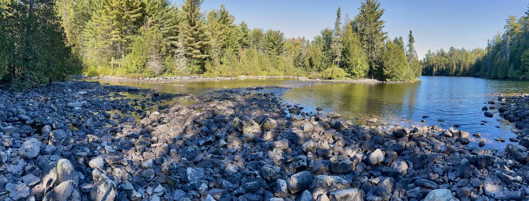
Red Squirrel Lake Outlet

Red Squirrel Portage
From the portage put-in it is a delightful paddle down a meandering and fairly narrow stream to Sandy Inlet. It would have been nice to step out and do some sight-seeing when we got to the Camp Wanapitei property, but given late September’s shorter daylight hours, we kept on going. Passing under the Camp bridge, we headed south and east into Ferguson Bay to check out the campsites indicated on our Chrismar map.
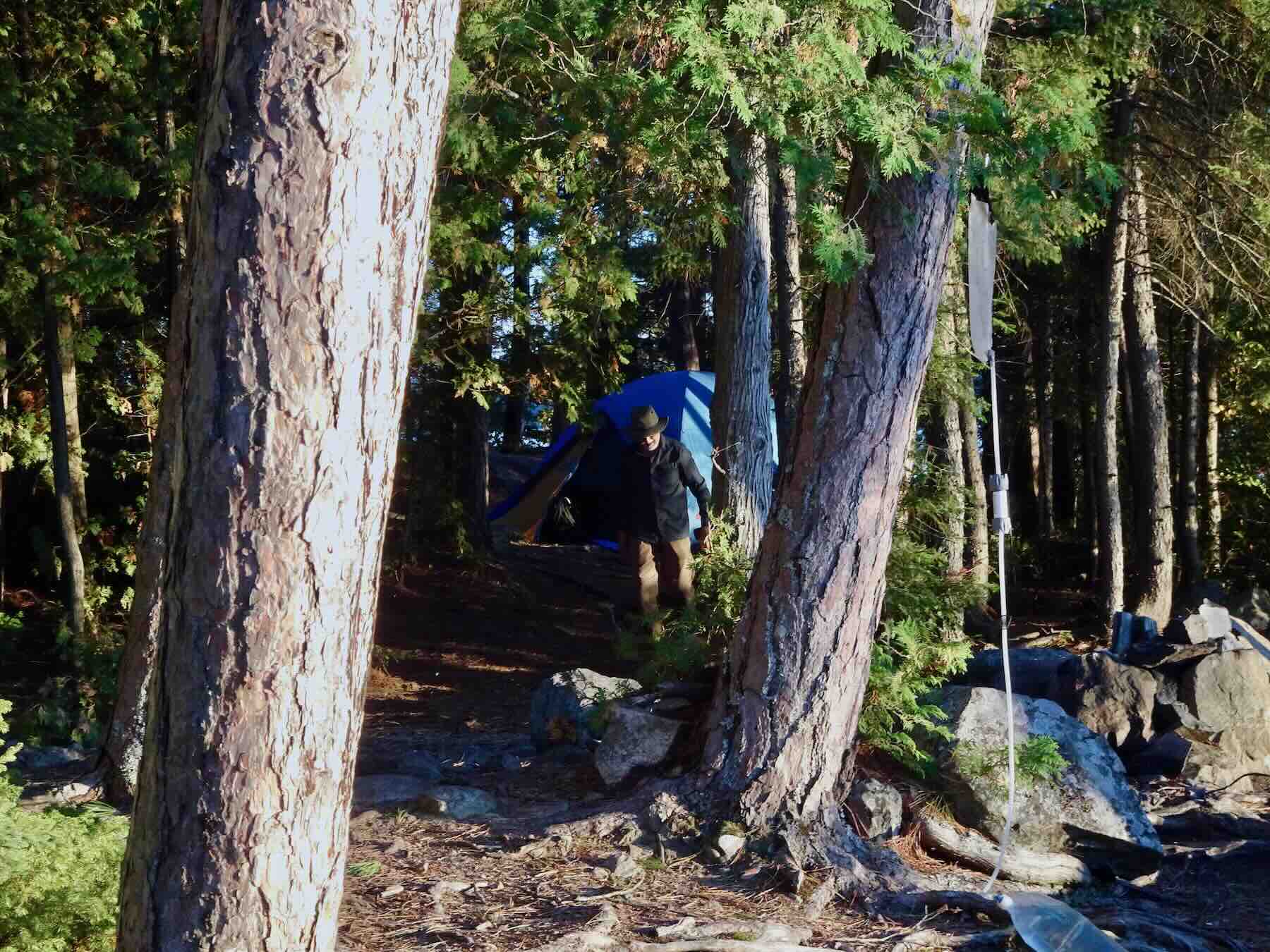
We found one we like just south of the rock pile at the foot of Ferguson Mountain and soon the tent was up and the Gravity Works filter was doing its thing to four liters of Lake Temagami water. It is our main water treatment method, along with boiling and using the Steripen UV device,
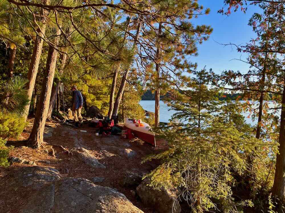
Ferguson Bay CS
A decent tent site and with exposure to the west meant we got to see a nice sunset. As the sun fell below the horizon, the temperature dipped noticeably and our insulated jackets came out. Sitting in our Helinox chairs, we surveyed the glass-like water. That glass-like water was to become a daily theme although we didn’t know it at the time. A nearby loon broke what had been an absolutely quiet scene. It was good to be back in Temagami.
—————–
Day 2: Ferguson Bay to Diamond Lake
- Date: September 24, 2026
- Distance: 26 km
- Time: 6 hrs – 8:50–4:25
- Portages: 1
- Weather: sunny and warm
- Sightings: usual avian creatures
- Campsite: 1 x 4-person, multiple 1-2 person spots
- CalTopo link : https://caltopo.com/m/MJRVBRN#
- Ottertooth Lake Temagami Atlas articles: Racoon (North Arm); Sharp Rock Inlet.
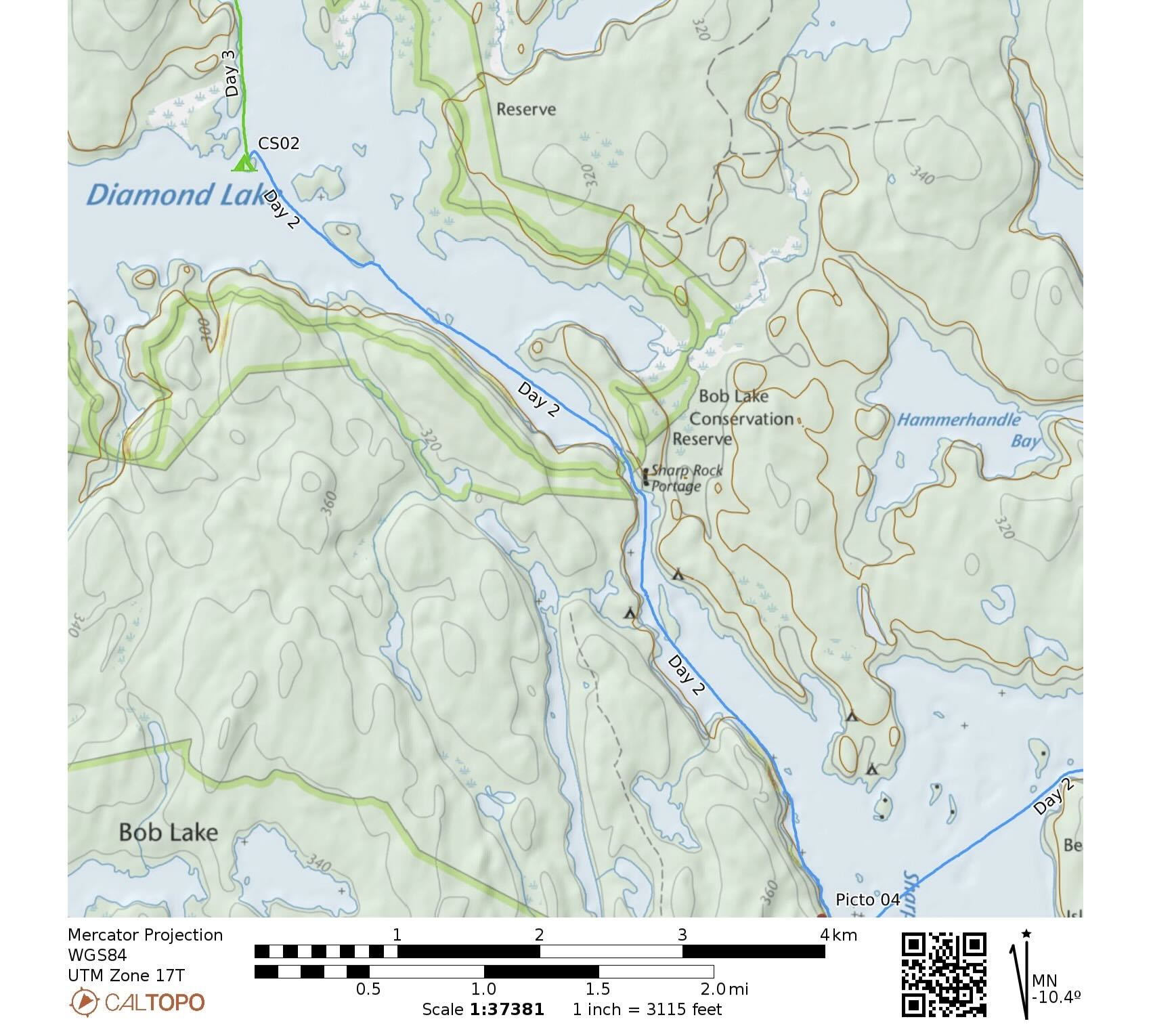
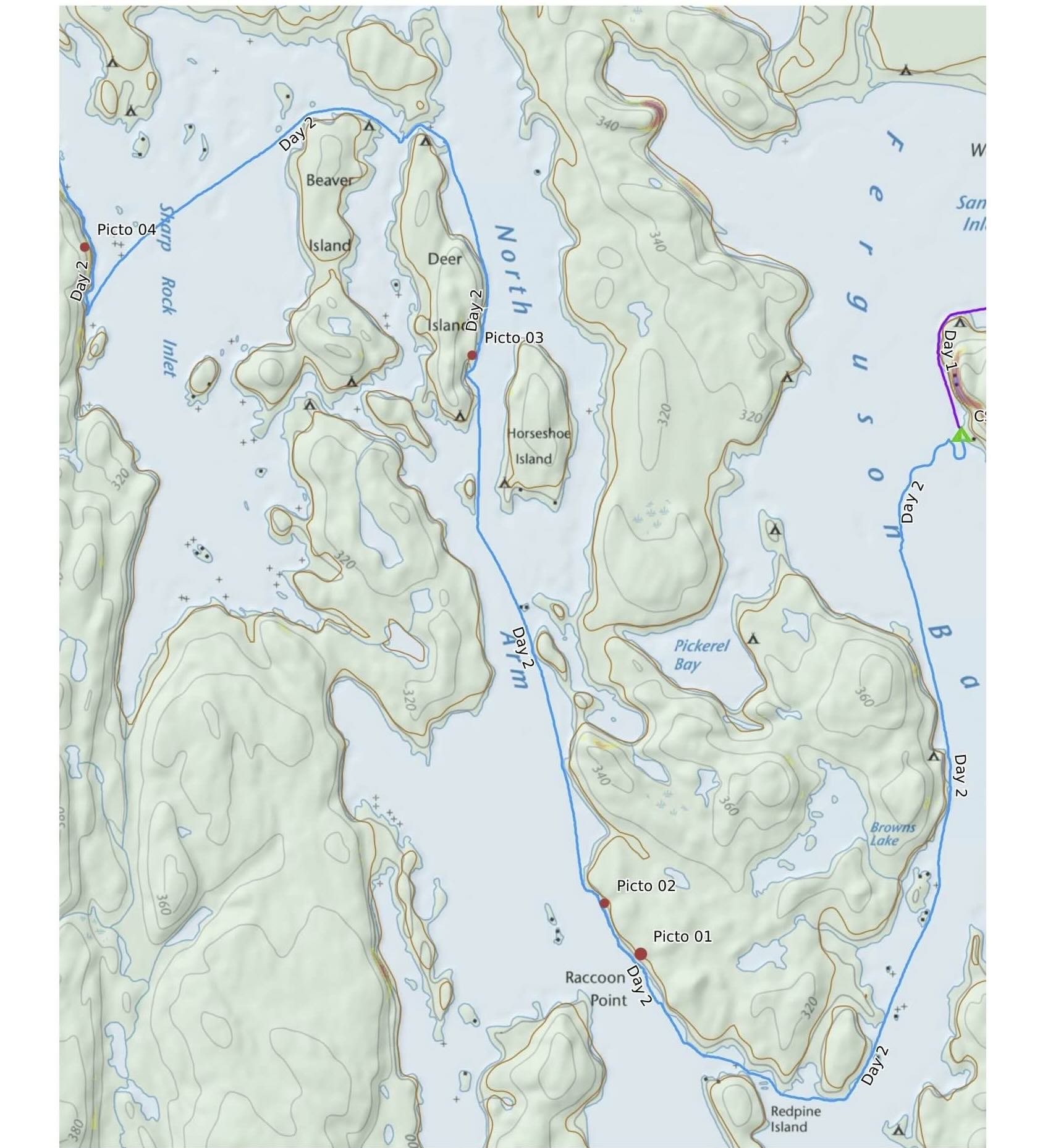
The maps start at the bottom and then head up to Diamond Lake.

Morning mist on Ferguson Bay
We set off around 9:00 into a thick mist which obscured the shoreline. The stern paddler was a tad confused after setting off from our campsite as confirmed by the track. Within a half-hour the mist had burned off and we were rounding the point by Redpine Island.
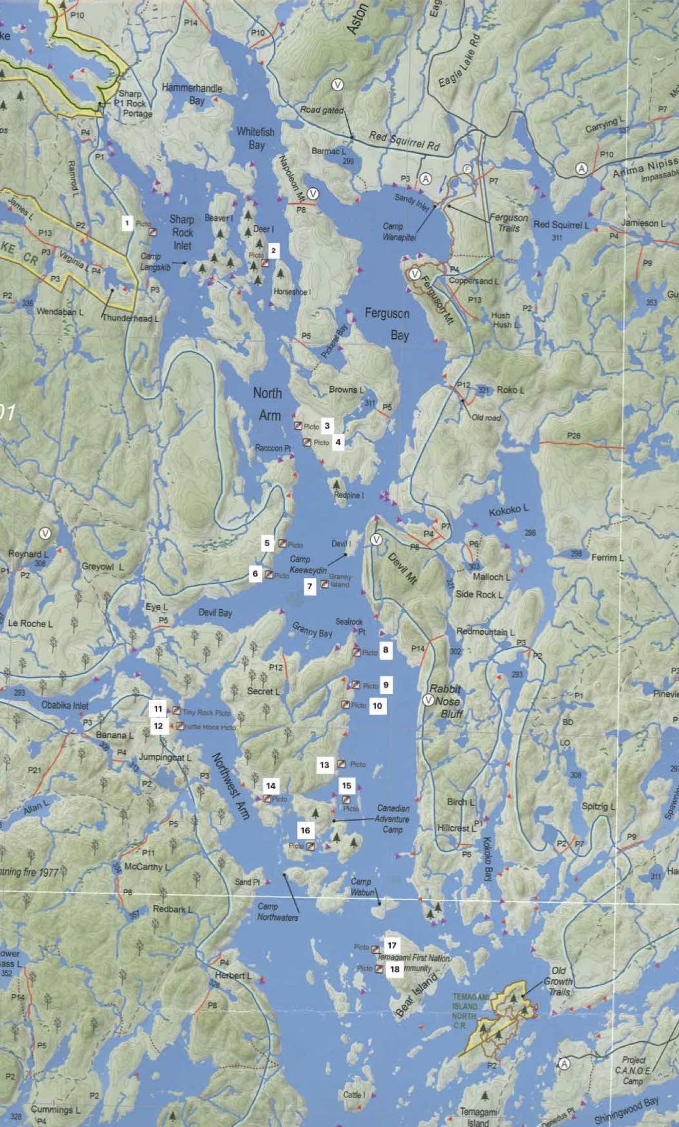
On tap were the first two of our pictograph sites for the day. Jeff’s Temagami map indicates the location of these and most of of other sites in the Temagami area.
On Lake Temagami itself, there are 24 recorded pictograph sites. A detailed study entitled “Beyond the Sacred: Temagami Area Rock Art and Indigenous Routes“ in Ontario Archaeology (2013) by Dagmara Zawadzka is the best single source of information about pictograph sites in the Temagami area.
On this trip, we limited ourselves to the northernmost four labeled on this map (see here). My post on Pictographs in Ontario has a section on Northeastern Ontario and includes links to articles and research papers on Lake Temagami and the surrounding area.
Of the four sites we paddled by on this day, we only missed finding anything at the Sharp Rock Inlet site.
————
Note: You will not see much more than simple geometric patterns, and vertical and horizontal straight lines. The “paint”, probably a mixture of iron oxide powder mixed with fish oil, was applied with a finger to selected vertical flat rock surfaces on the lake or river’s more dramatic rock outcrops. The morphs or images are usually no more than two or three centimeters wide, and perhaps 10 or 15 cm long. They are probably two to three hundred years old and painted by Algonkian shamans and vision questers who came inland from the upper Ottawa River area and Lake Temiskaming.
Little that you will see in the Temagami area will come close to the following pictographs found elsewhere in Anishinaabe Country.

Mazinaw Rock – Mishipeshu and the Canoes panel

Mishipeshu pictograph at Agawa Rock

Shaman and Bison at Artery Lake on the Bloodvein River system
Paddlers we have met have expressed disappointment at not finding the pictographs. They thought they would be larger and grander, more like the pictographs above,. Looking for those, they end up not seeing the admittedly underwhelming and basic ones that are there. Grand or simple, to paddle by and spend time with them is still a memorable experience that connects you to the water and the rock and the ones who lef their mark on it.
————
Before we got to the first pictographs, we paddled by two rock faces that seemed promising from afar but we found nothing.
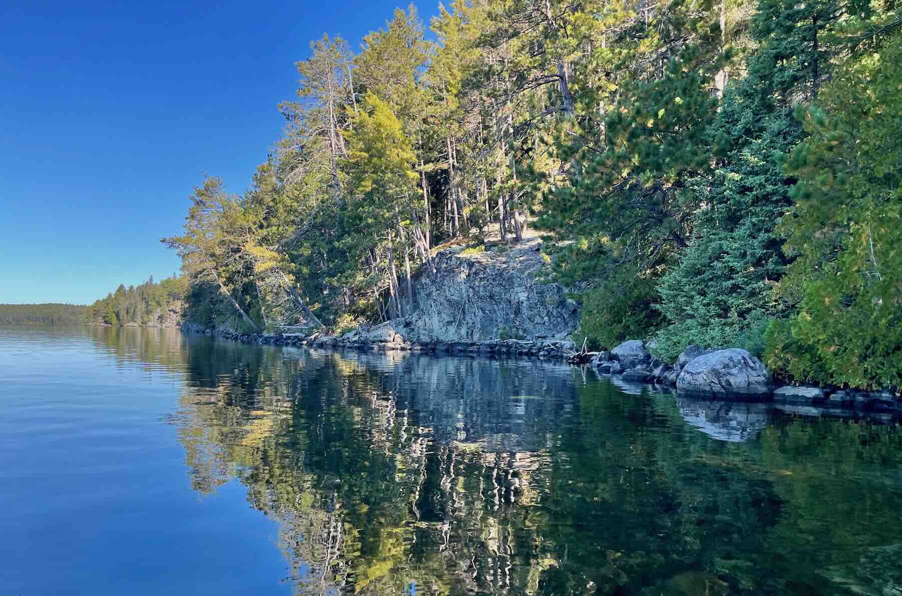
Temagami rock face
Our Picto 01 Site
The photo below captures a pictograph panel at the first site we stopped at. Along with marks created by humans are bits of natural iron oxide color peaking through. It is often difficult to tell which is which. If you want to see a pictograph, your mind is certainly capable of creating one for you, even if it is not really there! We have come to call this condition “picto fever” and I will admit to having surrendered to it on occasion.
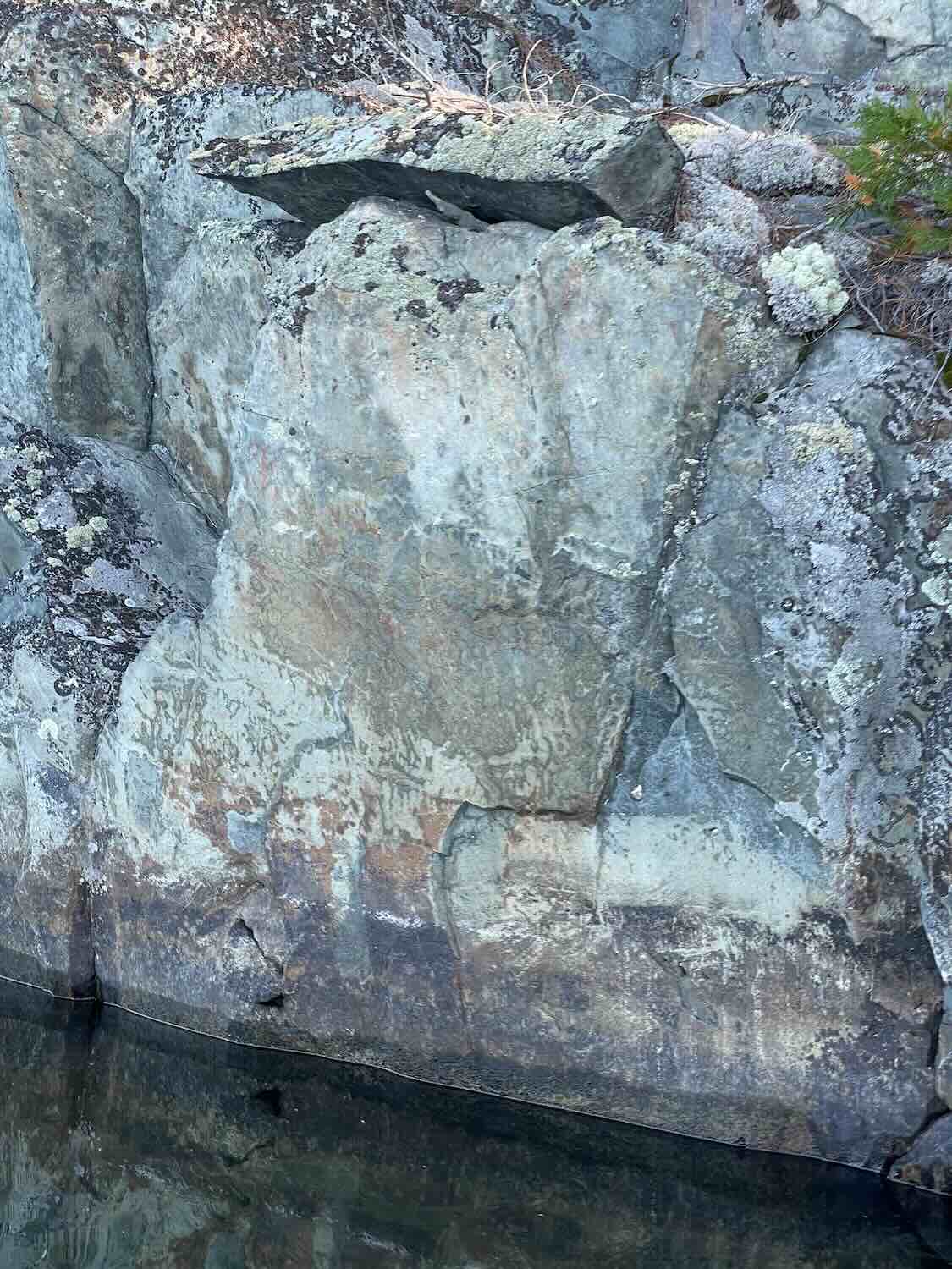
A closer view revealed a stick figure — perhaps a rendition of an animal or an otter skin or of Nanabozo with his rabbit ears. Or maybe not. Two circles above and two short straight diagonal lines below the stick figure can also be seen, as well as two horizontal lines or perhaps a sideways U-shape. Other marks are also visible above and to the right of the main image.

Click the image above to see a version with the red hue augmented.
Our Picto 02 Site
A bit further to the north we came to the site pictured below.

As with the first site, we had no idea about the shape of the pictograph(s) we were looking for. Most appear within the 1 to 2 meters above the water surface. As we approached the section of the rock face with the overhang, we figured that would be a good place to leave one’s image.


What we found was a single vertical line, finger wide and about four centimeters long. A pictograph? We are not sure,

If it is, it is the only one we saw at Site 02.
Our Picto 03 Site
Next up was the site on the east side of Deer Island. Having paddled Lake Temagami with fierce winds and white-capped waves, we were enjoying the almost ripple-free water. In fact, this is what we had for the entire week – on Diamond Lake, on Lady Evelyn Lake, on the Montreal River, on Anima-Nipissing Lake – the best fall weather we have ever had. No rain, no wind, no waves, no bugs, no other paddlers. Even the motor boats on Temagami, Lady Evelyn, the Montreal, and A-N added up to maybe three or four!

Approaching the Deer Island Picto site
No debate about what appears in the image below. That is a pictograph! Underneath the white calcite mineral runoff are faded remnants of other vertical lines.

Deer I. pictographs
Not too far away we found the following marks – two crosses and a vertical line to their left. The vibrant color of the double vertical lines and one of the crosses make me question who put them there. Do they date back to the 1770s or to the 1970s? Arey they an expression of traditional pre and early-contact Anishinaabe culture or of the indigenous nationalism which swept through the Temagami area fifty years ago?
As for the cross image, it is one which appears across the Canadian Shield. Just what it represents is up for debate.

We stopped for lunch at the north end of Deer Island before heading across Sharp Rock Inlet.
Our Picto #4 Site
We had no luck finding anything at this site. There are a few natural iron oxide smudges and marks that could be turned into pictographs in a pinch. One such that I aimed my iPhone at was what you see below.

Diamond Lake Island Campsite
Our day ended at the tiny island in Diamond Lake as shown on the satellite image below. We had set up camp there a few years ago after a tense paddle from the north end of the 1200-meter portage from Bob Lake. That time, a fierce east wind slammed into us as we crossed the open water to the island. This time? 100% different.

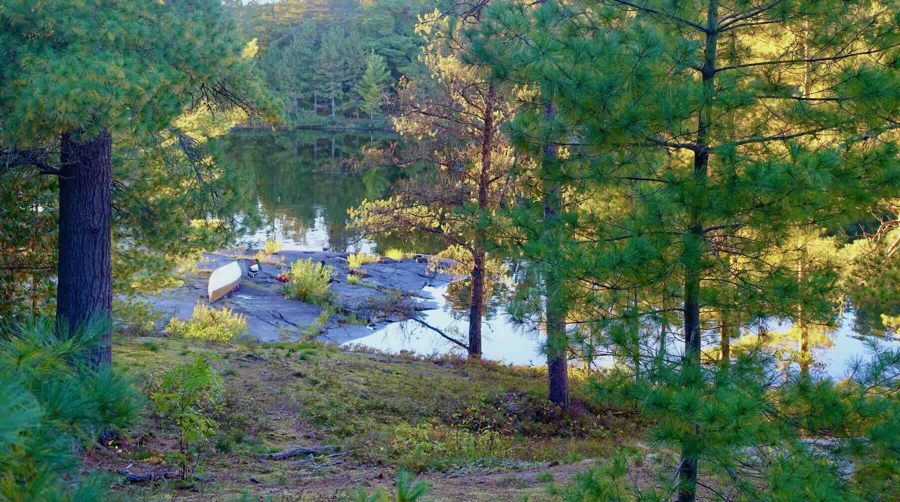
A thunderbox on the east side of the island was a nice find. So far, both of our tent sites had toilet boxes. Also, both sites were remarkably tidy and litter-free, as were all the others we stopped at in our six-night loop.
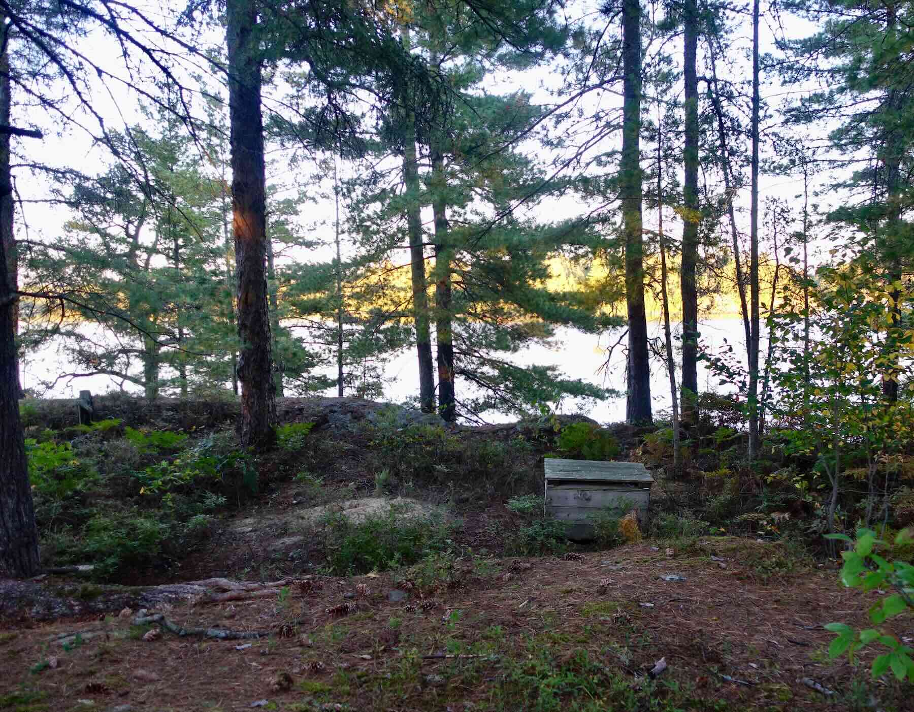
Diamond L Thunderbox (with view!)

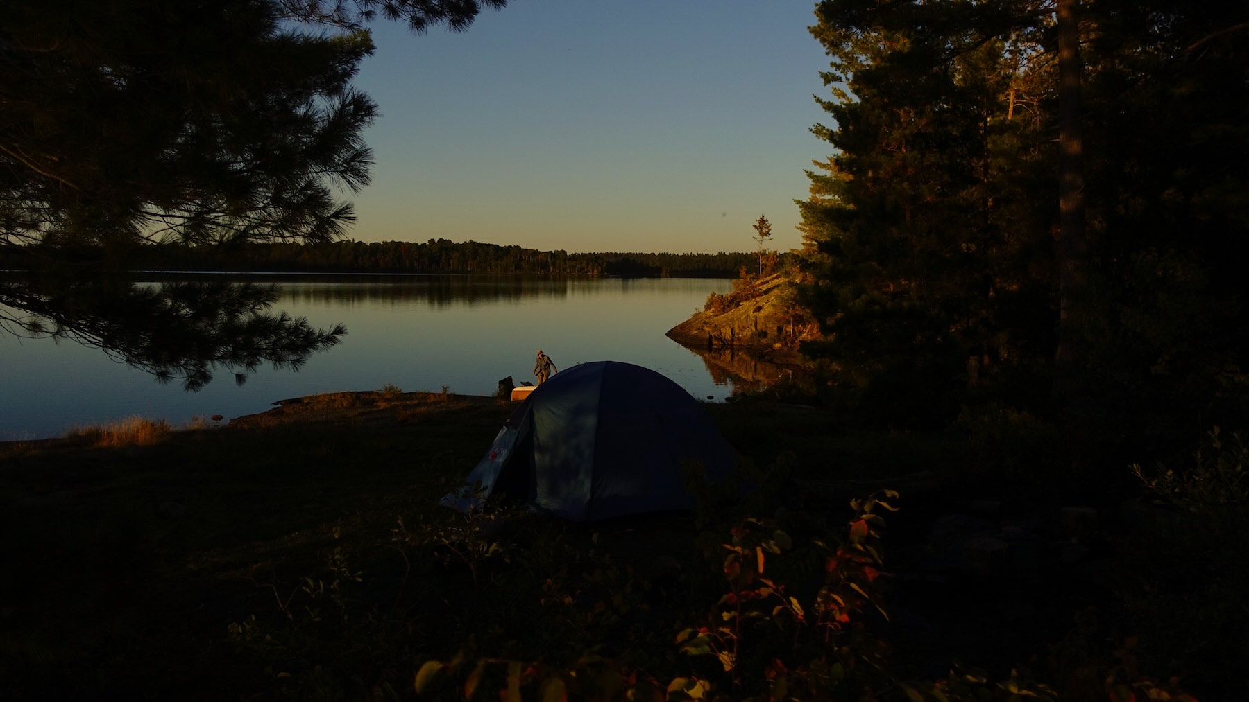
Diamond Lake Island CS
—————–
Day 3: Diamond Lake to Lady Evelyn
- Date: September 25, 2026
- Distance: 23 km
- Time: 4h:45m, 8:50–3:00
- Portages: 0
- Weather: sunny and warm
- Sightings: minimal
- Campsite: 1 x 4 person; multiple 1-2 person spots
- Caltopo link : https://caltopo.com/m/MJRVBRN#
- Ottertooth Articles: Lady Evelyn Lift-Over
Maps arranged from bottom to top
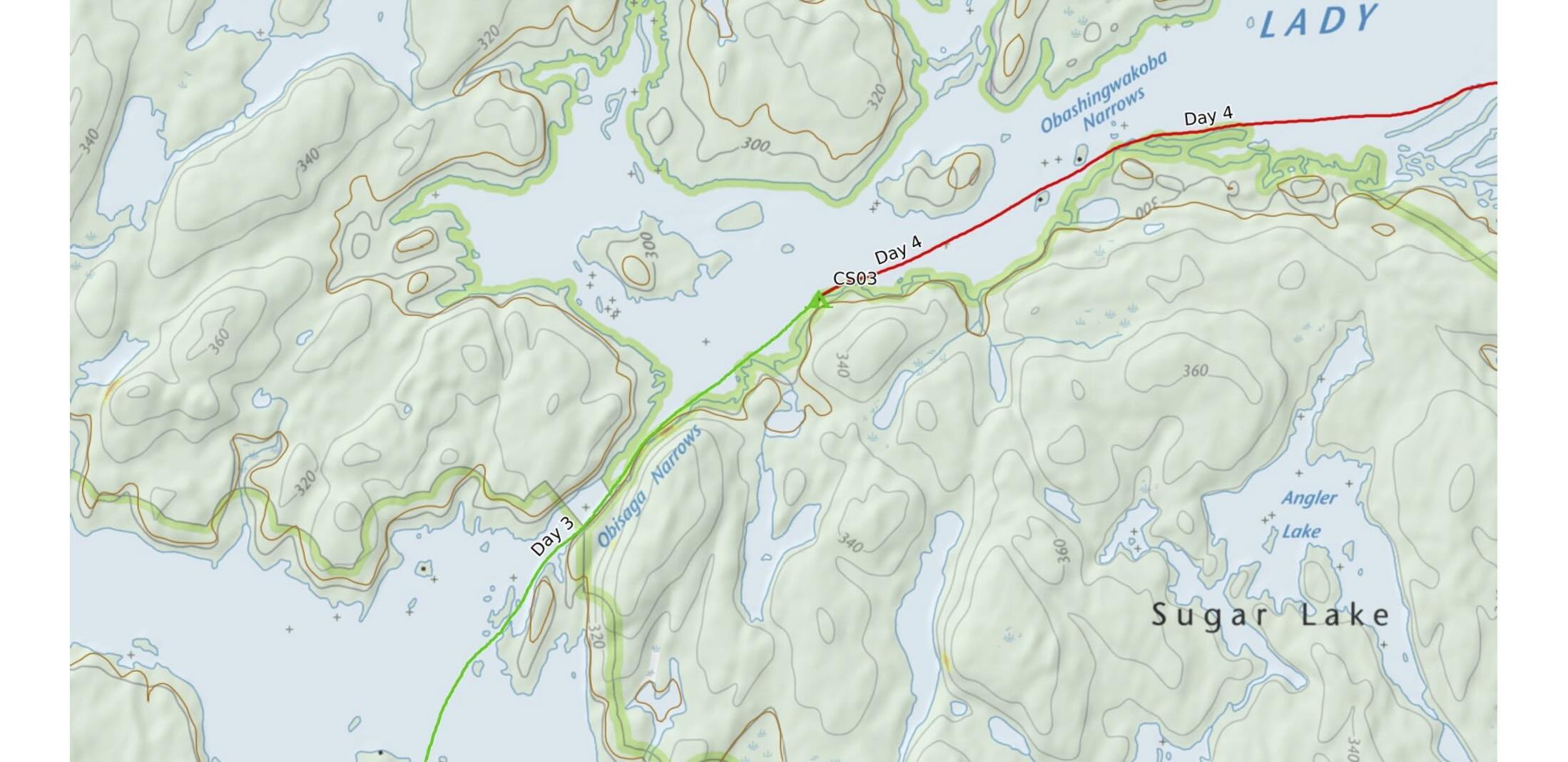
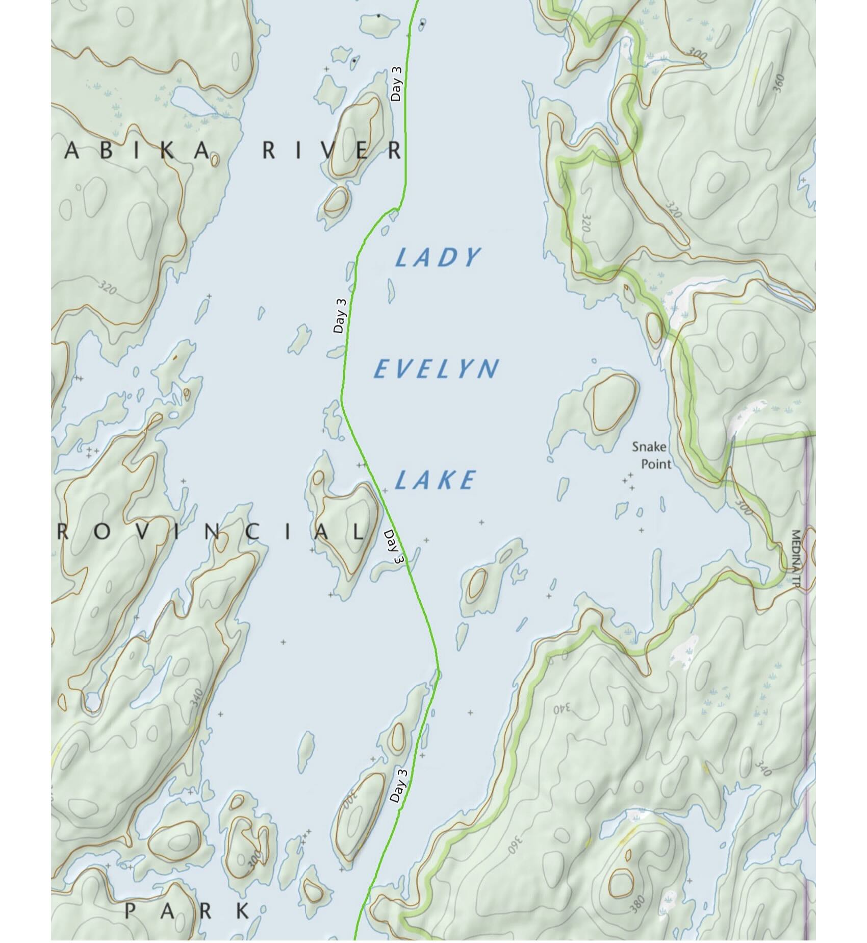
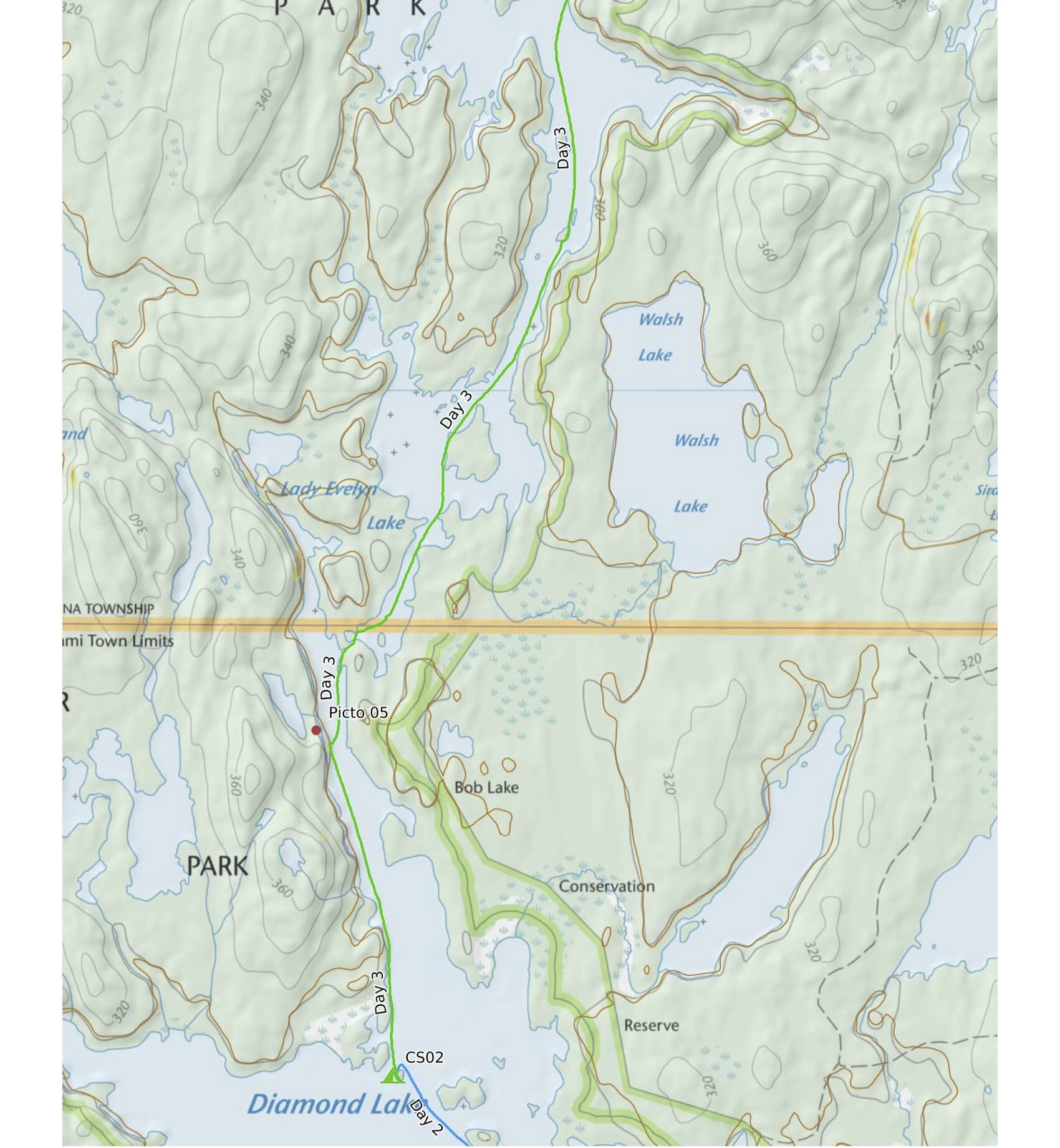
As we had breakfast on our north-facing island patio, we were treated to another atmospheric mist-covered lake view. Over bowls of oatmeals and cups of filtered coffee, we looked at the maps and figured a 20 to 25 km day would put us somewhere between Lady Evelyn Lake’s Obisaga and Obashingwakoba Narrows.
[Obi and oba are Ojibwe words for “narrows”; saga means “lake”. and shingwak refers to red or white pine. Gleaned from this online dictionary.]

Diamond lake canoe and morning mist
Not far from our island tent site is one of northeastern Ontario’s largest rock painting sites. We have visited it a few times over the years. On our last visit we decided to do a more thorough recording of the marks and images painted on the vertical rock outcrop. The image below is what we saw as we approached from the south.

Diamond Lake pictograph site from the south
Here are a couple of photos that capture some of the pictographs from the Diamond Lake site.


Diamond Lake pictograph site view from the north
One last overview shot of the site – this time from the north – and it was time to move on. If you’d like a more comprehensive examination of this pictograph sites, check out the report below.
Just north of the pictograph site is the outlet of Diamond Lake at what was once Lady Evelyn Falls. There was a fifteen foot drop as their water tumbled into Lady Evelyn Lake. The building of the Mattawapika Dam raised the water to such an extent that there is now no more than a 1′ drop! See this Ottertooth article for more interesting history.
Below is what is now referred to as the Lady Evelyn lift-over. Really, even a lift-over is not required. We have tracked our canoe up and, on this occasion, lined it down into Lady Evelyn in about a minute or two.

into Lady Evelyn – the lift-over
While our initial plan had been to head east via the Sugar Lake Conservation Area, we scrapped the idea when we added up the extra portaging needed. That 60 lb./27.2 kg canoe of ours is not getting any lighter! North on Lady Evelyn Lake we headed, stopping for lunch at the spot pictured below, before ending the day at an official tent site between Obisaga Narrows and Obashingwakoba Narrows

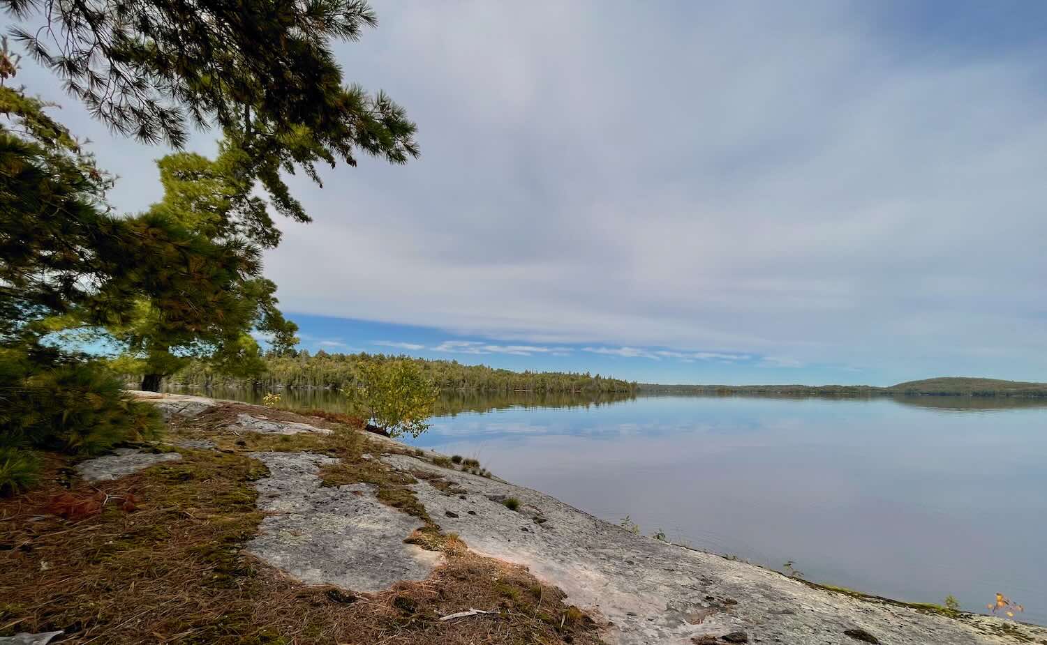
It was a west-facing site and like the others so far, quite clean and litter-free and equipped with a thunder box. We put out or sleeping bags to catch a bit of sun and air and enjoyed the end of yet another wind-free sunny day in Temagami with a nice cup of coffee.

Lady Evelyn CS


dusk on Lady Evelyn
—————–
Day 4: Lady Evelyn to Mattawapika Dam/Montreal River
- Date: September 26, 2026
- Distance: 20 km
- Time: 5 h 50m, 9:00–3:00
- Portages: 1 – 250 meters
- Weather: sunny and warm
- Sightings: 1 solo paddler, distant motor boat
- Campsite:
- CalTopo link : https://caltopo.com/m/MJRVBRN#
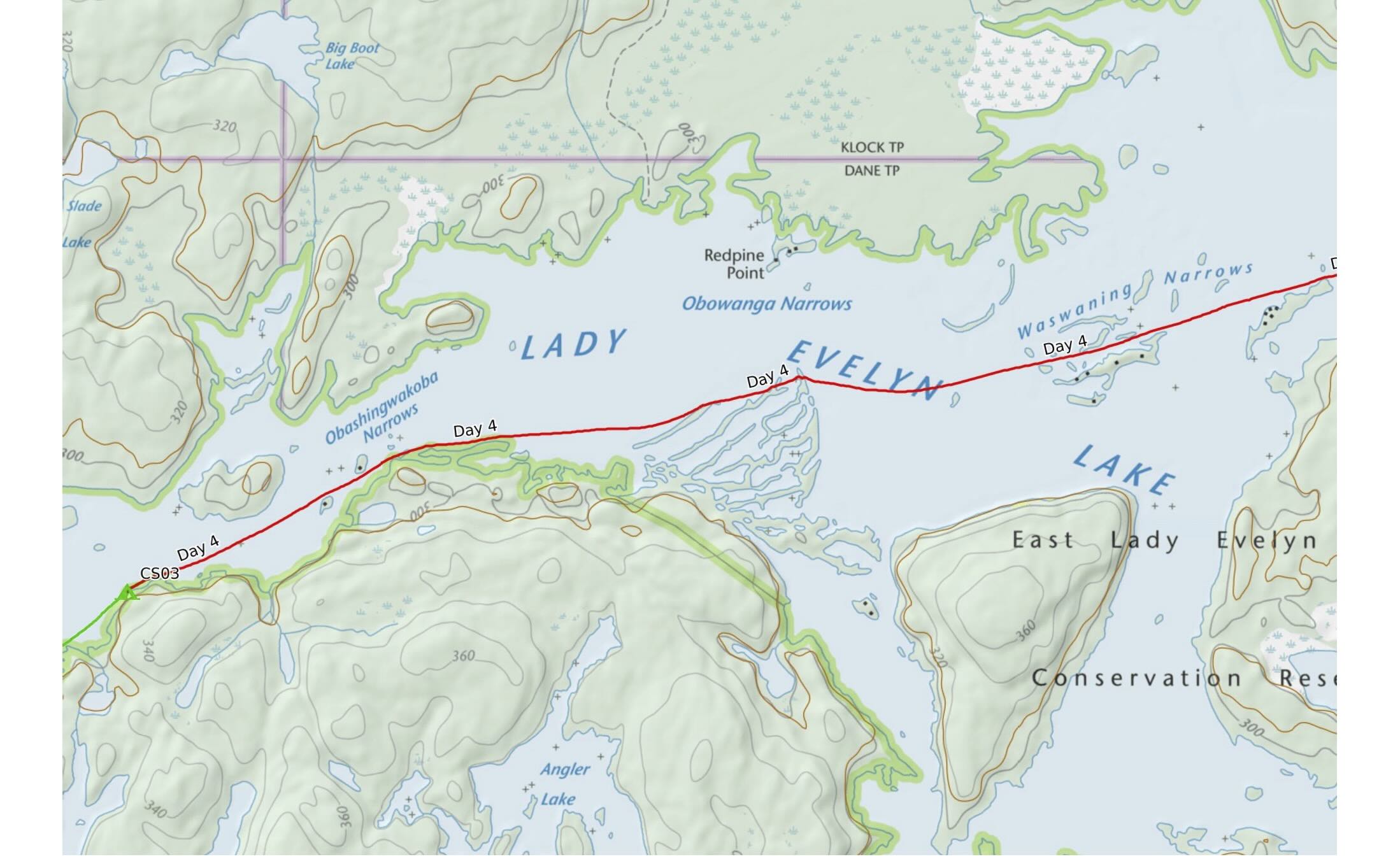
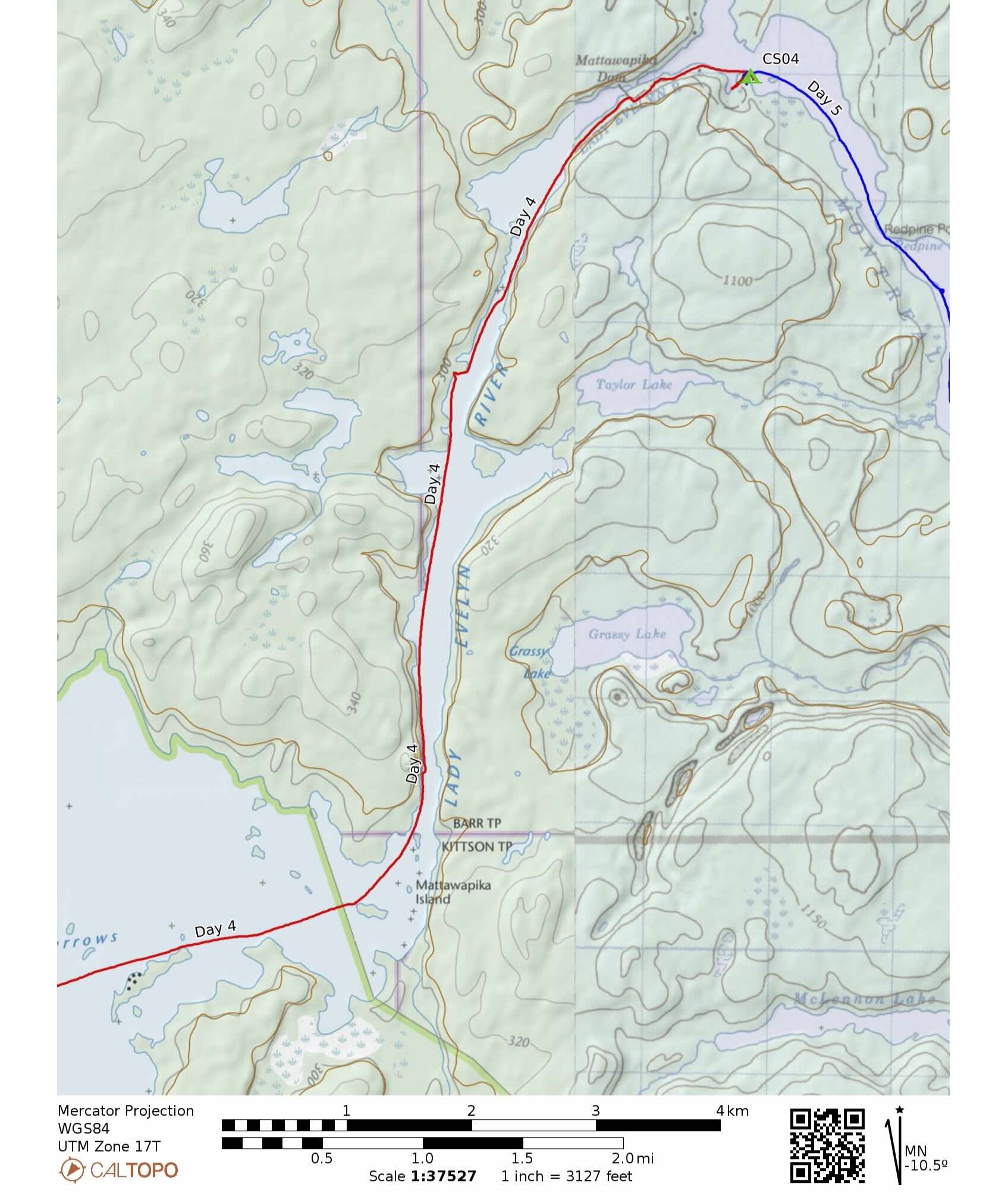
Lady Evelyn Lake can be rough on paddlers, especially those heading into Temagami from the lake’s east end and into strong winds from the NW or SW. It is usually easier for those heading east across the lake – or those like us who lucked into yet another windless sun and cloud kind of day. At times it felt we were paddling in a dreamscape And as a bonus, only one motor boat the entire way to the Mattawapika Dam to ruffle up the otherwise placid water.
Late September is a great time to go canoe tripping, especially in busier spots like Temagami or Algonquin. Many cottagers have shut down for the year and if it is mid-week it is even more quiet.

Passing by a lodge on Lady Evelyn Lake


After a leisurely lunch in the shade of the majestic pines photographed above, it was on to the Mattawapika Dam. As we approached we met the first of two paddlers of our trip. He was doing a four-day solo trip which would take him across LE and maybe up to Maple Mountain and back. He was hoping to catch some wildlife with the camera and lenses along for the trip.
The dam appears in the photo below – we had done the river-right portage around the dam a few years ago so we knew the drill. Had we forgotten, the large signs make it very clear.

Approaching Mattawapika Dam
To the left of the motor boat dock is an opening to the canoe corral pictured below.

Paddlers’ exit at Mattawapika Dam
Our canoe is already sitting on the gravel shore while we check out the so-so views from the Dam. This is the end of the Lady Evelyn River system; it begins just south of Smoothwater Lake and merges here with the Montreal River.
Back in 2021 we had done the entire river from Apex Lake. See this report for some planning info if you’dlike to know more about the logistics of doing it.
Temagami’s Lady Evelyn River From Top To Bottom: Route Options, Maps, Shuttles, Permits, And More
From the bottom of the portage it was just a short paddle to our tent site for the day. My Chrismar Temagami 1 map indicated a site on the point. However, when we got there we found, not a tent spot but a cottage property! Later, when I looked at the map more closely I noticed the 2006 publication date! I had purchased the map for our first ever Temagami canoe trip in 2007.
The response to my email to Chrismar noted that the map has seen a few updates since them. Click on the map image below to see what it looks like in 2026.
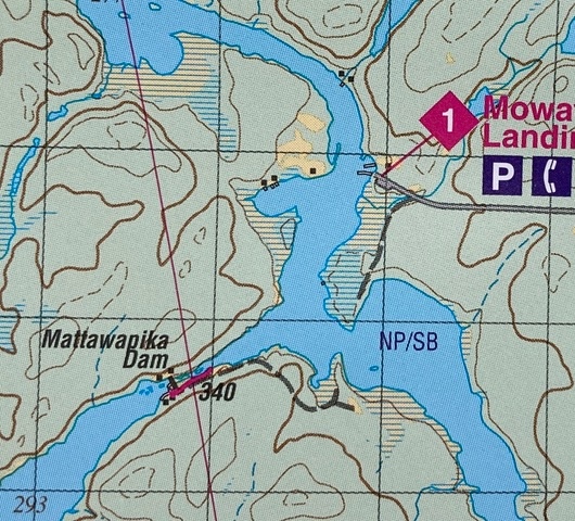
Lady Evelyn/Montreal Junction
As the track below indicates, we kept on going to the next point where we found yet another cottage property. This one was boarded up and clearly closed for the year. Landing on the outside of yellow marking tape that looked like it marked the edge of the property, we walked down an overgrown trail, off of which we found a spot to put up our tent.


Not long after our tent was up an ATV came down the trail! It was the shuttle guy from the dam and his wife and children out for a Sunday afternoon ride and just checking up on Otto’s shuttered property. He informed us thast the prpperty was definitely private but with our assurance to leave no trace, he let us be. He did note that
- there were no Crown Land camp spots for paddlers in the vicinity
- even the vehicle parking area on the point across the river was verboten as a tent site.
- there are few even marginal tent sites as you paddle down the Montreal until Pork Rapids.
Suggestions for future paddlers following our route and tent sites –
- Use the tent site just before the Mattawapika Dam.
- Splurge on a night at the White Pine Lodge on the other side.
- Tent at Mowat Landing Cottages, as we did before our trip down the Lady Evelyn.
- Head down the Montreal and make do with the first “it’ll have to do” tent site.
After our overnight stay, we pushed off shortly after 8 the next morning.

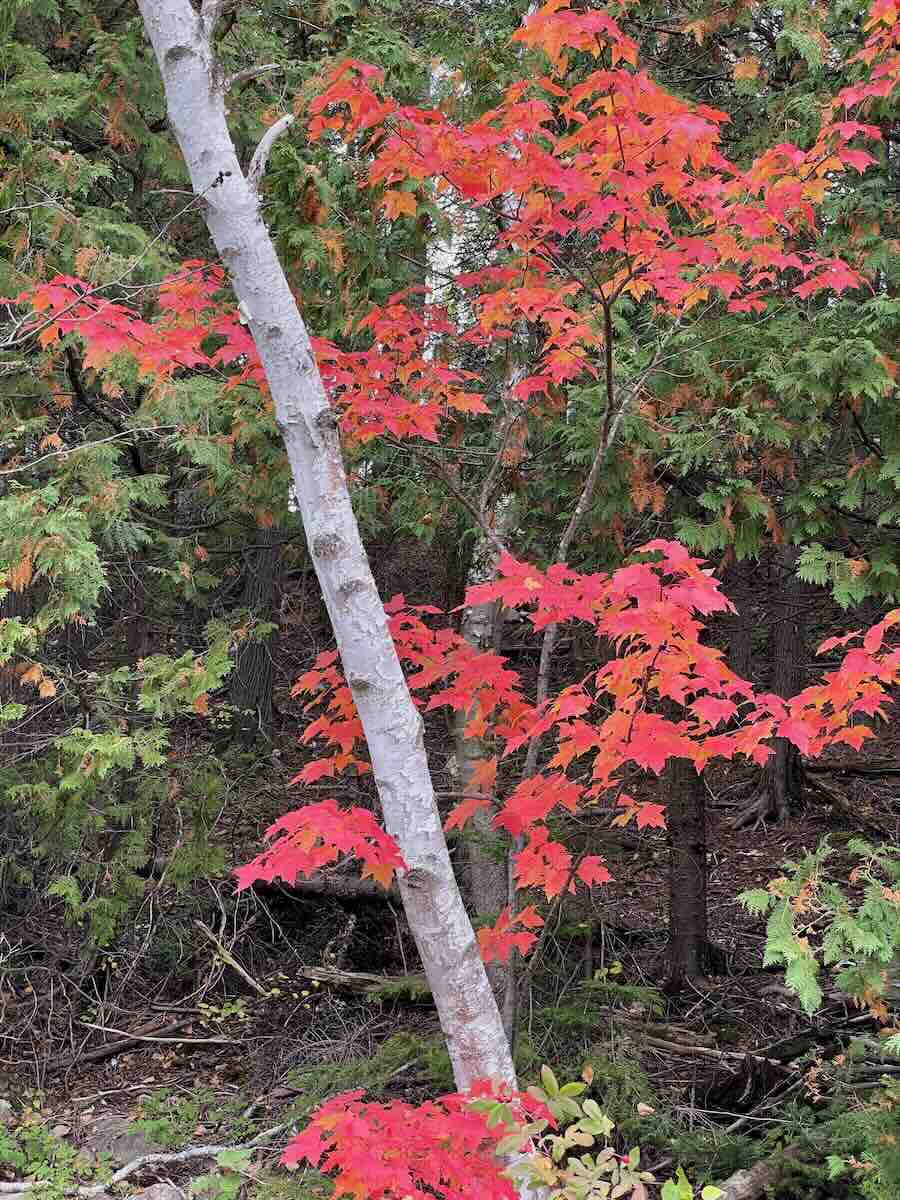
sat view of the neighbourhood
—————–
Day 5: Montreal River to Anima-Nipissing Lake
- Date: September 27, 2026
- Distance: 21 km
- Time: 6 h 25 m, 8:15–3:40
- Portages: 1, ~2400 m (2 h 50 m including lunch)
- Weather: sunny and warm
- Sightings: campers (cottagers)
- Campsite: at portage end; 2 x 4-person possible; 1-2 person multiple
- CalTopo link : https://caltopo.com/m/MJRVBRN#
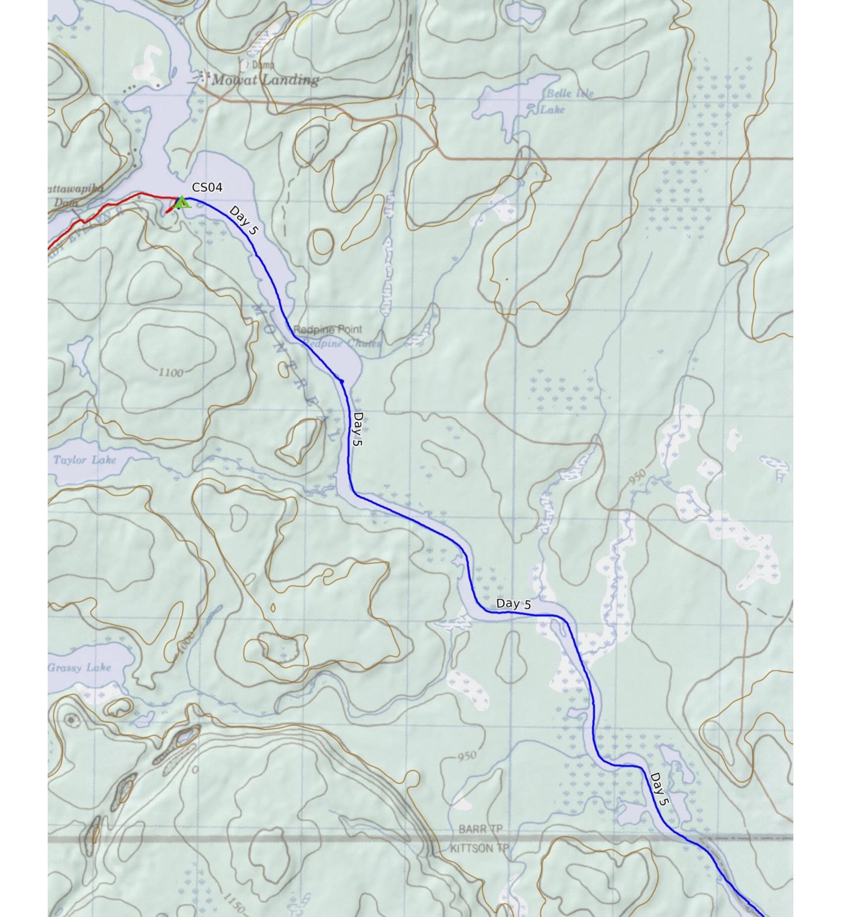
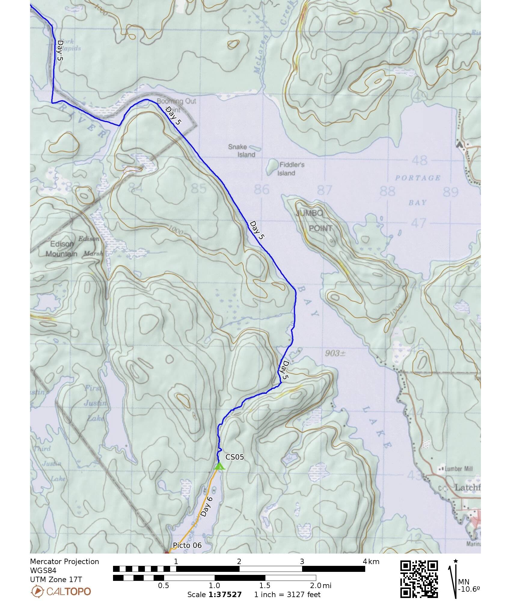
Coming up on Day 5 – a two-parter:
- a leisurely paddle down the Montreal to Bay Lake and the take-out spot for the portage into Anima-Nipissing Lake.
- an afternoon to get the 2.2 km portage done.
As we headed south we saw lots of wetland shore line like in the photo below. On the plus side, no boat traffic at all and another day of ripple-free water. By 9:30 it got hot enough that we made use of the river left shoreline for some shade when we could .

down the Montreal River – Day 5
The image below shows what is left of Pork Rapids after the construction of the Latchford Dam in 1913 . There is a tent site on river right by the rapids but we did not confirm that it was there.

the once-Pork Rapids on the Montreal
As for the dam, Its purpose was to control water levels on Bay Lake and the Montreal River up to Mowat Landing and thus make it easier to navigate. Logging operations also benefited as logs were floated down to the mills in Latchford. The marshy shoreline is the result of higher water levels.
In 2017 the original 1913 dam was replaced by a new dam seen the sat image below.

The Latchford Water Control Dam, Hwy 11, and rail crossing
Te Latchford Dam, like the Mattawapika Dam built in 1925, are water control dams only There are other dams (e.g. Hound Chute Generating Station) further down the Montreal River which generate electricity demanded by mining operations with the discovery of silver in Cobalt in 1903.

2.2 km portage into Anima-Nipissing Lake
We got to the start of the portage into Anima-Nipissing around 12:15. As we paddled south on Bay Lake we considered the different journeys made by the waters of the Montreal and of Anima-Nipissing take.
- The Montreal River flows into Lake Temiskaming and the Ottawa River, which then merges with the St. Lawrence down by Montreal.
- Meanwhile, our 2.2 km portage took us to the top of Anima-Nipissing Lake. Its waters flow into Lake Temagami and then, via the Temagami River, into Lake Nipissing before ending its journey by way of the French River in Georgian Bay and the Great Lakes system.
It reminded us of another canoe trip when we were on Endogoki Lake, 500 meters from Savant Lake, which flows down into the Albany River on its way to James Bay. Meanwhile, the Ogoki, at least 95% of it thanks to the Waboose Dam, flows east and then south to Lake Nipigon on its way to Lake Superior and the Great Lake water system.
Keen to make the portage seem shorter, we decided to knock off 700 meters or so but stopping for the lunch we had originally planned at the takeout spot. That would leave 1.5 km after a leisurely lunch somewhere on the portage trail.
By 3:30 or so we were at the Anima-Nipissing end of the carry. We had taken a bit over two hours to git ‘er dun. After that initial 700-meter carry, I took my rain jacket out of the duffel and rolled it up in such a way that it provided paddling between my pinched shoulder blades and the canoe yoke. It made the rest of the carry go by much faster!

The tent site is just off the portage trail to the left and is nicely sheltered.
- We did some site maintenance, Max’s new Silky Gomboy 240mm Outback Edition Blade Folding Saw ripped through a couple of 8″ cuts in record time!
through that tree trunk in record time! - put up the tent,
- flipped the canoe over to serve as a table,
- got supper done, and
- walked down to the shore to take in the late Sunday afternoon glow and quiet,
- disturbed only for a few moments by a boat taking passengers 6 km down the lake to a parking area on the other side of the lake and then returning some time later.
That was the only boat we heard until the end of our trip.
Japanese saw – Silky Gomboy 14″ pruning folding
—————–
Day 6: Anima-Nipissing Lake – Top to Bottom
- Date: September 28, 2026
- Distance: 20 km
- Time: 5h 15m, 9:00–3:30
- Portages: 0
- Weather: sunny and warm
- Sightings: cottager boats in the distance
- Campsite: 1 x 4-person, 1-2 person options
- CalTopo link : https://caltopo.com/m/MJRVBRN#
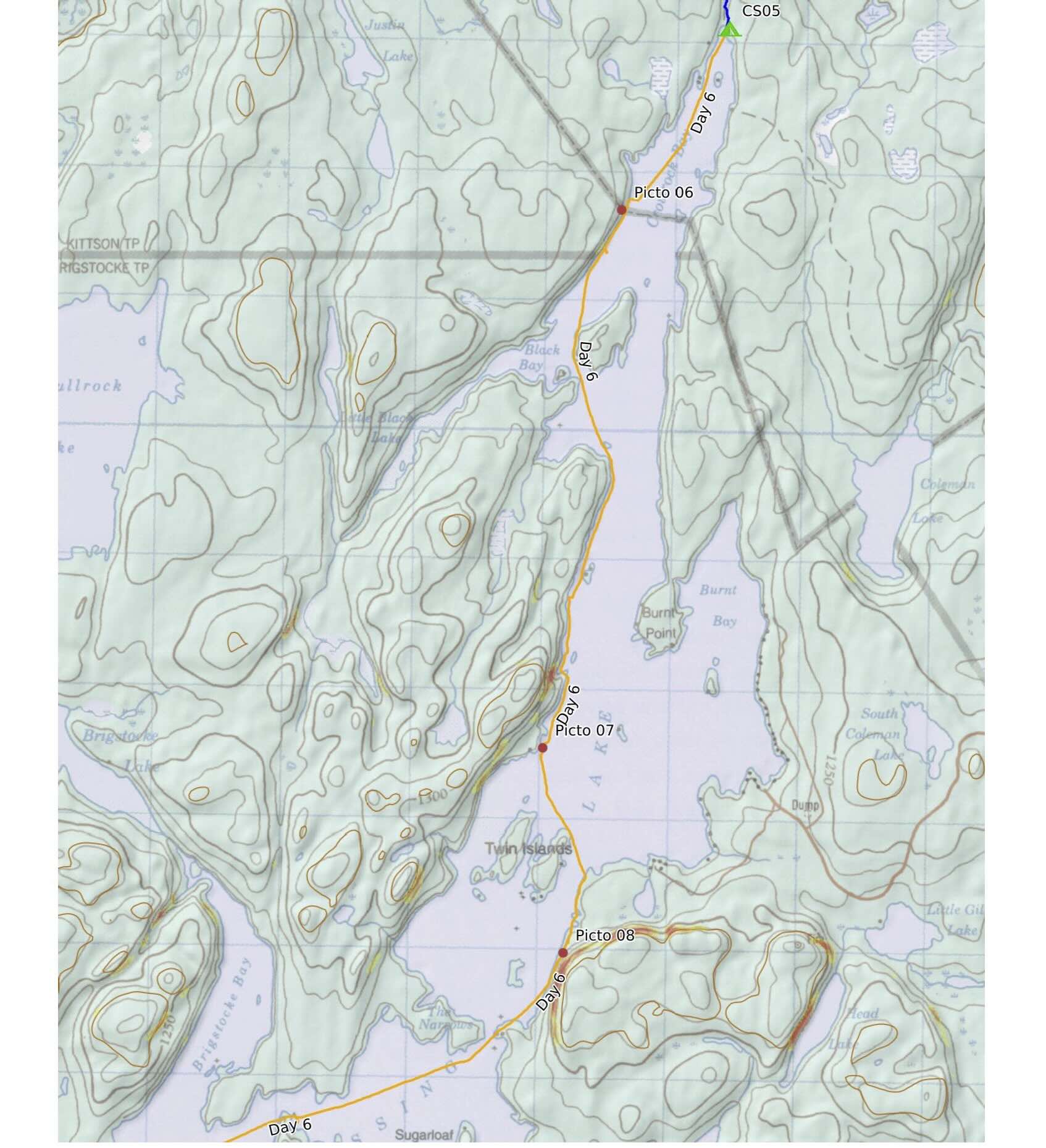

Our last full day on the water and we were looking forward to it. We planned to spend it paddling down to the bottom of Anima-Nipissing Lake, stopping at each of the five recorded pictograph sites along the way. We were not sure exactly what we would find since time spent scouring the internet had turn up only a few references and images.

the top of Anima Nipissing Lake on a clear fall morning
Behind our tent was the carcass of this vehicle. Given the nature of the portage trail, it is unlikely to have been used to haul stuff up and down the trail. If you have the answer, let me know in the comments below!

vehicle remains behind our A-N tent site
It did not take very long to get to Crowrock, our first rock painting site of the day.
————–
A-N Picto Site 01 Crowrock

Anima Nipissing Rock Painting Sitesthe most dramatic stretch of vertical rock that we paddled by in our 115 lm loop trip
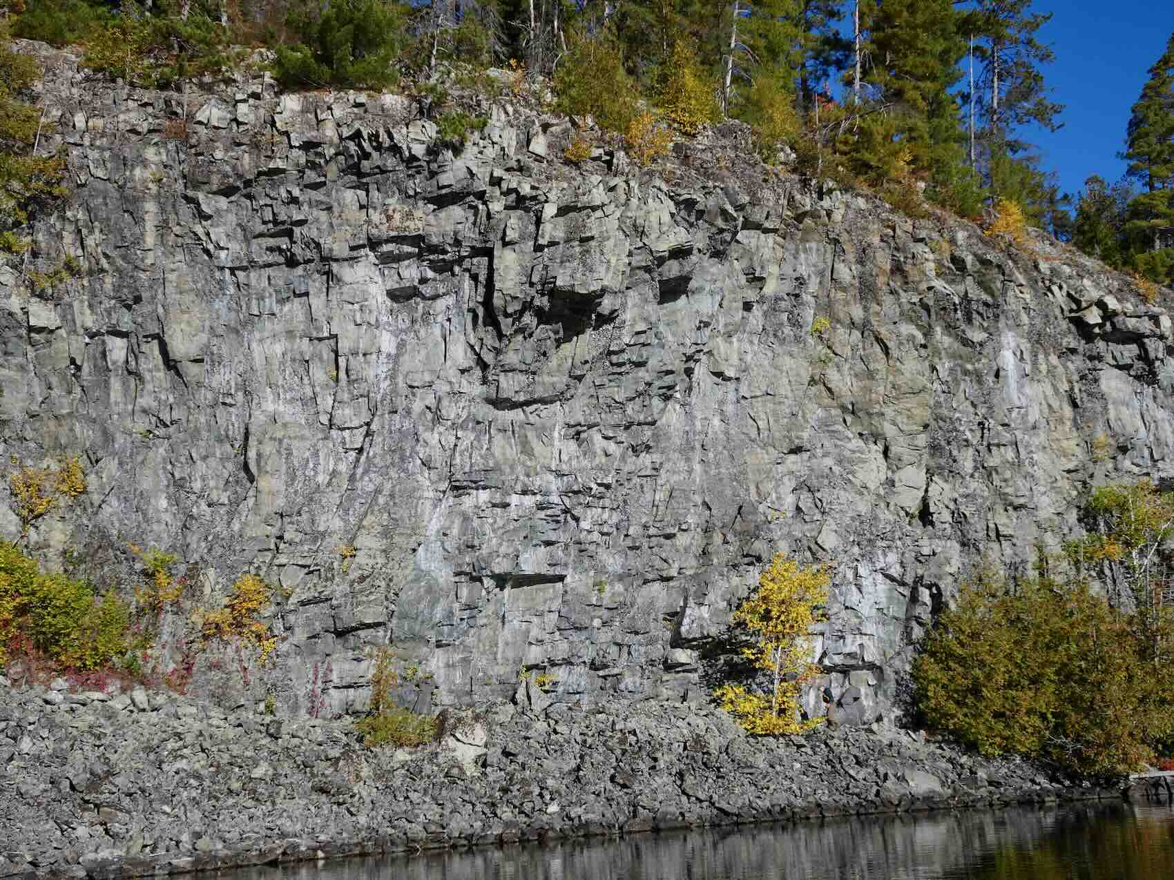
Crowrock section

Crowrock – walking along its base
We spent about 30 minutes at Crowrock, either paddling slowly by the rock face when it came right to the water, or walking along its base as in the image above. As the photo below shows, there are a number of reddish marks and lines that could be taken from pictographs, even if they are no more than natural rron oxide streaks and stains.

Crowrock Pictographs – Anima Nipissing Lake – click on the image to see enhanced red image
The marks below are a good example. At other sites we have seen simple Thunderbird images that look like what you see on the rock. We left undecided about its status!

pictograph – or natural stain?
The vertical lines in the two images below , however, definitely come across as intentional.

Crowrock Picto Site – vertical lines

Crowrock pictos – more lines or a hand?
More time at Crowrock would probably turn up other clear examples of faded pictographs in the form of lines and simple patterns. We continued south on the lake to the next site.
————–
A-N Picto site #2
Like four of the five sites on Anima-Nipissing Lake, this on is on the west side of the lake. It is located directly across from the A-N parking area on the other side of the lake. Easy access to the lake from Highway 11 would make A-N are great way to spend a day or two on a pictograph pilgrimage. Canoe required as you visit all five sites!
There was no doubt as we saw the two canoe images on the rock face below.

A-N Site 2 canoes

Anima Nipissing Picto Site #2 – south of Crowrock


canoe image at A-N Site 2

south end of Anima-Nipissing Picto Site #2

Anima Nipissing – Picto Site #2
The close up of the bottom splash of red may be an image of a human figure. It reminded me of one that we had seen on Cliff Lake in Wabakimi a few years ago. I may be forcing it to be something it is not.

image with red colour augmented

a Cliff Lake (Wabakimi) image in dar brown of a standing human figure
————–
Picto Site 03 – east side of Anima Nipissing
Then it was over to check out the only site on the east side of the lake. We passed by this mini-cave on the way and I hpped a shore totake a alook inside.

on the way to Site 3 on A-N
It reminded us of the Turtle on Lake Mazinaw which has a cave on its north side that we checked out. In both cases, nothing to be seen.

approachng the Mazinaw Turtle Rock from the north
Site 02 came soon after with a thoughtfully erected inukshuk to catch the searchnig eye! Four vertical lines to see and then, a bit further down, an arrangement of pairs of more vertical lines.

Anima Nipissing Site #3 Pictographs
I could definitely have framed the shot below better!

Anima Nipissing Pictos – Site #3
————–
A-N Picto Site 04- Whitewater Lake Outlet
Then it was back across the lake the outlet of Whitewater Lake for the next site. There was also a tent site there which we figured might be our stop for the day before finish our loop with a takeput at the bottom of McLean Lake the next morning.
As we approached the site we met our second paddler. He had left his vehicle at the McLean Lake putin and was out for a couple of days of the lake. Lke us, he had lucked into a beautiful stretch of weather combined with off-season tranquility.

A-N picto site #4 – overview of panel

Anima Nipissing Picto – Site #4 Whitewater Lake outlet

A-N Lake Picto Site #4 – enhanced image
Since it was only 2:30 we decided against stopping just yet. We headed south to the last of the pictograph sites and one of the tent sites at the bottom of the lake just before the swfits that run into McLean Lake. It would mean an even shorter paddle out the next morning.
————–
A-N Picto Site 05
1.2 km down the lake from the Whitewater Picto site is the last one we visited. We were surprised not to find anything in the dramatic cavity – a doorway to the manitous! – in the rock face pictured below.

approaching picto site #5
A bit further down, a sheltered nook looked promising. The red stain on the rock had us wondering.

A-N Site #5 pictograph
When we got to the rock face pictured below, there was no question! On the rock are vertical and diagonal lines and a combination of the two. It had us wondering what it all meant to the one dipping into his medicine bag for the special red paint to create something drawn from his culture’s collective image bank.

Anima-Nipissing Site #5 as is

————–
Anima-Nipissing Campsite
After bouncing around various tent sites at the bottom of the lake we finally ended up at the very last Anima-Nipissing Lake site before the swifts into McLean.


—————–
Day 7: Anima-Nipissing Lake to McLean Lake
- Date: September 29, 2026
- Distance: 3.5 km, 8:10–8:45
- Time: 3:00 –
- Portages: 1 – the Grand Portage
- Weather: sunny and warm
- Sightings: minimal
- Campsite: ok, maybe 1 x 3-person, 1-2 person more likely
- CalTopo link : https://caltopo.com/m/MJRVBRN#