Since January 1, 2024
Recent Comments
Most Viewed Posts & Pages (last 48 hours)
Tag Archives: Bloodvein River corridor
Canoeing The Bloodvein Day 14 – Sharp Rock Rapids to Namay Falls (W80)
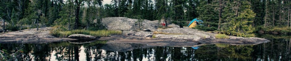
The Day’s Basic Data distance: 26 kilometers weather: a beautiful day on the river rapids/portages: a “lite” day. See map 4 in Wilson’s book for an overview and specifics. campsite: Namay Falls Convention Center! … Continue reading
Canoeing The Bloodvein Day 12 – Kautunigan Lake to Gorge Rapids (W56)
Most of Atikaki Provincial Wilderness Park lies east of Kautunigan Lake. West of the lake, the Park is reduced to three narrow river corridors with one-to-two-kilometre strips of land on each side as the rivers – the Pigeon, the Leyond, and the Bloodvein – … Continue reading
Posted in wilderness canoe tripping
Tagged Atikaki canoe trip, Bloodvein camping, Bloodvein canoe trip, bloodvein river canoe trip, Bloodvein River corridor, bloodvein trip report, Chap Falls Bloodvein, Gorge Rapids Bloodvein, Kautunigan lake, Meekinako Rapids Bloodvein, Pictograph Fever, Sekak Rapids Bloodvein
2 Comments