Table of Contents:
- Day 1: Highway 2 and the Waterfront Trail From Toronto to Port Hope
- An Afternoon in Port Hope
- Day 2: Hwy 28 North to Burleigh Falls
- A Quick Visit To Peterborough’s Canadian Canoe Museum
- My Burleigh Falls Cottage For The Night
- Day 3: A Half-Day Cycle To Bancroft
- Day 4: A Half-Day Cycle To A Denbigh B&B
- Day 5: Denbigh To Renfrew
- Day 6: Renfrew To Rideau Street in Ottawa
- Day 7: Ottawa To Kanata
- Day 8: Kanata To Brockville And the VIA Connection Back To T.O.
————

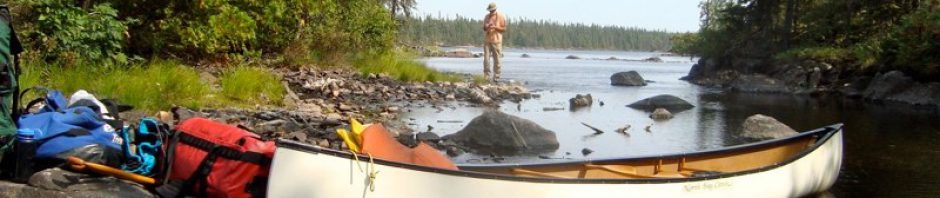
Day 1:From East End Toronto to Port Hope
It was a Sunday afternoon at the beginning of June. Some five hours after having left downtown Toronto I was approaching Port Hope on a traffic-free stretch of the Waterfront Trail that hugs the north shore of Lake Ontario. (The Trail starts at Niagara-on-the-Lake and follows the shore of the lake for some 780 kilometers all the way to the Quebec border.) The wind was at my back and it was a beautiful day, even with the threatening clouds. It felt great to be taking in the world from the vantage point of my Brooks B-17 saddle!
(All images enlarge in a new window with a click; all clicked blue text leads to a new page.)

the Waterfront Trail and countryside just west of Port Hope
If you want to see the post where I describe route planning and what I packed, click here.
Eastern Ontario Bicycle Tour: From Toronto to Ottawa via Peterborough, Bancroft, and Renfrew
I had picked up the Trail in Newcastle, just east of Bowmanville, after having left the east end of Toronto via the Kingston Road (a road which takes on many different names as it passes through Pickering, Ajax, and Oshawa). It was at this point that I finally got the wonderful feeling of being on a bike tour- and away from the never-ending urban sprawl that is the GTA (the Greater Toronto Area).
For the next week, I’d cycle my way across eastern Ontario, stopping in to visit old friends at stops along the way. The map below summarizes the route- including the warm-up spin from London to Toronto a couple of weeks before.

route map- from London, Ontario to Brockville via Ottawa
The fact that I did the Toronto-Oshawa stretch early on a Sunday morning had definitely helped in terms of traffic but if there is a next time it will begin with a one-hour GO Train ride from Toronto to Oshawa just to get past the urban sprawl! Either that or I’d go back to using the Waterfront Trail all the way from Toronto, even if it maddeningly dipsy-doodles its way at times!

I’ve just connected with the Waterfront Trail at the bottom of Mill Street in Newcastle, ON
————
An Afternoon in Port Hope
Port Hope is, as a slogan by the town’s tourism folks once proudly proclaimed, “the town that radiates charm” as well as the small-town Ontario of 100 years ago. My visit there included a guided tour of some of its key landmarks. It is famous for more than the nearby nuclear reactor. Here is a pic of the playing fields of Trinity College School, an elite private school open since the 1860s-

Port Hope’s Trinity College School Playing Fields- shades of Eton!
We also visited Port Hope’s golf course, very nicely nestled on the shores of Lake Ontario-

Port Hope’s Golf Course and the Lake in the background
A mid-afternoon shower put some sparkle on the streets as the sun reappeared.

Port Hope’s main street after the rain
My bike was nicely tucked away on the covered porch of Ken’s century-old house-

bike at rest and safe from the rain
As we left Jim’s Pizzeria House on Walton Street, I took my first of many shots of the waterfalls and rapids I would pass along the way. This first set was a rather humble affair- the Ganaraska River just before it finally enters Lake Ontario.

rapids on the Ganny from the bridge at the end of Walton Street, Port Hope
————
Day 2: Hwy 28 North to Burleigh Falls
After a good night’s rest at the Comfort Inn at the north end of town, it was time to head northeast to Peterborough and then on to Burleigh Falls, the destination of Day Two’s ride.

I’d be travelling 28N for the next three days- all the way to Denbigh, east of Bancroft
Days Two and Three proved to be a bit of a challenge; headwinds of 15-20 km from the NE meant that I had to accept the fact that I wasn’t going to be zipping along. Parts of the undivided single-lane each-way highway also lacked even a foot of paved shoulder so it got kind of interesting at times, especially when traffic coming at me was met by truck traffic coming up from behind!

the paved shoulder was often in scarce supply!
Fortunately, the traffic was fairly light and the surroundings made up for any of the stresses that arose. Sometimes there was even a generous paved shoulder!

the road and countryside on the way north to Peterborough
————
A visit to the Canadian Canoe Museum
As I approached downtown Peterborough along Lansdowne Street I was presented with an incredible bonus- the Canadian Canoe Museum, the veritable mecca of canoe fanatics was right there, just off Lansdowne! (I will admit to being even happier on a canoe seat than a bicycle seat!) I ended up making an impromptu 90-minute stop to check it out. It definitely put me in a totally different space for a while- a great tangent.

Ojibway-style birchbark canoes from the mid to late 1800s

some of the many vintage canoes on display

a birchbark Hudson’s Bay Company canoe- to be replaced in the 1950s by the all-but indestructible 17-foot Grumman aluminum canoe!
Note: In May 2024 the stunning new Canadian Canoe Museum opens.
George Street and Water Street took me through Peterborough and I cycled on to Lakefield for a Day Two late lunch- a Greek salad at the Lakeland Restaurant. Somewhere along the way, I cycled by one of the locks of the Trent-Severn Canal that passes through the area-

Lock 29 or 30 on the road from Lakefield to Young’s Point
————
My Burleigh Falls Cottage For The Night
My day ended at Burleigh Falls. I had booked a cottage at Marrick Landing Resort- the $100.+ tax would have been a better deal had I not been travelling solo. Burleigh Falls is right on the southern edge of the Canadian Shield in this part of Ontario so I was looking forward to my first real set of rapids. I was not disappointed-

Burleigh Falls below the bridge- a great walk along the banks of the Trent River/Stony Lake

Burleigh Falls- another view

Burleigh Falls- zooming in on a landscape I can’t get enough of!
And then it was time to head to the cottage on the other side of the bridge. The owners had gone to town but left the cottage open for me. It was very clean and inviting-

inside my Marrick Landing cottage- home for the night on the shores of Lower Buckhorn Lake
It was a Monday night in early June so, as you might have guessed, it was not very busy; in fact, I was the only guest that night. (July and August are the two big months for cottaging in Ontario.)

bike at rest on the deck of my Marrick’s Landing cottage

empty chairs on the shores of Lower Buckhorn Lake

paddles at rest- along with the toys in the sandy beach playground at Lower Buckhorn Lake

The day ends on Lower Buckhorn Lake.
————
Day 3: A Half-Day Cycle To Bancroft
Day Three gave me another opportunity to perfect my technique of cycling into a wind coming from the NE but the distance- about 75 km.- meant that a half-day on the road and I’d be in Bancroft knocking on the patio door of Ed’s place. The road was less busy than it had been on Day Two; it was also a bit hillier. Stretches of the road had been recently repaved with more generous paved shoulders.

Highway 28N east of Burleigh Falls
You always know you are getting close to your destination when you see the service club display ahead of you on the side of the road- here is the one for Bancroft!

Bancroft service clubs- signs of life in this small central Ontario community of 4000

approaching the heart of Bancroft downtown

the view of the meandering York River from the Eagle’s Nest, a lookout to the north of town
I had visited Bancroft once in 2005 but it was in the middle of winter and we had come up to climb the ice walls of the Eagle’s Nest. Looking at it now, all overgrown with bush, it was difficult to imagine me going up the wall with ice axes!

the look-out deck on the top of Eagle’s Nest viewpoint

a suburban Bancroft property three minutes from the downtown business area
I also jumped at the chance to visit spectacular High Falls on the York River a few kilometres north of town. I don’t know what it is about rapids and waterfalls; maybe the amount of oxygen in the air is higher close to rollin’ and tumblin’ water and as you breathe it all in you just feel more alive.

High Falls on the York River, north of Bancroft- inhale and feel the energy!

High Falls provides the backdrop for a birch tree

these waterfalls are certainly more impressive than those at Burleigh Falls
————
Day 4: A Half-Day Cycle To A Denbigh B&B
Day Four cycling started a bit late; after we visited High Falls in the morning we had lunch at the Market Cafe so I didn’t leave Bancroft until one. My experience with the winds the two previous days had made me reluctant to tackle Bancroft to Renfrew (135 km) in one long day so I decided to cycle as far as Denbigh on Day Four. That would leave a much more manageable 70 km or so for Day Five.
All I had to do was find a bed for the night! A visit to the Bancroft Tourist office turned up a B&B on Highway 41 just east of Denbigh so I all was set. The clouds looked a bit worrisome as I left but I figured that four hours and I’d be there, even if a bit wet. I certainly wasn’t expecting to be sitting here-
The rain lasted over an hour and was accompanied by lightning and thunder. As you saw in the video above, I had lucked my way into a perfect shelter from the storm and waited it out. A last look back at my good fortune and then it was back on the road.

The gods smile on me as I watch the rain come falling down.
I didn’t have to wait too long to “pay forward”, as the expression goes. As I was cycling over a bridge I came upon this scene in the picture below. I knew I had to stop and give the fellow a helping hand or he’d probably be run over by a vehicle in the next few minutes. In retrospect, I should have picked him up and carried him to the end of the bridge and brought him down to the river; I hope that my picking him up and dropping him down to the water didn’t shock him so much that he ended up drowning! Here he is-

Mr. Turtle on his walk across the bridge- I hope he’s alright!
This is where I’m hoping he is telling his pals about his crazy adventure on the bridge- I dropped him into the water near the bottom left-hand side of the image.

Mr. Turtle’s domain-
And then it was time for some serious pedalling to make up for all the drama of the day. This afternoon’s ride was the hilliest yet- but the traffic was very thin.

lookin’ back at a stretch of traffic-free Highway 28N east of Bancroft
And then some bad news! It looked like I would be spending two or three hours to cover the next twenty km. I had cycled my way into a complete road reconstruction!

road re-paving season opens in the Denbigh area and my ETA calculations go out the window!
As I cycled past a few of the work crew I asked how far the repaving job went on. “Almost all the way to Denbigh” was what I got as a reply. According to my odometer, that meant about twenty kilometres of pushing my bike over the soft rain-soaked sand or riding slowly where I could.

looking back at another stretch of the sandy road I’ve completed
And then- another surprise! Well- or even better- a reward for having negotiated ten kilometres of sand! Ten kilometres of freshly paved highway with just me on it- all the way to Denbigh. It turned out that the workers had exaggerated the extent of the repaving zone; I have never ridden so much great pavement for so long. I went from this –
")
the last of the sandy sections of road construction
to the scene in the picture below from one minute to the next.

I was hitting speeds in the mid-50/s kph on the downhill stretches of the newly paved road
I kind of felt like an Adam who had just stumbled into the Garden of Eden from the desert; the grinding and uphill pushing and trudging of the past hour were long gone and here I was having one Zen-like WOW moment after another as I whizzed towards Denbigh. Along the way, I passed several farm properties, including one with a few horses in the field-

I’d love to have this shot over again- this time with no wires and full legs! Still, the light was incredible…
After all that, I got to the B&B- Piper’s Rest– a few kilometres east of Denbigh by 6:30. It proved to be a very comfortable place to spend the night with hosts Mark and Susan making me feel right at home. As a bonus, the wifi allowed me to Skype with my wife back home in Toronto with my iPod Touch.
————
Day 5: Denbigh To Renfrew
The journey continued the next morning; at 8:15 on Day Five I was back in the saddle and on the way to Renfrew. It was about 75 kilometres and I would get to the Comfort Inn on the eastern edge of town by 1:00. As was the case the day before, there was little traffic to deal with on this stretch of road- just lots of beautiful vistas to take in.

road and countryside on the way to Renfrew

roadside lake- a brief diversion from my pavement studies
And finally- up ahead- the Service Clubs’ sign and I knew that I was indeed in Renfrew.

definitely a bigger community than Bancroft- given the number of service clubs

one of the grander buildings on Renfrew’s main street
After checking into the motel and resting a while, I spent an hour walking back into town- along a truly dreary stretch of road filled with recently-arrived box stores taking up acres of land. As I walked along Raglan Street., Renfrew’s main shopping street, I was struck by how dead it was shortly after 5:30 p.m. This store sign cleared up the mystery-

a sign that downtown will be pretty dead after 5:00 p.m.- as people drive to the shopping malls on the edge of town or further down the road in Arnprior or Kanata
I was on my way to see the waterfalls and the McDougall Mill on the north bank of the Bonnechere River. I also got to cross the “Swinging Bridge” as I tried to find the right angle to get a good shot of it all. Eventually, I was standing on some rocks in the middle of the river- here it was only early June and not much water coming down.

the McDougall mill on the Bonnechere River

the Bonnechere waterfalls from my mid-river location!
A return to Raglan Street and a bite to eat at the Chinese restaurant- and then a cab ride back to the motel and that was Renfrew, Ontario. I found out that Ted Lindsay, one of my favourite hockey players in my youth, was born here. (To be expected since he played for my fave team, the Detroit Red Wings!)
————
Day 6: Renfrew To Rideau Street in Ottawa
Day Six was a long day- south of Renfrew I cycled on Country Road 6 (Lochwinnock Road) until I hit Country Road 1 and followed it south into Arnprior. I finally checked in at the Econolodge on Rideau Street in downtown Ottawa at 4:30, having cycled about 115 kilometres, most of it on empty secondary country roads and, for the last twenty kilometres into Ottawa, an incredibly well-maintained and signed bike path.

my first sighting of the Ottawa River- as I approach Country Road 1 from Renfrew

lots of asphalt in downtown Arnprior
Given the waterfall theme of this bike trip, I did stop in Arnprior to get a shot of the seriously tamed waterfalls there. Little evidence remained of the natural state of the river as the following pic makes clear-

concrete replaces nature’s rapids on the Madawaska River
South of Arnprior I cycled east on the Galetta side road until I came to Carp Road, which I followed SE all the way to Richardson Sideroad (although I should have turned left on March Road- the stretch of Carp Road to Richardson Rd on a Friday afternoon was the worst 30 minutes of my trip in terms of traffic).

Road sign on the Galetta Sideroad near the northern end of Carp Road- quiet country roads

The superb NCC Ottawa Bike Trail- I used it to get from Kanata to my accommodation on Rideau Street in downtown Ottawa

Remic Rapids Balanced Rock Sculpture Project- every spring since 1986 John Felice Ceprano has been creating rock sculptures here with on-site rocks and every fall and winter nature destroys his art- and then spring comes again!

The Ottawa River Bikepath as it approaches Parliament Hill in Ottawa

some of the locals on the multi-use bike path

The Rideau Locks and the East Wing of Parliament

The Rideau River tumbling into the Ottawa- I stood there wishing I could turn back the clock two hundred years and see the “before” picture

Bixi bikes for use in the Byward Market area – one of ten or so stations around the downtown area

a reminder that I am indeed on Parliament Hill- or in the hockey arena parking lot at Scotiabank Place!

bridge over the Rideau
————
Day 7: Ottawa To Kanata

my breakfast spot in the Byward Market
After a night on Rideau Street at the Econo Lodge, I headed back along the bike trail to Cyril’s in Kanata. I would spend a night with Cyril and his wife reminiscing about past canoe trips and bike trips he and I had done in the 1990s.
————-
Day 8: Kanata To Brockville VIA Station
Cyril had also dusted off his bike so that he could escort me through Kanata the next morning to the Trans-Canada Trail. We said goodbye on Terry Fox Boulevard at about 9:00 a.m. and then I turned onto the gravel Trail which took me all the way west to Ashton Station Road. Then it was south into a bit of a breeze towards Merrickville for lunch.

the bridge over the Merrickville canal locks with the main street in the distance
My arrival coincided with that of riders doing the annual Rideau Lakes Cycle Tour which goes from Ottawa to Kingston on Saturday and returns on Sunday. Well, it was Sunday and here they were, enjoying the south wind blowin’ them back to Ottawa!

tour riders taking a break in Merrickville on their way back to Ottawa
I pushed on to Brockville to end my 102-kilometer ride for the day- and to end my 600+ kilometer ramble through eastern Ontario. The following map shows the route through some pretty scenery- and surprisingly empty of settlement.

Kanata-Kemptville- Brockville bicycle route – click here for a “live” Google map to zoom in on
After a night spent in Brockville, I caught the train heading for Toronto the next morning at 9:30 and by noon I was on Front Street. While it did cost $20. to have my bicycle taken on board it is nice that on some trains VIA no longer requires the bike to be taken apart and put into a bicycle box; there are now bike racks in the baggage car. It means that when you get to your destination you don’t have to put everything back together again.
So ended my leisurely ride through southern Ontario- starting with my warm-up run from London to Toronto a couple of weeks before I headed east to Port Hope, Peterborough, and on to Renfrew and down to Ottawa and Brockville. I had never quite seen this part of the province the way I did over the eight days it took to cover the distance- so it was a real positive eye-opener. I learned yet again that you don’t have to go very far from home to see something new! There’s a whole world out there on the roads of backcountry Ontario that makes for excellent cycling adventures.
The following post has more about the route I took, the stuff I took, the bike I took..etc.
Eastern Ontario Bike Tour Plan – Toronto To Ottawa Via the Back Door
Thanks for sharing. I am thinking about riding from Toronto/Ottawa and back in Late March 2015 weather permitting. Last May/June 2013 and 2014 I also did something similar but in Europe. I rode the Camino de santiago de Compostela from Saint Jean pier de port to santiago de compostela (800 KM). In 2014 I actually rode from saint Jean to santiago lisbon (1400 km in total). I might do again in 2015. All the best!!
John, “weather permitting” is the key phrase here! The secondary roads can be pretty gritty at the end of winter thanks to the use of sand. You will probably want to pass on the more northern route I took and head down to Brockville and along the St. Lawrence and Lake Ontario shoreline. Check out this link for more info –
http://www.waterfronttrail.org/2014-10-31-13-04-56/interactive-map
BTW, congrats on your ciclismo de camino! Sounds like a memorable trip.
Would you believe I took the very same photo of that country scene on the highway before Renfrew. Lots of hundred plus year old homesteads on that stretch from Bancroft. Superb job capturing your adventure sir. I found your story while seeking the best route TO to Ottawa. I might vear northbound on 15 towards beautiful Merrickville or maybe Westport.
Regards,
Gary Scully
Georgetown
Gary, incredible what you find on the net, eh! There are lots of convoluted ways to Ottawa! Mine was just one. The straightforward way is via Kingston and then up to brockville and over through Merrickviile, a pretty little town. Next time I may follow the Rideau Locks from Kingston. Enjoy your travels!
My friend and I stumbled across your awesome adventure while planning our trip from Peterborough to Montreal…We were hoping for a scenic route with lots of camping opportunities and to avoid major highways. This sounds like a good way to get us there. Thanks for sharing😀 Best part, I used to live in Youngs Point and travel to Bancroft often….bring on the nostalgia. Can’t wait…can’t stop thinking ’bout this adventure. We r going at end of June with plans to b in Ottawa for Canada day then off to Montreal
You will enjoy the ride – there was little traffic and as you say it is very scenic. It was also a part of Ontario I did not know very well.
I wonder if from Ottawa you could plug into the route Verte system on the Quebec side to take you down to Montreal – though the run on some secondary roads on the Ontario side will be just fine too.
P.S. you still have four months to get your butt and legs and lungs ready!