The Day’s Basic Data and Maps
- distance: 17 kilometers
- time: 9:30 to 2:30
- weather: beautiful sunny day; slight wind from NW
- rapids/portages: W26 portage finish + W27 rapids – 185 meter carry
- campsite: an excellent one about 1 km above the start of the Goose Rapids Portage
Previous Post: Day 8 – Moosebone to X-Rock Rapids
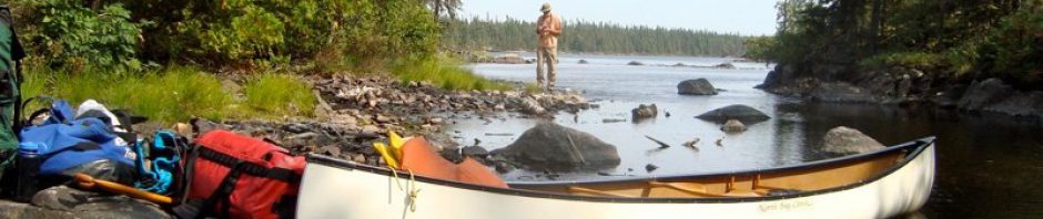
Canoeing The Bloodvein Day 8 – “Moosebone” Rapids to “X-Rock” Rapids


—————-
Finishing Off the X-Rock Island Portage
At a bit over thirty kilometers the previous day had been one of our bigger ones; This day would be one of our easier ones and would see us on the move for less than four hours. We were in no big rush to get going and sat there sipping coffee and enjoying the rays of the rising sun as they streamed through the trees onto the open campsite area.
The island setting is very dramatic, given that it is framed by two impressive falls/rapids. I went down to the rapids on river left with my tripod and clicked away for a while. Most of the shots were variations on this view –

the left-channel rapids at Bloodvein’s X-Rock Island
After packing everything away, we did the second half of the portage down to the put-in at the bottom of a fairly steep descent to the water.

trail down to W26 put-in on X-Rock Rapids Island
Max was good enough to video me carrying the canoe down to the water – and looking super-competent as I managed to ram the canoe between a couple of badly placed trees!
—————-
W27 – Our One Full Portage of the Day

W27 P185
Our one full portage of the day came up an hour into the day at W27. The map to the left shows the 185-meter carry on river left.
We took out our cameras and spent some time snapping pics at this scenic spot. A few of them can be seen below.

a view of Bloodvein rapids – W27 – from the bottom

Max’s shot of me framing something on Bloodvein’s W27 …the shot below is the one I took

Bloodvein Rapids W27

Max checking out the end of Bloodvein W27
And that was it for portaging for the day.
—————-
We Meet Paddlers Headed To Scout Lake
Sometime before noon, we passed three canoes coming upriver. We had heard bush planes around 7 a.m. and so figured that they may have dropped off the eight guys and their three canoes – either that or they had set out from the lodge nearby. The only trouble was, even though I had a lodge marked on my GPS map, we did not see any sign of a lodge as we passed by its supposed location.

Basecamp map of the Bloodvein and Scout Lake
As for the paddlers, they said they were headed to Scout Lake to do a bit of fishing – a later check of our maps made us wonder just how they got up to the lake. The red arrow on the map shows our best guess. The fishing must be out-of-this-world to justify the effort in getting there!
—————-
Lunch By A Hunters’ Blind
We stopped for our customary one-hour lunch at the nice spot you see below. Not too far in the bush was the decaying hunters’ blind overlooking the reedy bay in the background. Either First Nations hunters from Bloodvein Village or hunters staying in one of the lodges in the area made use of it. While Atikaki Provincial Park takes its name from the woodland caribou (Atik in Ojibwe – combined with aki meaning land), in all likelihood it was moose these hunters were expecting.

a potential in-a-pinch Bloodvein campsite above Goose Rapids- but we paddled on a bit

basic moose hunters’ tree stand – overlooking a marshy area on the shoreline
—————-
A Campsite Above Goose Rapids
Lunch done we paddled through the nearby Class 1 set of rapids (W28) and approached Goose Rapids. When we saw the campsite on river left we decided the portage could wait until first thing the next morning. So – 32 km the day before and 17 km on this day, We figured out the average and knew we could live with it.

Bloodvein Campsite above Goose Rapids – some signs of a massive windstorm

Bloodvein Campsite above Goose Rapids – a different perspective

looking south to Goose Rapids and the next morning’s portage

Golden sunset on the Bloodvein above Goose Rapids
Next Post: Day 10 – Goose Rapids to Rapids below Gammon Junction
Canoeing The Bloodvein Day 10 – Goose Rapids to Rapids below Gammon Junction